Ellipsoid representation
Tuesday, 5 September 2006
Maps fascinate me. After all, they take a planetary sphere and reduce (usually a piece of) it to a flat version that is instructive and compelling (at least the good ones do). Essentially, a map is a kind of propaganda, the product of a suite of choices that prioritize certain things and disguise or eliminate others.
Cartographers control multiple mapping elements, especially projection, orientation, scale, and symbols. Scale, orientation, and symbols are straightforward concepts. Scale is the simplest—a map may have a single scale, or the scale may vary in certain directions; the accuracy of that scale is also variable. We often think of orientation as “which way is up?�?, but myriad choices may be made; AAA strip maps would prioritize the route in the layout. Symbols allow distilling of complex ideas and information constituting the pictorial language of the map.
Projections are trickier. Here’s the fifty-cent definition of cartographic projection: the representation, on the plane, of all or part of the terrestrial ellipsoid. Projections are grid systems (where’s the datum?) that in effect generate geographic addresses, and introduce systematic distortions. Map projections affect area, shape, direction, distance, and scale, such that not all can be accurate simultaneously.
When building, drawing, or constructing a map, you have to first select your projection—in effect, you first choose what to prioritize, then orientation and scale.
Of course, with new programs like Google Earth (with interactive projections), hand-held GPSs for the masses, and even augmented reality, cartography and projections are increasingly complex and in flux.
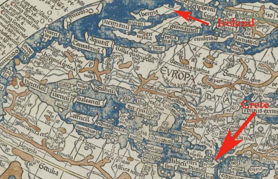
All of this is by way of the fact that I came across this Boston Public Library interface that lets you look close-up at a 2nd century map by Ptolemy, published in 1482, and other maps. Click on “Open in Map Viewer�? for the closeup and then zoom in!