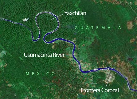
Yaxchilán is notable for its location, inside a tight bend of the Usumacinta River, which along this stretch separates the modern nations of Mexico and Guatemala. [Thank you, Google Earth.] Look closely, those teeny white dots you can see in this satellite photo in the green canopy are pyramids.


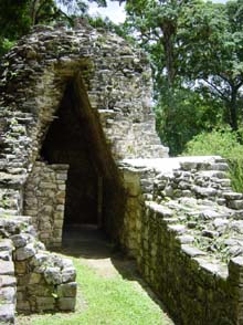
Enjoy a motor launch ride on from Frontera Corozal (after Mexican military officers check your passport), although there’s not much to see but other watercraft until you get to the site, when you may spot grey-white mounds peeking through the vegetation.
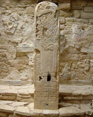
 Visit Yaxchilán if you are interested in stela. You can see lots of them here, many in pretty good condition. This one’s protected by a roof, and is in front of a wall with some remaining imagery. I think the black smudge must have been from recently burned incense, but maybe that’s just my imagination. There’s a very large stela that officials tried to take to the national museum in Mexico City, but ended up returning it to the site because of all the misadventures as they began to transport it.
Yaxchilán is also known for its many carved lintels, which like stelae and panels in buildings, note important events in the city’s history. Using these sources, epigraphers have constructed the dynastic history of Yaxchilán, which was founded and grew in importance in the Early Classic, and remained an important political center in the Late Classic.
One part of the site is along the river, but other buildings were built atop the escarpment to the south. It’s a nice hike uphill through the jungle, but watch out for slippery stones in the path.