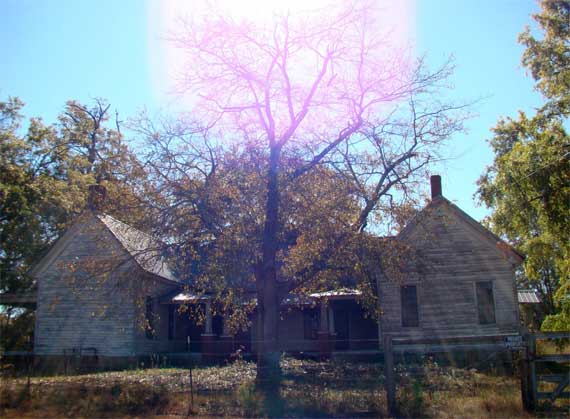
Many of the still-standing old houses across the countryside are empty. Many more are now gone, leaving a few tall trees and abandoned vegetation, unless the house site has been bulldozed and turned into pasture or field or pine plantation.
Serendipity dragged us out of the house to drive a triangle in the central Georgia Piedmont. We made a beeline to just west of Athens, then commenced our wander. We scrutinized the Georgia Atlas, and chose the smallest roads that we hoped were paved, since the unpaved roads are pretty dry and dusty in this drought….
We dropped south to Eastville, crossed the Apalachee River at North High Shoals (ex-textile mill town), meandered down to Bostwick, and scooted into Madison. Madison is famous for its lovely residential antebellum architecture; accounts vary on why the Union army didn’t burn the town, as they did many others, when they marched through on their way to Savannah in 1864.
From Madison, we turned west. You have your choice of four parallel routes. The newest is Interstate 20. The old highway it replaced is US-278 or the Atlanta Highway. That one superceded the Dixie Highway. The oldest road, following an Indian path, is the Hightower Road. Hightower is a corruption of the same Cherokee word that Etowah is. Additionally, it is possible the Hightower footpath followed a Late Pleistocene megamammal trail.
Hencequently, we set off along the Hightower route, but it disappears frequently. We went through Dorsey and Rutledge, through Social Circle (where we thought of Nell, whose maternal ancestors lived here, I think), and on to Jersey. I had never noticed Jersey on the map before. West of Jersey we found the historic Gum Creek Court House (they use four words), high on a well-mown hill. Then we did a little detour down and up the Haynes Creek valley (well on the sides of it), then found the Hightower Road again, and followed it over to Norris Lake. Never had heard of Norris Lake. Looks like some places here are second homes, like an old resort community with some architecture upgrades.
We crossed the Yellow River and immediately encountered sprawl, more precisely, the Georgia International Horse Park, which was built for equine and mountain biking events during the 1996 Olympics. From there we were in suburbia, and we made a beeline for home, looping around the north side of Stone Mountain.
We didn’t take many photos, but here’re a few:
* Sorry to get your hopes up, Marquis, but this isn’t about a bike race….
7 November 2008 at 7:34 am
kayak woman says:
love the lens flare!
7 November 2008 at 7:36 am
Sammy says:
Yeah, dirty (wide-angle) lens & looking into the sun, not Photoshop.
7 November 2008 at 2:37 pm
tom says:
I’ve explored that area a lot on 2 wheels. Kept spotting Faulkner in my rearview mirror.
7 November 2008 at 3:52 pm
Sammy says:
Ooooh, it’d be a great area to explore like that! Nice rolling terrain, with little traffic! Place names are shorter than Faulkner’s faves, though….
8 November 2008 at 9:10 pm
Marquis says:
Well you had my hopes up.