One thing about the SAAs, most people throw up a Keynote (or that other MS format), and since archaeology has a lot of spatial variables, there’re often maps. Well, they used to be maps, hand-drawn back in the old days; now a GoogleMap or two creeps in….
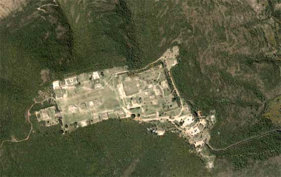
Note that the cleared area on this image had just civic-ceremonial architecture—no normal residential area. Some of that was on the terraces that sprawl down the slopes, mostly toward the top and right of the frame (no, north is not “up”). When this was a vibrant community a millennia ago, it extended outside this image. It was BIG. Uh, scale? Those rectangular things are tour buses on one of the whitish patches toward the lower right….
I had a good idea today—at least I’m pretty sure, even now, that it’s a good idea. That makes today a superb day!