Musings
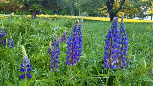
Early-ish, I braved the dew-wet grass to capture an image of the sentinels; however, the shadow makes them less interesting.
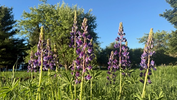
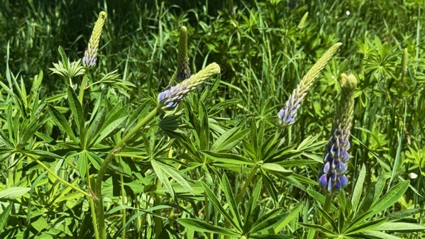
Here’s another group, far better lit.
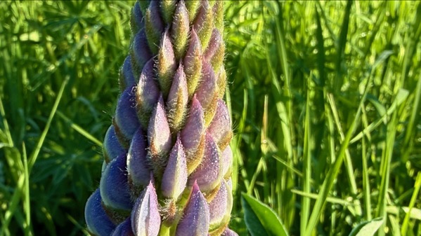
I thought I was seeing tiny dew drops when I took this, but maybe it was just lupine hairs, now that I examine them enlarged.
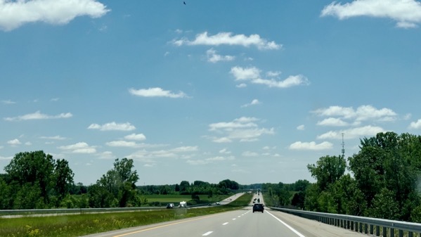
Ordinarily, I would post an image of The Bridge on this travel day, but I’m mixing it up and posting one of the view south from what my family called The North Country Hill. It’s just north of Clare, and I assume it’s glacial, perhaps a moraine. Without the contrast of passing through the rolling hills to the north, it doesn’t look like much. Bridge photo next time?
Posted at 7:44 PM |
2 Comments »

First light (ish).

First apple petals blown off the trees in large numbers.
First color showing on lupines.

First bath in the lake. I visited the fishes.
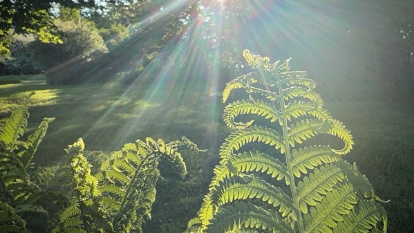
First ferns all the way unfurled.
Posted at 9:18 PM |
No Comments »
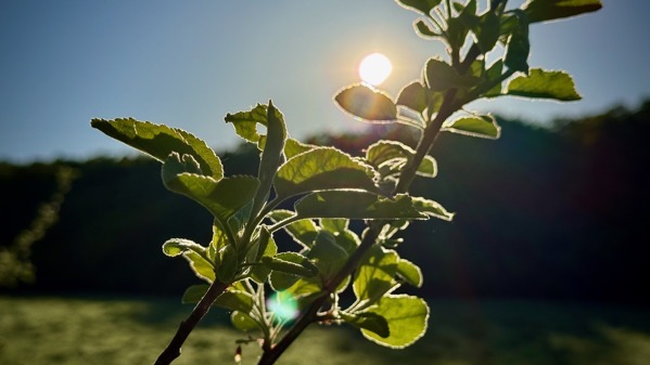
Morning sun with apple leaves.
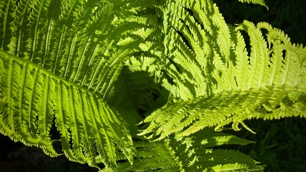
Black hole of fern.
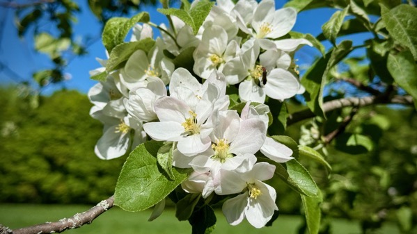
Apple blossom cluster (in late-day sun).
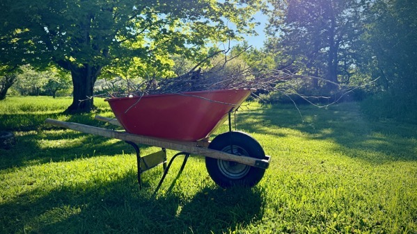
Work, interrupted.
Posted at 7:37 PM |
No Comments »
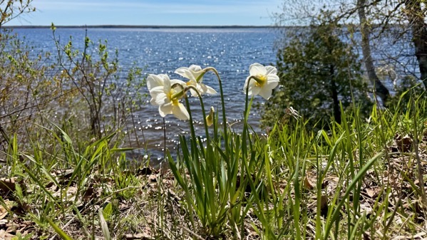
We made it! We found daffies looking at the lake…
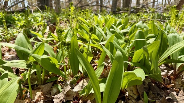
…and ramps and fiddleheads in the woods…
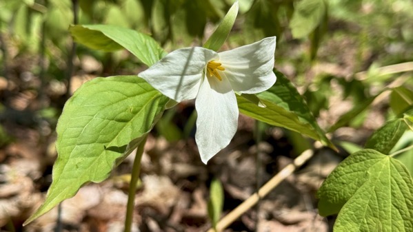
…along with the earliest trilliums…. All a wonderful balm for my soul.

I tried for an artsy shot of the cabin-to-lake view, and flubbed. You can see the rain barrel is not yet in position, and there are many untackled chores you can’t see (thankfully), many of which eventually got eliminated from the to-do list. We are so happy to be here and the sun warmed the front porch enough that we sat there between waves of chore-ing and to dine tonight, just soaking in the bird calls and the aura of agreeableness.
Posted at 9:31 PM |
2 Comments »

If you know this statue, you know two things. One is that the accompanying golden mare has been missing for several years; there’s no information about what happened. The other is that the golden foal is at the entering-Kentucky-northbound-on-I-75 rest area. Yes, we are northbound!
Posted at 9:17 PM |
No Comments »

We don’t while away the afternoon chatting with friends over coffee sitting under an oak tree and enjoying a breeze often enough.
Posted at 9:22 PM |
No Comments »

A couple of weeks back, I came up with an idea for an index to describe the intensity of my activity/projects/that kind of undertaking. Back then I was doing mattock work, and my watch periodically would offer to call emergency assistance. So, my index idea would be the number of times it did that. I guess it would be slightly better if that count was set against the time involved.
The most intense project was a six—six offers to call for help because I had fallen (so my watch assumed—it was really mattock-thunks that set it off).
Lately, I’ve been doing pressure-washing. No offers to call for help. Therefore, these days have been zeros, one after the other. Comparing zeros isn’t terribly illuminating, so, pfft, the index is now in the dustbin of history.
Posted at 9:31 PM |
No Comments »

This morning’s most important errand: early in-person voting (primary). I had a hard time getting even basic information about down-ballot candidates, but managed to make sufficiently informed decisions (pretty sure).
Posted at 10:28 PM |
Comments Off on Being civil

I’m convinced that I met the Guru because of Ted’s choice to become a media guy. Of course, it wasn’t that simple! RIP, Ted.
I asked the Guru to create an image that portrays the intersection of his design work and Ted’s stations. There’re interesting visual tidbits.
Posted at 9:03 PM |
Comments Off on Things change
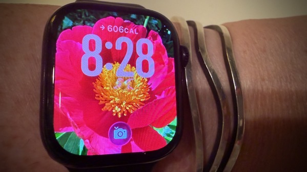
I never tried a photo on my watch before; I knew it was possible, but I didn’t think it was…me. However, peony-watch is a fine look.
Posted at 9:08 PM |
Comments Off on Flower on my wrist