Amazing azalea
Sunday, 31 July 2022
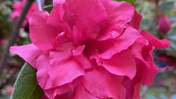
I’m guessing this is bloom cycle five of 2022. This bush is persistent, even though it’s very hot and humid and maybe not the best weather for being a flowering azalea with high energy demands.
Sunday, 31 July 2022

I’m guessing this is bloom cycle five of 2022. This bush is persistent, even though it’s very hot and humid and maybe not the best weather for being a flowering azalea with high energy demands.
Saturday, 30 July 2022

I’m going with juvenile magnificent frigatebird. Love the delicate blue of the bill.
Another in my Remembering Galápagos series.
Friday, 29 July 2022

Wow. We had some rain come through 5ish and it cooled things off…to a mere 79°F now. Take me back to the equator, please! [Where it’s cooler, at least on the water.]
Thursday, 28 July 2022

When I’m not focused on something, my mind drifts back to the Galápagos, including marine iguanas (Amblyrhynchus cristatus)…
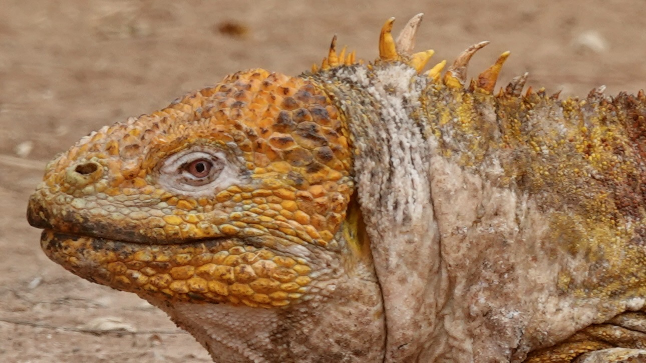
…and Galápagos land iguanas (Conolophus subcristatus).
Both do lots of thermoregulating and basking.
My body is finally starting to get used to being here. The relatively brief overnight flight Sun/Mon is what messed me up, I’m pretty sure. Last night I was asleep shortly after 8:30pm, and I slept over nine hours.
And tonight—hey, I’m still awake. 😎
Wednesday, 27 July 2022

I’m still adjusting to…not being on a tippy ship; not being at sea level; not being at 9400ft (plus or minus); and, not having a chef and sous chef to cater to my food needs and subsequent clean-up.
Dish processing tip: put the clean, damp dishes—all stacked as they will be on the shelf—in the microwave and dry them that way.
Tuesday, 26 July 2022

Given how many people we were around during our relocation from the southern hemisphere to home over Sun/Mon, we are unofficially in quarantine. During different parts of our trip more and fewer people around us were masked; however, few of the masks were at this 95% level of filtration, so ya gotta consider that germs were out and about. Thus, we have to trust that our well-fitted 95% masks did their job vis-à-vis Covid (and monkeypox, and the common cold…etc.]. We won’t know for a few more days, however. [I prefer the model on the left. The Guru prefers the type on the right.]
Monday, 25 July 2022
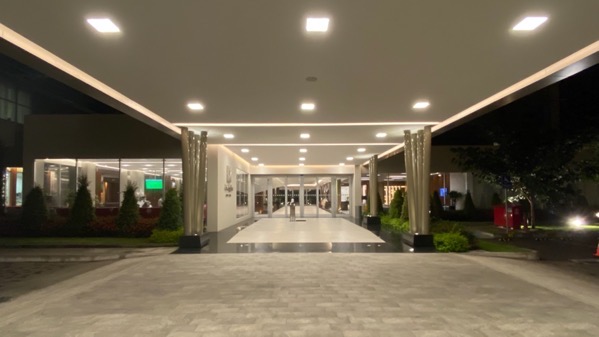
I’m going to start Monday at dark in Quito “last night.” This is the main entrance to our hotel-home. The wide entry shoots straight past the desk to the pool area at the rear of the property. Off to the left on this side is the restaurant. Opposite to the right is the lobby where we used the hotel wifi for several hours after we checked out at 2pm. Around 5:30 we moved to the restaurant for a simple meal before catching the hotel’s shuttle to the airport at almost 7:15pm.
We people-watched in the main entry area until 9:15, when the Delta employees showed up. Then, we queued to check ourselves in and check our big suitcase. We relocated past security and bureaucratic whatnot to seats by gate A11, and finally got to board about 10:40pm, for departure before 11:30pm. The flight was almost full, three seats on each side of the aisle in the main cabin. We were oh so fortunate to have a row to ourselves, and an exit row to boot, so relative comfort.
Overnight flights are by definition a trial. Short overnight flights are an even more intense trial. Our flight time was 4 hrs 44 mins, and we gained an hour while in the air. I got maybe two hours of sleep.

We landed on schedule, or was it a bit early?, at perhaps 5:20am. We got through the necessary inspections of documents, luggage collection, etc., and queued anew here outside to wait for the airport shuttle to carry us from the international terminal to the main terminal, where the MARTA trains arrive/depart. Considerable energy has been expended complaining about this awkward situation. We waited just to the right of this frame for something like twenty-five minutes for a bus to arrive, in oppressive, humid 75°F. Nevertheless, we were home shortly after 7:30am, having transferred from the MARTA train to a MARTA bus. Sooo glad we’re home.
We found the house fine, and not too large a pile of mail awaiting us. I started some laundry, as that was pretty much the maximum braininess that I could muster. I also took a ninety-minute nap before noon. Two more loads of laundry and some dry mopping, and what else? Somehow the time ticked by, and I predict an early night. Duh.
Sunday, 24 July 2022
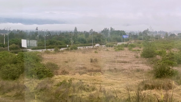
I looked out the window at 6:30am this morning, and saw the thick clouds mostly obscuring the far hillside (it’s hazily visible as the darker area between the white cloud layers) and thought: this isn’t a day for touring the countryside.
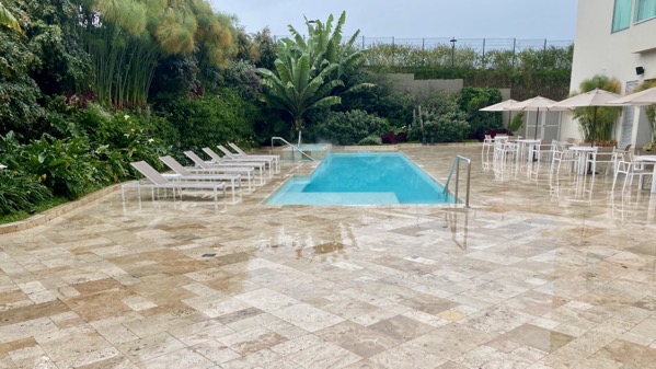
Here’s the hotel pool area at 3pm; it’s been rainy and will be again.
We fly out tonight, just before midnight. We checked out of our room at 2pm, and are ensconced in the lobby by big windows facing west, using the hotel internet and enjoying the fact that other people are far from us, although most are masked, as the hotel requests.
You might think this spot in the lobby is rather boring, but we watched three hotel employees wearing suits and dress shoes herd two Holsteins out of the front lawn about an hour ago.
It’s been a extraordinary trip, and we have accomplished what we set out to do. I sit here in a light jacket, and my trusty Apple Watch indicates it’s 54°F here. It will be months before we see the 50s in Atlanta, I think.
Saturday, 23 July 2022

Not long after we got on the (major, national) divided highway this morning, we came upon a construction zone, and got shunted over this side route leaving both travel lanes to the repaving crew.
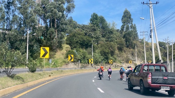
During this morning’s jaunt, we came across several groups of bicyclists, leading us to conclude that Saturday is for bicycle outings and practices.

We also found this wide load (carga ancha). Not sure what it was, but it looked rather like a reviewing stand, with many streamers.

Just off the highway, we made our turn at this church to take a very local road to the parking area for hiking in the Pasochoa cloud forest, officially Refugio de Vida Silvestre Pasochoa.

For all but perhaps fifty meters of the 5.3 km access road, we bumped along at a very slow speed. Many pickups passed us, despite this being such a narrow, one-and-a-bit lane road.

The land use change is the edge of the park, with farmers pasturing animals right up to the forest.
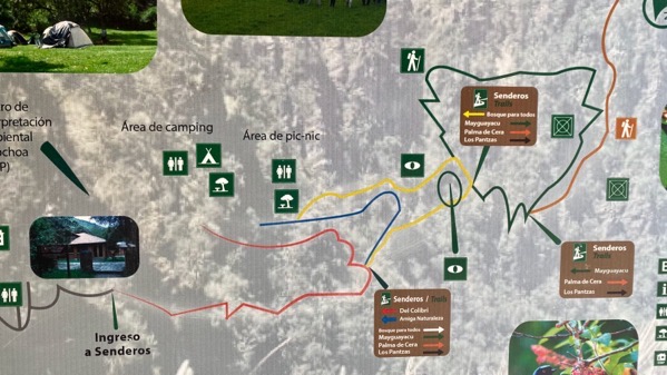
Here’s the map of the hiking trails, aka senderos. We opted for the medium-length middle one.
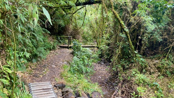
The path was okay, not muddy thankfully.
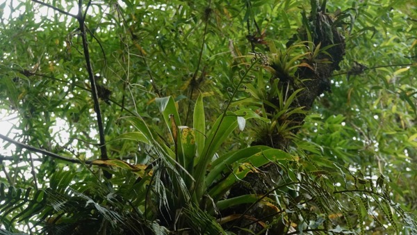
We immediately found bromeliads.

The path was in the selva (jungle), but just in it along the edge of a field. I suspect some of the plants we saw were introduced from agricultural undertakings. Not sure about this, but clover seemed like it was a pasture escapee, as they looked like the versions I’ve seen in fields in North America.
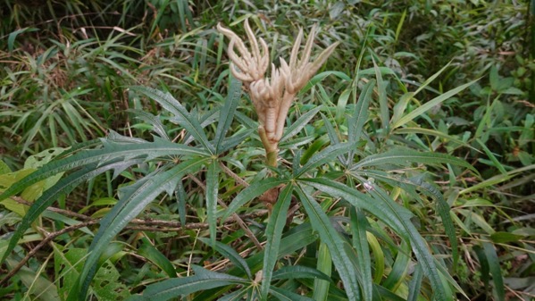
I had one of these, far less vigorous, in my freshman dorm room. I never got to see the new, beige leaflets.

Here is the downside of the path. It went up and up and up, to perhaps 9800 feet (from perhaps 9100 at the parking lot). We took it very slowly, and looked for plants, flowers, and creatures of interest.

I found a slug on a trail marker and heard a very few bird calls. I expected more….

Descending, we found a great valley view. Green green green.

The last feature before the parking lot was a fancy “pic-nic” area. We saw maybe nine of these.

We bumped along that miserable 5.3 km, then took a different route than we came through in the morning, to avoid Sangolquí, which I have nicknamed Traffic Jam Town. This is our turn off the highway to access the route to the hotel. As you can see.
This was a very different day than the previous ones we’ve spent here in the Ecuadorian valleys. Nice to have the diversity. This place is high-altitude for us, and today we really felt it. And survived.
Friday, 22 July 2022

Today’s goal is to go southeast, crossing a major pass, then turning south toward Tena and Río Napo (~1300 feet was our lowest point), on the west edge of Amazonia. We’re climbing away from the greater Quito metro area. I noticed these large rolls of steel(?) on this truck. Little did we know that we’d be amidst many of these trucks Quito-bound from Amazonia. I do not know where the metal was mined or processed.

I loved watching the clouds “sitting” on the ridges and peaks. The road markings are warning drivers to slow, this time for a sharp curve.

And, of course, the clouds mean waterfalls below.
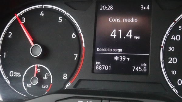
And with the increasing elevation, the temperature drops. Significantly.

Crossing Paso Papallacta, all evidence indicates we got up to 13,330 feet. Plus or minus. Breathe deeply.

Also, watch out for spectacled bears (Tremarctos ornatus). Ecuadoreans often mentioned seeing them; however, I don’t know if they were wild and free.

We descended far enough to encounter homes and agricultural undertakings, complete with places to stop and eat.
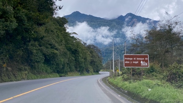
Clouds are now above us. Sign urges protecting alders and nut trees.
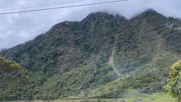
Again, that persistent cloud layer engenders landslides and waterfalls.

Shown here…but the road is open! And navigable in a mediocre rental car.
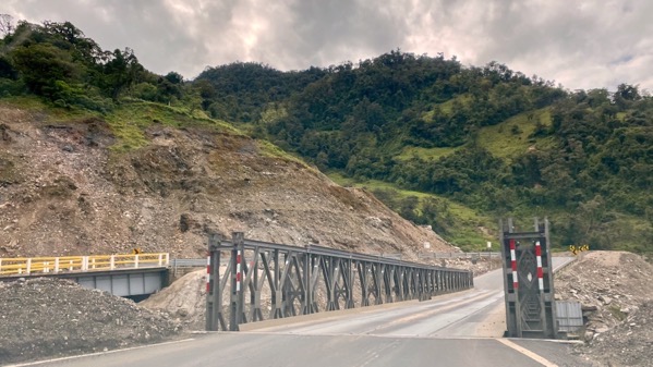
I’m guessing the regular bridge is left, and we were sent across a “temporary” bridge. Speculation.
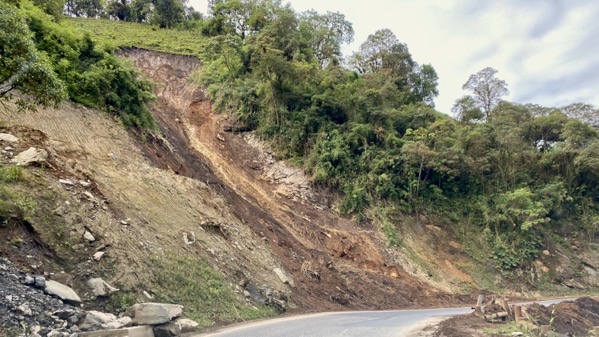
Fresh landslide, perhaps two days ago, but not last night.

Horse grazing roadside. Ditch and vegetation clearing crew ahead.
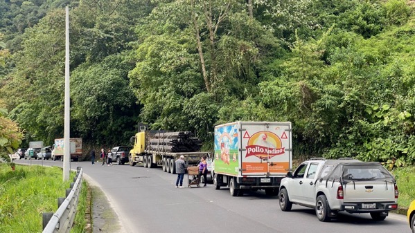
We encountered stopped traffic. An official came by and said there was a bad accident ahead, and it’d be two hours before we could continue.

Our car was stopped with the rear wheels on a bridge over Río Quijos. I could step out and get a great shot, not through the windshield.
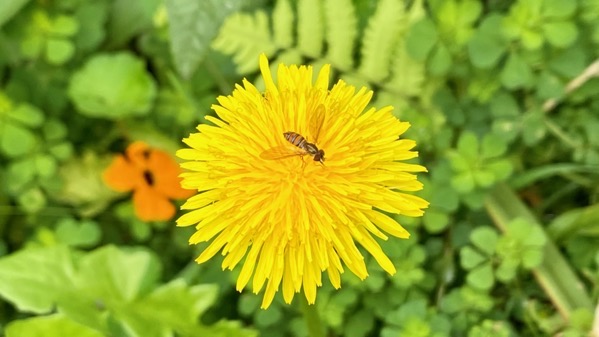
And also find flowers to photograph. We were very lucky. In perhaps forty-five minutes we heard a whooping and whistles, and drivers dove into their vehicles. We do not know why down-bound traffic got to go first.
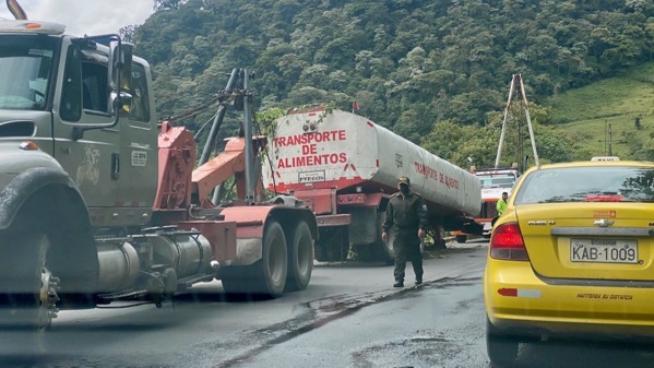
Soon, we saw some of the accident remains. This was on the left. Note the vegetation on top of the tank; it must have rolled. On the right (no photo) was a dually axle. Note the two huge wreckers. Not sure what happened, but it was awful. Not far down the road, we entered a busy town, and the first sign I saw was gruas, that is: wreckers.

We descended and the terrain became much flatter, and the temperature rose (eventually to 88°F).

Another ridge to cross. Glad we don’t have to go straight.
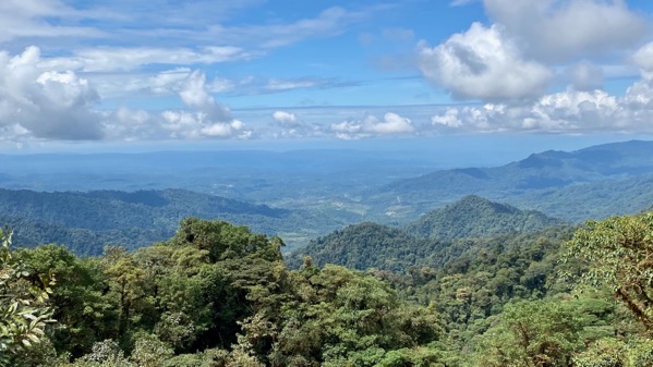
And an overlook: mirador. Not complete Amazonia flatness, but close enough for these two first-time visitors to South America.

We weren’t too happy with the defective metal decking plates on this bridge over the Río Ñachi Yacu.

Note the frond roofing; different plants grow here in numbers. And the tire atop the circular structure and sheet plastic on the others.

We roll into Tena and find it busy with locals, non-locals, and a wide variety of commercial activity. This town is humming.

And someone had the money and will to build a green-glassed building on a busy corner.

We crossed the new bridge over the Río Napo.

Río Napo’s headwaters are from the flanks of Volcán Cotopaxi and other mountains, It flows 668 mi before joining the Amazon. Clearly, it’s capable of carrying lots more water here, yet is plenty wide today.

We recrossed the river on the old, one-lane bridge.

We are even less happy crossing the Río Ñachi Yacu bridge northbound, closer to the branches and flagging tape.

Aha, here’s the other part of the accident vehicle. We had no clues on why the vehicle rolled.

We took a side trip on a loop through Papallacta, as we’d heard so much about the thermal baths there. Here’s the hotel by the spa and other facilities. Looks special. We did not stop to bathe.
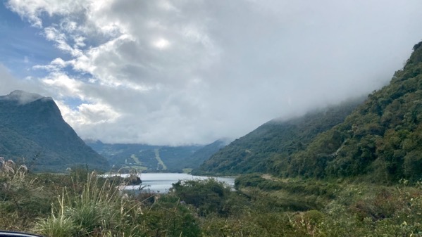
Northbound, we could take the old road out of town (one way), and saw this, Laguna Papallacta. It’s clearly a reservoir, and there was no power generation facility. I speculate it’s to protect the town, which isjust downstream.
There was more rain as we reached the higher elevations. Otherwise, the trip back to the hotel was a version of what I’ve already portrayed.
A fabulous day.