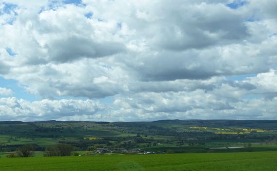
We saw the landscape change today, first as we drove north, eventually through the Pennines, and then as we drove east, descending the Tyne drainage. We saw more critters than people throughout most of it, I daresay.

We watched the row crops yield to pasture, with fields defined almost exclusively by stone walls.
We did this in Our New Car!! Yes, new to us, but ALSO it had 40-some miles on it when The Guru received the keys! New car smell! Shiny white!

The rolling countryside became treeless….
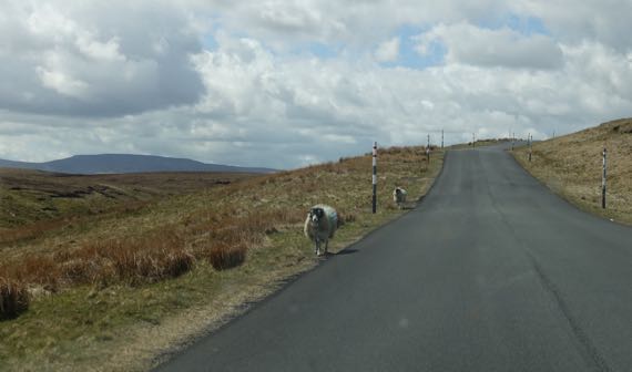
And we were on the open range, driving between the snow-sticks, and watching for “LAMBSONROAD.”

Even more exhilarating, we visited a Roman fort…. That’s the land of the barbarians on the left, and down at the bottom of the hill…the creek…that’s Knag Burn. Burns are creeks. Other things, too…. Many of the trees in this area were pine plantations, and some were newly logged, but not these “forests.”
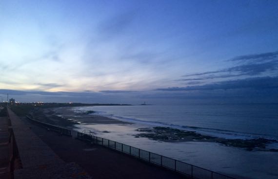
Our east leg took us to the end of the wall/road, and we watched the afterglow on a North Sea seawall.
Technical report: we’ve been using Goog__Maps to do our navigation, with Miss Voice turned on. She mentions nearly every roundabout, even the ones that are just a big white dot in the middle of a circle of pavement. Keeping us on our toes. Every once in a while she skips one, but our route is obvious. Sometimes she over-narrates curves and turns. Today she totally skipped one, and we had to backtrack. I think it was a new subdivision that wasn’t there in her world, although it was on the map. Still, using technology makes the whole process quite smooth compared to scrutinizing printed maps…without the magic blue dot of self-ness (as in, I am here, right HERE, therefore I exist…).
21 May 2015 at 8:08 pm
Rebecca says:
Lovely seawall photo!