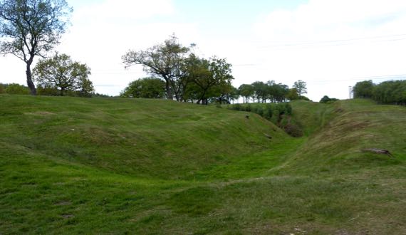
This may be the last about Roman occupation on this trip. This is a turf fort on the Antonine Wall, called Rough Castle. The Romans took twelve years to build this wall, and after eight more years they abandoned it (the forces of political economy…). To the right is the land of the barbarians, with a ditch and rampart in the mid-ground, facing the threats…to the far left is the fort, and I am standing on a gate (I assume; one sign on the whole fort…). This is the second-smallest fort along this wall, and the best preserved. It’s rough, humpy ground surrounded by a ditch, and would be a royal pain to sketch-map with a compass by pacing.
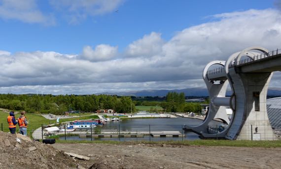
By the time we got to the other side of the hill (roughly speaking), the sun was out, and we found two guys and a drone watching the Falkirk Wheel. This is some major industrial engineering to bring boats up/down between two canals at very different heights. The drone is left of center near the top and the boat is at the bottom ready to enter the lower basin. The arm takes the boat and water on side, with a counterbalance on the other. This lift replaces eleven (I think) locks that used to be used to span the 79–foot elevation change.
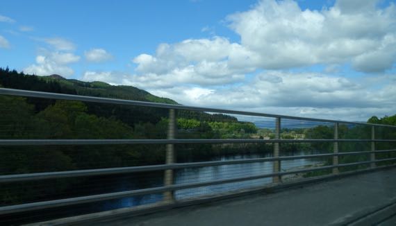
As we climbed, we saw many plantations, including bits of Tay Forest. Some of Tay Forest is old(er) growth…. And rivers, some with rocky beds and rushing water. Elevation….
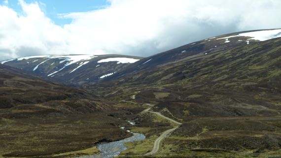
As we climbed higher, we got above the treeline (or at least where trees have not returned since the last glaciation), into glacier-rounded peaks and valleys, with some snowpack remaining. The dark brown landcover is heather. The lambs up here are much younger than at lower/warmer elevations, and most were hunkered down napping, not gamboling about, as we have seen everywhere else.
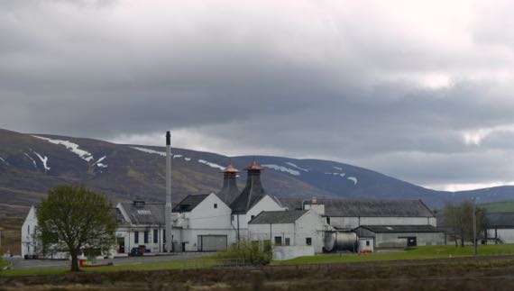
We have driven past several whisky distilleries, but have yet to stop. Crazy, eh?
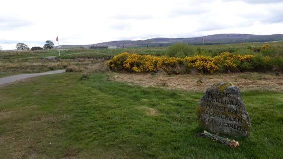
Many men died on this relatively flat moor, properly called Drumossie Muir/Moor, including Scotsmen fighting on both sides. This is where the Blàr Chùil Lodair, or Battle of Culloden, happened beginning about one in the afternoon of 16 April 1746. The Jacobites, who sought to restore their beloved Stewarts to the throne, opened with cannon fire, and English forces answered with their own cannon. As the National Trust for Scotland puts it:
Bombarded by cannon shot and mortar bombs, the Jacobite clans held back, waiting for the order to attack. At last they moved forwards, through hail, smoke, murderous gunfire and grapeshot. Around eighty paces from their enemy they started to fire their muskets and charged. Some fought ferociously. Others never reached their goal. The government troops had finally worked out bayonet tactics to challenge the dreaded Highland charge and broadsword. The Jacobites lost momentum, wavered, then fled.
Hardly an hour had passed between the first shots and the final flight of the Prince’s army. Although a short battle by European standards, it was an exceptionally bloody one.
Culloden was the last pitched battle on the British mainland, and the ramifications for the Scottish people have been immense. The English subsequently sought to suppress ethnic Scottish behaviors, including kilt-wearing, the Scottish Gaelic language, and the clan social structure. The effect of these changes was a depopulation of hinterlands, and disruption of pretty much everything Highland.
This and other rough stone markers were installed in the 19th-C. Archaeologists have used non-destructive, remote sensing techniques to define the areas where bodies were buried in mass graves.
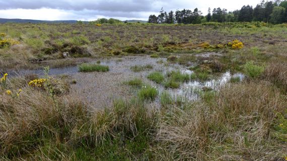
Another problem for the Jacobite troops was that the part of the battlefield they sought to cross was even wetter than today, slowing the advance of a major portion of the line. Indeed, this was a little marsh we found that would have been difficult to slog through.
Managers of the battlefield are encouraging the plant species that were here on the day of the battle, and the moor is turning from pasture into…gorse and grasses, along with wildflowers and other woody plants. One type of feature that was here in 1746, but is mostly gone now, are stone field enclosures…. The powers-that-be are also trying to convince landowners in the preservation area to refrain from tree plantations.
Such are the cycles of land management.