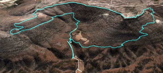
Our route, courtesy of our aging Garmin and Google Earth.
Good thing it was downhill for miles back to the car…. This loop, around and through The Pocket, totaled 9.71 miles. Whew!
It’s still the earliest of winter/spring transitions up in NW GA. We found only three sets of wildflowers, although I saw non-blooming greenry almost constantly along the path.
For Googlers and other researchers, there are two hiking areas/landforms called The Pocket in NW GA. The other one is on the edge of John’s Mountain in the Armuchee Ridges (that looks like you’d say are-moo-chee, but locally they say are-murr-chee; go figure). This one is nestled up next to Pigeon Mountain. Cherokees took refuge across this area when Intruders began to proliferate across this continent, and they have contributed substantially to the surviving place names….
3 March 2008 at 11:05 am
jcb says:
It was all downhill from..uh..a certain point.
3 March 2008 at 9:04 pm
Bill says:
No, it REALLY was all downhill. The uphill parts would have been downhill if we had been going in the other direction. Sort of like it’s always 5 o’clock somewhere.
3 March 2008 at 10:33 pm
Sammy says:
Guys, after I get rested I’ll give you another chance to nail the point when the trail starts going downhill; maybe the lovely V can join us then, too!