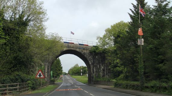
Kinda overcast when we set out. We did have spots of sun and showers, the perfect set-up for a mellow day.
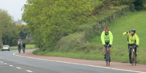
We came across a bike race with dispersed riders soon after we hit the road. Some were wearing bright anoraks…thankfully, they were going the other way.
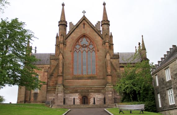
It’s Sunday, so here’s the Church of Ireland Cathedral in Armagh. The RC Cathedral also honors St Patrick. The Archbishops of both sects are here and both are Primates of All Ireland (if I have it right). Armagh is historically far more of a center than it is today.
We still don’t know how to say Armagh. (Is it guttural?)
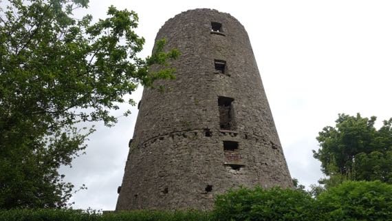
We found this six/seven-story ruin up Windmill Avenue, and indeed it was a windmill perhaps two centuries ago. No access; it’s fenced off. No informative signage.
Due west of Armagh is the pre-Patrick religious center, Navan Fort, properly Emain Macha. Folks don’t use much Irish around here, but the instructional materials at this location prefer the Emain Macha name.
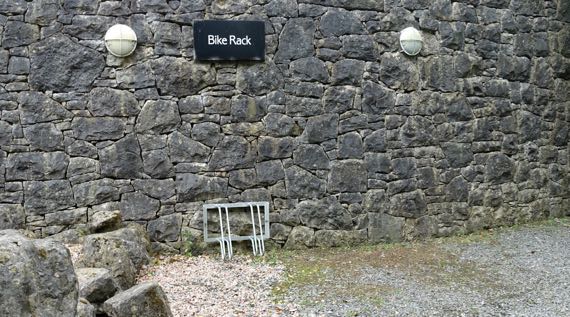
Good thing the bikers weren’t headed here. This bike rack has a limited capacity.
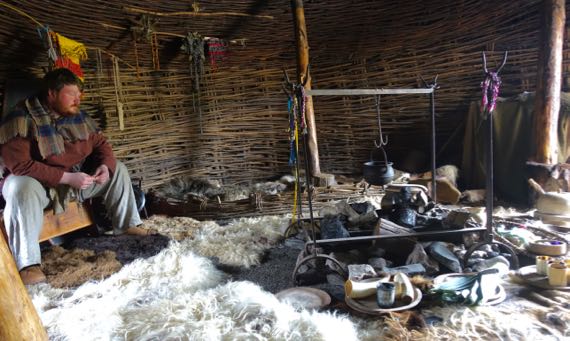
We began with a visit to an Iron Age house, reconstructed and populated with this warrior, Fergus, and a bard named Sanka. Great fun!
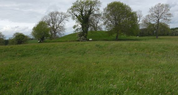
The most unexpected thing that archaeologists discovered about these ritual features atop the hill is that the bump in the distance was the location for a series of timber structures. The largest, indeed the largest Iron Age ritual structure known in Europe, was built in 94BC (based on tree-ring dating). Before this hill became a ritual/construction site, a different hill was favored. Of course, later, the geographic ritual focus of the people living in this area moved to Armagh.
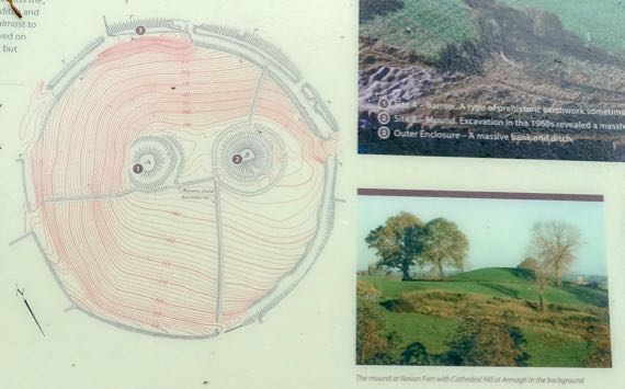
This topo map may be helpful. I am standing on the left, lower feature (#1), and looking toward the right, major feature (#2). The white signs outline the outside of the hill outside of the ditch that encircles where the enormous soil-covered timber structure used to stand.
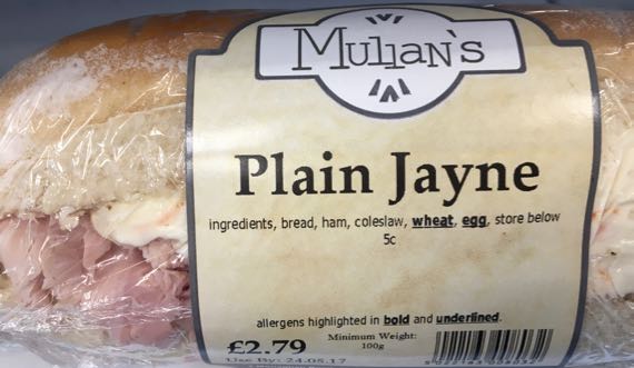
Lunch time: would you like a Plain Jayne sandwich, ham and cole slaw? (Did not buy.)
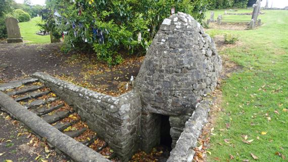
We moved on to the remains of a medieval motte-and-bailey castle (eroding; not pictured) and to the adjacent ruined church and graveyard. This is on the Hill of Faughart, believed to be where St Brigid (~451–525) was born and brought up. If she didn’t live on this ridge-nose, I’m pretty sure she must have come here. If, indeed, she was from what is today called the Hill of Faughart. Anyway, this dipping well is associated with St. Brigid. Leaving the rags tied to the tree is part of ritual visits here.
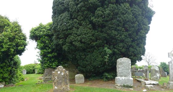
The church walls are beneath the ivy at the far left and left center of this photo, left of the dark green evergreen. Just to the right of that dark green juniper? is a “flat” grave. The marker records that Edward Bruce (~1280–1318), brother of the Scottish king Robert the Bruce (Roibert a Briuis) is buried there. He died from wounds received in a battle in the lowland below this ridge nose.
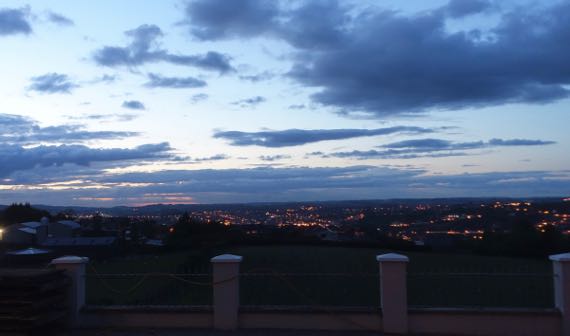
This is last night’s sunset, a bit prettier than the one tonight, and appropriate as we bring this chapter of our lives (trite trite) to a close and get those stray belongings packed into checked baggage, rather than in separate containers that can be stashed in the car, ready to be dragged into the next B&B.