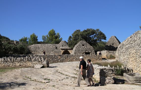
If you chose to live on a limestone deposit that will break into flat stones, you have the perfect material to make…corbeled-arch buildings. Around here, these are called bories, and the village of Gordes has several hundred to the west of downtown, a small cluster of which were restored in the early 1970s, and are now owned by the town. The earliest in this cluster date to the 1400s, but the oldest known date to well before Christ. I believe this cluster was abandoned early in the 20th C. Anyway, they’re quite…interesting.
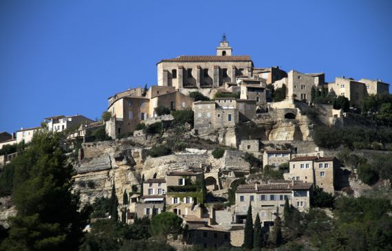
If you have a medieval mentality, you build on top of hills, and put your church on the highest ground. (Or maybe you command the populace to do so.) Terracing works to hold the slope yet make the steep terrain useful. Worldwide.

We wandered the small town square of Oppède-les-Poulivets (43.84360,5.16855), with about a dozen parked cars, and caught some nice late-afternoon light shots. Then a local bus arrived, and a bunch of kids got off, headed for the cars, and within three minutes, most of the cars had disappeared.
Posted at 10:22 PM |
1 Comment »
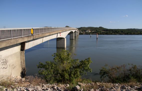
I keep thinking about the Rhône, and we keep visiting its environs, but I have yet to SHOW you the Rhône. So, here it is. A bridge downstream of Avignon—we were avoiding the afternoon traffic through town….
On our way back from…Ambrussum.
This is a Roman hillfort and surrounding community that basically was not trashed by later occupation. So rare.
Also, except for some foundation walls and part of the city-wall, there’s been no reconstruction here. I like that.
We had a hot walk (no rain today!) up the hill and on the trail, mostly looking at limestone chunks, with scattered sherdlets among the stone-crud. Parts of the trail followed the old Roman cobblestone ways.
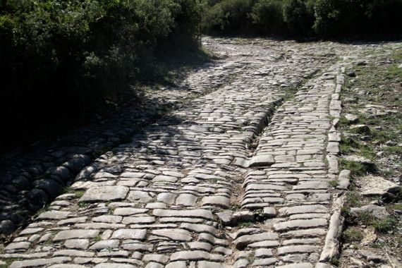
The interpretation is that these cart-wheel wear patterns date to Roman times. Given the layer of overburden and lack of medieval/later occupation here, I’d buy that.
This hillfort is immediately adjacent to the River Vidourle, although the fortified area is a slog above the river. Still, the community needed a bridge to be effective in controlling trade, and so it was.
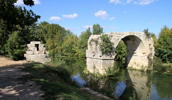
The bridge, Pont Ambroix, had a second standing arch maybe a century ago, the arch that connected to this bank. If you look into the water, you can see the large blocks that must have been part of the bridge, including on the other side of the standing arch. The vegetation growing among the stones doesn’t help preservation, either….
Ambrussum and other places we plan to visit as we proceed west are along the Via Domitia, the section of Roman road that went west from the Torino area (Po Valley, northern Italy), crossed the Alps, and dropped down to the upper Lower Rhône area, then went west paralleling the seacoast, and into the Pyrenees.
Title credit to The Guru.
Posted at 1:18 PM |
4 Comments »


