From kings to peasants, via local leaders
Thursday, 21 May 2015
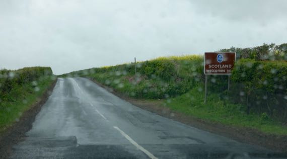
Today was designated Abbey Day in our itinerary. It was not wrong. What we really did that was most important was get to…Scotland! (And, yes, mostly we had a rainy day.)
Historically, as today, there’s a sociopolitical core to the north and south on this great island, and somewhere on the lands between has been a border zone. Today, the border’s an agreed-upon line across the landscape. For generations, it was a wide swath of contention. The border was generally porous, often dangerous, and yet had economic potential in an agrarian economy. And, land, after all, is land, and land is territory.
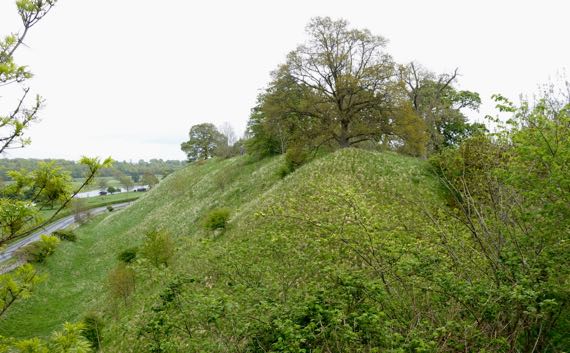
From the 1100s–1400s, a castle on this hill, between two rivers, was a political and economic center. Kings lived here, and both the northern and southern sides held it in repeated succession cycles. This was Roxburgh Castle, founded in the mid-1100s by David I, King of the Scots from 1124 until his death in 1153. Now, at the foot of this rough double-hill, there’s a small layby with room for maybe four vehicles, and no signage.
King Henry I (coronated 1100, died 1135; fourth son of William the Conqueror, King of Normandy) held sway in England, but suffered from pressures brought by rulers on the continent, in Normandy and elsewhere on the northern rim.
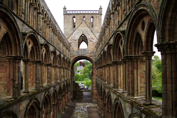
The economic and political elite of the time included both nobility and the guys who controlled large abbeys-and-churches. They were two sides of the leadership coin. Yet, the petty kingdoms of the time rarely could dominate the peripheries for long. Accordingly, cagey religious leaders were happy to build and run Jedburgh (above) and several other abbeys not far from the Roxburgh core that for centuries held sway in the borderlands—and to feed off and accept the wealth of the nobility as donations to fund repeated monk-prayers (see how well it worked, the buildings of…almost…all are now in ruins). The leadership of some of these abbeys came from afar, others from Lindisfarne….
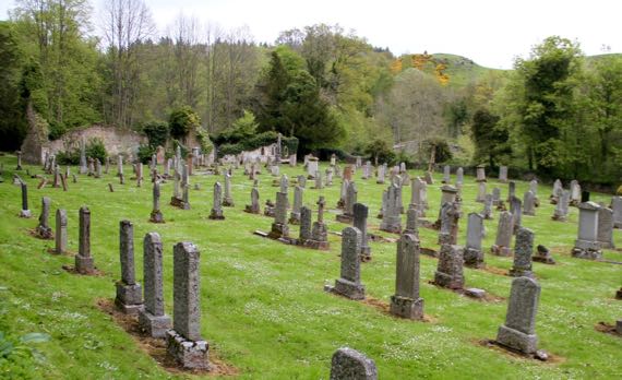
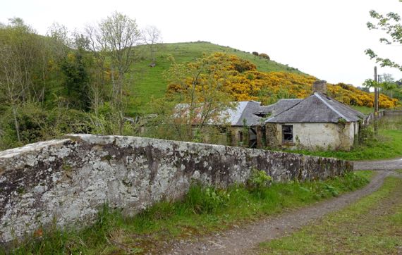
Into this general pattern of upheaval over the centuries, the place I found most interesting that we visited relates to my family history…. Traced through my mother’s father’s mother’s ancestors, we get back, after something like a dozen generations, to the Livingstons of Ancrum, post-Reformation (them, post-Dissolution) men of god here. The original Christian outpost here was established by David I, and it became a parish church after the Reformation in 1560. John Livingston became the minister here in 1648. Some of his relations migrated to the New World in the later 1600s, including signer of the Declaration of Independence for New York Philip Livingston (1716–1778). Anyway, (somewhat tenuous) family ties to the village of Ancrum (pop. ~300). In older times, the town center was west of the modern town center, near the ruined church, now surrounded by (mostly) 19th- and 20th-C headstones, and across the river from the ruins of a flax mill….
The icing on the cake…across that bridge by the church-cemetery, and up on the hill that has yellow blooms on the woody shrubs, are the remains of an Iron Age ring fort!