Musings

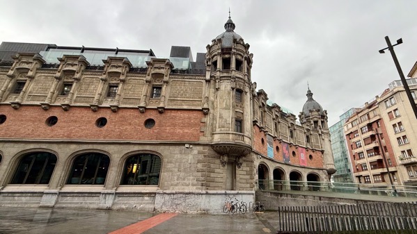
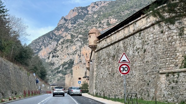
Different day, different museum: Museo de Bellas Artes de Bilbao, established 1908. This is the “Old Building;” behind it, the new is being reworked—note crane. The collection focuses on Basque and Spanish works.

This is Ramiro Arrue’s (1892-1971) “Euskaldunak karta jokoan,” meaning Basques playing cards.

He did it about 1919. I was fascinated by the footwear, especially the boots on the left with exterior laces.

Aurelio Artete did this in 1930–35, and called it “Euskal arrantzaleak,” or Basque fishermen. Again: footwear…. I’m wondering if the short boots are of rubber? They do look globular. Also: bare feet.

We saw one Picasso on display: “Still life with glass/bowl of fruit,” dating to 1937 (don’t know the original language of the name). In English, it’s “still life,” but in Spanish it’s “naturaleza muerta,” or, literally, dead nature.

They had three Goyas on display, including the side of the shipping crate they came in from France…I didn’t get the full story. This was the middle painting of the three (yes, I cropped it), the esteemed Bernard Tavira, dated about 1787-88.

Here’s a detail of the Señora’s carnation and ruff.
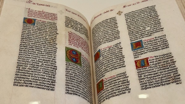
A few smaller rooms displayed fascinating historical documents and the like that normally no members of the public get to see. These are a pair of pages from “Corpus Iuris Civillis;” it dates to before 1477, and is in Gothic script. This is a later copy of a compilation of Roman laws from AD 117–565; the compilation was ordered by Emperor Justinian I, who was emperor from AD 527 to 565. This copy was made for Pierre de Laval, who became archbishop of Reims in 1473, and died in 1493. Many modern legal systems relate back to these laws.

Here’s a small section of the official document of excommunication of Henry VIII of England by Pope Clement VII and the Holy Council of Cardinals. This is an authorized copy sent to the Spanish court, and dates to 1531.

And then we were outside enjoying the sun…we found groundskeepers at work—here the fountain cleaners.
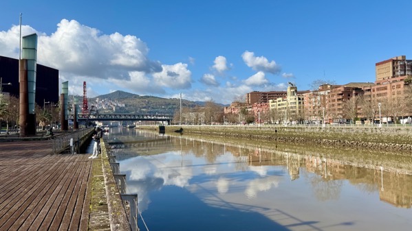
Here’s Bilbao’s river, the Nerbioi (Basque), or Nervion (English). This view is toward the mouth. This area was once the port area. With larger ships, it’s moved to the bay at the mouth. Note also that Bilbao, the city, is along the river, and the higher elevations are forested.

The façade of this building stood out to us both. It appears to be a private business…. BTW, that’s a pedestrian bridge to the left.

And, our riverfront trajectory brought us back to…this sculpture/building by Frank Gehry (born Frank Owen Goldberg, in 1929).

I very much enjoyed seeing Anish Kapoor’s “Tall Tree & The Eye” (2009) without raindrops.

Here’s this combo moto and lift that I posted yesterday from the other side.

Guggenheim detail. I think this is employee parking on the “back” side.

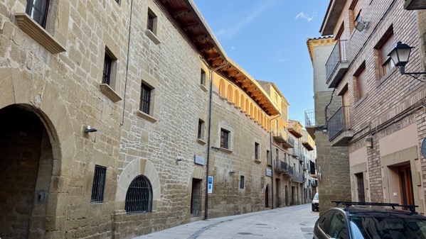
And, for giggles, a totally different façade, in town, away from the former port area.
Posted at 12:55 PM |
Comments Off on No archaeo, day three

When in Bilbao…and especially if it’s rainy…. This famous Frank Gehry-designed museum opened in October 1997, riverside where the port was, opening up this part of the city with a major international attraction. Alternatively, people come to see “Puppy” by Jeff Koons, a flowering-plant bedecked West Highland terrier behemoth.

We joined a HS group crowded under a meager overhang waiting for the museum to open. They were speaking French and English, perhaps from a posh school over in Bayonne…I didn’t ask.

It took just a moment to scan our phone-born tickets, and another moment for a brief uncurious security inspection of my purse, and in we were. Entry hall, empty and quiet, so different subsequently.
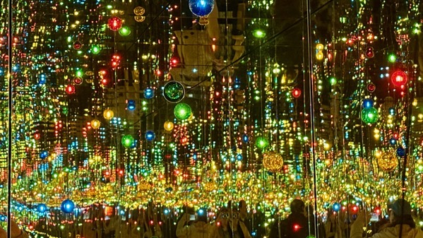
We went directly to the top/third floor, and our amazing first stop was to be closed in a room, just the two of us, with lights and reflections…guaranteed to make anyone smile. It’s called “Infinity Mirrored Room—A Wish for Human Happiness Calling from Beyond the Universe” (2020), by Yayoi Kusama. Her works are very diverse and include novels; she has done many Mirrored Rooms. The vibrancy of the space seems appropriate to someone who experienced hallucinations beginning at age 10.
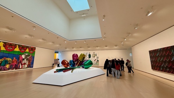
The rooms and spaces elsewhere tend to be huge. Five pieces only are in this room, e.g., a Warhol multi-Marilyn to the right, and a Roy Lichtenstein on the far wall, with a Jeff Koons flower bouquet in the middle.

Making art with art…selfie of the two of us…and a different school group.
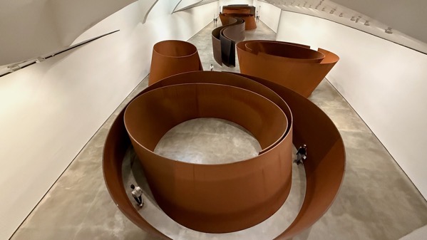
A whole wing held this Richard Serra eight-piece composition called “The Matter of Time” (1994–2005). My favorite section was the fifth one, called “Torqued Spiral (Right Left).”
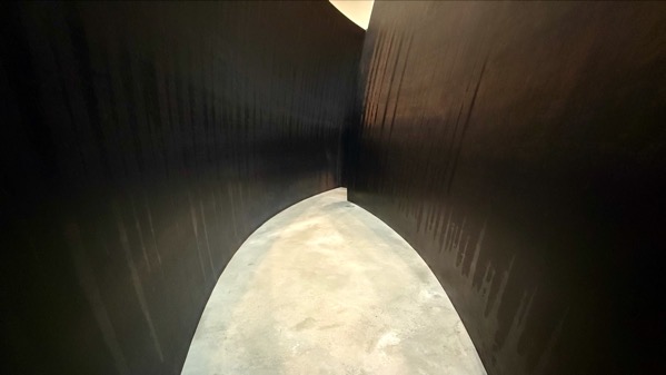
The steel walls framed a passage that kept going and going. This was the view looking out from the dead end.

Much of the second floor was dedicated to the works of Hilma af Klint (1862–1944), a pioneer (almost everyone uses this word about her, so don’t call me a copycat) in abstract art. This is her “The Ten Largest” (1917), showing the four stages of human life: childhood, youth, adulthood, and old age/being elderly.
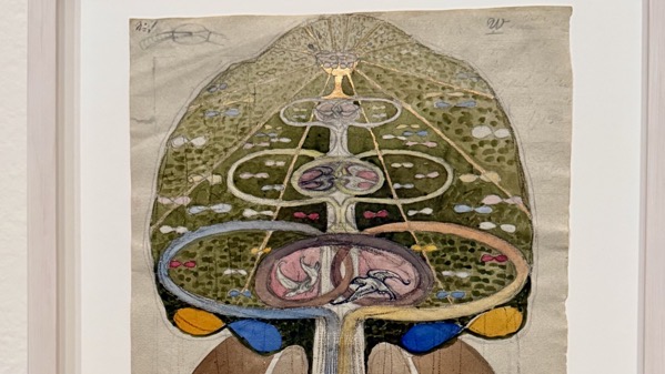
Her other pieces are smaller, sometimes much smaller. This is one of a series called “Tree of Knowledge” (1913–1915).

It was just too wet/windy to comfortably visit the many sculptures outdoors, so we glimpsed them through the windows.
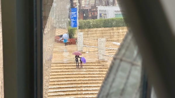
Life outside the museum—endlessly eye-catching. Hopeful umbrella vendor and two museum patrons, already equipped.

Bridge view, by river.

Bridge view, with lift and moto.
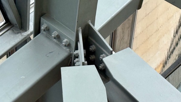
Building detail—nuts and bolts of it, and the beams they join.
Posted at 11:43 AM |
2 Comments »
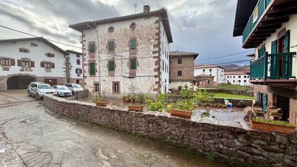
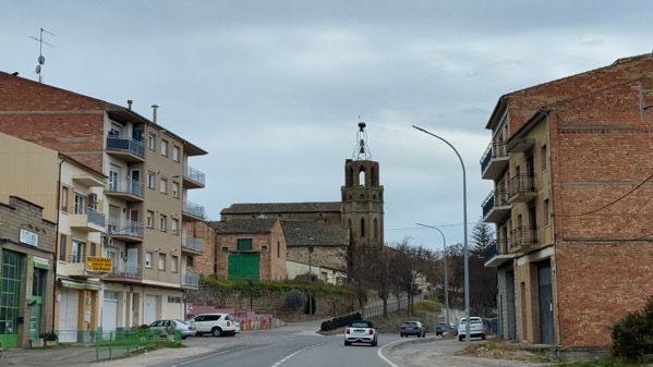
We stayed last night in the Baztán Valley, deep in the mountains. One of the routes of the Camino de Santiago de Compostela comes through here, so there were buildings here in the 10th C.
Later, residents historically went to the USA to work, returning with enough wealth that the buildings are relatively spiffy—and not just homes. This is the monastery that was across the street from the church in yesterday’s post—ornate and expensive, no?
One other cultural anthro detail about this valley and the general area, including into France, was that from at least the 13th C, a marginalized population lived in separate hamlets from the “regular” people, with stringent social restrictions imposed on them that varied by time and place. Interested? WikiP has entries in Eng, Fr, and Spn, under cagots for the first two and agotes in Spn.
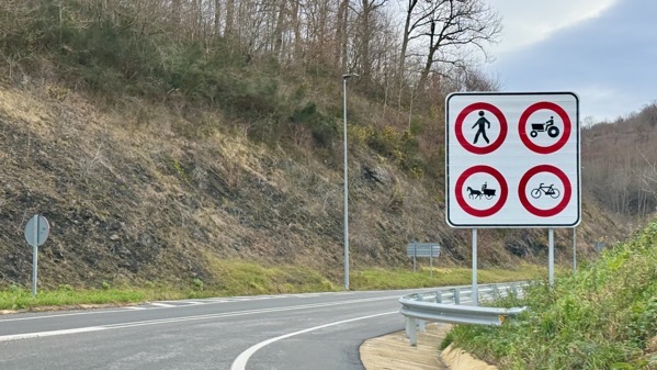
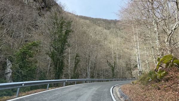
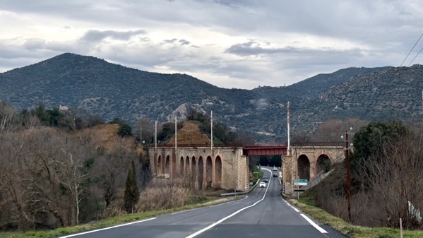
We set off, happily on a faster road, with these limited access criteria. No knowledge of Basque needed to get the meaning.
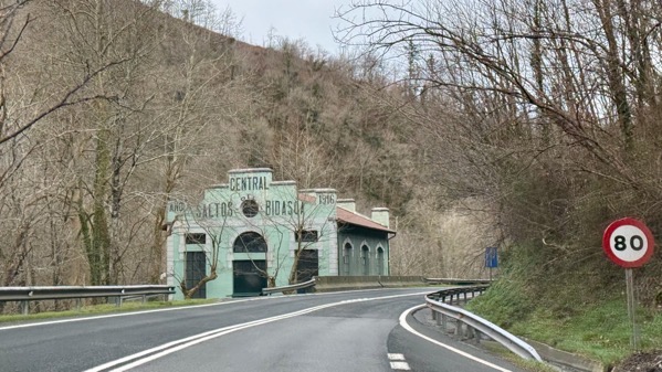
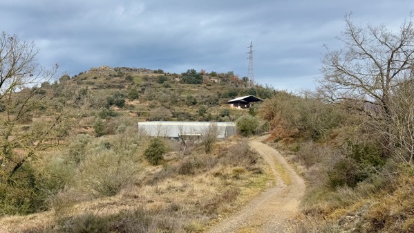
I managed to get a shot of this building as we motored along, with no idea what it was. In general, we passed through areas with some abandoned, and many active factory zones, so I figured this was another. Turns out it had something to do with the electrical distribution system.
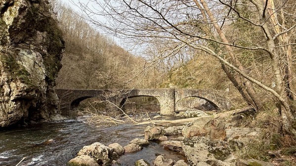
There was a ford here for cattle long ago, and a bridge by 1736. This is thought to be a 19th C re-build. Folklore has it this bridge was built by the Sorginak, Basque for witches, a term taken from that of the assistants of the Basque goddess Mari (she controls the weather and dispenses justice). The stories vary about how all this came about.
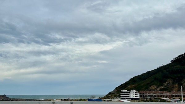
Here’s proof that we made it to the Atlantic (yucky picture over the guardrail, yet evidence). Today was windy, especially along the highway paralleling (but not adjacent to) the coast…we noticed wind socks at most gaps/bridges over rivers flowing north to the sea.
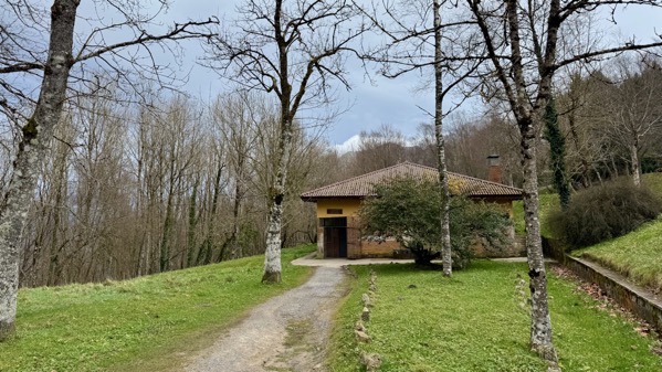
We scrapped a stop at a lighthouse: windy, and went on to another mountain point-of-interest. However, at elevation, it was blowing rain, so we didn’t walk around. I did see the door was open on this structure and thought: bathroom (rarely to be passed up).
I went in and discovered yes, toilets, but also it was a bunker for outdoor adventurers needing refuge from bad weather. The least noise echoes, but the bunker-like engineering seems safe.
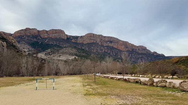
We stopped in this mountain park, Urkiola, because I was interested in a land-counting/measuring system called by a specialist “a pre-decimal metric metrological system characterized by septenary units of measure as well as the material and immaterial instantiations of these units, including the way they were manipulated and integrated into social practice.” Septenary means seven is the key figure, especially simply seven, but also 49, etc.
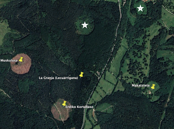
The areas had an upright stone in the center, with a diameter measured around them; this system was in use into the 20th C. This satellite view figure shows four that academics have identified; I put stars where it looks to me like two more may be.
Leaving to descend back to the coastal highway, I was surprised to see Durango on the sign…Basque shepherds in Colorado, hence the name used there?—I hypothesize.
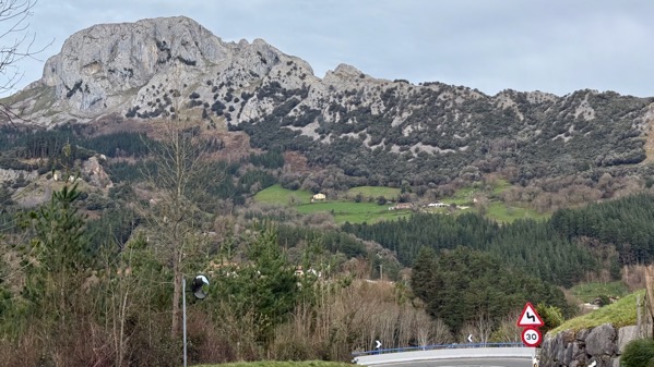
We had good views of this distinctive Rocky Mountain (not Colorado) on our descent. BTW, 30 km/h is 18.6 mph—slow is careful on tight hairpin turns.
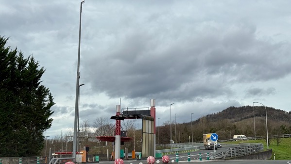
Some of the highway was a toll road. Here’s a special elevated payment machine for semis (some from Eastern Europe). There’s a camera on the tall pole to the left.
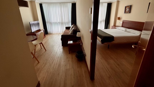
For our three nights in Bilbao, we splurged on a wee apartment downtown. It’s fabulous to have the extra space—and a mini-kitchen!
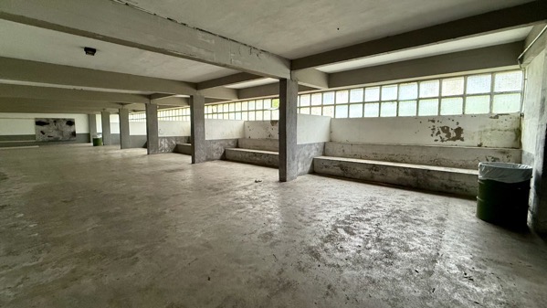
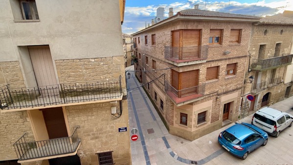
We braved light rain to walk about the area. This is a theater—upstairs.
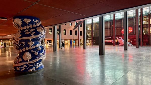
At street level, it’s this cavernous open space…well, the lower ceiling has thick pillars, each one different.
Evidence we’re in a city….
Another architecturally interesting building….
Proof we got some sunshine….
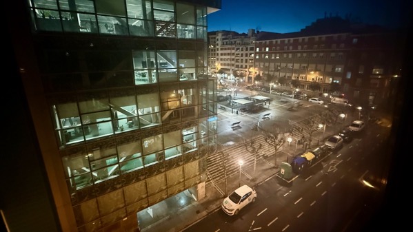
Night view from our abode….
Posted at 1:14 PM |
1 Comment »
Our room last night had a pair of those arched windows on the third story (second above ground floor) that have gold framing. I learned that if you live in a place with narrow streets and multi-story buildings, like this neighborhood, you may not see much sunshine.
Ah, there is sunshine after last night’s rain.
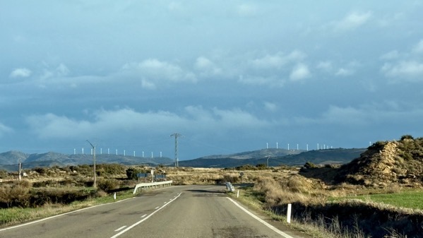
Is MaNachur offering some kind of irony in lighting up the wind turbines?
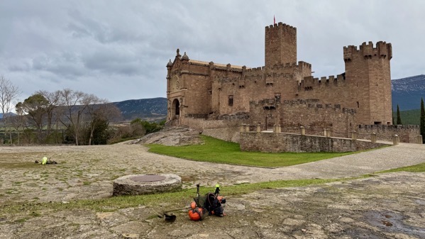
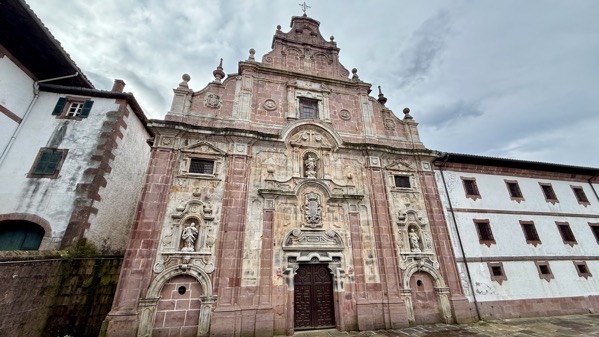
I wanted to see this church-castle-tower combo for the massive high walls on the tower. I did not expect to have the quirky bonus of arriving when the grounds crew was taking a break, leaving their equipment to mark the spots where they should resume, and highlighting that the priests rely on so much outside labor to strut their stuff.
This is the Castle of Xavier (Basque: Xabierko gaztelua), and the name Xavier/Javier is derived from the Basque Etxeberri meaning new house. [However difficult we thought Catalan was to grasp, I find Basque words impossible.] The Basque Jesuit cleric and famous proselytizer Francis Xavier (1506–1552; canonized 1622) was from here, taking the name of his hometown as his priestly cognomen (or whatever they’re called). Xavier is now used by many institutions, including Xavier University in Cincinnati, Ohio, to honor the man.
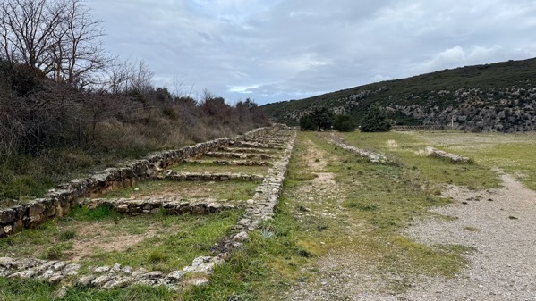
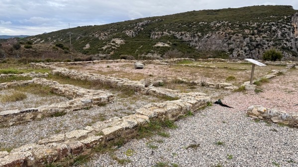
Changing gears, the is the entry area for the Villa Romana de Liédena, which was occupied from the 1st through 4th Cs AD, with its greatest size and decorative opulence at the end, including various mosaic floors. This was a villa, so an agricultural complex and a fancy dwelling complex merged together.
A visitor, it seems to me, would pass through the agricultural entry area and into this impressive patio that featured an open-water pool (the narrow-double-stones outline it) that drained toward the lower left of the photo and away from the house.
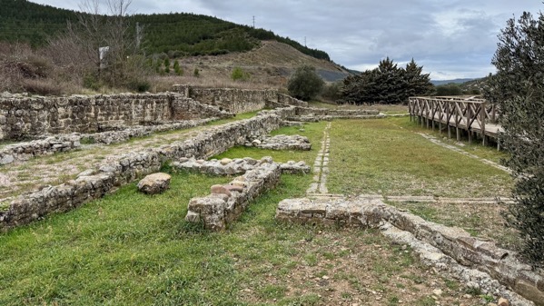
This large room was perhaps the core of the elite dwelling.
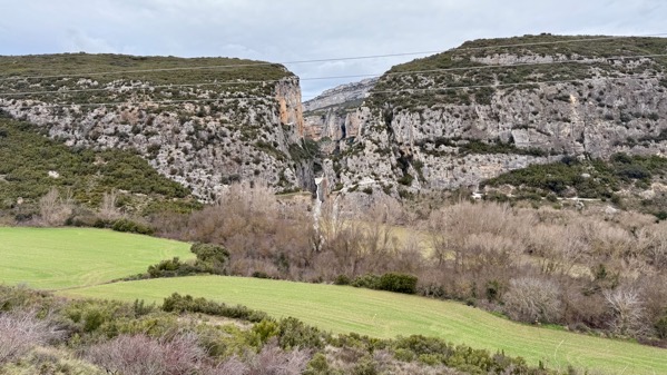
The villa’s location was chosen with this fabulous view of the Foz de Lumbier, or Lumbier Canyon, with the Río Irati in between, as well as the fields this villa controlled.
Next, we followed the Río Urrobi upstream a long ways. We had some precip, but thankfully it was too warm for the snowflake warning signs at the higher elevations to reflect our current situation.
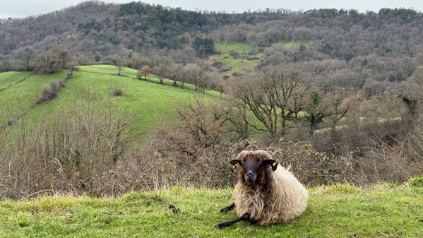
Despite many signs cautioning us about open range animals, this is one of the first we’ve seen, only a trifle worried that we’ve stopped moving.
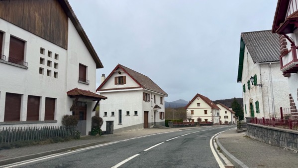
This is the typical domestic architecture in these parts…very different.
Sometimes, the homes are slightly fancier.
Our guesthouse is to the right, with the green shutters.
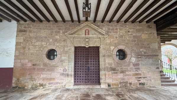
Next door is a church, with a portico over the entrance (seems unusual). Goodnight.
Posted at 2:42 PM |
Comments Off on We enter Basque territory
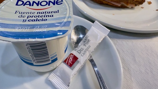
Go to the trouble of getting plain yogurt, yet perhaps you want sugar with it?
Puffy cloud layers above.
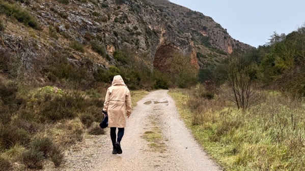
Let’s walk up this scenic valley. What’s that curve in the rock wall?
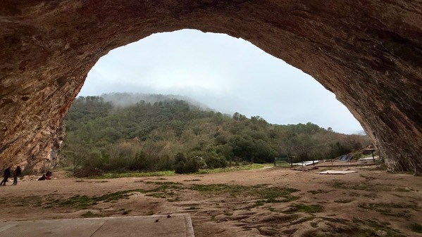
What a giant, gorgeous cave! Archaeologists have found early Upper Paleolithic remains that show repeated short-term visits (not creating deep deposits), including hearths spaced at about 3m apart. These visits are interpreted as related to the seasonal migration of prey species like deer and horses.
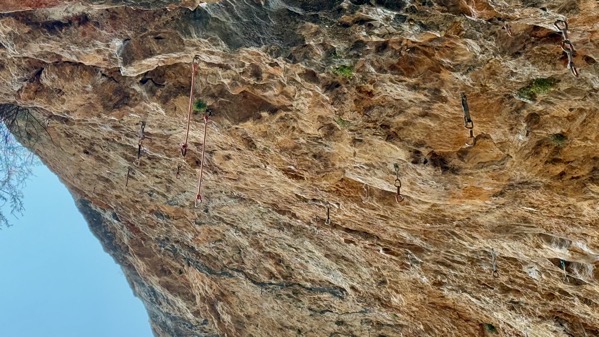
However, current usage leans heavily toward the rock-climbing crowd. I count at least 20 safety helper carabiner lanyards, or whatever they are, on the small section of the roof, ready for the next upside-down adventurer.
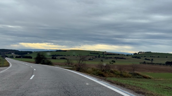
Back on the road, we see signs of clearing.
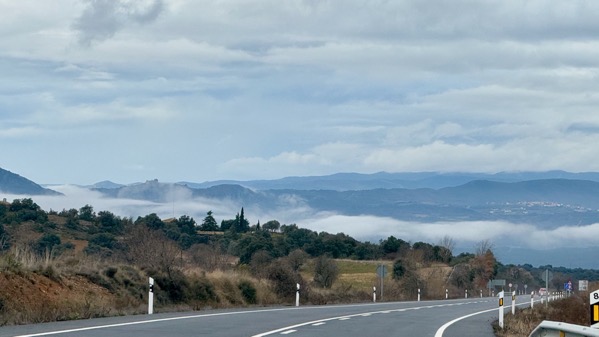
Clouds below, nice.
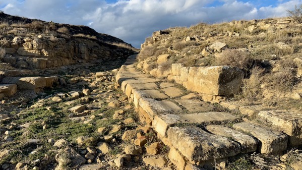
No rain or mist, so we climbed a hill to see this now-scruffy Roman town now called Labitolosa. It had two bath complexes, and a curia and forum, so it was at least locally important in the 1st C BC (so pretty early); it supplanted an indigenous community.

Details of the big bath complex.
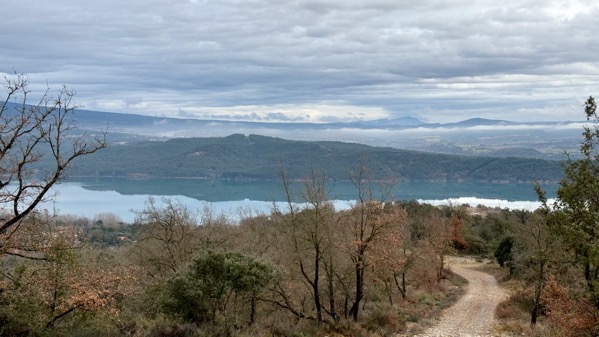
Descending, we could see how still the water of this reservoir was.
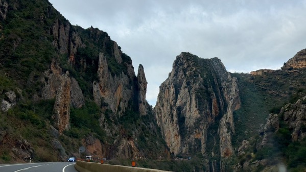
Our route away from that area took us through this stunning gorge.
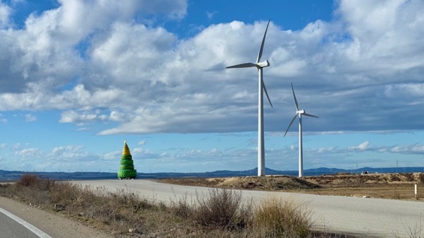
Soon, we were out on what I’m calling the windy flats, here with a bonus tire sculpture.
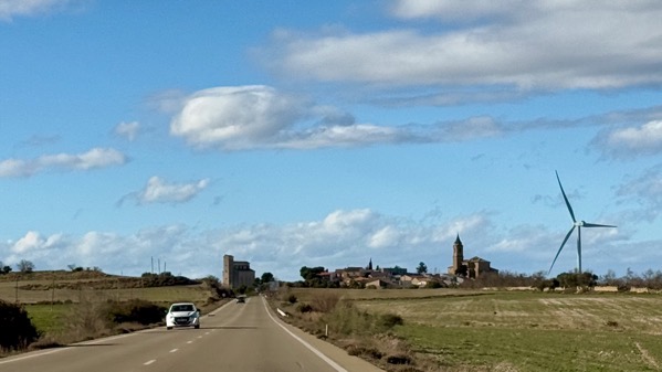
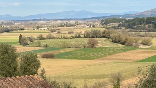
Scattered towns seem lightly active with farming.
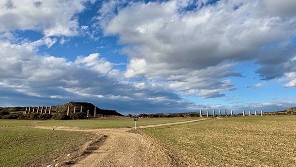
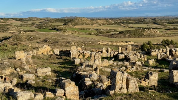
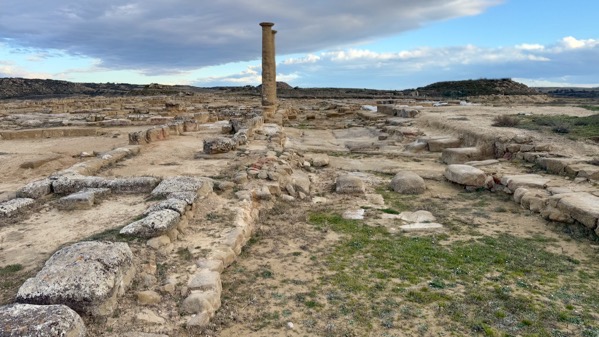
Much further along, we checked out these Roman aqueduct piers (actually vertical—it took a wide shot to get them all in).
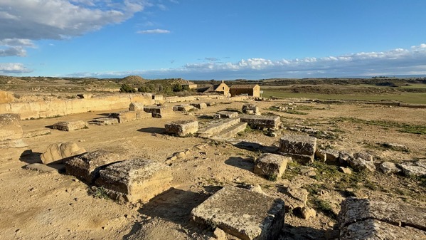
The Roman town the water supplied is today called Los Bañales. This area was the forum. The later building complex in the background is called Ermita de Nuestra Señora de Los Bañales. One record I found dated some of its architecture to the 1740s.
Here’s a section of road connecting housing above the civic-ceremonial zone that included the forum.
Here’s the view down from higher up. The aqueduct piers are visible. This is looking east.
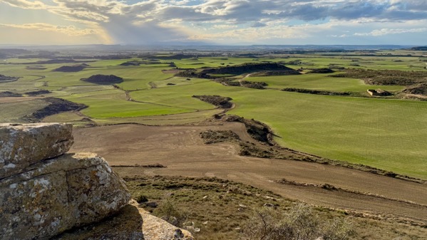
From the top, the light made the landscape look rather different when we looked to the northwest.
This area is separate from the civic-ceremonial and had many elite domestic complexes. I saw two parallel wide streets; this was the upper one. This settlement was later than Labitolosa, dating to the 1st C AD, so after the Romans had dominated this area for several generations.
Our hotel is within the old Medieval core of Sádaba, although the façades of the two buildings opposite our room look later. Recent demographic data indicates the highest population of the town was in the 1960 census. It’s less than half that as of 2021.
We heard a story on TV the other day about housing problems in Spain. I think they meant in the large cities, however, as the rural areas we’ve been passing through show a significant percentage of apparently maintained and usable housing that is not inhabited.
Posted at 3:46 PM |
Comments Off on Drizzle, rain, overcast, sun

Today’s objective: cross the Pyrenees, and whatever else happened. Here’re some views through the windshield…. Driveway gate…
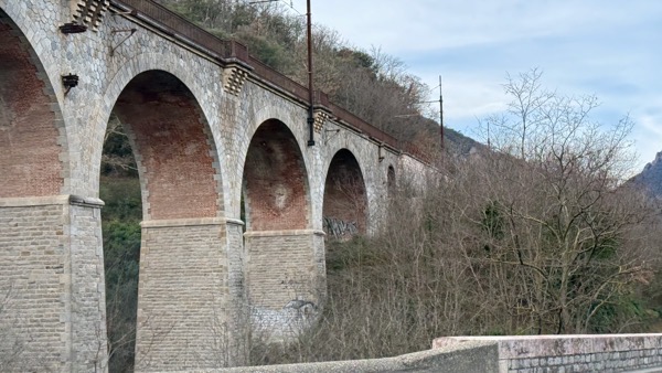
Railroad bridge for Le Petit Train Jaune.
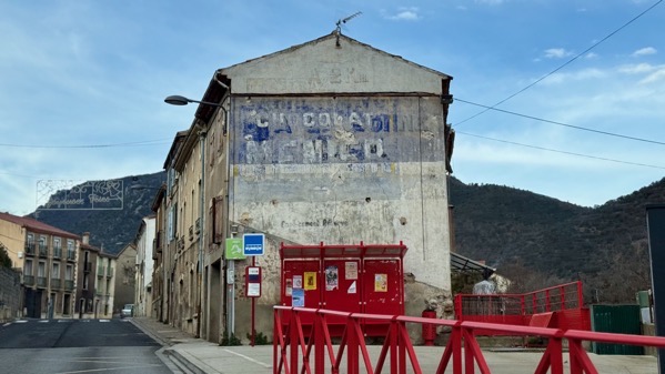
Random flaking sign on building.
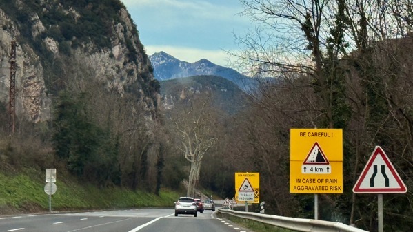
Road safety warnings. We did have a short period of precipitation in the dark hours, a spin-off from the Storm Éowyn system.
We didn’t know what this was driving by. Turns out its part of a 17th C fortification…to control access to the valley we’re headed toward.
Today’s roads don’t fit well into the spaces between buildings….
At the pass, we did see bits of snow on the ground, but just (thankfully) moisture on the road. Some cars that passed us, presumably from ski areas, wore 2 or so inches of new snow.

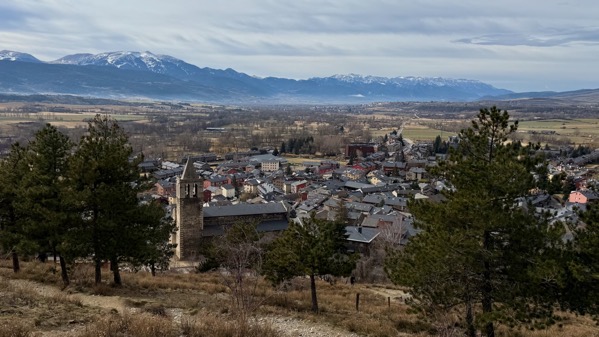
We were very pleased to descend into the Cerdanya valley, with its wide fields and pastures. And horses, many horses, all winter-shaggy. Most were heavy-bodied, the shape I associate with working horses. I thought I got a decent shot of grazing horses, but when I zoomed in, they were mules. Harrumph.
I was going to title this post something about border crossings. This was our first—out of France and into a small bit of Spain that’s entirely in France, called Llívia. It’s dominated by the castle hill, which we climbed up a ways, but only perhaps ⅓ of the way…which was plenty to get this good view of this part of the Cerdanya, and the church bell tower below us.
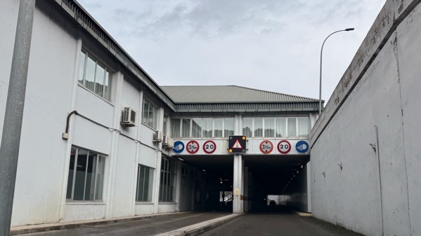
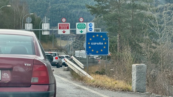
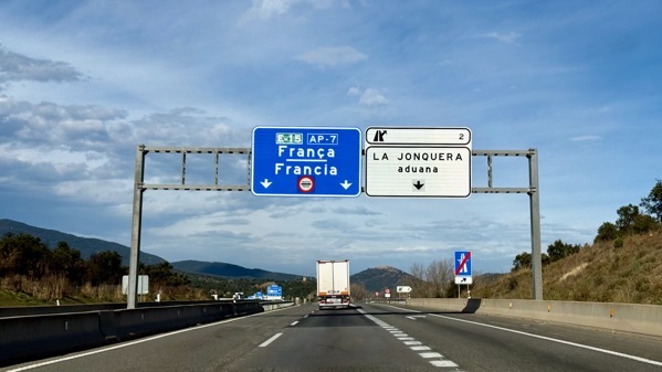
Then we crossed back into France, then back into Spain, and carried on until…I’m calling this Aduana Uno, that is, Customs One…for leaving Spain…
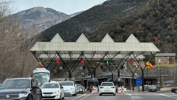
…and Aduana Dos, for entering Andorra. You want to read about a strange international situation, look up Andorra. The first thing we noticed was all the traffic exiting into Spain and backed up perhaps 2 km. Yikes. These motorists, we guessed, were headed home after weekending in Andorra, skiing perhaps.
We found Andorra gritty and traffic-filled, the main valley overstuffed with multi-story apartment buildings, and rather yucky. We ducked into a Carrefour and bought some lunch makin’s, then headed back to the traffic jam, and ate while nudging along. Summary: we went to Andorra for lunch.
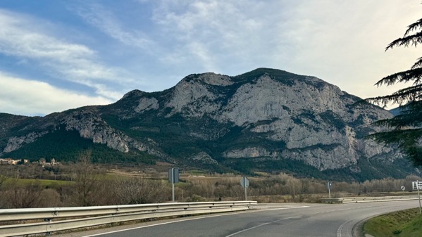
Back in Spain, southbound took us out of the mountain rockiness eventually.
From afar, we both thought this looked like a mushroom spire. Turns out it was a stork nest providing the flare.
This rock face is just at the edge of the mountains.
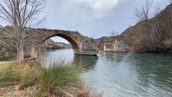
And, if you face the opposite direction, you see the ruins of a Medieval bridge. The exposed “guts” offer insight into construction methods and engineering strategies.
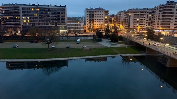
The view from tonight’s room…sluggish river, and far more space riverside than we saw in Andorra….
Posted at 2:11 PM |
Comments Off on Ups and downs
A beggar came by to watch the sunrise with me. Truth: it was more interested in begging than the view.
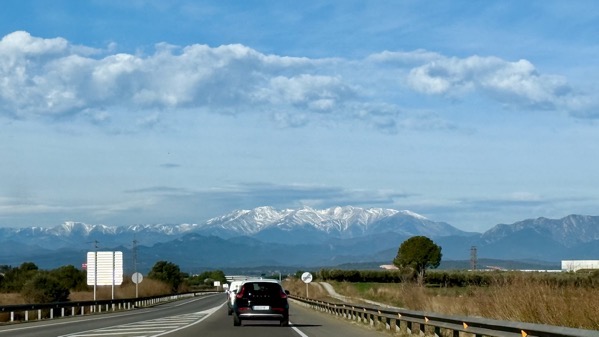
On the road, these snow-caps dominated our skyline to the northwest. We headed first into the mountains out of the photo to the right.
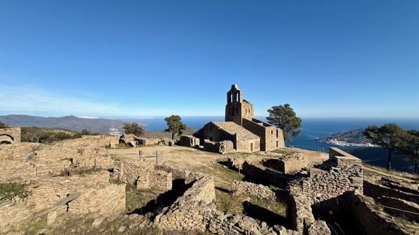
We drove most of the way to this ruin, walking the last hundred meters. This is the Église de Santa Helena de Rodes (sometimes Elena), and the ruins of the medieval town around the church, called Santa Cruz de Rodes. This is a satellite community about a half-kilometer from the Benedictine Monastery of Sant Pere de Rodes. The Monastery was famous for having small relics of THE Saint Peter, which justify the size of that complex, undoubtedly paid for by donations (eh-hem) from the many pilgrims who flocked to this out-of-the-way place.
Rodes is now Roses, on the bay to the south. The central part of the church and most of the bell-tower date to the 10th C (archival mention in 974), although there may have been an earlier use of this location. Several expansions widened the structure and added a portico to the entry.
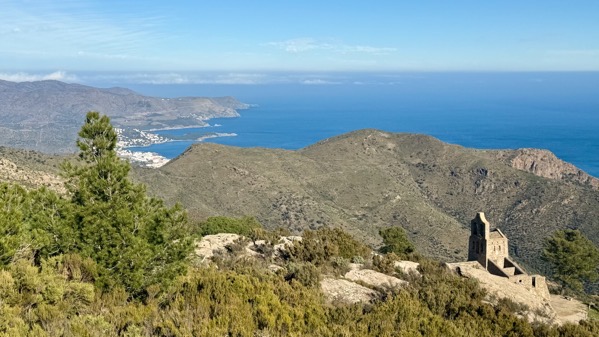
I scrambled up the slope to get this shot. The bushes are woody and tough. Arguably, they make gorse seem wimpy.
The north gate, away from the monastery, is more elaborate. I’m guessing pilgrims and supplies came from that direction.
Here’s a closer view of some of the dwellings south of the church and outside the South Gate.
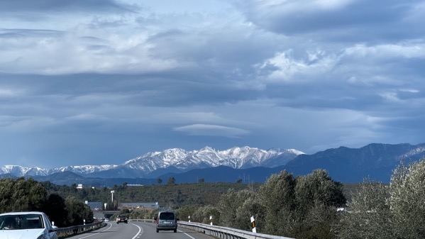
We backtracked away from the church, then continued north. The snow-caps remained to our left (although they don’t appear that way on this bend).
I find it interesting that aduana (customs) remains on the signs, although the building complex is abandoned.
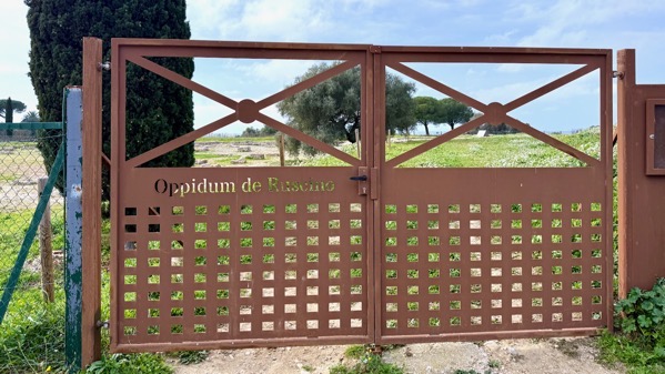
For now the site of Ruscino is closed. This was an important trading center in Greek times, when a string of them were dotted along the coast of the Gulf of Lion. By 218 BC, Livy described Ruscino as walled and hosting boats in river trade…meaning that their principal trade goods came from inland, upstream via the river we now call Têt. I think valuable goods from the Canigó massif south of the river and inland, where there is still a mining area.
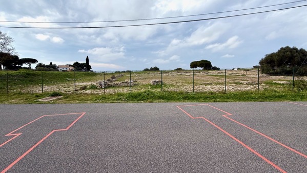
Clever archaeologists have indicated the outlines of walls buried by the road.
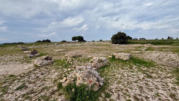
This is a wide shot of the excavated area beyond the fence (west). The historic area of France called Roussillon takes its name from this ghost town. Hannibal and his thousands crossed the Pyrenees somewhere around here on their way from Cartagena toward the Alps.
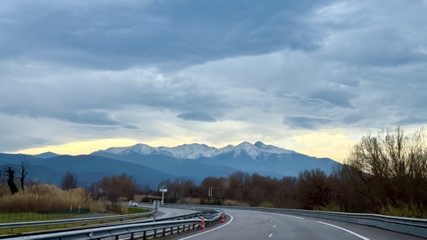
As we continued up the Têt valley, the mountains still attracted our eyes.
Interesting railroad bridge.
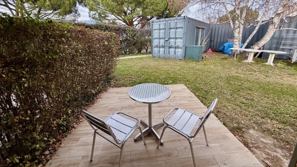
Our room has a sweet patio, sweeter if it were sunny and the shipping container weren’t there. No seagulls, and no sunrise view expected.
Posted at 12:13 PM |
2 Comments »
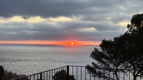
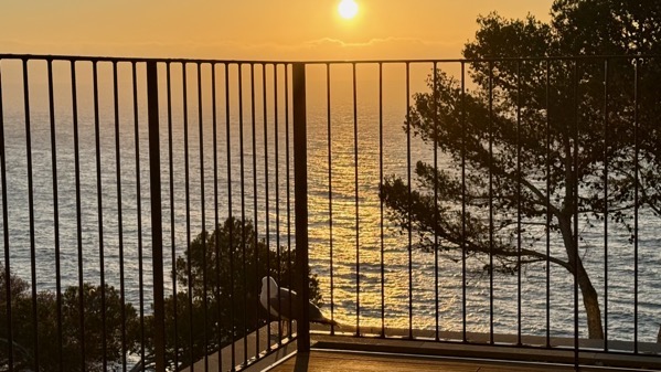
Every day it’s different. I know that’s not a surprise, yet I’m drawn to the sunrise past our balcony each morning.
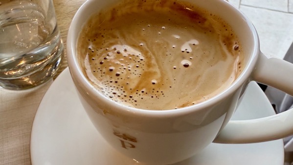
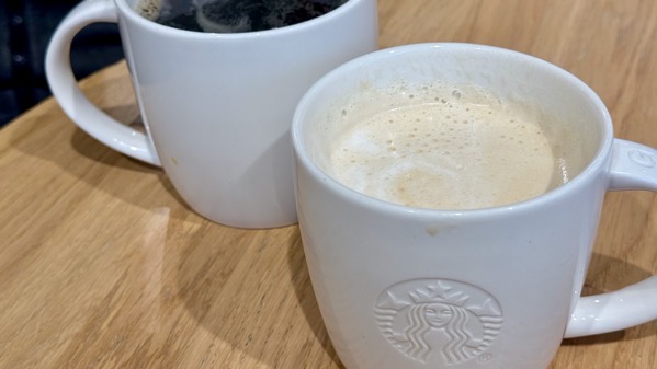
I’m back on a coffee jag, as the waitrons bring the table a pot of hot coffee and a pot of hot milk, and I can’t resist refilling and refilling.
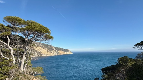
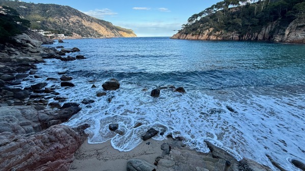
Sea view off the point of our peninsula.
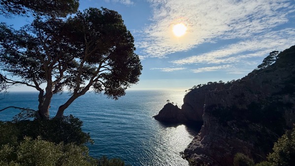
The cliffs I’m obsessed with watching…wide shot blown-out by the sun.
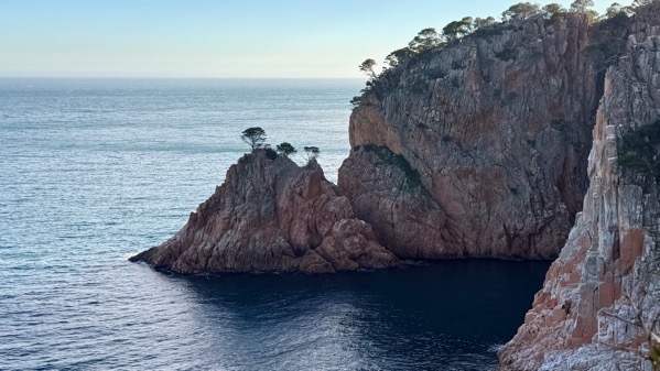
Obsession rocks, I named them in my head.
We are half-way through our trip, and had/did a totally relaxed day, no driving anywhere, no learning about the past or present, no agenda beyond getting packed to leave for another country tomorrow! We won’t stay but one night—France awaits.
Posted at 12:35 PM |
2 Comments »
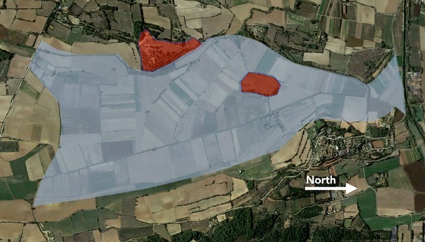
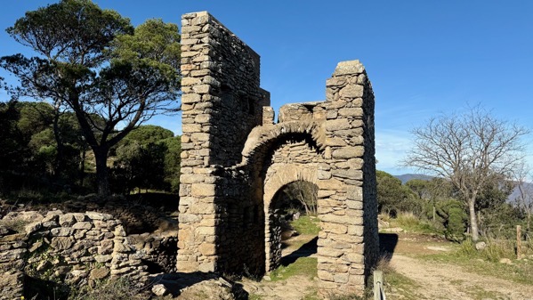
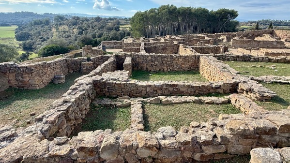
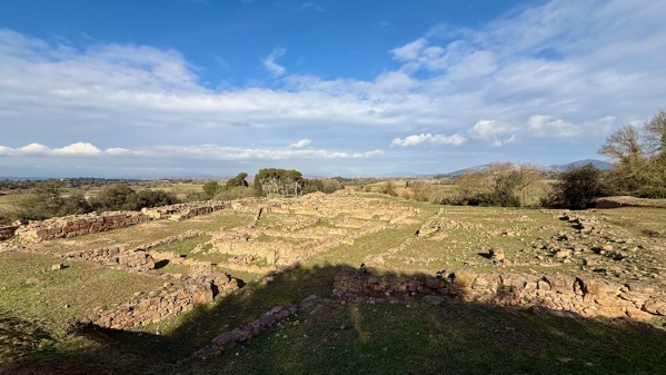
Here’s another pair of settlements, the west one on a hill and heavily fortified with tall walls of large stone blocks, and another on an island in a lake. Both were occupied from the 6th–5th Cs BC (so: Iron Age), thriving even when the Greeks settled at Emporion (see yesterday). Indeed, the walled site was a regional capital, with perhaps 6,000 residents, large grain stores and an active trade with the Greeks in luxury goods. Archaeologists know far less about the island settlement, and it is not open to the public, so I know even less. The Romans conquered the territory at about the end of the 3rd C BC, and these settlements were abandoned in the 2nd C BC.
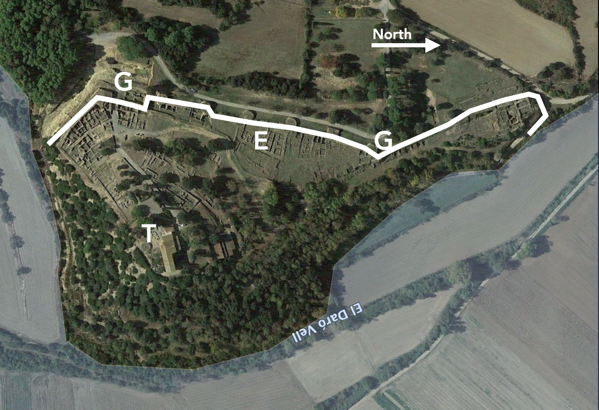
The layout of the capital is interesting, with the lake to the east and south, and a major wall along the other sides. I’ve drawn in the wall, and the bumps along it are large, round towers plus two angular ones. “G” means gate. We entered the South Gate, and outside it is a deep moat. “T” indicates a pair of temples that were built on the summit of the hill. “E” is an elite domestic complex, huge, and it has produced most of the fancy, expensive goods found at the site. The name archaeologists use for this site is Ullastret, which is the nearest town, and no relation the name its residents used.
Ditch outside south gate, view south.
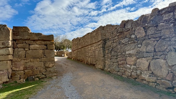
South gate, view east, looking into settlement.
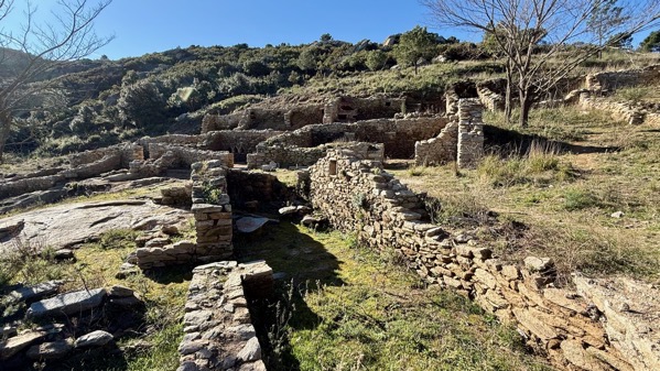
Houses in the southwest part of the site.

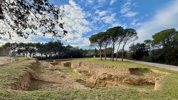
Archaeologists call these silos, which makes sense as they are round and were for storing grain. Only the bases, which were excavated into bedrock are visible now. When used, they had conical tops with a small opening at the peak made of a mixture of mortar and ground discarded terra cotta. They were lined with the same mixture, and apparently totally sealed when finished. What surprised me is they were not reused—I hypothesize it’s because they couldn’t be properly sealed again.
The left half of this area is the elite complex. It had its own small gate through the defensive wall. The interpretation is that it was used by a large family unit. I don’t know any of the details of what archaeologists found here, but I keep thinking it may have been an area used by a guild of traders—but were there such groups?
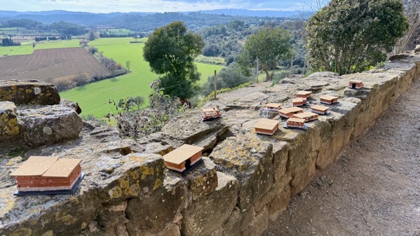
Plopped on the hilltop, obliterating one of the temples, is a church that is now a museum. Today a student group was making house models with glue and blocks and cork roofs.
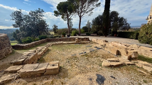
Here’s the foundation outline of the surviving temple. It seemed pretty good-sized to me.
That almost complete circle of trees is the island. Imagine this view when the lake still spread around it.
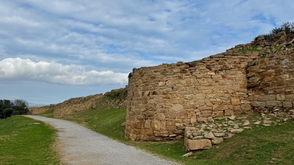
View north along the outside of the towers. Formidable.
Not yet high tide on the beach near our hotel—I’m guessing as the rack line is still dry.
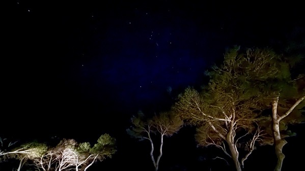
Three-second exposure from our balcony a few minutes ago: that’s Orion in the middle…I hope the resolution isn’t so hammered it erases him! [Zooming will help.]
Posted at 1:57 PM |
Comments Off on Two more settlements

Orientation first. Left satellite view; this is the southern Gulf of Roses. On the right is Greek Emporion (amplified right), Roman Empúries (left lower, with “R”). North is “up.” The scale is huge. IMHO, these were cities, not ho-hum towns.
First, however, indigenous people lived in the area. Although later occupations have covered them up, that round knob at the top, an island with an elevated summit, was an Iron Age settlement, and inland were others.
Greeks were trading here before establishing a settlement. They first built on the knob to trade, and called it Palaiaopolis; the harbor was to the south of the island. Celt-Iberian pottery was changing from this presence by the 7th C BC. In the 6th C BC, Greeks moved to a new area to the south of the harbor; they called it Neapolis. This community was given repeated updates and modifications. By the 4th C BC, this was a city with a Greek layout—including an acropolis on the highest spot, and markets and an agora, the central public space. In the 2nd C BC, they beefed up the walls, expanded the sanctuary areas, and added new port structures.
You can research the warfare/conflict that gave the Romans the upper hand by the 1st C BC. On the left, the rectangular “R” area is the Roman city. Ultimately, the grid of streets was 6 or 7 wide, and 15 north-south. The amphitheater is just outside the wall south of the southwest corner.
Now, some photos of the Greek city.

Sarapieion temple, southeast corner of Emporion.

Peristyle domestic complex, the largest of Emporion, close to the bay and immediately south of the agora.

View east-southeast, with stoa along the left (colonaded public structure), and agora in mid-ground.

View south from houses north of the agora, down the main north-south street of the southern part of the city.

Port—now green grass and trees; view north.

Acropolis. View is to the north. I found it amazingly small, perhaps 5×5 m.

Somehow this is a water filtration system, up near the acropolis. No info was offered about how it worked.

This gives an indication of the density of houses (almost all of these rooms were dwellings/dwelling complexes), looking toward the acropolis from the main north-south street, view to west.

They’ve put a museum in the church, between the two cities. This statue was found in 1909 in the temple area in the southeast of the city. The upper part was in a cistern, and the rest in the temple where it stood originally, and a replica stands now.

From the museum, we ascended the hill and entered the Roman city. It is vast. This view is from the northeastern edge of the excavated area, looking south. I’m pretty sure all of what you can see, except perhaps the tallest trees, lies within the city (maybe not the walls, but the city).

Here’s looking the length of the forum from the north. I’m standing on the front of a large temple honoring Jupiter, Juno, and Minerva. Colonaded structures lined the other three sides, and more temples flanked this one on the north side. Again, all but perhaps the tallest trees: in the city.

Looking north through the door/gate in the south wall, up the main street, the length of the city. Ish. That partial structure on the left is a reconstruction of the southwest corner of the forum.

Outside the wall, but snugged up against it is the amphitheater. The vertical element is gone, and I find it difficult to visualize its scale.
Well, that’s enough. Remember, too, that, big as this Roman city was, the whole population of the immediate area was not living here. Indeed, there were other communities and villas scattered about. ’Nuff said.
Posted at 12:54 PM |
2 Comments »