Musings

See this magnolia? It’s actually two adjacent trees on the bank of a former railroad ROW (to the right). Now the ROW is the BeltLine, a pedestrian and bicycle corridor, with landscaping by Trees Atlanta. To the left is a shopping center with a Whole Foods and a Staples (guess which one gets more traffic 🤣). Delivery trucks are the most common traffic along this route behind the stores (and us when the “front” is clogged).
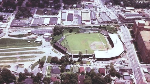
Here’s a ca. 1950 photo from Georgia State’s archives of the Ponce de Leon Ballpark. The info that follows is from 2020 article by Adam C. Johnson (here). In 1890, there was a lake where the field is, and the magnolia was already there. The ballfield was first built in 1907. The photo shows the version built in 1923. If you were sitting behind home plate, you were looking straight at the magnolias. Johnson writes:
If a baseball hit the magnolia tree and bounced back into the field, then the ball was in play because, per the rules, it had to pass through or remain in the tree to be a home run. To this day, the Spiller Magnolia Tree is the only tree in baseball that has been in play, and [Babe] Ruth and Eddie Matthews are the only confirmed players to have hit home runs into it.
Recently, Trees Atlanta has cloned the magnolias, and planted the new trees along the BeltLine.
End of baseball trivia.
BTW, that big building to the far right facing the ballfield was a huge multi-story Sears that had a side track from the RR for deliveries. The building recently was redeveloped and is now Ponce City Market.
Posted at 8:22 PM |
1 Comment »

On this day in 2018, we landed in Paris in the early morning and boarded the fast train down to Marseille for a daylight run across central France. We got settled in our apartment, then headed out for a stroll, and caught the sunset near the docks for the ferries that go to Africa and other distant ports.
Hey, it was either this photo of another one of those modern Ferris wheels, or a window display of lovely “meringe” desserts, only €39.50. Thought I wouldn’t tempt you….
Posted at 7:54 PM |
Comments Off on Marseille memories

I strolled around the easternmost of Atlanta’s string of Olmstead linear parks. Its along a tributary of Lullwater Creek—I couldn’t find its name, but the park is Deepdene. The trails have a half-dozen stepping-stone crossings like this. Some of the stones are askew and haven’t been realigned in years.

Here’s a spot where I found a nice, clear pool framed by ferns. Lovely, despite the traffic noise.
Posted at 7:21 PM |
Comments Off on Forest bath without tub

When I moved here, this was a relatively new sculpture, lacking moss-n-lichens. Pet-owner hygiene practices meant we nicknamed this small spot of open terrain+art the Dog 💩 Sculpture. At present, dog-walkers are very conscientious and I haven’t seen deposits here in years. [I read an article this past week about dog 💩 parasites, so I’m very glad my exposure is drastically reduced.]
Posted at 7:43 PM |
Comments Off on Social evolution
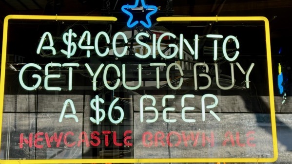
Local bar hilarity. Also price without tax.

I called this “top down.”
Posted at 8:41 PM |
Comments Off on Trying for a giggle
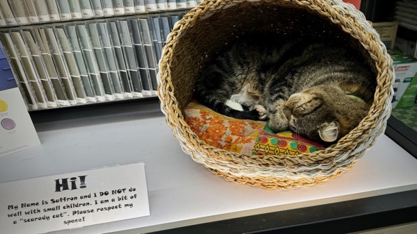
We made a quick trip to the neighborhood hardware store for minor necessities, glad to support the local vs the big-box only a few more blocks away. Over in the paint section, we found Saffron, sleeping the afternoon away as only a happy cat can, despite how many customers were galumphing up and down the aisles (like us 🤣).
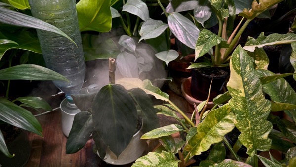
And over in the garden area, the indoor section, I found this humidification zone, don’t know how it works, but the steaminess is a nice effect. 😌
Posted at 8:04 PM |
2 Comments »

Here’s the story of a brave tree that repeatly offers blossoms in December and January and other winter months…or maybe the genetics of not making fruit screw up its flowering patterns.

Is this an ethical dragon…I mean, eating gnomes…? But, then, can dragons be ethical? Or maybe it’s a dinosaur, and, we’re seeing merely that worlds have collided. [Oh, and note bulb foliage behind the monster.]
Posted at 10:16 PM |
2 Comments »
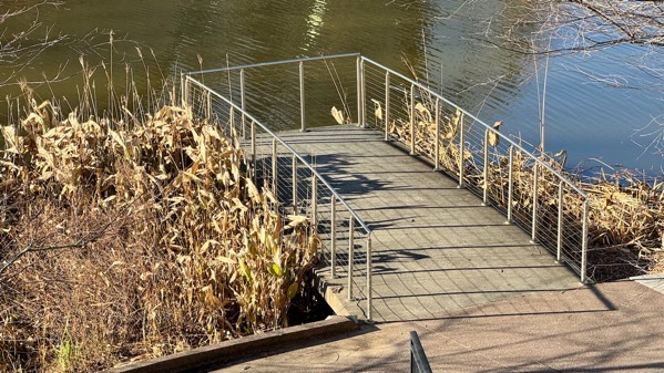
O4W stands for Old Fourth Ward. The northern part of that neighborhood, according to the present boundaries, is centered around Historic Fourth Ward Park, which is where there was a spring, and now there’s a pond that’s designed to impound stormwater. Here’s a bridge to nowhere, or a pier, over that water.
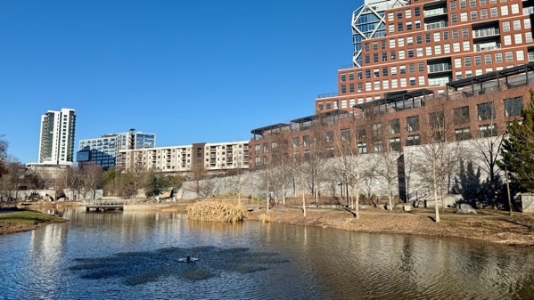
All the buildings on the right, and most of those at the far end, have been built since the park, and the BeltLine trail you can’t see (to the right behind the buildings), were established less than a generation ago. The star-shaped pattern is from the aerator fountain, which stopped just as I snapped this (just the way I timed it haha).
Posted at 8:00 PM |
Comments Off on O4W (park)
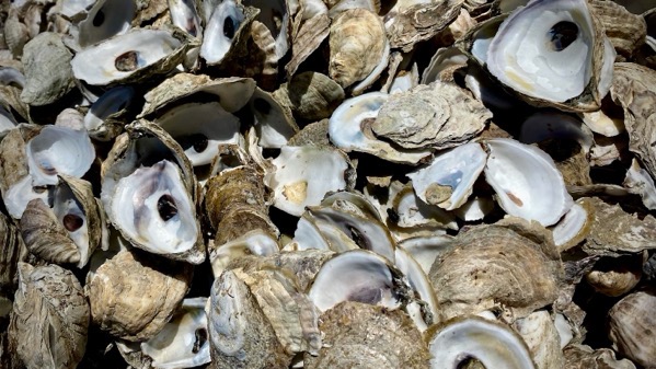
Photo from this day in 2020. Never quite grasped the logic behind “the world is your oyster.” Oysters are slimy and evanescent. Their shells are durable and hang around for thousands of years. If the saying refers to pearls, as some allege, why doesn’t it use the word pearl? I’d rather find parallels, and hope, with oyster shells.
Posted at 10:22 PM |
Comments Off on Live like an oyster shell?
I had some grand idea about suggesting a parallel between sunshine and…prosperity…but, instead, I’ll just say…well, the first fireworks went off within my hearing at 6:50 this evening.
Posted at 9:53 PM |
2 Comments »