Musings

We made a pre-10am run to Trader José’s while it was relatively calm, before the squadrons of desperate shoppers hit the doors mid-day, then continue in rotation until Monday morning (in our experience, anyway). We discovered that plenty of exercisers visited in the same temporal window…lots of stretchy outfits, etc.
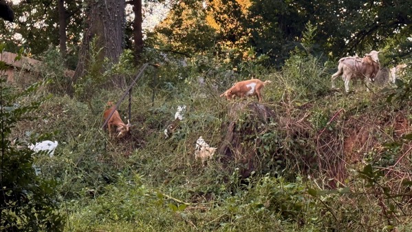
Another goat picture: busy troops.
Posted at 7:05 PM |
Comments Off on Neighborhood news
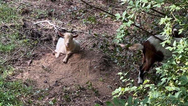
Welcome to goat world. Note that the last few days the goats have done a bit of excavation.
Also, I read an academic article on knots, as a global cross-cultural technology, presented with more detail than I would have believed possible.
Posted at 7:26 PM |
Comments Off on Goats n knots
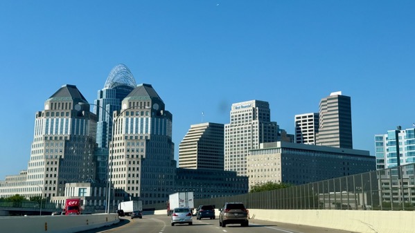
We almost always come through Cincinnati on I-75, or parallel side routes; however, today we took to the side streets and ended up on I-71, which gave us this different view of downtown.
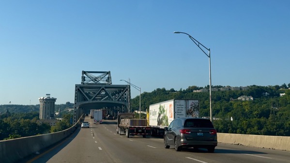
They both cross the Ohio on the same bridge. The traffic was moving just fine.
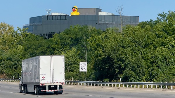
Climbing away from the river, we spotted this whimsy.
[By focusing on Cincy, I can easily avoid discussing the traffic *fun* we had in metro ATL during rush hour, complicated with rain. However: home safely.
Posted at 8:55 PM |
Comments Off on Ad-ven-churs

We met up with an extended family of the combined genetic and friendship sorts for a very lovely ritual…
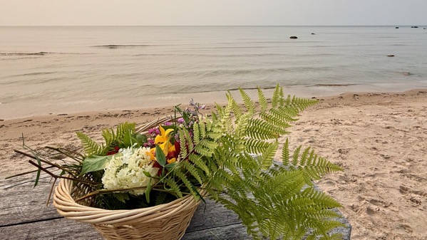
…involving kayaks and a few flowers. Soooo glad we attended.
BTW, almost no breeze yet no biting flies down on the Lake Michigan shore. We did not kayak, but we admired those who did, and the paddleboarders, too. I now know there are inflatable paddleboards.
Note the smokaze.
Posted at 8:17 PM |
Comments Off on Water activities
Apologies for delayed post. I just got too yawn-y too early to have sufficient thought to post before crashing.
I’m fine (she indicates while sipping her morning coffee).
Posted at 10:22 PM |
Comments Off on Oooops
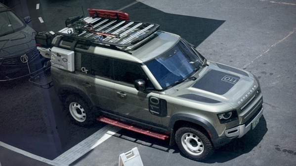
Yeah, this is an odd angle to look at a vehicle. Yet, what’s the vehicle tricked out to maximize? Are those rectangular forms antennae or liquid holders? That implement on the roof—it’s not a weed eater, so what is it?
Quick goo-search: Land Rover Defenders start at 73K or 153K, depending on I’m not sure what. But that doesn’t explain the extras….
Posted at 8:37 PM |
Comments Off on Mystery machine
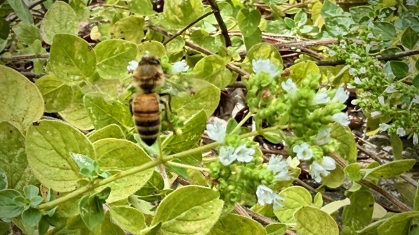
Universal reason #8 for out-of-focus photo: very hot-and-muggy, so I didn’t hang around to take a proper photograph, and not merely a snap.

Okay, admit it: you smiled (or at least thought about it inside).
Posted at 8:22 PM |
Comments Off on Bee a cutie
It’s a wild weekend here in the ATL, with Beyonce doing cowboy hat concerts downtown, and the baseball folks congregating on the north-side ahead of the All-Star game on Tuesday. I’m glad we’re just outside of those orbits.
Posted at 9:56 PM |
Comments Off on On edge
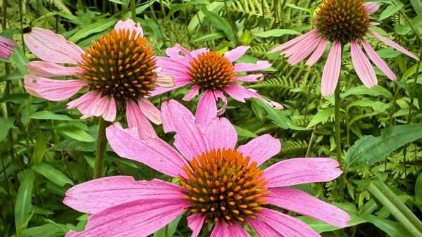
Seeking words to add to this photo, I discovered that coneflowers (Echinacea) are native to eastern and central North America. That surprised me…in a good way. I often figure (erroneously) that pretty garden flowers are from elsewhere, like Asia and Africa.
Bonus: dahlias are also New World—from the Basin of Mexico area, as I understand it.
Posted at 9:36 PM |
Comments Off on Where are you from?

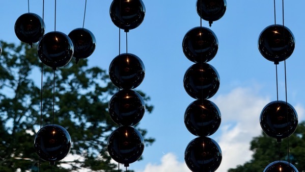
Seconds after this, the rainbow colors disappeared.
Posted at 8:20 PM |
Comments Off on Moments change things