Musings
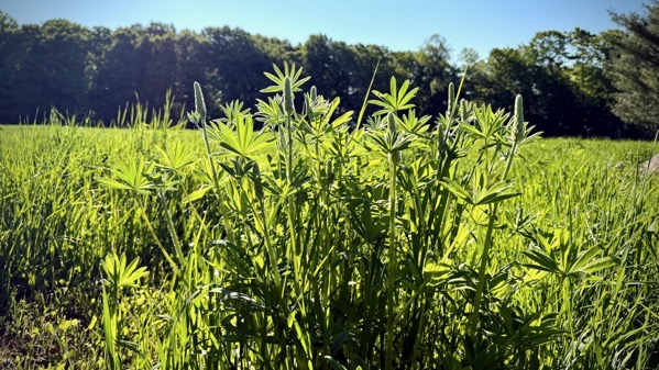
Despite it being dry, the lupines are rolling into blossom-time.
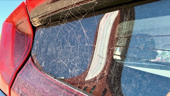
I discovered this decoration after driving to Marquette via the Seney-Shingleton stretch; clearly, it has lasting power.
That distorted building in the reflection houses the Vierling, a long-time restaurant-bar on the corner of Front and Main. We’ve been going there since the first time the Guru came to the UP.
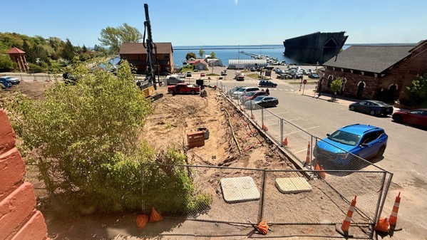
Here’s the view from the Vierling. That construction site will be a five-storey Hilton property atop a parking garage, which means it’ll block this view of the Marquette harbor. Progress.
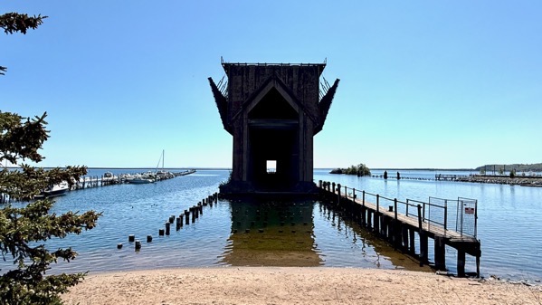
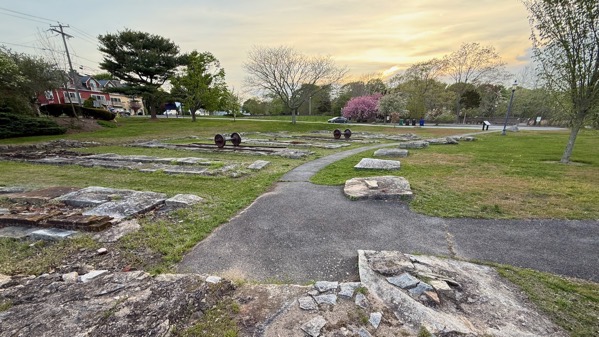
This is the remains of the ore dock, with no attachment to the land that would facilitate human exploration. I guess the powers that be figured these ruins were safe to leave unsupervised.
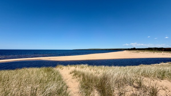
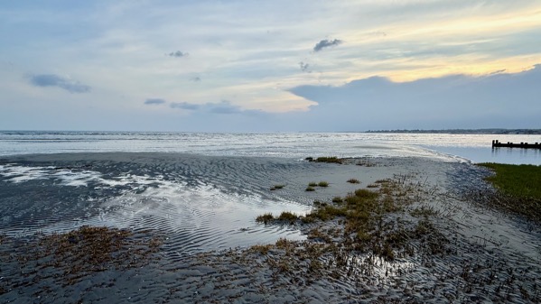
On our return leg, we stopped on the dune-top on the west side of the Au Train River, where it dumps into Lake Superior. The lake-ice has shifted the river mouth so that there’s no beach on this side. That winter-ice is powerful.
Posted at 7:36 PM |
Comments Off on Sight-seeing, west

Today, I learned that along the eastern flank of the eastern Carpathians are an arc of salt springs. I was looking at ones near Hoisești and Negritești. Both have nearby Chalcolithic and Bronze Age settlements, which, of course, is why I found out about the saline seeps.
Posted at 8:46 PM |
Comments Off on Cause ‘n’ effect
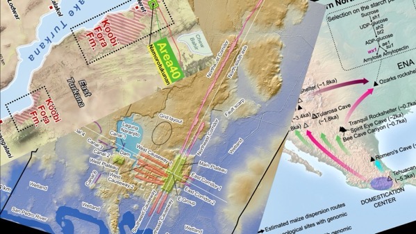
One of the impactful benefits of academic publications shifting to digital rather than dead tree versions is that the graphics have improved greatly…by adding lotso color.
Posted at 8:22 PM |
Comments Off on Science has upgraded
I’ve been reading articles about this and that, including various Roman villas, towns, and necropolises in Iberia…which reminded me of our trip to Iberia early this year.
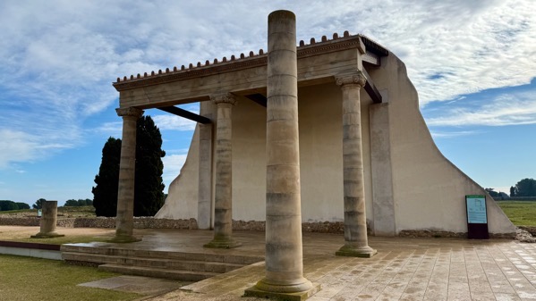
Here’s a reconstructed porticoed ambulacrum (one corner) that would have surrounded a forum square (depression, left foreground). This is the southwest corner of the Roman forum at Empúries, in far northeast Spain. There was a major trading city here under the Greeks, later built much larger by the Romans.
Posted at 7:50 PM |
Comments Off on Remembering a Roman city
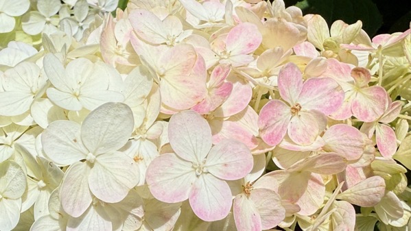
When I think of viburnums, I think of these snowball bushes. Turns out Ötzi, the mummified fella found in 1991 emerging from melting ice on the Austrian/Italian border in the Alps, was carrying arrows with viburnum shafts. Of all things.
Posted at 9:44 PM |
Comments Off on Genus: viburnum
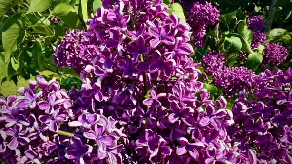
We found the darkest purple lilacs I remember ever seeing, which we found on the Seul Choix lighthouse grounds.
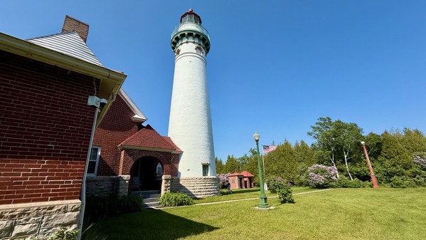
There’s the light, with the keeper’s home to the left. [Apologies for the exaggerated keystoning.]

It’s on a point that projects out in the M of HOMES.
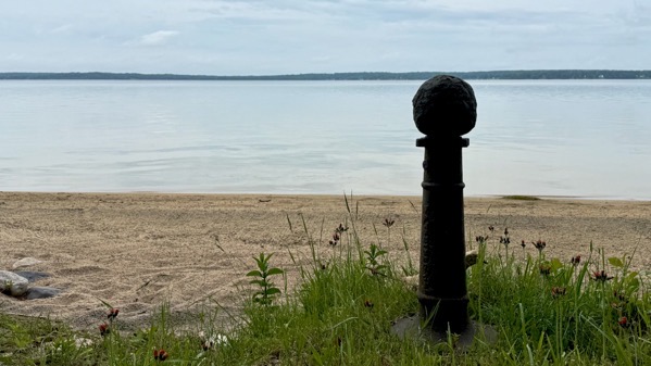
Contrast that with “our” lake. That’s a round rock (perhaps/probably rounded by humans, and thus an artifact) atop a binnacle. Because of this weighty binnacle that was on/near our beach, that word was part of the vocabulary of the kids who grew up in my generation on this property, and probably would not otherwise have been familiar with the term. Now, why there was a binnacle of this scale here, I do not know, because it’s way too large for a ship/boat on this lake, but not for one a HOMES lake.
Posted at 9:27 PM |
Comments Off on Only choice, plus binnacle
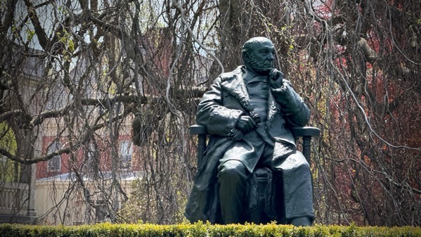
We went through the core business district of Newport, saw looming masts, shops of various sorts, and many tourists. Then, we looped around among the fancy houses, and I mean fancy. However, this is the only photo I took during that entire circuit, and I don’t know who it is…just driving by, ya’know.
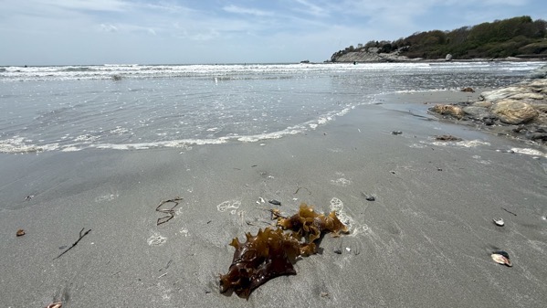
I read up a bit on Rhode Island as we drove along, and wondered where that island was, as the state is mostly not-island. Turns out this island, now more commonly called Aquidneck Island, is historically tagged as the island called Rhode, Ile of Rods, or Rhod-Island. BTW, if you can see dots out in the surf, they’re surfers. They only get short rides, but then they don’t have to paddle much to set up again.
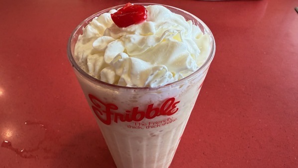
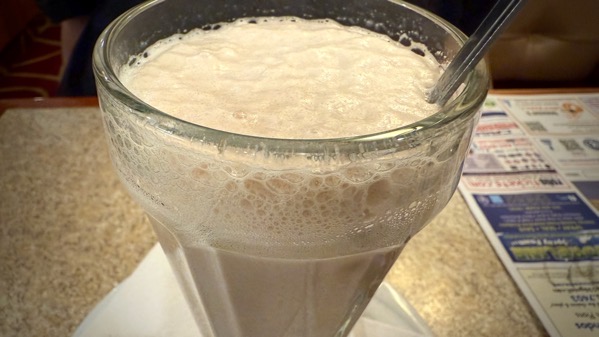
Today’s drink I’m sure I never had: a coffee Fribble at Friendly’s (one of the dwindling few still in business). Egads, it was sweet. And huge.
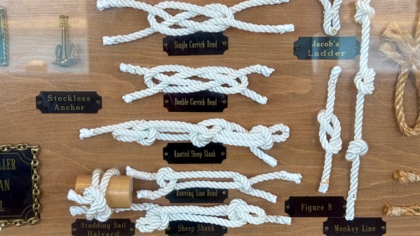
I enjoyed this large knotical display 🤣 🤣 🤣 but you only get to see a few examples.
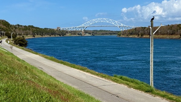
Technically, the border is more complicated, but this canal is commonly considered to separate Cape Cod from the mainland, which is where I’m standing and the cormorant is posing.
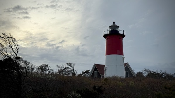
Our late-day adventure was a visit to Nauset Lighthouse, at the beach where The Guru and his fam used to hang. It was relocated in 1996 because coast erosion threatened to topple it. This lighthouse originally stood in a different town from 1877–1923, when it was moved to this area. So this is the third spot for it (I hope I’m making sense 😄; g’night).
Posted at 9:01 PM |
Comments Off on Nautical-ish
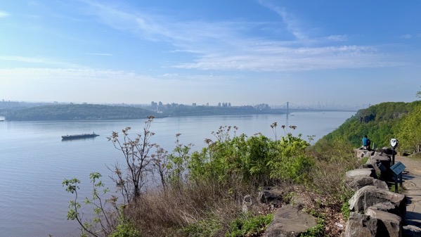
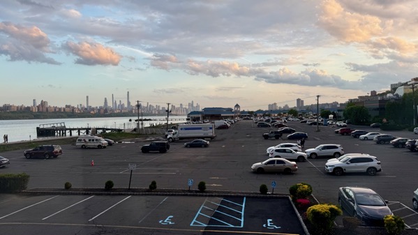
Obv, our travel today was on land, yet water was a near-constant companion. We began by heading north on the Jersey side of the Hudson River. Here’s a view south back toward NYC. I think the haze is humidity (ish).
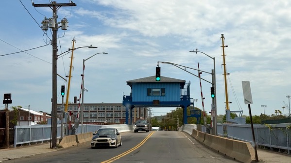
Then we turned east(ish) for the rest of the day. Here’s a swing bridge that crosses the Mill River in New Haven.
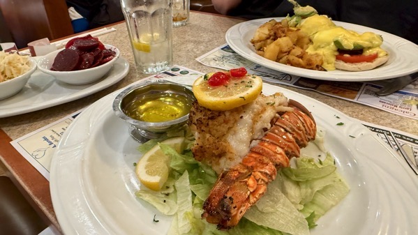
We got a fancy lunch, stuffed lobster tail for me and Eggs Benny for the Guru. The Benny was exceptional, and included avocado. My pickled beets side was prepared in a way I’ve never had before, with mustard seeds, then with fresh onions and bay leaf added before serving, and was not very sour/vinegary. The other side is a Cole slaw that may have had a salt treatment to soften the cabbage before dressing.
We also split an egg cream, like we were teenagers on a date. I think I had it once before and thought the same now as then: it tastes like watered-down chocolate milk.
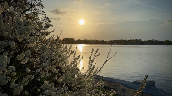
We took a sunset tour of the west side of the mouth of the Connecticut River, not far from our hotel.
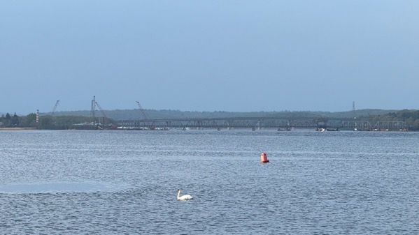
We found a pair of swans, keeping their distance, so I have only shots of one at a time. That’s the railroad bridge over the lower Connecticut in the background.
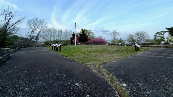
Here’s today’s version of Fort Saybrook; construction began in 1636, directed by Lion Gardiner (1599–1663). Gardiner’s wife Mary Willemsen Deurcant (c. 1601–1665) accompanied him, and their first two (of three) children were born at the fort before his contract ended in 1639. They then moved to what is now called Gardiners Island off the east end of Long Island. The Montaukett sachem/chief Wyandanch (c. 1571–1659) deeded it to him in 1639 independent of the colonies extant at that time. The 6×3 mile island remains in the Gardiner family, whose many descendants include Alexander Graham Bell’s wife, Mabel Gardiner Hubbard.
Next to the fort remains are railroad remains, including this roundhouse. The railroad opened in 1871.
At another stop, we watched the ebbing tide, the clouds, and a few airborne water birds.
Posted at 9:17 PM |
Comments Off on Watery places, lunch
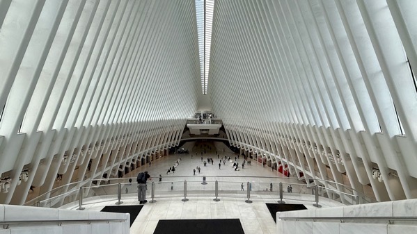
We surfaced in NYC in the Oculus. Here’s the view the length of it, where the eye shape looks far more like two rows of tall, elaborate fencing.
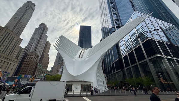
Oculus exterior: these features are to mimic eye-lashes?

Turn around a walk a short ways and you’re amidst the World Trade Center memorial and park area. Here’s the north tower pool with names engraved on panels just exterior to the cascade.
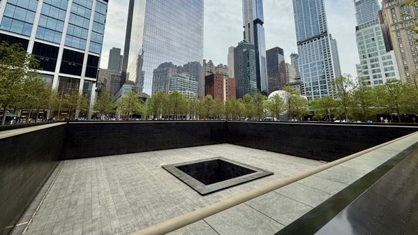
We found the south tower pool dry for maintenance, and almost 100% without spectators, unlike the “wet” pool.
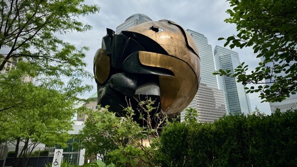
A bit farther along and up a few steps, we revisited this sphere (official name: Große Kugelkaryatide N.Y.), originally between the two towers and damaged on 9/11. We saw it in its temporary location in Battery Park, and wanted to revisit it here.
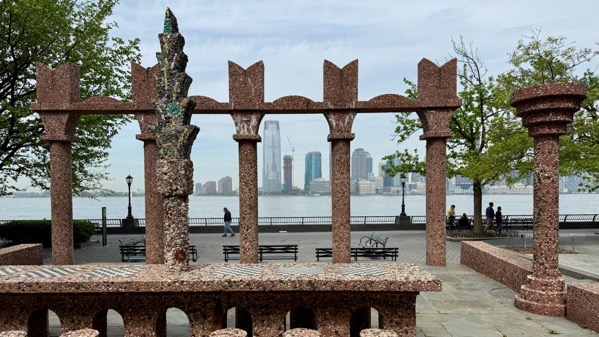
We walked south along the Hudson. From a distance, this sculpture, called Upper Room, looked like it was surfaced in huge bird seeds. I wonder if anyone plays checkers/chess here.
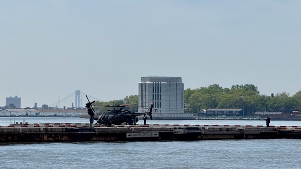
The fabulous viewing locations for the Statue of Liberty are under construction, so we continued around to the East River, and saw lots of arrivals at the Heliport, including military choppers (perhaps as many as four). They match the black SUVs we saw parked at the Heliport, with plates reading something about Military Affairs and Navy.
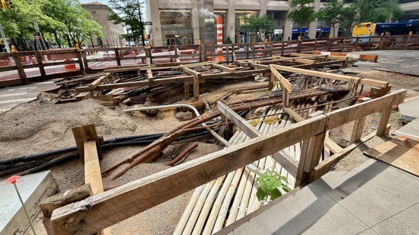
If you’re curious about what is under Manhattan streets, here’s a peek…overlapping infrastructure, no?
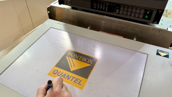
JCB made special arrangements to see and use this Quantel Paintbox, the magic graphics machine that preceded Photoshop software. Memory lane!
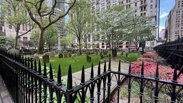
We also ascended to Trinity Church, exploring the graveyard next door.
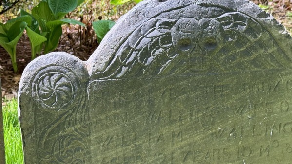
I enjoyed the decorative details still visible on some of the stones.
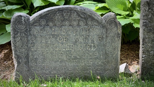
Most of the stones are of other materials and far more eroded.
Sunset sky from our room.
Posted at 9:07 PM |
Comments Off on Remembering
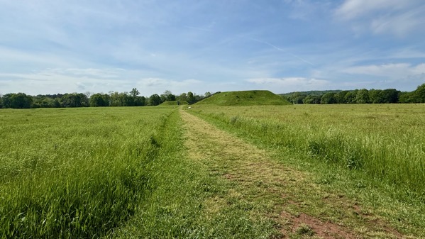
Today, we toured the Etowah mounds, all six of them. That’s the largest and second largest in the distance.
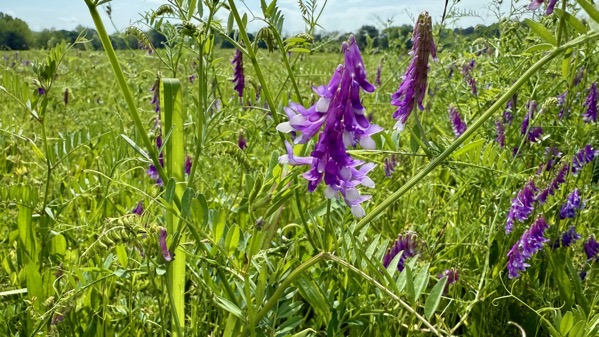
Archaeology is ever-so-cool (duh)…I also enjoyed the vetch among the planted meadow flora. Bitter vetch is one of the earliest domesticated plants in the Levant. This, however, is probably common vetch…one of my favorites for the color and the delicate foliage with probing and twining tendrils.
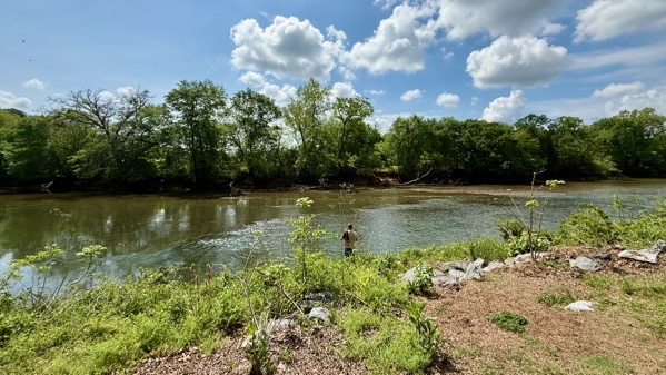
The sacred zone aorund the mounds buts up against the Etowah River. That riffle on this side of the river is half of a weir that certainly has been built and modified in historical times, but may date back into prehistory and the era of the mounds.
Posted at 10:43 PM |
2 Comments »