Musings

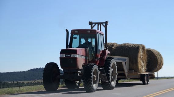
A little agriculture…lots of irrigation around here, not all productive row-crop fields, but most, it seems to me. And the product must move to the consumption area. Not many alternate farm roads, so we travel the US highways with tractors and combines….
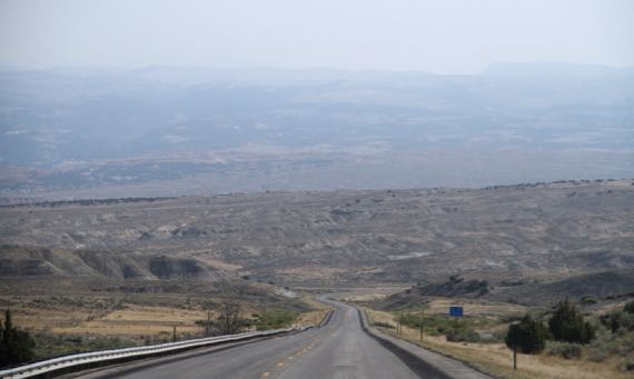
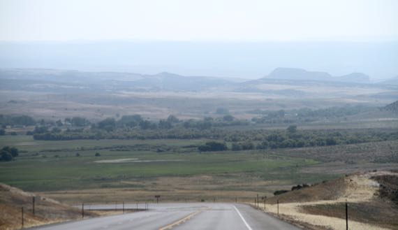
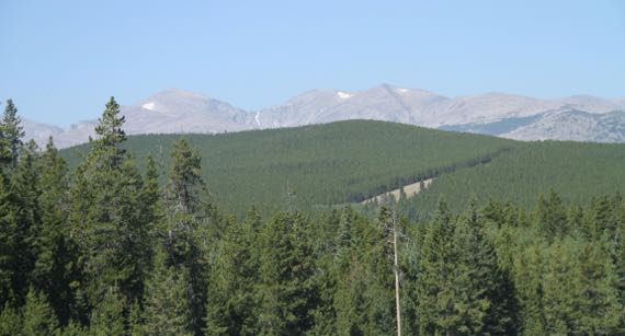
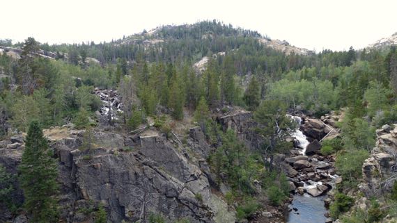
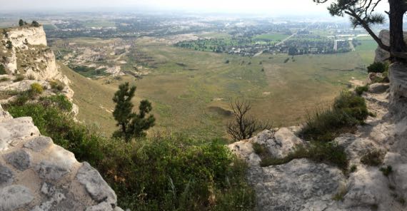
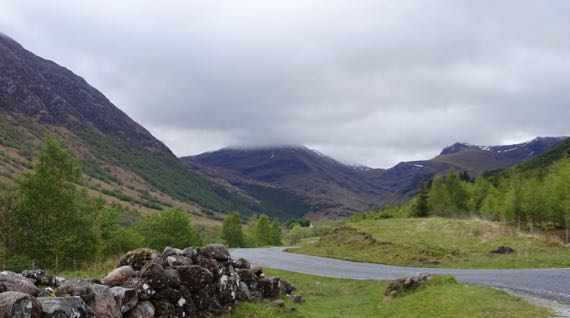
Three long views…different colors. The third is the heights of the southern Bighorn range. Note the surviving snowpack, in the last half of AUGUST, kids.
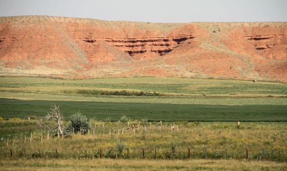
Midground color variation…red/green (not the man/show), and the grey rocks of the cliffs on one flank of the Bighorns.
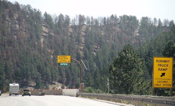
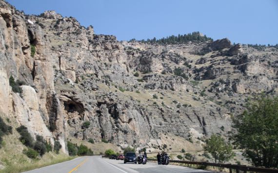
I didn’t check it, but the crossing from Ten Sleep to Buffalo seemed to have long, grinding climbs/descents, just as we found east of Greybull. I don’t know if they were 10 miles, but they are close. This runaway truck ramp, really some cable-gates, I thought, is on the descent into Buffalo. (Will they change their name to Bison? Is there even a movement afoot?)
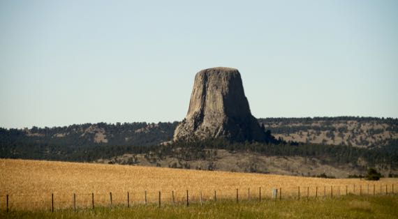
Aha. And the geology. An igneous island amidst eroding sedimentary formations. Or the twenty-second wonder of the world, something like that.
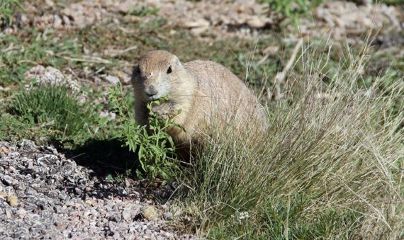
Despite the many signs in the parking lot and along the trails below Devils Tower preaching sensitivity to this place that is sacred to many indigenous Americans, as in, they wish you wouldn’t climb it, the splash page on the NatPkServ website is all about what a wonderful climb it is. Doesn’t even mention the deer, turkeys (no photo), and prairie dogs you may see.
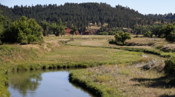
And this deer, in the low ground inside the bend of the river…better photo than the one we saw at DT, and a pretty river to boot!
And now my back posts are caught up! Yay for connectivity and energy…in conjunction. Thanks for waiting for me, Gentle Reader.
Posted at 11:46 PM |
Comments Off on Short stories
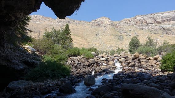
The most scenic view was OUT the cave….
We began the day by checking out one of those minor mysteries of the world. In this case, there’s a river rushing down a mountain, and it gushes into rocks where it has carved a shallow cave, and, in the back (of course), it disappears from view!
The name of the river, and, of course, its canyon…I had a hard time remembering how to say it correctly if I looked at the way it is spelled. The pronunciation (if I have it right): poe-POE-zhuh*. [Yes, scroll down* if you want to see the WhiteMan spelling that I found so troublesome, but get the pronunciation in your head first.]

Pretty fish.
About a quarter-mile down the canyon, there’s a large spring-pool…which the Powers That Be have stocked with trout, with a handy trout-food vending machine on the overview deck (25 cents). And the critters rise with gusto even if you just make a tossing motion with your arm. Great fun, teasing fish. And these are well-fed, unculled, gigantic, yummy-looking trout!
Enterprising scientists have put dye in the cave-water, and discovered the does indeed feed the lower pool…. The mystery is that it takes a full two hours for the dye-water to appear below.
These places are called the Sinks and Rise.
With that curiosity burdening our minds, we continued up the drainage to where the road turns to sidewind up the canyon wall and leave the drainage. There we parked in a trailhead lot, and began to ascend on foot.
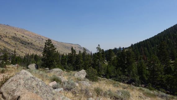
The whole climb, both in car and on foot, one side of the canyon is tree-covered and green, while the other is comparatively sere. The green side is north-facing, and retains the moisture from its snow-load longer and better, allowing far more robust vegetation to thrive. A display claimed that there is more biodiversity on the dry side, however. Where the trail runs.
I kept thinking of that as we climbed. Insects. Heard some birds. Saw no rodents, mammals, even lizards. Maybe because I found the walk so taxing. It was. We climbed. And at a good altitude for us flat-landers. Still, we stopped when there was shade, and sometimes even in the sun. Pant pant.
Our reward, or at least where we turned around…a split in the river, with waterfalls on each side. Actually cascades over rounded boulders. Not as dramatic as we were expecting. Still, we are quite proud of ourselves for making the hike. [Fitbit gave me 67 flights for our altitude gain (GoogleMaps and our GPS track suggests it should have been 82); I think it shorted me on minutes of effort (only 74; felt like WAY more).]
The sections of running water left and right in this photo are the two parallel river-sections.
We shared the trail with horses, and even saw three enter our route a few minutes ahead of us as we began to descend, and from afar heard the squinching of the leather saddlery. They seem to leave road apples in the same spots, at least sometimes, so you can see several stages of desiccation at once (science). And, if you ask me, the animals disproportionately chose trail-narrowings to make their deposits. I’m sure that’s my bias, developed as I stepped around the apples….
We took Forest Service drive through the southern Winds, as this range is affectionately called, which has as its spine the continental divide. We did cross the divide at the southern margin, and saw the trail-crossing at the historic town of South Pass City (some 30 still standing structures from the 1860s–70s), which also has a less-historic part where people still live.
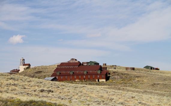
Carissa mine, near South Pass City.
While many white folk crossed the pass and moved on, some stayed and mined. Yet, the immense scale of the building complexes is dwarfed by the landscape.
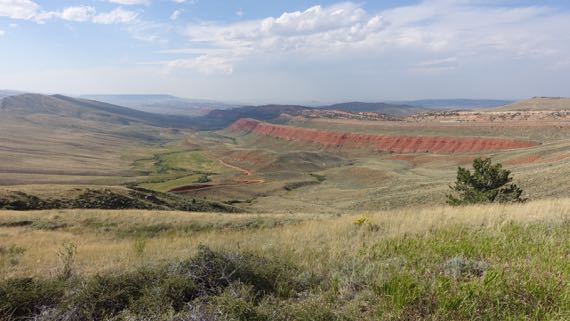
If you’re into naming, and humans as a group are, could you really name this other than Red Canyon?
* And the way it is written: Popo Agie. The “A” kept erroneously invading my pronunciation….
Posted at 10:22 PM |
Comments Off on Up, down
Long miles of distant vistas sometimes with a nearby creek or river, punctuated by interesting stops. The long miles permeate my memories, but I’ll give you the fun stuff from two notable stops, Gentle Reader.
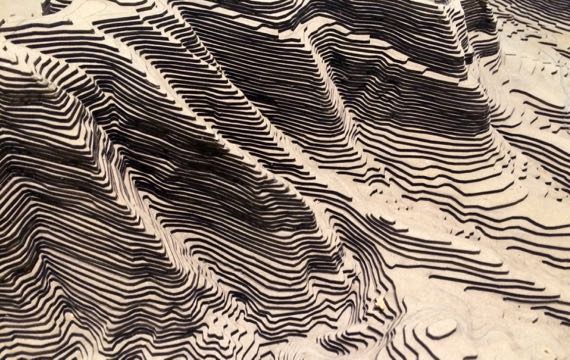
We started with a big climb to the top of Scotts Bluff, or the Prius made the climb. We merely sat. This vertically exaggerated model is in the vistor-center-museum. The actual feature an eroded 740′-high ridge of alluvial and aeolian deposits that are relatively soft, but a hard limestone caprock has allowed them to be preserved, although they of course continue to erode away. The survey marker that was installed on the “highest point” is now sitting atop a metal pillar that sticks above the surface over a foot in the air….
Here’s the view to the ENE from the top, a slight pano. That’s the town of Scottsbluff (yes, different spelling) there in the haze. The ranger thought it might be smoke not typical haze. I can’t say. We never smelled smoke, but saw the haze for miles.

If you ever wander through Douglas, Wyoming, you must stop at the Chamber of Commerce visitor center. Sweet people and every state highway map from the area. Also, lots of RR cars to look at—and two to clamber through! Here’s a Pullman kitchen! Cleaned up but not restored—soooooo special. Even the duckboard is on the floor, just like the carpeting is in the adjacent hallway that bypasses the kitchen….

They used plastic dishes and plastic toppers, but the visual flavor of the dining section is preserved. The decorative details, like the rug and the carving of two deer on the bar at the end (brown zone, sorry no detail in this shot) demonstrate the care taken to make dining pleasing even as the wheels click-thunk over each rail-joint.
Posted at 8:15 PM |
Comments Off on Up, and back

Sometimes the distribution of species across the landscape is a great clue to previous human occupation, because people move plants around, to have preferred species nearby. For food, medicine, aesthetics. Sometimes yucca is one of those human-distributed species.
I also spotted a volunteer tomato plant among some bricks paving a verge…. See…out of place.
Posted at 8:51 PM |
Comments Off on Leaves as bayonets
Archaeologists use the term activity area for places where people do the same activities over and over. Think of kitchens…. Many types of activities have obvious and easily recognized suites of artifacts and features.
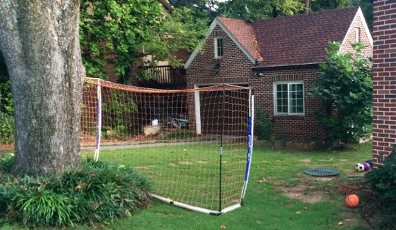
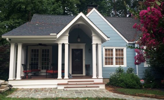
The upper photo features a front porch, a place for a wide variety of activities such as relaxing, child play, and perhaps shelling peas. This is a new porch, added to the house this spring…and it matches…nice. The second photo shows evidence of lots of ball-play. Look at all the different colors of balls! More relaxation activities….
Posted at 5:42 PM |
Comments Off on Activity areas
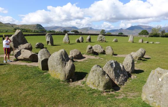
We started our morning—look at that glorious sky!—at our last standing stone circle of the trip. This one is on a high hill surrounded by much higher mountains. I learned absolutely nothing about the ritual landscape…other stones, where settlements were, other architectural elements…. Sigh. I bucked up, though, and on we went!
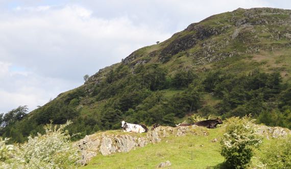
We motored up a hill, and discovered even the cattle enjoy lake-views…
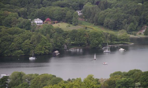
…and watching sailboats….
Remember, this is the Lake District, and people here tend to be flush and indulge their notions…can these be considered garden follies?
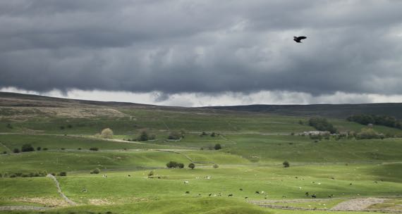
We motored along winding roads into the nearby Yorkshire Dales, which we found stunning, yet rather sere in comparison, with rock outcrops and different land-use patterns.

With last weekend, we realized we had hit the summer festival season. I think this apparent gypsy wagon is advertising one.
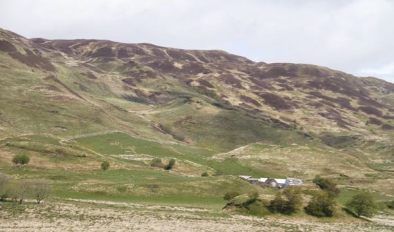
That stone barn…there were lots of these in the valleys and often not very far apart, although each was in a different stone-fenced paddock. I pondered this quite a while, and eventually postulated that they were part of a transhumance pattern, with summer graze on the heights of the ridges, and wintering near these barns, which always had some height and at least two stories, I assume for storing winter fodder. Just a theory, though….
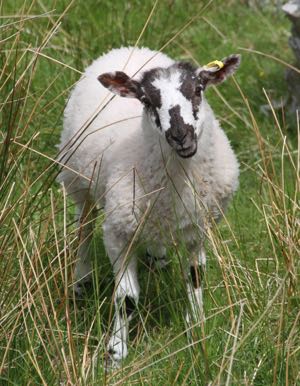
I doubt I’ll see any sheep close-up during the rest of the trip so one last sheep photo…and isn’t this a darned winsome sheep?
Posted at 2:38 PM |
1 Comment »
In the tourist propaganda, you see Arbroath called the birthplace of Scotland. This abbey was founded in 1178 by monks from Kelso, one in the Roxburgh border-abbey cluster. It took decades to build and the soft sandstone used for carved stone detail has become greatly eroded. Arbroath Abbey became the wealthiest in Scotland, and that was probably partly why it hosted a gathering in 1320 that composed the Declaration of Arbroath, which set forth Scotland’s independence from England, and finally was signed by Edward III of England in 1328. This was very early in his long reign, which lasted from 1327 to 1377. Of course, by the 1330s, Edward was invading Scotland…ah, the conflicts have gone on and on between these two groups….
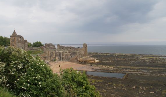
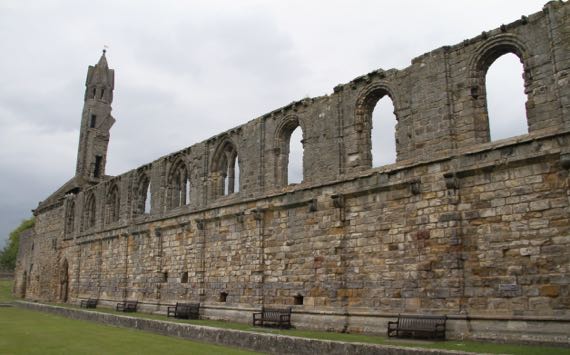
We enjoyed the town of St. Andrews more than we expected…. We looked at the castle from afar, admiring its “corner lot” above the sea. The tide was out…and this huge rectangular pond revealed…we never figured it out…. In the 1300s the castle was controlled alternately by Scotland and England, and in the 1400s it was held by Scotland. The later history…rather brutal….
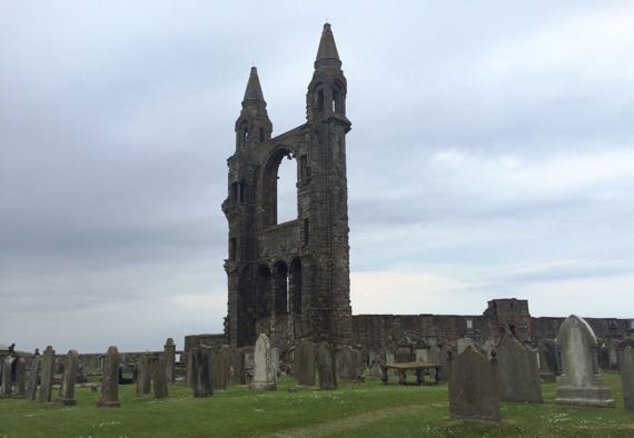
We wandered among the ruins of the cathedral, another one with bodies and headstones planted where the building used to be…. This was the east end of the church, looking at the inside of the wall behind the altar. I was surprised how stable this huge section looked, even without the side walls it used to have.
If I remember correctly, this was the back wall of one side of the monastery’s courtyard. I loved the row of benches anchoring it in the present.
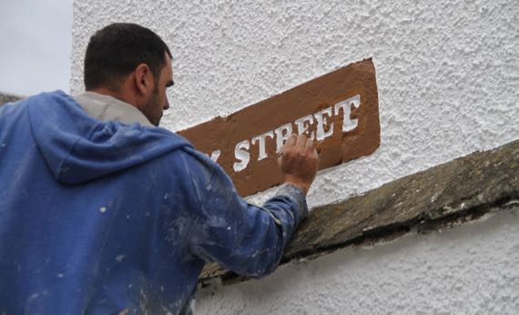
Speaking of the present, we found this fellow doing sign-maintenance on a high ladder at a main corner in old-town, near the University.
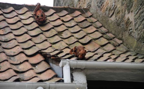
Also, JCB spotted this rooftop humor…. That is one UGLY rat…it is a rat, isn’t it? Not two cats?
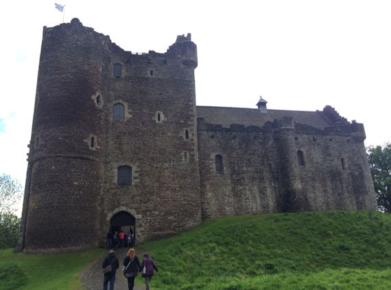
St. Andrews was not our only stop…we also climbed into nearly every accessible nook and cranny of this nearly-unchanged-since-Medieval-days castle, which you may recognize if you’re a Starz Outlander fan…. The real world calls it Doune Castle, and most of the construction we see dates to the late 1300s. Movie-makers have visited here with their cameras for decades…including for the Elizabeth Taylor version of Ivanhoe (released in 1952); Monty Python and the Holy Grail, shot in 1974; and the Game of Thrones TV series….
The title does NOT refer to the Guru and me…in either order….
Posted at 5:05 PM |
Comments Off on Very vs mildly dilapidated
Hold onto your shorts; we covered a lot of ground today, the weather included blue skies (!!!). Here’s a great sample from our day, and yet I am skipping many beautiful moments captured without the help of Kodak.
Glen Nevis.
Loch Nell.
Moors in the glaciated mountains…at least, I’m pretty sure this vegetation qualifies as moors.
Kilmartin Glen Neolithic ritual landscape…one of the rock cairns.
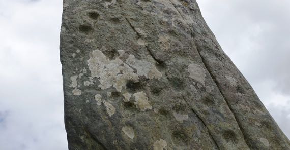
Kilmartin Glen standing stone with pecked “cup marks.” No idea what they were meant to convey.
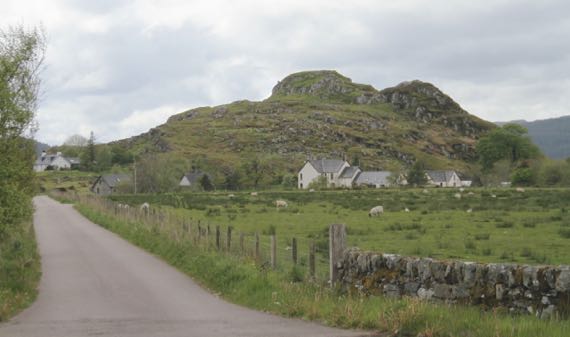
Dunadd landform from afar. Dun means fort, usually always a fort atop a high-point.
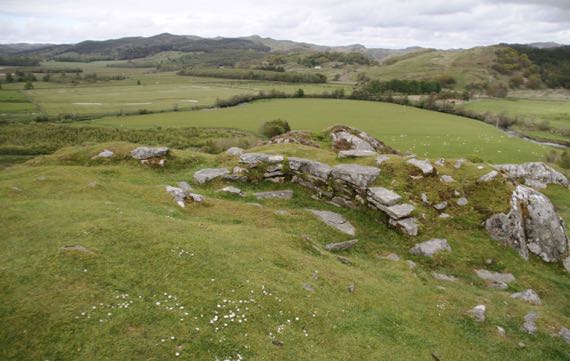
View northish from the summit of Dunadd, from the part described as the great hall and citadel. The later occupation here maybe began in the late 500s and lasted into the 900s. This was the capital of the native Scoti peoples and their “empire” Dál Riata….
Now, back to the present….
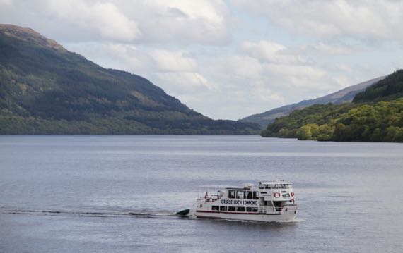
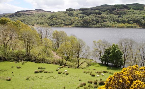
Loch Lomond. We did not cruise it.
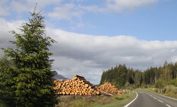
Active logging, Scottish style. The log piles show the neatest/tidiest stacking jobs I’ve ever seen. Still hurts to see trees whacked in their prime….
Posted at 10:22 PM |
1 Comment »
This is a new term I’ve learned, and it means, rainy, cold, windy, and generally unpleasant outdoor conditions…. And that was what we had today.
I have neglected to mention that we had several lovely days with ShedMan and CheetahWoman…lots of laughing and good times. Today, however, that came to an end….
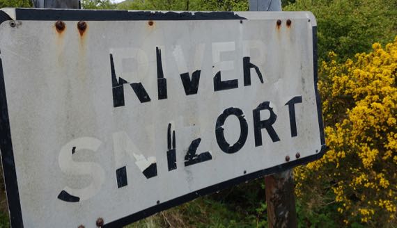
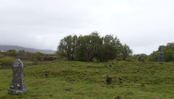
CheetahWoman had told us about a magical cemetery island she found in the River Snizort, and we were going right by, and so stopped in. Despite the rain and many cow-pies, we discovered a sliver of the magic she had observed in the fading light of day (no rain).
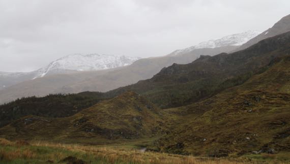
Given that it was in the high 40s (F) in the valleys, it’s not surprising that at elevated elevations, the precip was white. I think there’s new dusting atop remnant snowpack from last winter….
I really loved the narrow long chutes of water the mountains were shedding…. More a result of the rubbish weather….
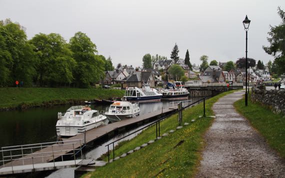
In light rain (still rubbishy), we checked out the Caladonian Canal (along the Great Glen Fault), which we paralleled for part of the day….
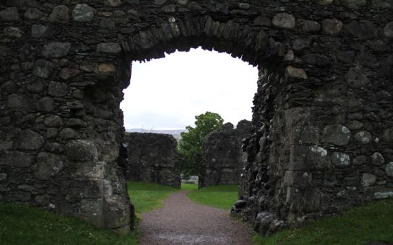
We finished up our touristing with a quick visit to Old Inverlochy Castle, which is in pretty good shape for dating back to about 1280. This view is through both gates, all the way across the interior courtyard. It had round towers in each corner, and the wall bases and part of the walls remain outlining the exterior walls and towers. The huge rounded stones are different than in stonework we’ve seen so far.
Finishing a day of rubbish weather is uplifting….
Posted at 10:22 PM |
3 Comments »
We moved through the landscape like we were nudge-budging time.
We began with an unexpected tire event…on the OTHER rental car…. Some confusion on my part, as we both, that is each couple, arrived here in a white rental car…. After several attempts, I finally got straightened out…and permission was given for tire replacement/fixing to happen, using a nonspecified contractor…. Then we discovered that the tyre business we could find (TY, G__gle!) in these parts is closed Sat and Sun, so the next phase of the tire fixing event will happen Monday…. The “boys” installed the “real” spare, and the car is back safely in the driveway, awaiting the weekday opening….
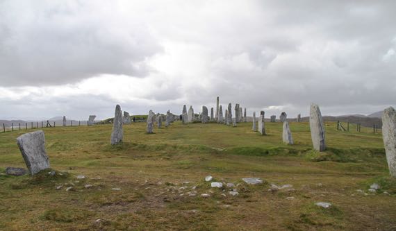
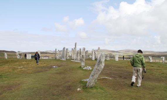
Our first (scheduled) stop was this fantastic four-pointed array of standing stones with a circle of stones and even a burial cairn in the center. What we see today is the result of several hundred years of additions and modifications…. Plus agricultural use as late as fifty (I think) years ago, when this was a potato field (if I have it right).
For me, the space and place was magical in that this hilltop and the laboriously erected stones seemed like a place where peace reigned. My projection? Probably.
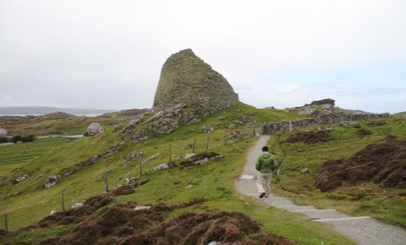
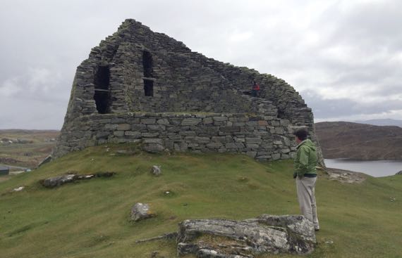
This magnificent circular structure dates perhaps a millennia closer to our own times, but still in the distant past. We read that no one knew the purpose of these huge circular buildings, and we also read about how it contained multiple levels of living spaces, likely used by several…families…. This broch (Friendly Autocorrect: plz don’t change it to broth again!) is huge and within the two-walled enclosure were steps and passages that permitted movement up and down, from level to level.
Very moving. Very different from the standing stones/stone circle….
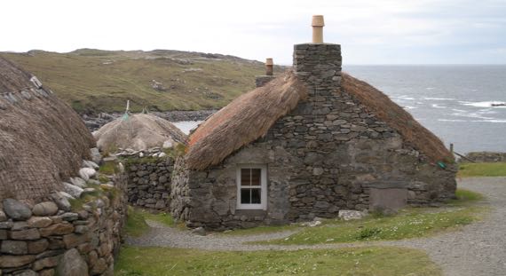
We also visited a blackhouse village (that’s blackhouse not blockhouse, Friendly Autocorrect). The last residents moved out maybe in the 1950s(?), and about 15 yrs ago preservationists began to reconstruct and preserve this cluster of blackhouses. We found displays and people here extremely informative…but I neglected to discover the reason behind the naming…. I heard that previously there were white-houses, hence the name as the structures contrasted in some way. I also heard that the peat fires inside blackened the interiors. Mostly, I just absorbed what it might have been like to live in spaces with your sheep/cattle, to have a dirt floor in your house, and to nearly always have your nostrils filled with the scent of burning peat. My imagination may not match reality.
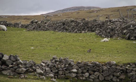
Adjacent to the blackhouse village was a rabbit village. [Rabbit is more central and in the fore-ground than sleeping lamb. Rabbit’s friends and relatives didn’t make this crop….]
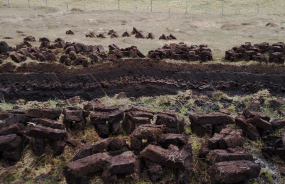
Still trying to figure out the complexities of peat cutting and drying. From my limited understanding, this bunch of peats is in the first stage of the drying process, which may take at least six weeks and can be longer if it’s repeatedly rainy.
Very exciting day all around. Plus, we watched the moon above, and we have seen the loch in front of our rented cottage in the hinterlands become still-surfaced. Given the constancy of the wind, I was very surprised by this…nature-mirror…moment.
Posted at 5:50 PM |
Comments Off on Time changes (noun verb)