I stepped outside this evening to try to figure out odd vehicle noises out on the road, and by my feet heard stampeding chipmunks…two, running like I broke up a party.
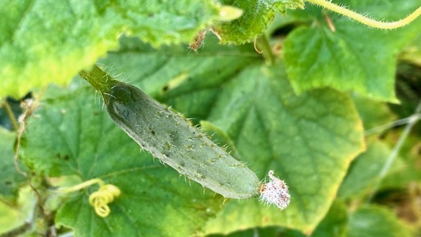
Meanwhile, here’s a tiny cucumber. The species is native to Asia, and now very widely planted and consumed.
Posted at 9:29 PM |
2 Comments »

I went to the lake alone for a pre-prandial, late-afternoon bathe and discovered I had some”one” looking out for me. S/He stayed around until I got out, then drifted away.
Posted at 5:56 PM |
Comments Off on Eagle eyes

After a hot and sticky day, the temp abated enough for a sunset stroll. And what a sunset. Now all the windows are open to let some cool(er) air in the cottage, as it is finally in the low, low 70s.
Posted at 9:50 PM |
Comments Off on Timing is all

Visual proof of season-changing underway…although I admit the color change was underway in August, which is far more of a headline IMHO than autumn reds in September in the Northwoods.
Also, I made mashed rutabaga tonight. First time for everything. Tasty, indeed, tastier than I thought it’d be.
Posted at 9:06 PM |
Comments Off on Sample branch

A heavy dew last night deposited diamonds on this humble cabbage. The look of the dew and the pellucid droplets…both stunning.
Posted at 5:44 PM |
Comments Off on Dew diamonds again
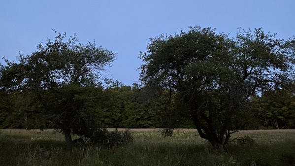
I take so many morning, even early morning, shots of this row of apple trees, of the field, and of the woods beyond (or just one/two of that trio) that I thought I’d try one in the late light-of-evening. Not so interesting, perhaps because the digital processing’s trying to make it a replicate a daylight shot. The result made me think of some savannah moments we had ages ago in bush camps in Tanzania.
Posted at 9:02 PM |
Comments Off on Mini photo experiment
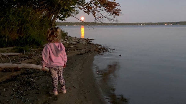
Here’s the blue moon. Yes, it’s orange.

And the sunset light the opposite direction was also orange. [I’m cheating to call it an orb.]
Posted at 9:15 PM |
Comments Off on Orange orbs
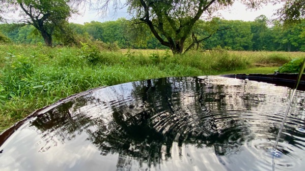
Of course, now that the rain barrel is full from the periodic overnight and morning rain, the plants are well-watered and don’t need a top-up from the barrel.
Posted at 9:20 PM |
2 Comments »
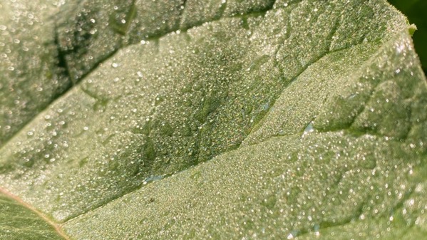
Dew on a rhubarb leaf in low-angle morning light. Rain is expected after midnight, so it’ll be wet again tomorrow morning.

Grocery store report: I sometimes eyeball the varieties of B_sh’s beans. I hadn’t seen this one before. Well, I thought, looking at that “zero” that had been altered to include a…zero…standing in for an “o.” So clever.
But, how can it be baked beans with no “sugar added,” I thought, so what’s the sweetener…’cause baked beans have a sweet element. I checked the ingredients, and the second-to-the-last ingredient is sucralose. No molasses, no maple syrup, nothing else sweet. Sucralose is chemically altered sugar, that the food folk don’t consider as sugar. So that cute blue label is right by them.
Also in the fine print, the third ingredient is “soluble corn fiber.” What’s that? Modified cornstalk? And the first ingredient, as I’m sure you’ve anticipated, is beans, but “prepared navy beans.” And what does that mean? Ones who’ve been to test prep classes? Ones in full makeup? Or ones ready for the anesthesiologist?
That was the last label I read in today’s grocery store visit. I was exhausted, and almost ready to cook my own beans.
Posted at 9:47 PM |
Comments Off on Visuals

Sometimes evening comes and the lake gets very still. Sometimes the moon hangs above the dock. Sometimes it all takes my breath away.
Posted at 9:11 PM |
2 Comments »