Ice sculpted
Wednesday, 7 September 2022

You’ve heard of ice sculptures. These trees are sculpted by ice. BTW, that’s foam not snow.
Wednesday, 7 September 2022
You’ve heard of ice sculptures. These trees are sculpted by ice. BTW, that’s foam not snow.
Tuesday, 6 September 2022

We assembled at 2:30 to get the boat lift in for the winter. [As in away from the crushing force of ice.] It’s been out at the end of the dock all summer, making fishing and outings easier, while the boat is protected from being tossed by the waves when not in use. We brought in the dock the other day. Today, the lift was an island needing removal. We put the wheels and axles in a canoe, and reattached them to the lift-frame (more complicated than it sounds), then pushed it to shore. There, we assembled (or D did) a cable, and an ATV did most of the pulling (out of the frame to the left). Here you see us lifting the frame so it smoothly pops up from the lake-edge, and, voila, it became simply a matter of parking. Oh, yay. All finished by 2:30. Then, two actively feeding ducks arrived, focused where the lift had been, perhaps finding a surfeit of tasty bits stirred up by our feet during the lift removal.
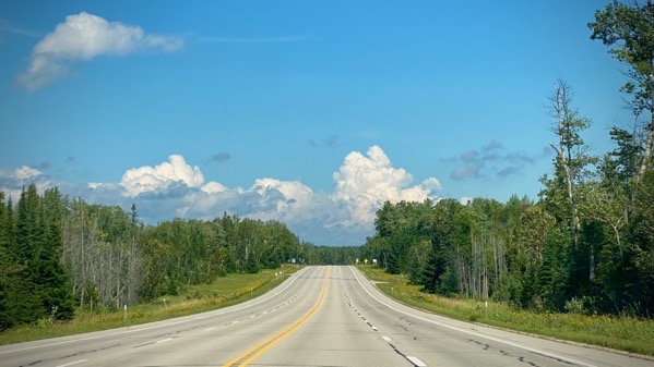
Monday, 5 September 2022

Although the late-day light has a faint orangeish tint, the leaves are also beginning to be less green. Overnight temps below 50°F also indicate the season is changing.
Saturday, 3 September 2022

We’re definitely enjoying the (relatively) open skies in these parts. Last night we watched two bald eagles cruise by multiple times. Here: first quarter moon over the orchard.
Monday, 29 August 2022
Kinda felt like today would be too…muggy for much outdoor work, or really much activity at all. So, we opted for an air-conditioned ride to Serious Grocery Shopping, or a UP approximation thereof. Eventually the overcast burned off and the sky became stunningly clear, with very white poufy clouds.

Because we rarely shop at this emporium, we did some aisle-wandering to find all items on our list. Somehow (as in: Someone Else wanted Oreos), we wandered past the Pepperidge Farm cookie section, and I discovered my recollection of the varieties offered is way, way out of date. [That’s a good thing?] I note the geographic distance between the locations referred to by these two names. Not being a particular fan of either coconut or milk chocolate, I easily gravitate to the Mackinac version. Also, at 8.6 oz vs 7.2 oz, whatta bargain.
Thursday, 25 August 2022

This afternoon, after the rain that started overnight stopped…

…I took a walk down to the beach as an antidote to the nauseating reporting by David Enrich in WashPo, “How a Corporate Law Firm Led a Political Revolution”…

…which discusses in detail how the law firm Jones Day inserted their (conservative) choices into the judiciary across the country, including into the Supreme Court.
Lest you think this was a side-effect and not a deliberate plan, note this quote from Rob Luther, one of Don McGahn’s assistants in the White House Counsel’s Office, soon after he left government service and joined Jones Day: “We did it! We reshaped the judiciary! We changed the country!”
Wednesday, 24 August 2022

It, indeed, was a foggy morn, but there was more than that going on. Here’s the earliest light. Just magical. My eye found more pink in the sky than this shows. If you like pink.

This was at the beach mid- to late-afternoon. I think this is a native mint/mint family. Love the flower-collar at the leaf junctions. [Kindly substitute the botanical terms, if you know/care about them.]
Tuesday, 23 August 2022

Clear, warm, and somewhat humid. Still, we did about eighty minutes of hard work this morning before the sun’s intensity ramped up—mostly cutting and vanquishing grass and weeds.
That’s the cycle of life around here. It’s either too cold for plants to flourish (or grow at all), or we’re in the brief period when it’s warm enough, and they grow with great urgency to make it through the growth cycle and produce seeds before freezing weather repeats.
This goldenrod (probably Solidago canadensis) is late to the blooming game, yet I know it’ll manage to be reproductively successful before the first killing frost.
Sunday, 21 August 2022

It’s official. We’ve reached the land of calm waters (at present)…

…and glowing white birches.
Life is good. [Also no extraneous critters that breathe (like mice or bats) were in the house, only a few dead “bugs” (like flies and spiders).]
Thursday, 11 August 2022

It’s August…it’s even the first half of August. Yet, I see the early-leafing redbud is already dropping a yellowing leaf…an early harbinger of autumn. Or fall. [Get it? Fall? Falling leaf? Fallen leaf? haha]