Good show
Wednesday, 12 July 2023

All day the clouds put on a show, even more than the sun. Mostly full cloud cover now.
Wednesday, 12 July 2023
All day the clouds put on a show, even more than the sun. Mostly full cloud cover now.
Tuesday, 11 July 2023

An hour after I made yesterday’s post, our power went out, then we had a fierce storm that didn’t last terribly long…thunder, lightning, rain. The power was out for about nine hours, but thankfully back on in time for coffee-making. By sunrise, it was all clear and sparkly out, although some of the now-tall grasses were wet and lodged. They perked up after the sun and wind dried them, and I managed to pull off two sessions with The Beast.
Monday, 10 July 2023

Bee-pea. Not a petroleum company. [Pale blossom compared to our usual specimens….]

Another frustrating day of intermittent potential-rain, with almost no actual rainfall…but the threat was enough to keep me away from Beast-work beyond about fifteen minutes I got in before nine, halted by the strongest rain of the day (until now that is…the rain came in after I began typing—sheesh).
Although I think a bit of wind brought down many of these leaves, they were already compromised…I think from heat and desiccation. It’s a bad summer for many plants.
Saturday, 8 July 2023
I never managed to get in my almost-an-hour with The Beast today. Weather was never permitting. Throughout the day, the predicted rain window was present, absent, moved, and returned. I didn’t want to get caught out in the field…not so much the rain, but lightning aversion was my focus. This was the threatening sky in the late afternoon.
And to top it all off, we never got enough rain to moisten even the flagstones. In essence, I got a slow Saturday without even trying.
Wednesday, 5 July 2023

We had a bit of a cloudburst this morning that filled the water barrel—almost filled it, actually.
The day was rain-free, although often overcast, until late afternoon when we had off-and-on pitter-patter, and right now it’s sprinkling again. That pattern made doing yard work difficult, although the plants are MUCH happier. I’ll bet the grass won’t be crunchy tomorrow (which is an improvement).
Sunday, 2 July 2023
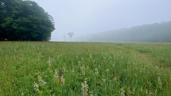
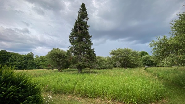
Previous summers I have had multiple opportunites to take foggy morning photos. This year I suspect it’s been just too darned dry for the fog to form. So, I was excited this morning to see the fog thicken as the sun rose, and went to to capture images. Since I now have a clear path from my activities with The Beast, I headed out into the field for a different perspective than I usually get from near the cottage. After this shot, and a few more steps, I scared up a sleeping deer, which huffed-snorted at me for the indignity.
Also, the day stayed cool longer in the morning, which made my almost-an-hour with The Beast easier to endure. Still humid, though….
Saturday, 1 July 2023
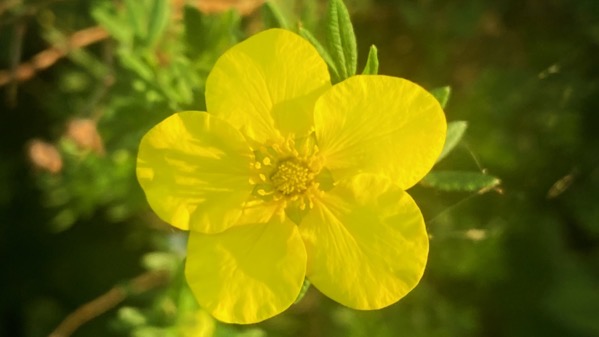
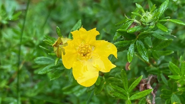
Golden-lit potentilla.
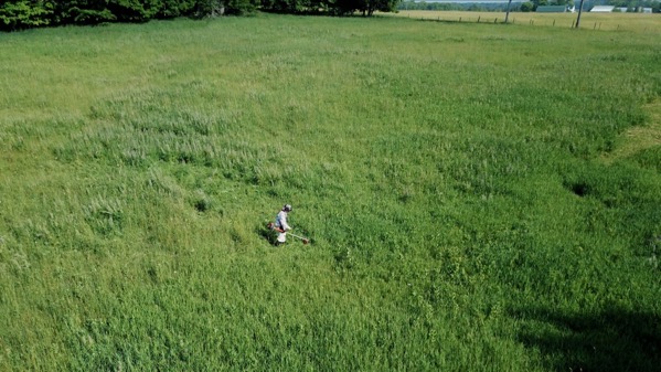
My morning fun…exercising The Beast.
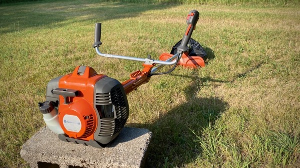
The Beast…waiting.
Last summer, we bought The Beast to frustrate, and hopefully to ultimately remove, an invasive grass that has very strong stems and out-competes the “normal” pasture grasses. Of course, this is no longer a pasture, nor doesn’t anyone hay it, or otherwise manage it for agriculture. Just. Too. Much. Effort. [Yes, more than operating the beast on hot, humid, hazy days. Long story.]
Thursday, 29 June 2023
The smoky haze continues to hang here; you can barely see the other side of the lake (approximately three miles). Thankfully, yesterday and today it didn’t smell smoky outdoors.

Meanwhile, on land, the lupine blooms have mostly become pods—still green—as Fabaceae do.
Monday, 26 June 2023
We did a wee bit of time travelling this evening and watched “Yellow Submarine.” I’m sure I never saw it before. Great music; I sang along with all the songs!
Sunday, 25 June 2023

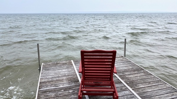
This yesterday-photo better illustrates the lake level than one from today would. Today has been breezy and variable, with 8-inch rain—as in drops eight inches apart…meaning enough to note but not enough to make any difference to the vegetation or even a measuring device. Note that there is beach, or enough sand exposed to be called beach, for the first time in, what?, two decades or more? I forget.
In my youth (yes…), the beach at the point (this view; this point) was sometimes twenty feet wide. You might be thinking “climate change” and that probably is not wrong, but more, it is the result of the lake outflow being far more heavily restricted, which has the effect of raising the lake levels. For years, it has been much higher, like on the order or two feet, than in the past. This means increased erosion, among other things.
Our lake is shallow, historically usually less than eight-to-ten feet across much of the basin (which is on the order of three by six miles), so people with their big speed boats, that is: MUCH bigger than the rowboats that we used to use, have been much happier with the greater depth, while…blah blah blah. I’m for the historic levels, but I’m probably in the minority of landowners with lakefront property.