Mining archaeology (roadside view)
Friday, 6 February 2009
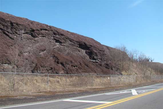
The mining company has piled this waste crap (okay, tailings) next to the road in Copperhill, Tennessee. I thought that strange until I got home and looked at GoogleMaps, and I can see that they’re using the pile as a visual buffer, so you can’t see the even uglier mining activities behind it. Clever. I had thought they would prefer not to remind us of the ugly by-products of their surface mining. Apparently, it was the lesser of two evils…. As one county webpage notes:
Copper ore was discovered in this region in the 1820’s.* From the time of this discovery through 1987 the Copper Basin had the largest metal mining operation in the Southeastern United States. Early profiteers gave no attention to the environment, cutting down every available tree for copper smelting, creating an acid rain that killed over 60,000 acres. This turned the land into what was later described as having the appearance of a red moonscape.
So, now most of that hideous moonscape is hidden, mostly by vegetation barriers, but also by being buried. Here, where the highway passes right next to the mine (or smelters, or other machinery—something ugly), they’re “using” the waste piles….
* Not quite; Native Americans knew about the copper deposits before Euroamericans arrived….