Blue, blu* waters
Wednesday, 25 May 2011

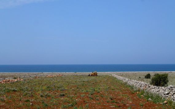
View ENE from cliffs above Castellammare del Golfo (Yes, the water is really that color). See the terrain in Google Maps by clicking here. Note that there’s a fortress-castle on the point that closes in CdelG’s harbor.
I did not understand how rugged the coasts of Sicily are. This is the NW corner of the island, looking back to the east. On the headland in the distance (left rear) is Palermo’s airport.
Notable facts from today, in no particular order:
- We are now a traveling duo, having said a heartfelt goodbye to our fine traveling companions at that same airport.
- We saw our first Prius in Italy, a shiny black one, arriving at the airport two cars ahead of us.
- Castellammare del Golfo was the port town for Segesta (37.94068,12.83426), which in ancient times controlled travel through the pass inland from Castellammare toward population centers in the SW part of the island.
- We did learn some lessons in the high art of snacking from F, although we did very well on our own today scoring a black-olive laced baguette to go with tiny mozzarelle spheres from the SISA up the road.
- Up by San Vito lo Capo we saw an abandoned tuna factory, including a net management area and housing for the fisher-dudes. The owners closed it in the late 1960s.

- We saw evidence of recent land speculation near San Vito lo Capo, across a bleak ocean-view terrain, partly cleared of its rocks (that’s a bulldozer out there), with boundary walls marking lots. Normally, we have seen unfinished or only partly occupied apartment buildings as evidence of the same over-development. For over a kilometer here, all we saw were stone walls, no houses, no gates, even.
- We begin our migration east and north tomorrow.
* “Blu” is Italian for blue.