City life
Tuesday, 7 October 2014
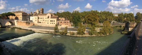
Three bridges.
Let me decode this photo. It’s taken from the west end of the Ponte Palatino, looking slightly northwest, then north, and finally east—a pano, hence the strange distortion. On the left, the bridge from the west bank of the Tiber to Isola Tiberina (Rome’s island), the Ponte Cestio. On the far right, the bridge I’m standing on, the Ponte Palatino. And next to the latter, also far right, is a single arch that remains of the ancient Romans’ Pons Aemilius, now lovingly nicknamed the Ponte Rotto, broken bridge.
For me, the Aemilius is the most interesting; core parts of the ruin, sources assure me, date to the 2nd C BC. The last updates came in the 1500s. The final insult came in 1887 when one end was removed to install the Ponte Palatino.
Construction of a bridge to this bank from the island was intentionally delayed by the Romans for centuries, we are told. While they long had a bridge from “their” side (the east/south side), the Ponte Cestio, anciently the Pons Cestius, was not built until about a century after the Aemilius (if I have it right). Thus, crossing the river using the island as a stepping stone was not prioritized, although we are told ancient Rome’s location was important as a crossing spot. It was or it wasn’t. Or, it was, but they didn’t want to make it too easy, as enemies and marauders lived to the northwest.
In the late 1800s, when the Tiber was channelized and walled in, with retaining levees built, they widened this part next to the island, I think to force more of the water on this side(?), and the ancient bridge wasn’t long enough any more, so, geeze, it was just an Ancient Roman Structure, so The City’s Wisemen ordered it replaced.
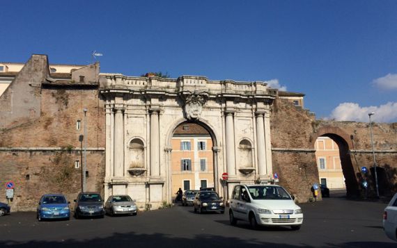
Enough about bridges. Here is a particularly comely city entrance, the Porta Portese. This was roughly the location of the former Porta Portuense. Both names refer to Rome’s port at the river mouth, and the road to there along this bank of the Tiber. The river-mouth was early important as a salt-producing zone, and major trade routes went inland from the sea flats on both sides of the Tiber, as well and up and down the coast. Later, this became a major port area, serving Rome and inland. Major engineering modifications kept it useful (e.g., the massive six-sided basin constructed under Hadrian’s watch and now just south of the airport—see satellite images).
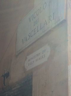
Two other bits to note. We found this sign on the wall of a particularly narrow alley—about one wide shoulder-width at one end—in the original neighborhood of Trastevere (meaning: across the Tiber), south of the Isola Tiberina. Today we first visited that area, and discovered that although unfailingly described as charming and old-world in guides, it is a tourist mecca, and thus a mecca for sidewalk salespeople of all stripes, and not quite an incubator of Roman life as lived by present-day Romans. As to unofficial the English sign, I love its formal design….
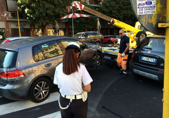
Now a bit of action. We also saw a speed-trap setup with four cop cars earlier in the day, with someone getting a ticket and not looking happy about it. Plus, right after we saw this towing (love that lift! a bar on each side of the front tires, spanned together—up and away), we saw another tow truck ready to pull out all loaded up a block away. Since these three aren’t far apart, I guess the cops were targeting this area today. ??