Musings
…photos….
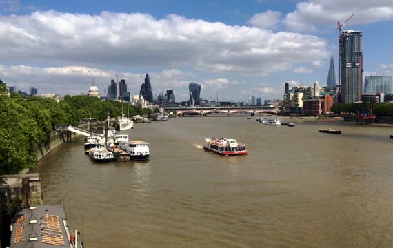
We went out on one last bridge to look at the River Thames. Tide out somewhat. Water murky. All active boats were tourist vessels.

From the upper deck of a two-level bus, we learned that passing horses trump pedestrian regulations…and have the power to STOP vehicular traffic. Have a great ride!
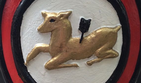
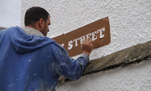
This is the symbol for the Seven Dials neighborhood. A quick G**gle search and I find no explanation.
The Seven Dials part is easy. When platted in the 1690s, to get the maximum street frontage thus increasing the value of lots, the owner opted for a radial street pattern from a point, where a sundial monument was installed. There were/are seven streets, but only six sundials–with the seventh the pillar they are mounted on!

We continued our practice of visiting Apple Stores in foreign capitals and large cities. The Guru asked about the new Apple adapter that has folding prongs and fits UK electrical plugs. The kindly Apple-lady said she hadn’t touched one, and opened a brand new package (was it £30? £25? I forget…pricy), so she and we could see/feel the smooth mechanism. The twin prongs move in the opposite direction from the third one, very solid mechanism. Lovely design. Points to Jony Ive, I understand. Thanks to our Apple-lady for modeling! (No points to me for OOF* image.)
* OOF = out-of-focus
Posted at 4:17 PM |
Comments Off on Random London…
Turns out we are B people; turns out B on this train is the quiet car…nice! The train-cars on this long-distance route (London–Edinburgh, I think) have alphabetical designations A through F, plus K and I forget what else. The Guru found mid-day, off-time tix for us for £13 apiece each way, London–York—a great deal!
While northbound our car, and I think the train in general, was lightly occupied; southbound, today, there were only a few empty seats. We got lucky, and only had companions at our table for about a half-hour of the ride, an older couple en route to visit their daughter in Sardinia for a month….
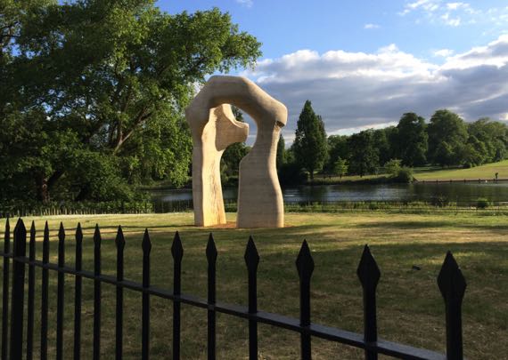
The Henry Moore Arch, with a display-management strategy that imitates Stonehenge, where the hoi palloi are kept at bay by fences. Rabbits, however, at least here, were dining by the half-dozen on the edge of the fenced-off greensward. (Would not normally use that word, but it fits here in London….)
We’re staying in a “new” neighborhood, near Hyde Park and Kensington Gardens. They are one contiguous green on my smartphone map with two named zones, confusing…plus I found this on an official website: “Kensington Gardens covers 242 acres and was originally part of Hyde Park.”* We strolled in both, after an early dinner….
We started at the Italian Gardens, where we began to discover heavy use across the park at this hour by Iranian(?) couples and small groups. The women tended to accent black with florescent or bright orange, e.g., in sneakers. Is this some kind of nationalism? A signal of availability? Mystery….
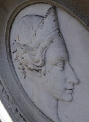
This Royal Park celebrates many royals, including this relief of Queen Victoria in the Italian zone. The quoted price of making the stone sculptures in the Italian Garden was around £200, if I remember correctly. Not sure what that is in modern £s.
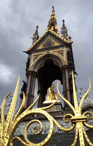
Check out this giant installation honoring a gold-crusted Prince Albert. He’s seated in a style we saw the Romans use, and I assume they borrowed/imitated from the Greeks. For the Romans anyway, seated on a special chair was a big deal for the leaders. I don’t know if it carried more status than seated on a horse, or if it was a different connotation entirely (e.g., referring to non-military leadership?).
Anyway, the sheer extent of this park in such a populous city is amazing. After all the cities we visited in Scotland, almost all with a castle on a high point, London’s layout, on comparatively flat ground, feels quite different.
* Apparently, in 1536 good ol’ Henry VIII created the park as a private/crown hunting ground. It was opened to proper members of “the public” (thus, only the few) in 1637.
Posted at 10:22 PM |
Comments Off on Moving on…
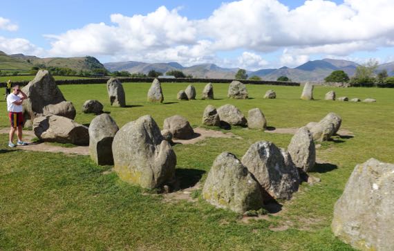
We started our morning—look at that glorious sky!—at our last standing stone circle of the trip. This one is on a high hill surrounded by much higher mountains. I learned absolutely nothing about the ritual landscape…other stones, where settlements were, other architectural elements…. Sigh. I bucked up, though, and on we went!
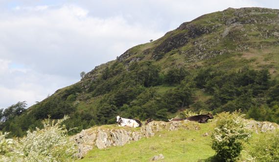
We motored up a hill, and discovered even the cattle enjoy lake-views…
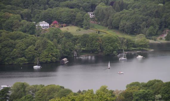
…and watching sailboats….
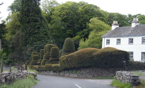
Remember, this is the Lake District, and people here tend to be flush and indulge their notions…can these be considered garden follies?
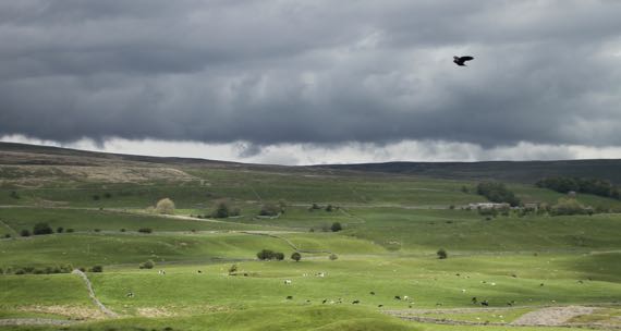
We motored along winding roads into the nearby Yorkshire Dales, which we found stunning, yet rather sere in comparison, with rock outcrops and different land-use patterns.

With last weekend, we realized we had hit the summer festival season. I think this apparent gypsy wagon is advertising one.
That stone barn…there were lots of these in the valleys and often not very far apart, although each was in a different stone-fenced paddock. I pondered this quite a while, and eventually postulated that they were part of a transhumance pattern, with summer graze on the heights of the ridges, and wintering near these barns, which always had some height and at least two stories, I assume for storing winter fodder. Just a theory, though….
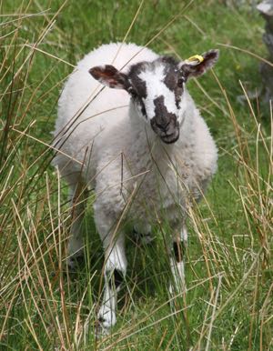
I doubt I’ll see any sheep close-up during the rest of the trip so one last sheep photo…and isn’t this a darned winsome sheep?
Posted at 2:38 PM |
1 Comment »
I took the title from a not-uncommon Scottish road-sign that indicates that the banking of the carriageway is counter to the curve…. I thought it suggestive of mornings that begin with insufficient coffee and other disoriented times…. Today, however—a great day! (Just didn’t want to forget the phrase….)
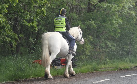
We came across this pair in this order about a tenth of a mile apart. They each waved as we went by, leaving them plenty of room. Big horse, I think the draft variety.
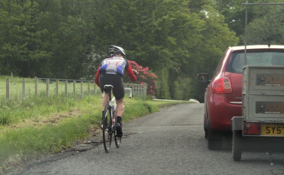
Later, we encountered several groups of bicyclists. Took me a while to figure out people were (skipping church) enjoying a Sunday outing.
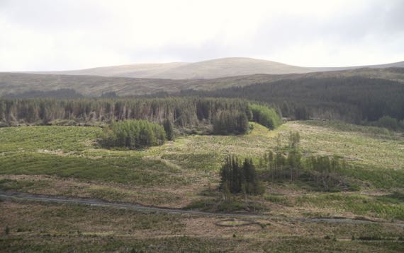
We set a route through Galloway Forest Park…I think almost all the trees are planted. We also saw tree-free moor. In the second shot, you may be able to see a circular stone wall near the bottom of the photo. I think this is an unused animal enclosure, probably for sheep before this became a forest preserve.
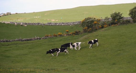
These cattle didn’t seem spooked…they are among over a dozen that ran across this field in a line rather than a bunch/herd, I think to meet up with buddies. Hard to know cattle motivation, though….
The sheep in the second paddock were utterly non-plussed.
We drove to the end of the road on the Machars peninsula and had lunch at a special “carvery” Sunday buffet, today highlighting roasted pork loin cut to request and homemade apple sauce, plus crusty baked peeled potato chunks. Yum.
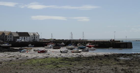
I took this photo of the harbor as we arrived in Isle of Whithorn (means white house, and is on a peninsula not an island, but no matter), and the tide was waaaaay out. I loved the little red car out with the seaweed clusters on the sand. By the time we left, the car was gone and all these boats were afloat.
We also checked out the roofless ruin of St. Ninian’s chapel on the headland, which Historic Scotland states was built about 1300. Ninian is traditionally considered to have lived in the 300s to 400s, but the historical references may be myth-fiction. While the on-site signs indicate pilgrims who landed here came to this chapel to recover from their sea legs before making their way several miles inland to the Candida Casa (white hut), the first Christian “building” in what is now Scotland.
I know nothing about dating ancient mortars, but I am skeptical that the ruin is really that old. Or maybe I’m just ignorant….
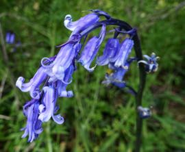
’Tis the season for these lovely deep blue flowers. I have been seeing them everywhere, along with white flowers that look like not-parsley and may be hemlock, and pink flowers I’m just not sure of.
I finally found someone to ask today. They are bluebells, Hyacinthoides non-scripta. Duh.
This website says almost 50% of the world’s bluebells are in the UK, and that they are the preferred flower of the house goblin. My house goblin never mentioned them….
Posted at 5:36 PM |
2 Comments »
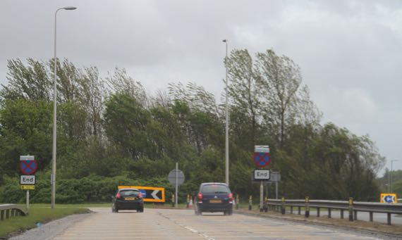
Mostly, today’s theme was windy. With rain. Not mist. The big drops—Rain with a capital R.
We have used Miss Voice and blue-dot navigation throughout our trip. The way G**gleMaps is set up, the voice informs of a pending roundabout, with which “exit” to take. This is almost always accurate (unless there’s new construction), but the thing that confounds us is that when you are in the roundabout, you are told to exit on a certain named street. It is a rare roundabout that has a street name. Route numbers, towns, yes; but no street names. This custom/programming choice introduces confusion….
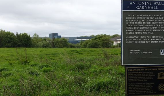
This morning we had an unexpected two-fer. We set out for the soundstage where Outlander (Starz version) is being shot. It’s in that grey-blue building in the center-background. The trucks area gate was open, but the walk-up/reception gate was locked up tight. There was a special instruction sign for people who came for costume fittings.
Here’s the two-fer part. We tried an escape out the back of the industrial park that became a dead-end, and…found a sign…for the Antonine Wall! (I said no more Romans…oops.) Yup, I could see the wall ditch, etc. extending each way from the sign, left and right at this angle. A fine surprise!

We also made a fast stop to see the market street of Kilsyth. This is another town where the Livingstons of a dozen generations back in my ancestry lived. It was then called Monyabroch (ca. 1500s).
The bar—excuse me: pub to the right is called the Scarecrow. Would sometime love to hear the story behind that! (Another pint, please!)
Regarding the sign to the left, how confusing is it for a butcher shop to list a cut of meat for XYZ pounds per pound (that is £XYZ per pound).
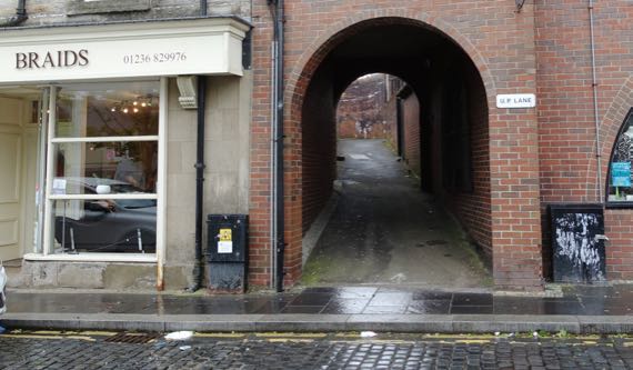
We parked just off Market Street at Market Square, very lucky to find a space on a rainy morning…. Note that this alley leading upward is named U.P. LANE. It leads up to U.P. ROAD. Both may refer to United Presbyterian (church). No one making internet entries seems to be sure. I took it as a ghostly link to descendants of the Livingstons with connections to way northern Michigan….
Let’s wrap this with some architecture bits….
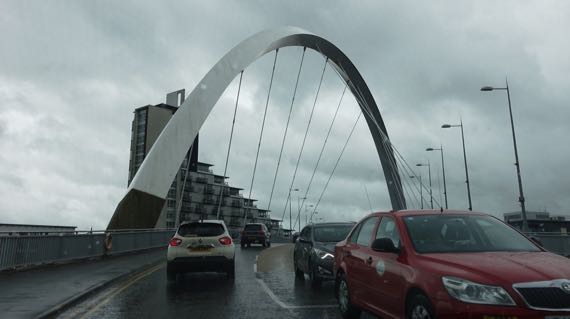
Unusual bridge in Glasgow…a single arch that crosses over the carriageway deck.

More red sandstone…like St. Andrews Cathedral, and many, many more buildings. I haven’t seen any quarries identified as for this stone, but there must be big holes out there where it all came from…. I don’t know if I’ve been seeing façades etc. of Old Red Sandstone or New Red Sandstone—or both. I think both are common outcrops….
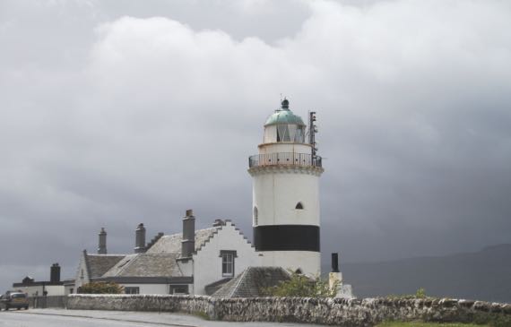
Fine lighthouse…we bagged joining the locals spending their Saturday at venues we had some interest in, and visited a mall (Starbucks) and drove along the Firth of Clyde, then more of the Firth of Clyde…. So we saw many navigation features on land and sea, breaking waves (splash!), and even a spot of sunshine. It came out when we were just past this lighthouse…brilliant for maybe four minutes….
Just one more of those “original” or “first place in Scotland” comments…. We’re overnighting in Ayr. Scotland’s first parliament was held here in 1315, lead by Robert the Bruce (aka Robert de Brus, in Norman), who ruled from 1306–1329. He’s the one who won at Bannockburn, where we began our day, in 1314….
Also, Ayr is often listed as the birthplace of the poet Robert Burns. It was really in Alloway, but that village is now in the Ayr metro area…so I guess it’s all the same….
Posted at 4:45 PM |
2 Comments »
In the tourist propaganda, you see Arbroath called the birthplace of Scotland. This abbey was founded in 1178 by monks from Kelso, one in the Roxburgh border-abbey cluster. It took decades to build and the soft sandstone used for carved stone detail has become greatly eroded. Arbroath Abbey became the wealthiest in Scotland, and that was probably partly why it hosted a gathering in 1320 that composed the Declaration of Arbroath, which set forth Scotland’s independence from England, and finally was signed by Edward III of England in 1328. This was very early in his long reign, which lasted from 1327 to 1377. Of course, by the 1330s, Edward was invading Scotland…ah, the conflicts have gone on and on between these two groups….
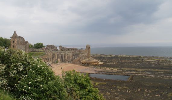
We enjoyed the town of St. Andrews more than we expected…. We looked at the castle from afar, admiring its “corner lot” above the sea. The tide was out…and this huge rectangular pond revealed…we never figured it out…. In the 1300s the castle was controlled alternately by Scotland and England, and in the 1400s it was held by Scotland. The later history…rather brutal….
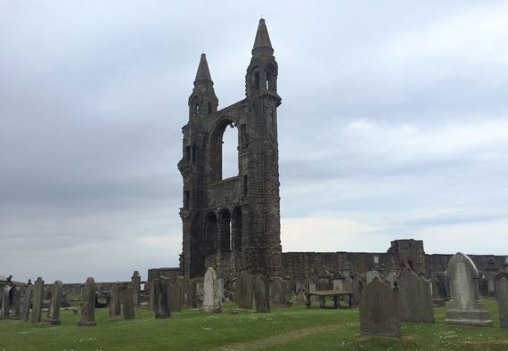
We wandered among the ruins of the cathedral, another one with bodies and headstones planted where the building used to be…. This was the east end of the church, looking at the inside of the wall behind the altar. I was surprised how stable this huge section looked, even without the side walls it used to have.
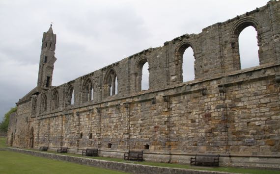
If I remember correctly, this was the back wall of one side of the monastery’s courtyard. I loved the row of benches anchoring it in the present.
Speaking of the present, we found this fellow doing sign-maintenance on a high ladder at a main corner in old-town, near the University.
Also, JCB spotted this rooftop humor…. That is one UGLY rat…it is a rat, isn’t it? Not two cats?
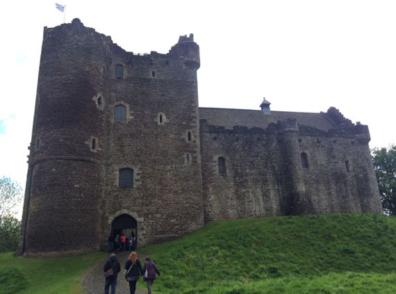
St. Andrews was not our only stop…we also climbed into nearly every accessible nook and cranny of this nearly-unchanged-since-Medieval-days castle, which you may recognize if you’re a Starz Outlander fan…. The real world calls it Doune Castle, and most of the construction we see dates to the late 1300s. Movie-makers have visited here with their cameras for decades…including for the Elizabeth Taylor version of Ivanhoe (released in 1952); Monty Python and the Holy Grail, shot in 1974; and the Game of Thrones TV series….
The title does NOT refer to the Guru and me…in either order….
Posted at 5:05 PM |
Comments Off on Very vs mildly dilapidated
Possibly the oldest tree in Britain, the Fortingall yew is 2000–3000 years old. It’s behind the wall with the vertical stones on top. The center is gone, and it’s now three remnants of its one-time girth.
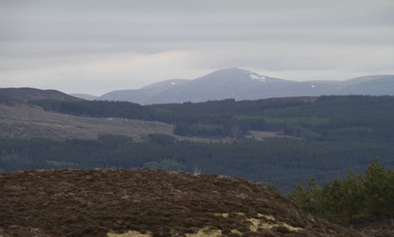
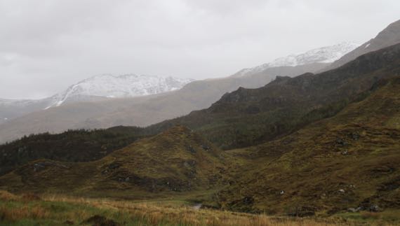
Still seeing snow remnants on peaks.
Loch Rannoch. We came here to visit the Black Wood of Rannoch, considered among the oldest forests in Britain. It seemed to me that the section we walked in had a few older trees, all twisted and looking like loggers had left them behind as not long-tall enough, interspersed among newer growth, although the sphagnum and other ground-cover looked less disturbed than I’ve been seeing.
Here’s another of those ancient places that were once centers-of-the-world and now are virtually ignored ruins. This is the recently stabilized ruins of Kindrochit Castle, used annually for many years by King Robert II (1357–1390, coronated in 1371), grandson of Robert the Bruce, and the first Stewart king.
One of the last highland scenes today, before we drove over the last summit (modern cairn there with at least a dozen bunches of soggy, desiccated flowers, left in memory of at least a dozen dearly departeds).
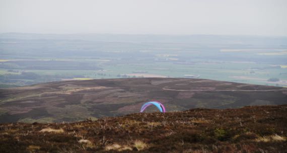
Here’s the view from the cairn, with a few fields of brilliant yellow canola we haven’t seen for a long time, and the canopy of a hang-glider? parasailor? In the way, way distance is the sea, which is a half-mile from us over some dunes, as I wrap this and prepare for bed.
Posted at 5:41 PM |
1 Comment »
Hold onto your shorts; we covered a lot of ground today, the weather included blue skies (!!!). Here’s a great sample from our day, and yet I am skipping many beautiful moments captured without the help of Kodak.
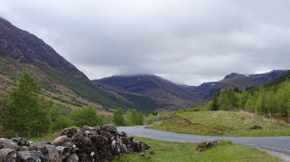
Glen Nevis.
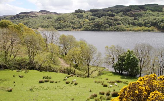
Loch Nell.
Moors in the glaciated mountains…at least, I’m pretty sure this vegetation qualifies as moors.
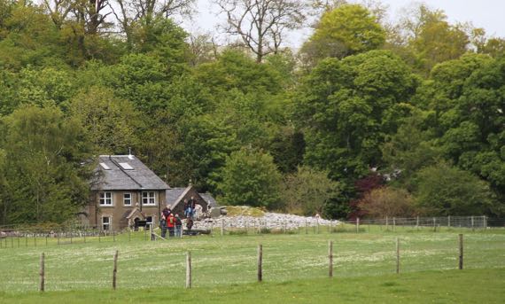
Kilmartin Glen Neolithic ritual landscape…one of the rock cairns.
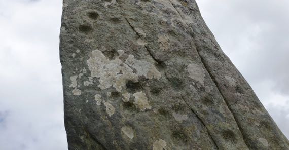
Kilmartin Glen standing stone with pecked “cup marks.” No idea what they were meant to convey.
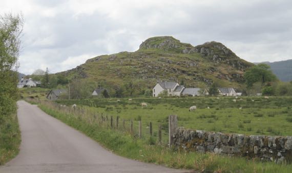
Dunadd landform from afar. Dun means fort, usually always a fort atop a high-point.
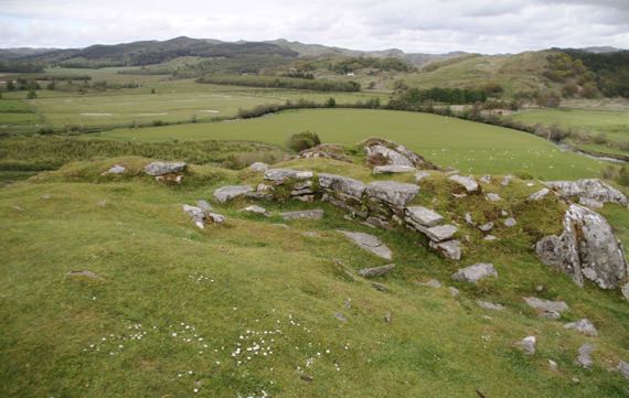
View northish from the summit of Dunadd, from the part described as the great hall and citadel. The later occupation here maybe began in the late 500s and lasted into the 900s. This was the capital of the native Scoti peoples and their “empire” Dál Riata….
Now, back to the present….
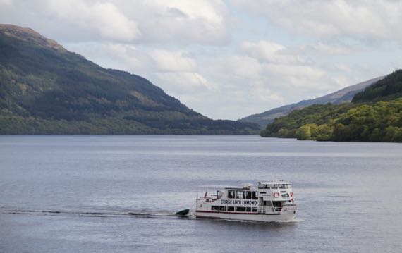
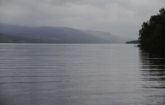
Loch Lomond. We did not cruise it.
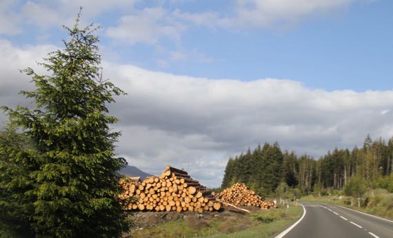
Active logging, Scottish style. The log piles show the neatest/tidiest stacking jobs I’ve ever seen. Still hurts to see trees whacked in their prime….
Posted at 10:22 PM |
1 Comment »
This is a new term I’ve learned, and it means, rainy, cold, windy, and generally unpleasant outdoor conditions…. And that was what we had today.
I have neglected to mention that we had several lovely days with ShedMan and CheetahWoman…lots of laughing and good times. Today, however, that came to an end….
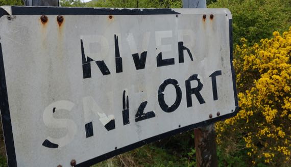
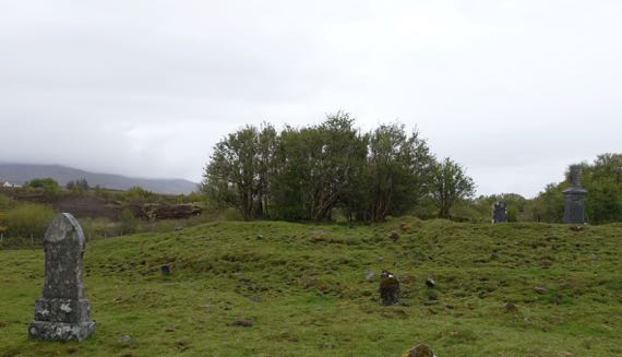
CheetahWoman had told us about a magical cemetery island she found in the River Snizort, and we were going right by, and so stopped in. Despite the rain and many cow-pies, we discovered a sliver of the magic she had observed in the fading light of day (no rain).
Given that it was in the high 40s (F) in the valleys, it’s not surprising that at elevated elevations, the precip was white. I think there’s new dusting atop remnant snowpack from last winter….
I really loved the narrow long chutes of water the mountains were shedding…. More a result of the rubbish weather….
In light rain (still rubbishy), we checked out the Caladonian Canal (along the Great Glen Fault), which we paralleled for part of the day….
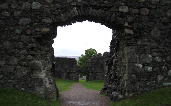
We finished up our touristing with a quick visit to Old Inverlochy Castle, which is in pretty good shape for dating back to about 1280. This view is through both gates, all the way across the interior courtyard. It had round towers in each corner, and the wall bases and part of the walls remain outlining the exterior walls and towers. The huge rounded stones are different than in stonework we’ve seen so far.
Finishing a day of rubbish weather is uplifting….
Posted at 10:22 PM |
3 Comments »
We parked near a sand-beach, between black rocks…basalt, we decided.
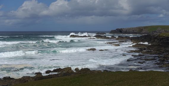
The surf crashed and boomed on the rocks, and sprawled up the sand. We walked up on the grassy peat-covered…cliffs, I guess you could call them. We stayed away from the edge where we could not tell how supported the green-top was by rocks….

Most of the sheep ignored us, but these were stare-ers. A moment before this, all their attention was on us….
We had set out to walk to the lighthouse (not shown), but bagged our walk after the second rain-storm (one lasting maybe 10 minutes, and one that pushed 20), and returned to the car. Then, we tried to drive to the lighthouse, which we were under the impression could only be accessed on foot…and presto, we could drive right up to it!
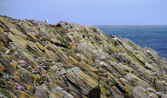
The gulls nested on this craggy rock amongst clusters of flowers that may be this kind….
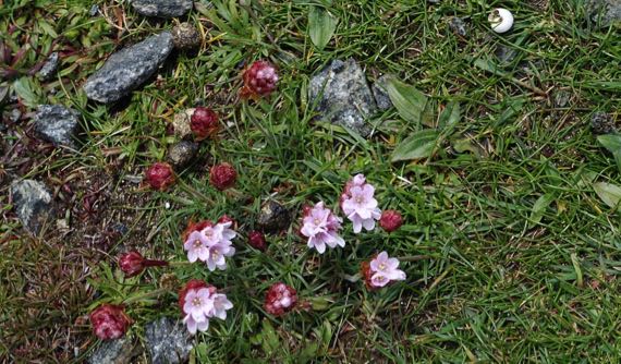
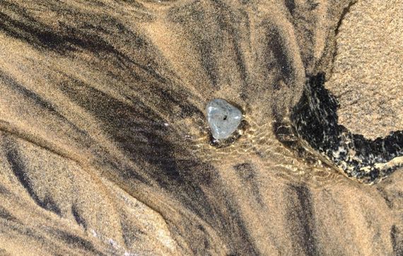
If you look among and around the flowers, you may find an easy-to-spot snail shell, and less easy-to-spot sheep-berries…. No points for gravel-rocks (probably granite).
Posted at 2:05 PM |
Comments Off on Beach/cliff-top/old-field walk