Up, down
Monday, 17 August 2015
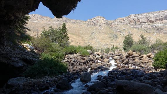
The most scenic view was OUT the cave….
We began the day by checking out one of those minor mysteries of the world. In this case, there’s a river rushing down a mountain, and it gushes into rocks where it has carved a shallow cave, and, in the back (of course), it disappears from view!
The name of the river, and, of course, its canyon…I had a hard time remembering how to say it correctly if I looked at the way it is spelled. The pronunciation (if I have it right): poe-POE-zhuh*. [Yes, scroll down* if you want to see the WhiteMan spelling that I found so troublesome, but get the pronunciation in your head first.]

Pretty fish.
About a quarter-mile down the canyon, there’s a large spring-pool…which the Powers That Be have stocked with trout, with a handy trout-food vending machine on the overview deck (25 cents). And the critters rise with gusto even if you just make a tossing motion with your arm. Great fun, teasing fish. And these are well-fed, unculled, gigantic, yummy-looking trout!
Enterprising scientists have put dye in the cave-water, and discovered the does indeed feed the lower pool…. The mystery is that it takes a full two hours for the dye-water to appear below.
These places are called the Sinks and Rise.
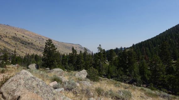
With that curiosity burdening our minds, we continued up the drainage to where the road turns to sidewind up the canyon wall and leave the drainage. There we parked in a trailhead lot, and began to ascend on foot.
The whole climb, both in car and on foot, one side of the canyon is tree-covered and green, while the other is comparatively sere. The green side is north-facing, and retains the moisture from its snow-load longer and better, allowing far more robust vegetation to thrive. A display claimed that there is more biodiversity on the dry side, however. Where the trail runs.
I kept thinking of that as we climbed. Insects. Heard some birds. Saw no rodents, mammals, even lizards. Maybe because I found the walk so taxing. It was. We climbed. And at a good altitude for us flat-landers. Still, we stopped when there was shade, and sometimes even in the sun. Pant pant.
Our reward, or at least where we turned around…a split in the river, with waterfalls on each side. Actually cascades over rounded boulders. Not as dramatic as we were expecting. Still, we are quite proud of ourselves for making the hike. [Fitbit gave me 67 flights for our altitude gain (GoogleMaps and our GPS track suggests it should have been 82); I think it shorted me on minutes of effort (only 74; felt like WAY more).]
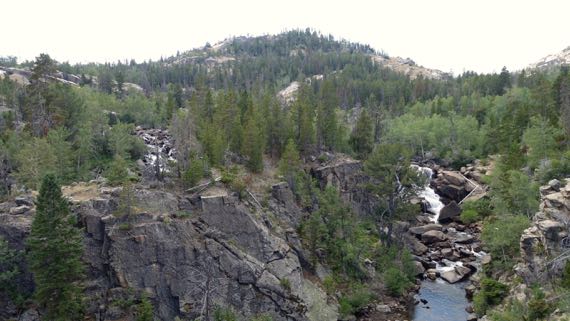
The sections of running water left and right in this photo are the two parallel river-sections.
We shared the trail with horses, and even saw three enter our route a few minutes ahead of us as we began to descend, and from afar heard the squinching of the leather saddlery. They seem to leave road apples in the same spots, at least sometimes, so you can see several stages of desiccation at once (science). And, if you ask me, the animals disproportionately chose trail-narrowings to make their deposits. I’m sure that’s my bias, developed as I stepped around the apples….
We took Forest Service drive through the southern Winds, as this range is affectionately called, which has as its spine the continental divide. We did cross the divide at the southern margin, and saw the trail-crossing at the historic town of South Pass City (some 30 still standing structures from the 1860s–70s), which also has a less-historic part where people still live.
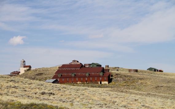
Carissa mine, near South Pass City.
While many white folk crossed the pass and moved on, some stayed and mined. Yet, the immense scale of the building complexes is dwarfed by the landscape.
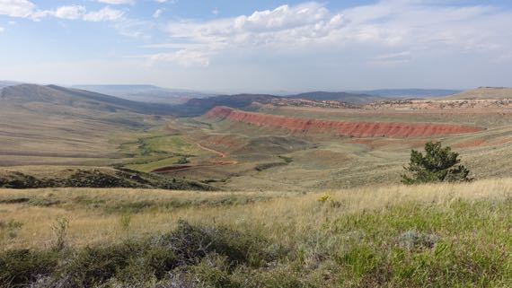
If you’re into naming, and humans as a group are, could you really name this other than Red Canyon?
* And the way it is written: Popo Agie. The “A” kept erroneously invading my pronunciation….