Musings
In the wee hours, rain came. With dawn, we found the haze greatly diminished.
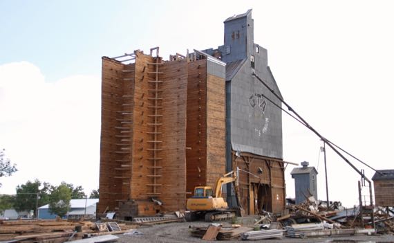
Heading out of town, we saw the skeleton of one of the many corrugated-clad elevators. I never thought about the interior engineering. Here it is: wood. Lots of it. Some big timbers to keep those walls aligned. I hope most of this is being reused.
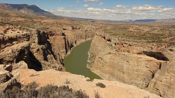
Took a side trip to see a canyon. It now supports a reservoir, I assume touted to locals by out-of-town politicians as both good for downstream agriculture, a producer of cheap electricity, and a great fishing and recreation destination. In short, build this and you’ll have a better, more inexpensive life.
Maybe.
Notice how light makes all the difference?
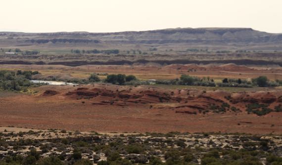
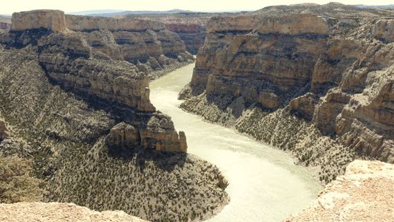
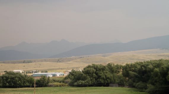
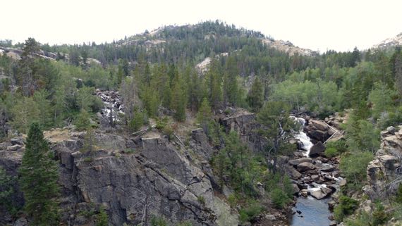
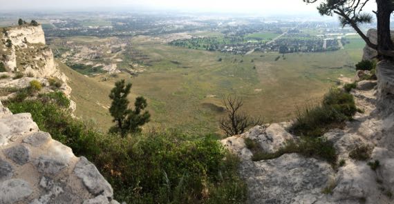
Here’s a pair of long-view shots…. The first is the valley above the canyon. Just a valley. A red valley.
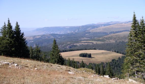
Also, we climbed up into the Bighorn range. About 10 miles up and 10 miles down. That is about 10 miles each way of grades up to 9°. Our mileage took a serious pounding. The down did not quite balance out the up-grind.
With that magnitude of elevation change, there’s such a difference between the valleys and the alpine zones. The landscape was generally rounded, often grassy and lacking trees.
Compared to the Winds…hmm. If someone told me I could come back to just one range, which would I pick? Very difficult call. I could go either way. This was the northern and central Bighorns. Tomorrow is the southern Bighorns.
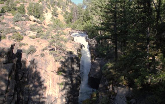
Descending, we checked out this canyon waterfall. I should have recorded the sound of falling water to use sometime as a stress-remover.
Posted at 10:22 PM |
Comments Off on Long views
We packed up camp and hit the road, north-northwestbound. I had thought the haze was dropping off, but maybe we went west enough to get back into the thicker air.
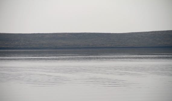
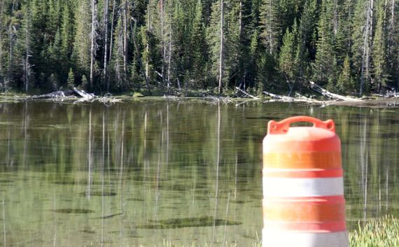
This is an eerie image of Quake Lake, which formed in the month after an earthquake in August, 1959. Over two dozen people, campers mostly, were killed in a huge landslide that blocked the river and weakened a dam downstream. Now the slide-scar is still obvious, with the piled up rock and soil at the base.
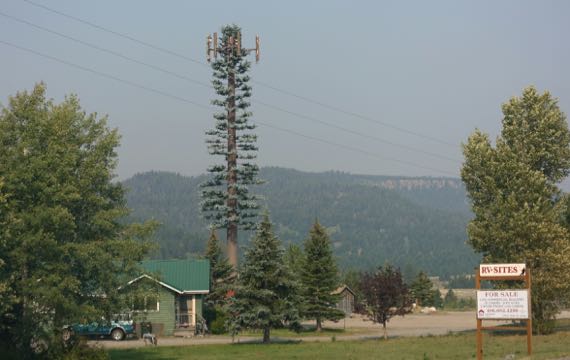
However far out you may be in the boonies, you can still find locals got aesthetic phone towers. One tall pine!
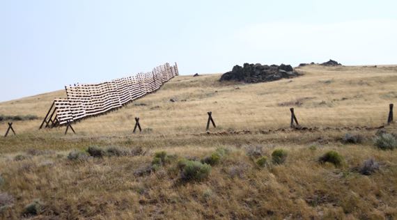
We saw these snow-retaining-fences near the road, like this, positioned on the pasture side of the fence, even on private land. We guessed that the wind-blown snow was so bad in these spots that this was the solution. Tall fence—at least 8 feet.
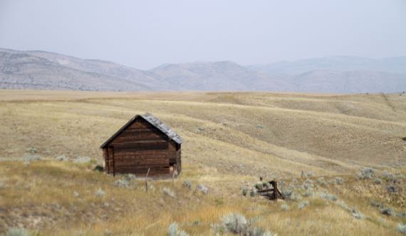
I became fascinated with the decaying wooden buildings today; I only give you one. See the haze?
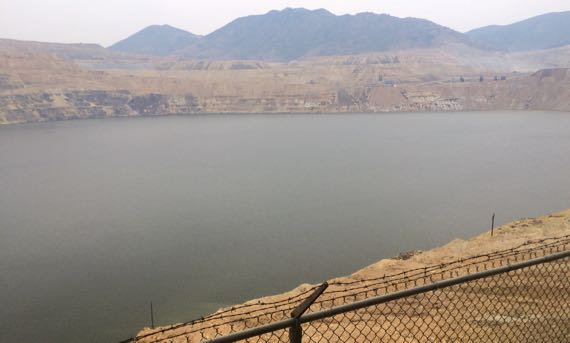
We checked out a mine pit, abandoned in the late 50s. With the groundwater pumps turned off, it quickly flooded. After many years as a “lake,” politicians changed the environmental rules, and the mining company has installed a water treatment plant, processing something like 5K gallons per minute? hour?…removing cadmium and other heavy metals I’m not sure how.
We said goodbye to our Western Rendezvousers in the pit parking lot (just past the pit toilets haha), and headed east. We’ve made one “corner” of this trip….
Love the three tiers of land use here…green valley bottoms, dry erosion-sculpted slopes, and higher ridges and jagged peaks…each a different color….
Posted at 10:22 PM |
Comments Off on Lakes with complex stories

And by that I mean Mother Earth.
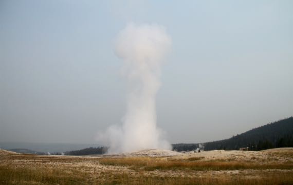
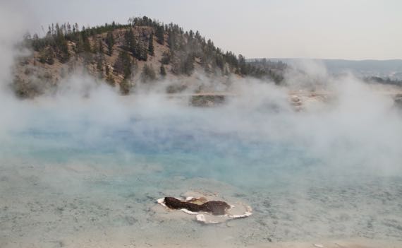
As I understand it, the geyser basin that includes Old Faithful (darn that haze!) contains more than half the active geysers in the world.
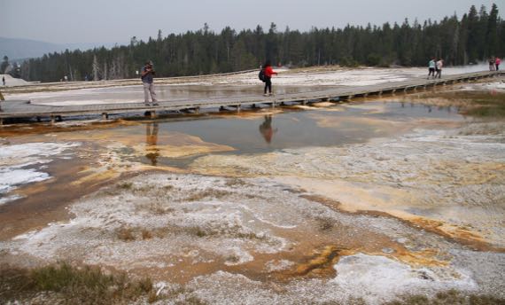
We took the boardwalk trail that loops around “behind” Old Faithful to see some of the geysers and fumaroles, hot pools and calcite ice (some of the mineral precipitate from the geothermal water—good with gin, perhaps). Even with the haze: stunning.
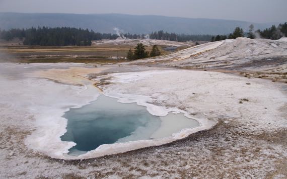
Not all the pools are in an exploding mode. Some are quiet. Even for years. Some drain and become “dead.” I loved looking into underground caverns that the water boils through (sometimes over 700°F when it becomes gaseous deep below the surface).
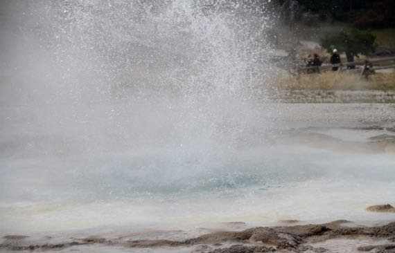
This one had been quiet as we approached, but started boiling and churning right in front of us.
Others oozed steam without a dramatic explosion.
The bison do walk among the geothermals. I saw an amazing photo in the Visitor Center…a crowd of shaggy, winter-furred bison, coated with ice crystals from the steam freezing on them. Just incredible. Long lens.
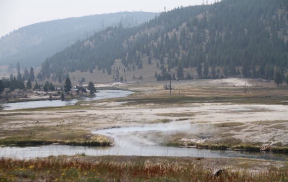
All the water the geysers and fumaroles generate…where’s it go? Here it drains into the Yellowstone River….

The minerals in the water weaken and kill trees, forbs, grass, many living things. Wind can then topple tree skeletons. Because of the rock/travertine, the trees have particularly shallow roots, pure artistry in their toppled death-throes. This was a pine.
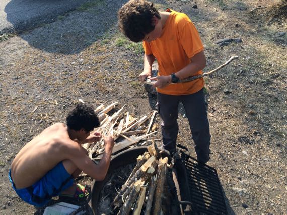
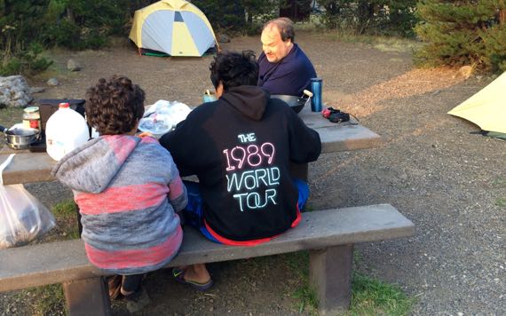
With s’mores ingredients newly at hand, the Nephews launched fire-making with a new fervor. Plus marshmallow-stick creation. Somehow marshmallow became mushroom, so, at our camp they were mushroom-roasting sticks.
Again, a hazy dusk, but not QUITE so thick. Gorgeous though.
Posted at 10:22 PM |
3 Comments »
We have two overarching goals today: travertine formations and critter-viewing. A great day awaits, we figure.
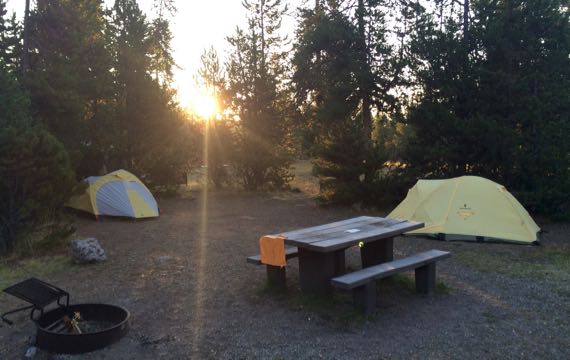
I am up earlier than the rest of the group. The campground looks positively weird as all possible bear attractants are in vehicles or tough bear-boxes that are scattered among the camp-spots, leaving the usual assortment of coolers and miscellany absent from tabletops.
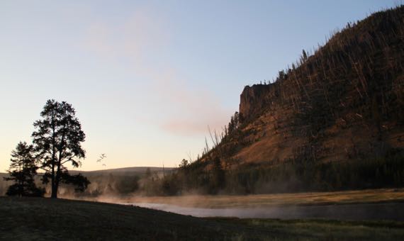
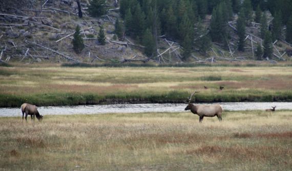
We get our morning elk fix, a short walk from our tents. We also discover that a small group of Canada geese relocate morning and evening (can you see them?) I love the steam rising from “our” river; I didn’t anticipate it, what a great find!
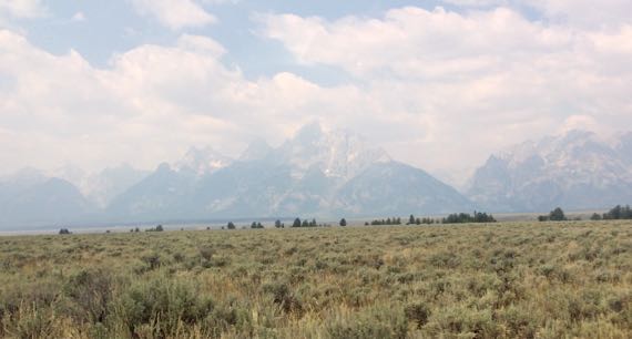
A haze has set in, from fires in eastern Idaho, we hear. I am disappointed by the loss of the long-view, and begin to focus closer, and thereby learn things I would have missed by looking at the far hills and peaks.
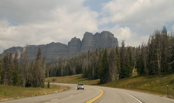
Heading out, we soon have to wait out a construction zone where we have been told to expect the wait to be 30 mins. We figure: perfect for snack time! Instead we get 15 mins, which is perfect for our snacking, and the wait never becomes a slog. Especially with the view!
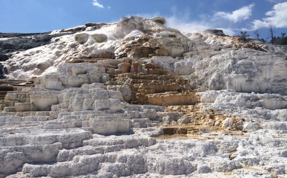
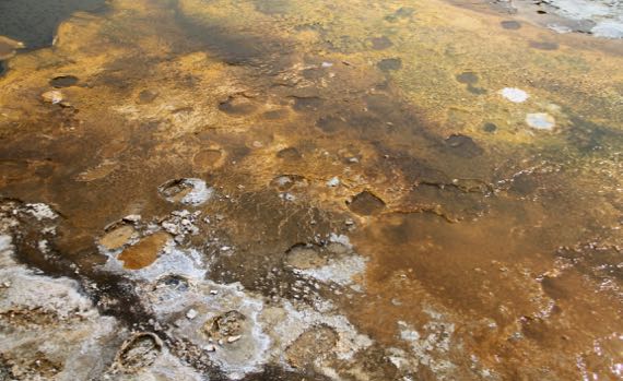
The travertine is eye-popping. The hot, mineral-laden water reaches the surface and spreads or pools, and then cools, and the minerals deposit on existing crusts, above or below standing or flowing water.
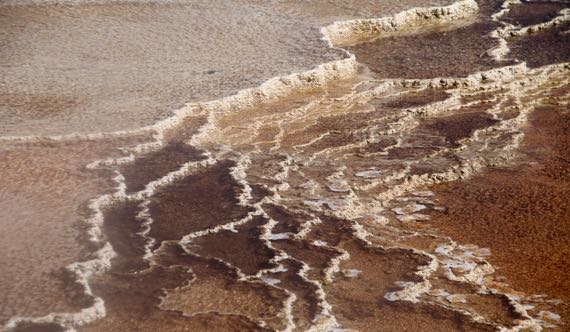
Sometimes bacteria give it dramatic color.
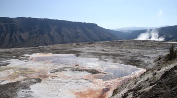
And the water can be tinted, with steam rising from near the water-sources. This is the top of the formation that the other two photos record pieces of.
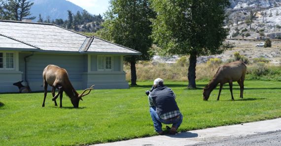
We lunch next to a noshing, napping, and cud-chewing herd of elk, mostly unconcerned by the many humans that tromp up to look and photograph and create person-elk selfies.
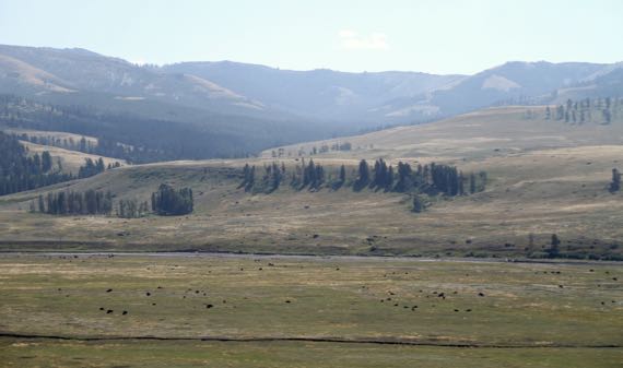
Not enough large critters…, so we cruise on…and find Bison Valley*! So many bison! Most of the dark dots you see here are bison. A few are bushes and rocks, but most are Pleistocene megafauna.
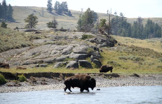
We walk down to the river to see a small herd on the other bank and meadow. We see a lone bull get sent packing by the herd-meister, solo-walking across the river, by another herd-let to…not sure where.
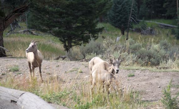
We also saw a trio of bighorn sheep. Close! Two does and a kid.

And pronghorns. They’re usually too far from the road/paths for “close” photos like this….
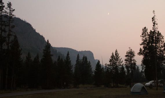
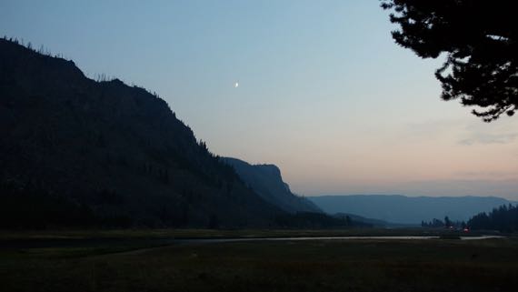
And elk by the campsite. Again. After all, it’s Elk Valley*. The haze has thickened in late-day, but does not obscure the moon.
* Not its real name.
Posted at 10:22 PM |
1 Comment »
We met up with our West Coast Rendezvousers a bit ahead of schedule. They came down off a mountain (really) sooner/faster than they had thought they would. I had expected this, so we were ahead of sched. Worked perfectly!
We motored north past lakes and mountains, past valleys and swamps, sagebrush and trees.
The critter wish-list from the Western Rendezvousers no longer includes bears, as they were seen on the mountain trek. I am happy not to see wild, and possibly aggressive, bears. We saw pronghorns in the morning, but not after the meetup.
As the light begins to fade, the Nephews get the urge to have a fire, and absent the $12 or so it takes to buy a bundle of kindling and a larger bundle of firewood, they set off into the woods surrounding the campground to scout for loose branches. Soon, they are back with the happy news that there are elk down by the river!
We all trundle back to watch large creatures browse. At a respectful distance, which is what it’s all about here.
We climb into our tents as the temperatures really begin to drop. I wonder how much worse the smoke-haze will be on the morrow.
Title is a quote of Bro, trying to sharpen my camping knife, found years ago on a project I don’t remember. He made fair headway even with a not-so-good rock.
Posted at 10:22 PM |
Comments Off on I need a good rock
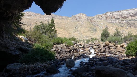
The most scenic view was OUT the cave….
We began the day by checking out one of those minor mysteries of the world. In this case, there’s a river rushing down a mountain, and it gushes into rocks where it has carved a shallow cave, and, in the back (of course), it disappears from view!
The name of the river, and, of course, its canyon…I had a hard time remembering how to say it correctly if I looked at the way it is spelled. The pronunciation (if I have it right): poe-POE-zhuh*. [Yes, scroll down* if you want to see the WhiteMan spelling that I found so troublesome, but get the pronunciation in your head first.]

Pretty fish.
About a quarter-mile down the canyon, there’s a large spring-pool…which the Powers That Be have stocked with trout, with a handy trout-food vending machine on the overview deck (25 cents). And the critters rise with gusto even if you just make a tossing motion with your arm. Great fun, teasing fish. And these are well-fed, unculled, gigantic, yummy-looking trout!
Enterprising scientists have put dye in the cave-water, and discovered the does indeed feed the lower pool…. The mystery is that it takes a full two hours for the dye-water to appear below.
These places are called the Sinks and Rise.
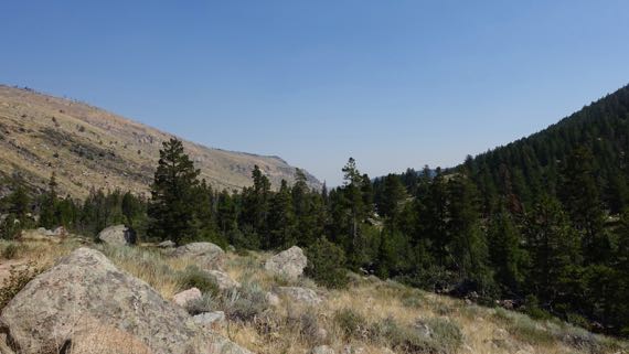
With that curiosity burdening our minds, we continued up the drainage to where the road turns to sidewind up the canyon wall and leave the drainage. There we parked in a trailhead lot, and began to ascend on foot.
The whole climb, both in car and on foot, one side of the canyon is tree-covered and green, while the other is comparatively sere. The green side is north-facing, and retains the moisture from its snow-load longer and better, allowing far more robust vegetation to thrive. A display claimed that there is more biodiversity on the dry side, however. Where the trail runs.
I kept thinking of that as we climbed. Insects. Heard some birds. Saw no rodents, mammals, even lizards. Maybe because I found the walk so taxing. It was. We climbed. And at a good altitude for us flat-landers. Still, we stopped when there was shade, and sometimes even in the sun. Pant pant.
Our reward, or at least where we turned around…a split in the river, with waterfalls on each side. Actually cascades over rounded boulders. Not as dramatic as we were expecting. Still, we are quite proud of ourselves for making the hike. [Fitbit gave me 67 flights for our altitude gain (GoogleMaps and our GPS track suggests it should have been 82); I think it shorted me on minutes of effort (only 74; felt like WAY more).]
The sections of running water left and right in this photo are the two parallel river-sections.
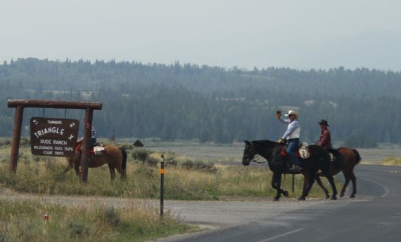
We shared the trail with horses, and even saw three enter our route a few minutes ahead of us as we began to descend, and from afar heard the squinching of the leather saddlery. They seem to leave road apples in the same spots, at least sometimes, so you can see several stages of desiccation at once (science). And, if you ask me, the animals disproportionately chose trail-narrowings to make their deposits. I’m sure that’s my bias, developed as I stepped around the apples….
We took Forest Service drive through the southern Winds, as this range is affectionately called, which has as its spine the continental divide. We did cross the divide at the southern margin, and saw the trail-crossing at the historic town of South Pass City (some 30 still standing structures from the 1860s–70s), which also has a less-historic part where people still live.
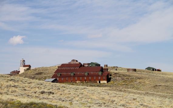
Carissa mine, near South Pass City.
While many white folk crossed the pass and moved on, some stayed and mined. Yet, the immense scale of the building complexes is dwarfed by the landscape.
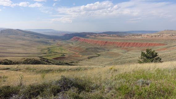
If you’re into naming, and humans as a group are, could you really name this other than Red Canyon?
* And the way it is written: Popo Agie. The “A” kept erroneously invading my pronunciation….
Posted at 10:22 PM |
Comments Off on Up, down
Long miles of distant vistas sometimes with a nearby creek or river, punctuated by interesting stops. The long miles permeate my memories, but I’ll give you the fun stuff from two notable stops, Gentle Reader.
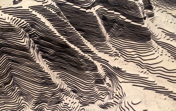
We started with a big climb to the top of Scotts Bluff, or the Prius made the climb. We merely sat. This vertically exaggerated model is in the vistor-center-museum. The actual feature an eroded 740′-high ridge of alluvial and aeolian deposits that are relatively soft, but a hard limestone caprock has allowed them to be preserved, although they of course continue to erode away. The survey marker that was installed on the “highest point” is now sitting atop a metal pillar that sticks above the surface over a foot in the air….
Here’s the view to the ENE from the top, a slight pano. That’s the town of Scottsbluff (yes, different spelling) there in the haze. The ranger thought it might be smoke not typical haze. I can’t say. We never smelled smoke, but saw the haze for miles.

If you ever wander through Douglas, Wyoming, you must stop at the Chamber of Commerce visitor center. Sweet people and every state highway map from the area. Also, lots of RR cars to look at—and two to clamber through! Here’s a Pullman kitchen! Cleaned up but not restored—soooooo special. Even the duckboard is on the floor, just like the carpeting is in the adjacent hallway that bypasses the kitchen….

They used plastic dishes and plastic toppers, but the visual flavor of the dining section is preserved. The decorative details, like the rug and the carving of two deer on the bar at the end (brown zone, sorry no detail in this shot) demonstrate the care taken to make dining pleasing even as the wheels click-thunk over each rail-joint.
Posted at 8:15 PM |
Comments Off on Up, and back
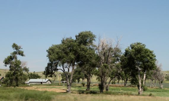
I became focused on the cottonwoods today. Groups tended to indicate a home and cluster of ranch buildings.
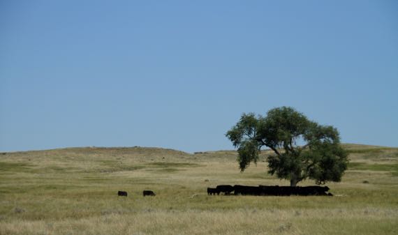
Solos tended to be in grazing land…. [I am being kind; I probably shot fifty photos of cottonwoods today.]
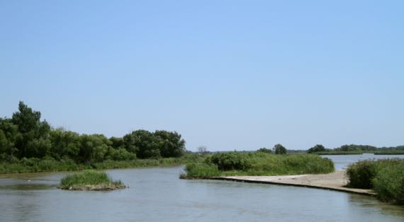
Of course, the real ecological focus of this area is the river, here the North Platte. This is a LOT of water for mid-August. We heard that somewhere north and west of here they got 8″ in something like an hour the other day. In pockets, we have seen flooding in fields. It’s spotty, though—but everywhere seems especially green.
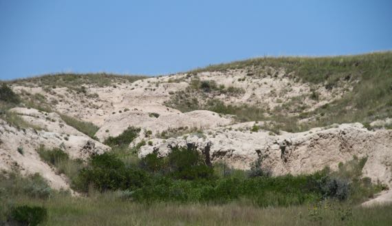
Hmmm. Not everywhere. We’ve been seeing blowouts since the Sandhills. When I worked there, people said the bison made some of them. Since the bison have been gone a good long while, I’m just not sure. This seems more like an eroded slope, however.
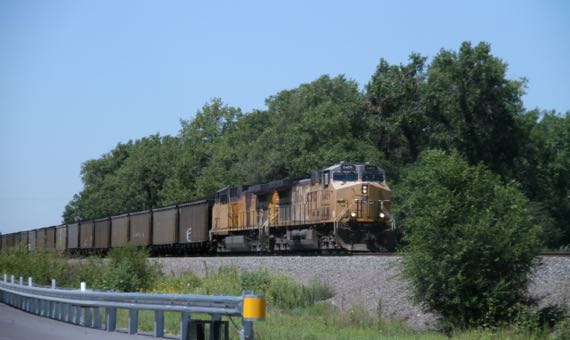
Wending among all of the above: coal trains. This is the famous Powder River coal that may keep you warm this winter. We usually count two engines in front (east end), and one pushing the train from the west end. The west-bound trains of empty cars are longer with usually two or three engines. Seems to me that the engine count in the Powder River Basin might become deficient.
Posted at 10:22 PM |
Comments Off on Of cottonwoods and the (N)Platte
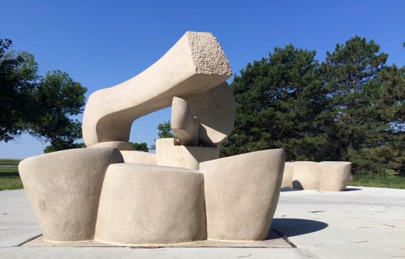
Art in a rest area.
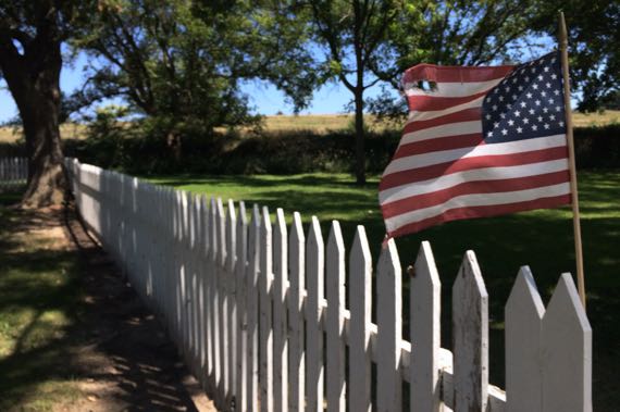
USA flag on picket fence, Fort Hartsuff.
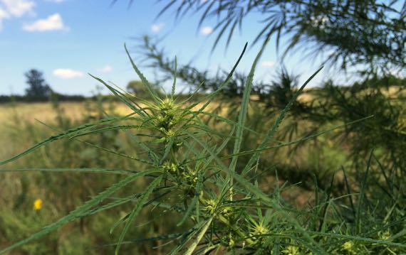
Industrial(?) hemp, gone wild(?).
Posted at 11:34 PM |
1 Comment »
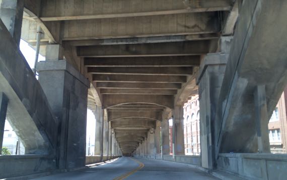
Massive industrial architecture, the aesthetic grace not offered through color and finish but instead (merely—mostly) through form and iteration, continues to amaze me.
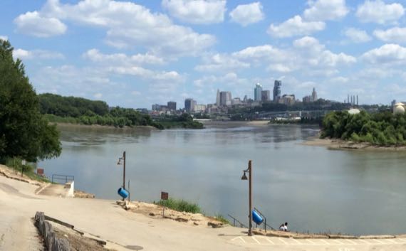
For a moment, I watched this river-meets-river scene and thought of the Selous and a tributary. It was long ago and far away when I was there…and the landscape looked sooooooo-very-different. (Critters, too….)
Posted at 10:04 PM |
Comments Off on Lost…in thought