Whew
Friday, 21 May 2021
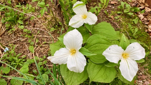
This trio and our neighbor duo welcomed us to the cottage. We made it! Great fun taking “the long way” via Seattle. Especially enjoyed being two days ahead of a foot-and-a-half of snowfall at Glacier.
Friday, 21 May 2021

This trio and our neighbor duo welcomed us to the cottage. We made it! Great fun taking “the long way” via Seattle. Especially enjoyed being two days ahead of a foot-and-a-half of snowfall at Glacier.
Thursday, 20 May 2021
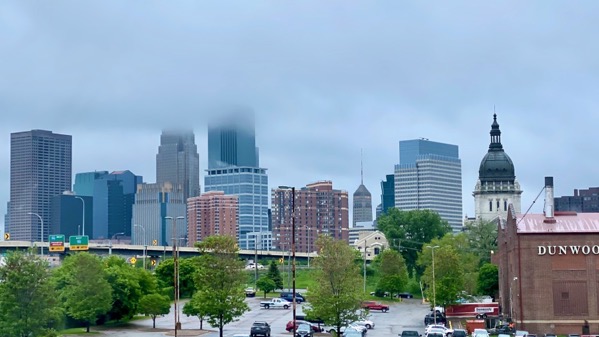
Today I walked around the old economic heart of A Real City.
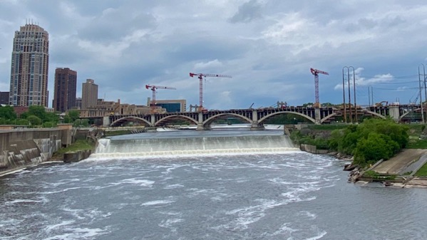
The Beating Heart was these falls, the Upper Saint Anthony Falls, now marred? by a lock and dam.
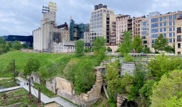
The power the river generated, and this is the Mississippi so it is a mighty generator, ran the Gold Medal Flour mill on the south/west side…
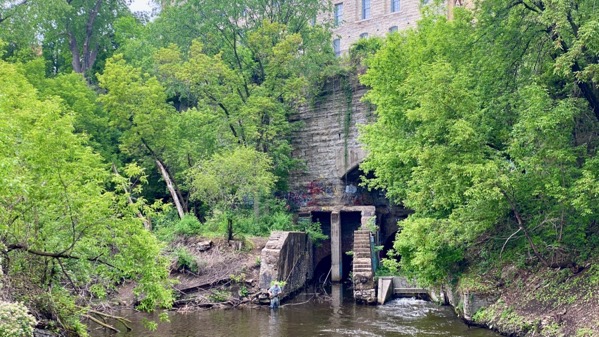
And the Pillsbury mill on the north/east side. This is the underbelly of the mill complex. [Note fisher-person.] Now the mills are no longer milling, and this sacred place of the people who were here before the EuroAmericans arrived is irretrievably altered.

I quite enjoyed walking across the curving Stone Arch Bridge that seems to connect the two mills. It’s a pedestrian bridge now, although it was built for rail cars. The water on the left is the lower end of the Pillsbury millrace (it seemed to me), and the bridge crosses the main channel of the Mississippi.
And all this? Yup. Couldn’t have put it better myself.
Wednesday, 19 May 2021
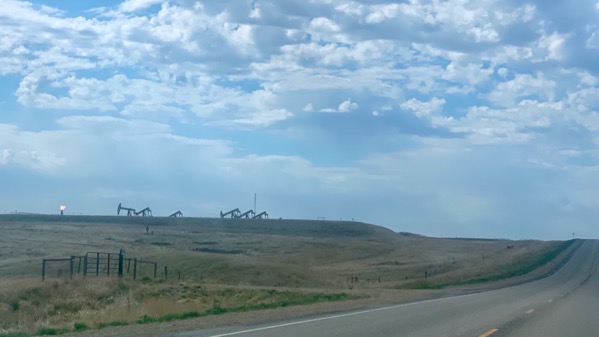
Steady eastbound motoring brought us from pastured beef with oil drilling, to pasture plus some row-crops (seemed almost exclusively wheat), to less and less pasture and more and more crop-fields.

Somewhere in there, the oil machinery disappeared, and then we got a few wind turbines. A few of these old-style windmills were scattered throughout.
Now, no photo, we’re in almost entirely row-crops, and no cattle/pasture whatsoever. Rain expected overnight, which is good as it is a bit dry; however, accompanying tornadoes are not desirable.
A more precise title might be along the lines of “Central continental longitudinal topographic and land use drift,” but, duh, too unwieldly.
Tuesday, 18 May 2021
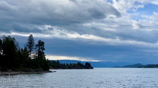
View south down lake from north end of Flathead Lake.
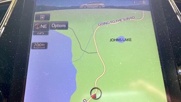
No sky in this shot, but JOHNS Lake! We only got a few more miles up Going to the Sun Road before we had to turn back, as it is not yet open for the summer season.
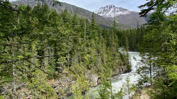
McDonald Falls, through vegetation.

Random view from east side of Glacier National Park. [Apologies; forgot to color correct.]

Vernal lake/pond on upper plains, with mountains in the right distance.

Penguin at Cut Bank.

Rainbow in far eastern Montana. Not caused by fracking.
Monday, 17 May 2021

Sometime today, yesterday’s Cascades became today’s Rockies. These long lakes are all fake, or perhaps more kindly, they’re reservoirs. With abundant power generation. I’ll take the reflections.

This murder scene welcomed us to tonight’s overnight housing.

When I first arrived, as part of the dying fish tableau, I watched a male mallard preen before departing. And among the plants, several Arctostaphylos uva-ursi, which I know as kinnikinnick (from the Algonquian referring to the plant’s use as a smoking substance).
If I understood the weather prediction correctly, places we’ve been today and will visit tomorrow will have snowfall Wednesday after we are out on the Great Plains.
Sunday, 16 May 2021
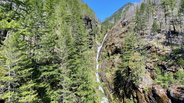
Our eastbound mosey began today. Meet Gorge Creek Falls. About one-quarter is chopped off the bottom (the perils of a horizontal format).

I think these are Jack Mountain and Crater Mountain, part of the Cascades. I particularly enjoy the vertical snow streaks that are avalanche chutes…they show the power of MaNachur.

We drove through miles of standing fire-killed timber. These fires are some of the ones that so drastically lowered air quality in Seattle and far beyond in 2020.
Saturday, 15 May 2021

I think this is Prunus serrulata, with the huge distinctive dangling blossoms.

Found this huge trunk; tree too tall to make a good “portrait” photo.

We spent most of the day with family, sitting and laughing/talking, with this great view. Also: great eats.
Apologies for the delayed post; we had too much fun for too long, so I didn’t have time to get my brain in gear to write a cogent post. I DID think of youall, Gentle Readers, however.
Friday, 14 May 2021
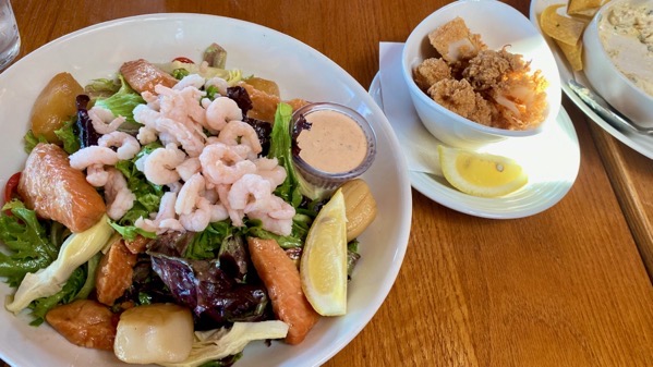
We planned to lunch IN A RESTAURANT today (yes, first time since…) before the mask mandate change. We planned to sit on the deck. Turned out the deck tables were already occupied when we arrived (plus, in the full sun!), so we sat INDOORS. The tables were arranged for 50% capacity, and we had our space. Everyone I saw wore their mask except when they were eating. Including us.
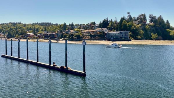
We ate with a view of the Olympics—so clear!—and of the mouth of Lake Washington Ship Canal—plenty of traffic in and out. The open water to the right (outside photo view) is Puget Sound and salt water. The Canal connects the the freshwater Lake Washington (follow the water to the left for a ways) to the Sound. The Ballard/Chittenden Locks enable boat passage as there’s a 20-foot difference in the elevations of sea and the lake. The Locks block the migrating salmon so the lock complex includes a fish ladder. The water passing through the fish ladder has to be “adjusted” (long story elsewhere) to include salt water to provide the proper scent for the fish to want to jump jump jump jump jump up the ladder to their spawning grounds. Constructing the Canal decreased the water level in Lake Washington by almost 9 feet, so I imagine there was some hue and cry from landowners whose docks became useless. But construction began in 1911, so maybe there was more rah!rah!rah! and less dissent about such changes to real estate value etc. I’m just guessing. You can find more info on all this on the web; ’sup to you.
My seafood salad includes smoked scallops. So very yum. What a great meal to be our first IN IN IN a restaurant since, well, you know.
Thursday, 13 May 2021

This is very close to what it looked like standing there. You have to imagine the fresh air, slight breeze, and faint noises coming from the water and moving vegetation. Down two-thirds of the way from the moon to the land, and to the right is Venus (thank you, SkyGuide app), and between the moon and Venus is Mercury, but I couldn’t pick it out, and the camera missed it, too.

I do like the camera’s computational capabilities, but this example is maladroit, and I didn’t take the time away from all the fun social hubbub to finesse it.
Wednesday, 12 May 2021

The high school nephew had an open day today, because: covid. So we had an outing. We took a short ferry ride, a little longer than it took to wait to board, board, and disembark. We were told to stay in our vehicle, because: covid.
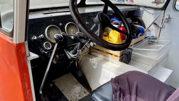
Since it was mid-day, our first stop was food. We drove by the possibilities and picked a hometown burger place. With a food truck. This is the drivers control area. Shift on the left, which I do not recall ever seeing for a left driver. Not because: covid.
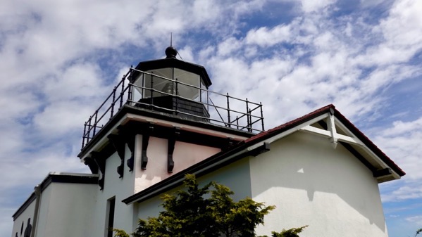
After wiping our chins and downing the last fry, we drove on to Point No Point Lighthouse. It is the shortest lighthouse I remember ever seeing.

Atop a row of evergreens I suspect were planted to protect the lighthouse from the prevailing winds, we saw eagles land and watch the doin’s below from on high—not so much the tourists as the fishing.
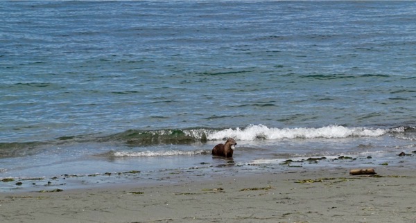
Down on the beach, we spotted an otter moving along, then finding something to eat—clam perhaps? An eagle spotted this, too, and dived the otter; however, the otter seemed to have positioned her/himself to see if this happened, and quickly plunged into the water, saving lunch from the feathered, screaming predator-thief.

Next stop had no David Attenborough drama, instead an eroding escarpment called Foulweather Bluff. Rusty red dot lower right is nephew’s jacket, so you can tell it’s a tall bluff.

Lucky us, the tide was out. We used our identification crutch, the iNaturalist app, and found out these are aggregating anemone. With seaweed and what we thought was a tiny jellyfish.
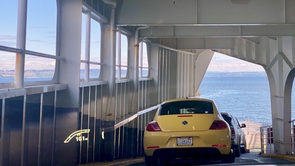
With plenty of excitement behind us, we headed back to the ferry, and were stopped behind HTBNANA. The plate surround indicated that “it only happens twice.” We remain unsure what that refers to.