Musings
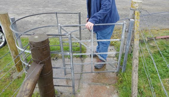
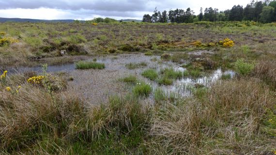
We are frequently entering landscape-spaces that are maintained by four-foots. To keep them in the right zones (aka pastures), we often pass through this kind of gate. I call them nudge-gates in my head, as I don’t know the “real” name. The gate section pivots, and you can only pass through if you pull it, then pivot around it. Since the sheep (mostly), only nudge the gates, they effectively close off passage…and remain in their designated area. Meanwhile, after we pass into the sheep-zone, we must “mind our shoes,” as they say here….
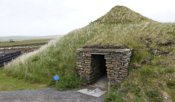
Skara Brae (say scare-uh bray; extra points if you can do the Scottish “r”) is a 5K-yr-old Scottish Neolithic hamlet that was buried by sand dunes perhaps 4500 years ago, and only exposed after a storm in 1850. Parts were being excavated as late as the 1970s. The domestic units are circular stacked-stone structures, entered through a low, covered passageway. The settlement has about six units that were occupied contemporaneously, although it’s atop an earlier set of household units that are unexcavated as that would involve removal of the later ones atop them. Anyway, this is a reconstruction of one of the houses, but without the passageways that lead to neighbor-homes and would have looped around it.
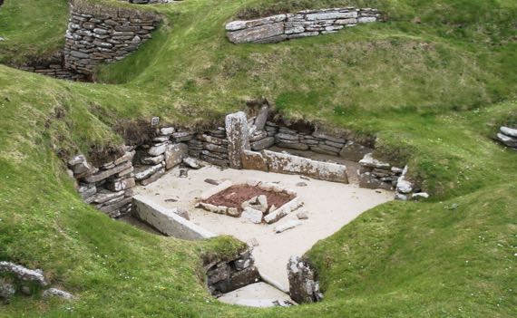
Here’s the real thing, roofless and open to the sky. The sign said that people brought refuse here to pile up around their houses when they built them, which sounded strange to me and I wondered what the archaeology revealed that made that the most plausible interpretation.
The big box in the middle contained the hearth. The chambers around the outside with stacked stone walls were storage costs. The spaces delineated by stones standing on edge are called beds. I would guess that they were filled with vegetation to act as padding/a mattress; I didn’t see an explanation, though…. Built into a side wall are shelving units that are interpreted as for food processing. In the reconstructed unit there were small stone-lined boxes inset into the floor that were interpreted as being filled I assume with sea-water to hold crabs…fresh meat!
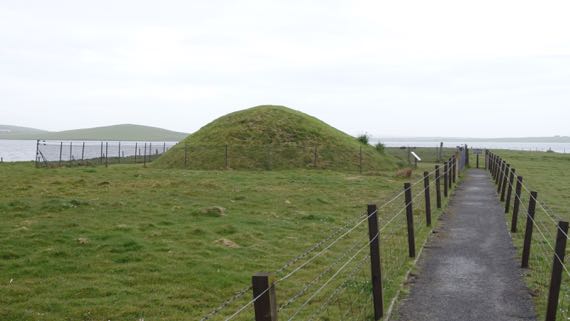
We also visited a chambered cairn. We could not get into the massive Maes Howe cairn, as the tickets are very limited and we didn’t act fast enough. Maes Howe is later than Skara Brae. The chamber inside is huge, and the passageway that leads to it is 36 feet long. This is gigantic earthen architecture. It likely was built for multiple purposes, although it is usually described as a burial mound, as bodies indeed were interred there. [Consider that we describe a Christian church as for services, including weddings and baptisms, when people may also be buried there.]
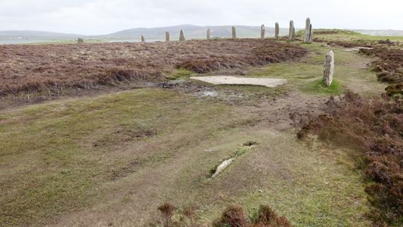
So, since we couldn’t go to MaesHowe, we went to a smaller chambered cairn that we were able to visit without ticket hubbub, which sits on a peninsula, very quiet (except for the wind).
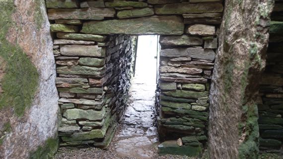
This one has five chambers in a line perpendicular to the entry tunnel, with the chambers separated by upright stones (compare to mini-standing stones…). You can see the uprights to the left and right of the doorway. One came out from each wall, and you pass between them to move from chamber to chamber. Excavators reported human bones from each of the five chambers. This cairn also offers a great habitat for mold etc, at least during the humid season….
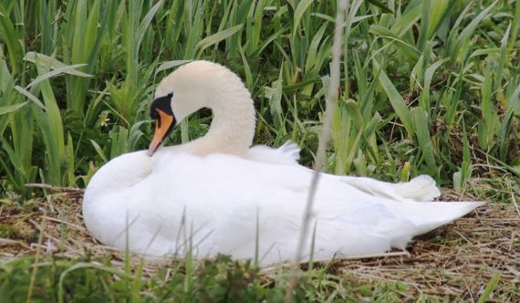
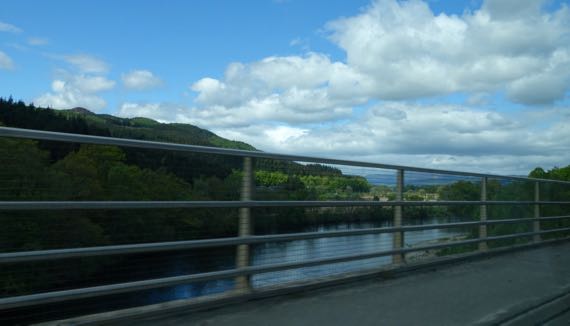
We aren’t just looking at sheep, seagulls, cattle, other marine birds, wandering cats, fishing boats, ferries, and military jets on maneuver…. This is the Guru’s favorite of the swans we’ve seen, and she’s sitting on a giant nest (which matches her size). I think she’s a mute swan (Cygnus olor), but bird IDs are not my specialty.
The rain has kicked up again, and I think I missed my opening to walk…on the other hand, I didn’t get caught out far from the B&B!
Posted at 1:06 PM |
2 Comments »
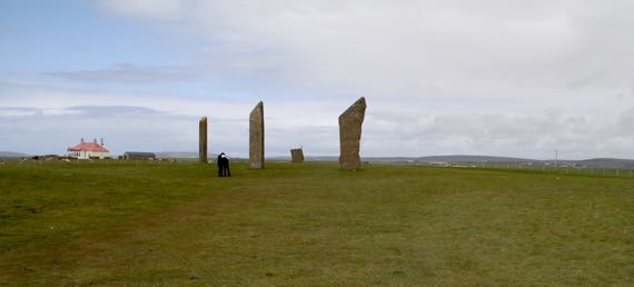
Although some stones are missing and others broken, this ring of massive stones was perhaps the earliest constructed in the British Isles. The henge (encircling ditch/ring made from that soil) is mostly plowed away, but we could see the remains of it. These are BIG stones.
In sum, the Stones of Stenness is an old feature, has nearby alignment stones, and is not a particularly large henge.
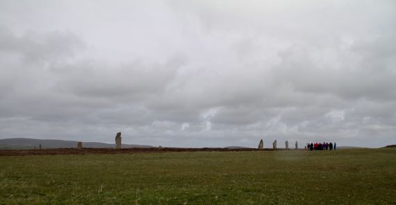
In contrast, the Ring of Brodgar, just over a kilometer away, is huge, one of the largest henge/stone circles in the British Isles, although the individual stones aren’t as broad/tall. The henge is on a slope such that from this perspective I couldn’t see all of them, although the size of the circle is evident…. That’s a large bus-load of high-schoolers to the right.
The rain started when we were half-way to the henge, but by the time we turned back, it had stopped (thank you, Odin or whatever forces smiled upon us). You can get a sense of the slope that this circle/henge is on, and see a cairn to the right, next to and outside the henge.
The Ring of Brodgar was created much later than the Stenness circle. Around these features are single and paired standing stones, larger and smaller cairns, cist graves, and even a village…today called Barnhouse—at least these are ancient features that have been recognized so far….
This was an elaborate ritual landscape, a rival to the Stonehenge area, and in use for a millennium at least. These two stone circles were on two narrow spits of land that point at each other and today are connected by a causeway; they used to be connected by stepping stones, perhaps even in ancient times. They are inland from the open sea, but connected to it by water. In addition, there are some pottery types found here and in southern Britain and Ireland; at minimum, the peoples who made/used these features had some long-distance contact.
This is a special area…. There’s another henge farther north, but no obvious public access. I could see it in the fields; it has a somewhat shallow but very wide ditch, and has been altered by generations of plowmen.
And now for something completely different…this is the view from our room under the eaves (several of our rooms have been under the eaves…). Love the fisher-dude getting out of his wetsuit to hop in his Honda sports car and resume his life on land…. Also, sheep-dots in the distance…. Many people walk their dogs out this road/trail, which seems to go to several WWII gun emplacements(?). BTW, we went to a town the other day that had a plaque that said the British military temporarily emptied the town to use the area to practice for the Normandy invasion….
Posted at 5:41 PM |
Comments Off on Stones, henges…
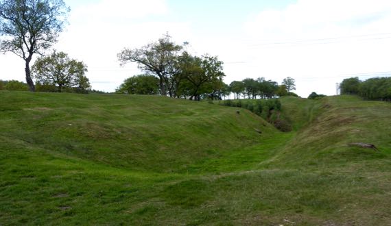
This may be the last about Roman occupation on this trip. This is a turf fort on the Antonine Wall, called Rough Castle. The Romans took twelve years to build this wall, and after eight more years they abandoned it (the forces of political economy…). To the right is the land of the barbarians, with a ditch and rampart in the mid-ground, facing the threats…to the far left is the fort, and I am standing on a gate (I assume; one sign on the whole fort…). This is the second-smallest fort along this wall, and the best preserved. It’s rough, humpy ground surrounded by a ditch, and would be a royal pain to sketch-map with a compass by pacing.
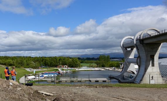
By the time we got to the other side of the hill (roughly speaking), the sun was out, and we found two guys and a drone watching the Falkirk Wheel. This is some major industrial engineering to bring boats up/down between two canals at very different heights. The drone is left of center near the top and the boat is at the bottom ready to enter the lower basin. The arm takes the boat and water on side, with a counterbalance on the other. This lift replaces eleven (I think) locks that used to be used to span the 79–foot elevation change.
As we climbed, we saw many plantations, including bits of Tay Forest. Some of Tay Forest is old(er) growth…. And rivers, some with rocky beds and rushing water. Elevation….
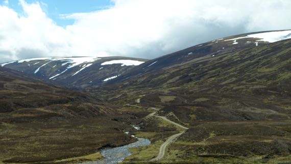
As we climbed higher, we got above the treeline (or at least where trees have not returned since the last glaciation), into glacier-rounded peaks and valleys, with some snowpack remaining. The dark brown landcover is heather. The lambs up here are much younger than at lower/warmer elevations, and most were hunkered down napping, not gamboling about, as we have seen everywhere else.
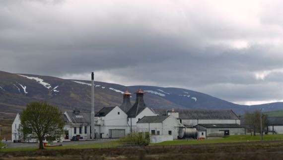
We have driven past several whisky distilleries, but have yet to stop. Crazy, eh?
Many men died on this relatively flat moor, properly called Drumossie Muir/Moor, including Scotsmen fighting on both sides. This is where the Blàr Chùil Lodair, or Battle of Culloden, happened beginning about one in the afternoon of 16 April 1746. The Jacobites, who sought to restore their beloved Stewarts to the throne, opened with cannon fire, and English forces answered with their own cannon. As the National Trust for Scotland puts it:
Bombarded by cannon shot and mortar bombs, the Jacobite clans held back, waiting for the order to attack. At last they moved forwards, through hail, smoke, murderous gunfire and grapeshot. Around eighty paces from their enemy they started to fire their muskets and charged. Some fought ferociously. Others never reached their goal. The government troops had finally worked out bayonet tactics to challenge the dreaded Highland charge and broadsword. The Jacobites lost momentum, wavered, then fled.
Hardly an hour had passed between the first shots and the final flight of the Prince’s army. Although a short battle by European standards, it was an exceptionally bloody one.
Culloden was the last pitched battle on the British mainland, and the ramifications for the Scottish people have been immense. The English subsequently sought to suppress ethnic Scottish behaviors, including kilt-wearing, the Scottish Gaelic language, and the clan social structure. The effect of these changes was a depopulation of hinterlands, and disruption of pretty much everything Highland.
This and other rough stone markers were installed in the 19th-C. Archaeologists have used non-destructive, remote sensing techniques to define the areas where bodies were buried in mass graves.
Another problem for the Jacobite troops was that the part of the battlefield they sought to cross was even wetter than today, slowing the advance of a major portion of the line. Indeed, this was a little marsh we found that would have been difficult to slog through.
Managers of the battlefield are encouraging the plant species that were here on the day of the battle, and the moor is turning from pasture into…gorse and grasses, along with wildflowers and other woody plants. One type of feature that was here in 1746, but is mostly gone now, are stone field enclosures…. The powers-that-be are also trying to convince landowners in the preservation area to refrain from tree plantations.
Such are the cycles of land management.
Posted at 4:22 PM |
Comments Off on From violence-bracing to violence
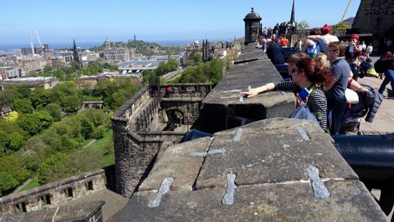
The preferred castle location: defensible, lofty, fortress position. From this massive castle hill, Edinburgh is laid out below, with occupation stretching to the Firth of Forth, where the River Forth melds with an arm of the North Sea. I loved this parapet, and the views.
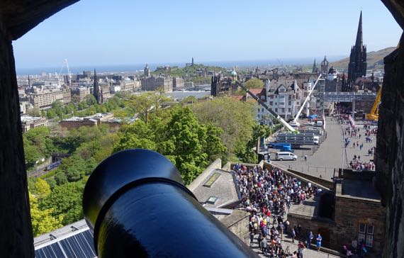
Of course, the cannons also have a great view. BTW, that mass of people to the right of the barrel and far below, sweating in the sun…that’s the line to buy tickets. It’s a holiday weekend…plus for a while, three of the six windows were closed. Sheeesh.
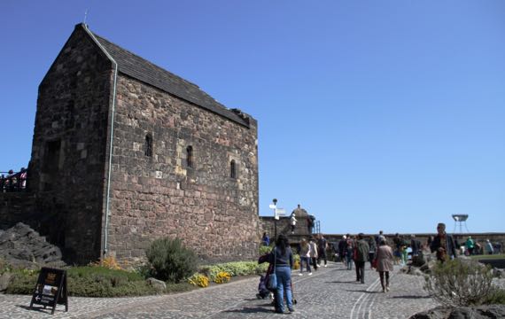
You can see a bit of the volcanic whatever that makes this feature extend far above the surrounding landscape. All the cannonballs and castle-terraforming have not eradicated or covered it. This building is the oldest one standing up here, a chapel dedicated to St. Margaret of Scotland (~1045–1093). It was built by her son, David I, previously mentioned in this space…. One of the fine things Margaret did was establish a ferry across the Firth of Forth. [Now there’s both a railroad and a road bridge.]
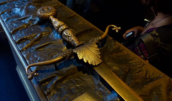
The most moving exhibit for me was our visit to the stronghold within the castle, where the Honours of Scotland are kept. These are the most symbolic objects in the nation. No photos/film allowed, so outside are bronze…not-quite-replicas. This is the claymore/sword (replica), which has a 4.5 foot blade. The real one is a bit more battered, and a bit sharper. Also in the room with the Honours is the Stone of Scone (I’ve seen pronunciation suggestions both as “soon” and to rhyme with done; haven’t heard anyone say it). I wanted to be more excited about this stone, for its history, but I couldn’t get there. The Stone has been used in coronations for something like eight centuries, customarily stored in the chair in which the sovereign sits when the coronation happens. It has a checkered history, and many doubt that this is the original. No matter; it remains very meaningful today. It was in England for recent centuries, and used in coronations there, and finally returned to Scotland in 1996. It’s not pretty, just rough, pitted sandstone, and suffers in comparison to the shiny and glittering sword, scepter, and crown in the same display.
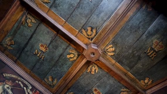
This is the ceiling of the bedchamber of Mary, Queen of Scots. It’s a small room, with nice wood paneling. And a window. And paintings on the walls just below the ceiling. I have no idea what furniture was in this room; there’s just a chair now.
I kept trying to visualize the pre-Scottish fort that was here, and the earlier castle-layout(s). This castle is still in active use, for official activities, for rental, and of course for tourism. Outside the gate, they’re installing a huge seating gallery, using giant cranes to lift large steel I-beams into position. I didn’t catch what it’s for….

Posted at 6:36 PM |
Comments Off on Super-castle!
Today was designated Abbey Day in our itinerary. It was not wrong. What we really did that was most important was get to…Scotland! (And, yes, mostly we had a rainy day.)
Historically, as today, there’s a sociopolitical core to the north and south on this great island, and somewhere on the lands between has been a border zone. Today, the border’s an agreed-upon line across the landscape. For generations, it was a wide swath of contention. The border was generally porous, often dangerous, and yet had economic potential in an agrarian economy. And, land, after all, is land, and land is territory.
From the 1100s–1400s, a castle on this hill, between two rivers, was a political and economic center. Kings lived here, and both the northern and southern sides held it in repeated succession cycles. This was Roxburgh Castle, founded in the mid-1100s by David I, King of the Scots from 1124 until his death in 1153. Now, at the foot of this rough double-hill, there’s a small layby with room for maybe four vehicles, and no signage.
King Henry I (coronated 1100, died 1135; fourth son of William the Conqueror, King of Normandy) held sway in England, but suffered from pressures brought by rulers on the continent, in Normandy and elsewhere on the northern rim.
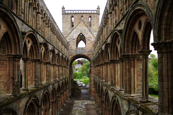
The economic and political elite of the time included both nobility and the guys who controlled large abbeys-and-churches. They were two sides of the leadership coin. Yet, the petty kingdoms of the time rarely could dominate the peripheries for long. Accordingly, cagey religious leaders were happy to build and run Jedburgh (above) and several other abbeys not far from the Roxburgh core that for centuries held sway in the borderlands—and to feed off and accept the wealth of the nobility as donations to fund repeated monk-prayers (see how well it worked, the buildings of…almost…all are now in ruins). The leadership of some of these abbeys came from afar, others from Lindisfarne….
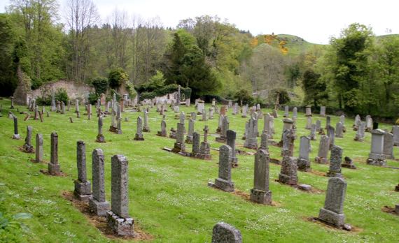
Into this general pattern of upheaval over the centuries, the place I found most interesting that we visited relates to my family history…. Traced through my mother’s father’s mother’s ancestors, we get back, after something like a dozen generations, to the Livingstons of Ancrum, post-Reformation (them, post-Dissolution) men of god here. The original Christian outpost here was established by David I, and it became a parish church after the Reformation in 1560. John Livingston became the minister here in 1648. Some of his relations migrated to the New World in the later 1600s, including signer of the Declaration of Independence for New York Philip Livingston (1716–1778). Anyway, (somewhat tenuous) family ties to the village of Ancrum (pop. ~300). In older times, the town center was west of the modern town center, near the ruined church, now surrounded by (mostly) 19th- and 20th-C headstones, and across the river from the ruins of a flax mill….
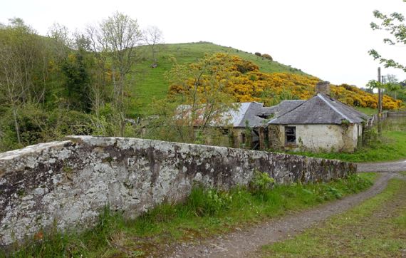
The icing on the cake…across that bridge by the church-cemetery, and up on the hill that has yellow blooms on the woody shrubs, are the remains of an Iron Age ring fort!
Posted at 10:22 PM |
Comments Off on From kings to peasants, via local leaders
I’m not sure how this…crest…was used, but I find the dragon-lion claw-displaying the spoked wheel just plain odd. Anyway, today we saw many locomotives, train cars, and railroad artifacts. Room after room of them. Fix-it areas. Curation zones with rack after rack of…everything from porcelain dinner sets to chairs to uniform insignia to station signs and model engines and cars of all sizes, plus we found an outdoor viewing platform for real trains on real tracks headed to local and distant destinations. This is the short version of what you can see at the National Railway Museum in York….
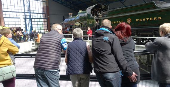
Two huge warehouse-display areas featured polished, clean “locos” and carriages. And one had a turntable, and we saw the demo, done by knowledgeable young women wearing “Explainers” on their uniform backs. We discovered that as we walked around the turntable that the reverb from the sound system varied. This was a good spot, but the man fondling his lady could have been distracting.
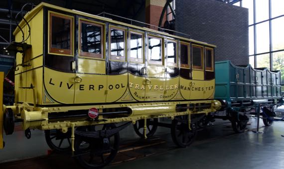
This was an early carriage. It was a clever merging of three horse-carriage units into one train-carriage. These were low-roofed and made for seating. There was no dining area, and precious little space for baggage. The driver sat on that ledge on the outside left. Think stagecoaches in the Westerns you have seen….
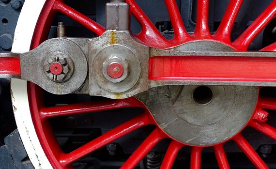
I will spare you the many closeups I took, but being able to see the mechanical parts that move the energy from up-down to around-and-around…I found it humbling in a strange I-grew-up-near-Detroit way.
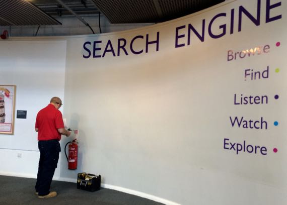
Jokesters take the reins every once in a while around here…. This is the sign for the library. The library was closed, but the fire extinguisher was getting its annual checkup.
Richard Trevithick adapted steam engines to use high-pressure, and thus be more powerful. Some were built to be stationary. Others were used for railways. He is credited with the first steam rail transport in 1804. If I have it right….
Posted at 12:21 PM |
Comments Off on Trevithick’s legacy
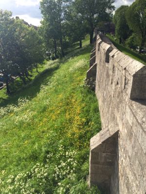
The whole city wall thing seems like it’s from another age. And that is true of this one…it’s the current incarnation of York’s Medieval wall. This view is west, toward Micklegate Bar. Gatehouses are called bars here. And –gate in Micklegate is from the Norse for main as in Main Street. This version of the wall dates to about 15 decades ago, when the parapet wall was added to make strollers feel safer. Notes Simon Mattam for The Friends of York Walls (p12 of the 24.04.2014 version of “On the Walls—A Guide to York’s City Walls Trail”):
The Romans started York around 71 AD. They built walls around their fort and then around the city that grew up on the other side of the River Ouse. Big bits of the walls of the Roman fort can still be seen and up to half of the rest are in the ramparts under the present walls. [Four hundred] years later there were new invasions: Anglian York developed, then Viking York in the 9th century, then Norman York in the 11th century; over this time the Roman walls fell but ramparts grew.
About 900 years ago, the times we call “the Middle Ages” began—these were when the present Walls were built—mainly to protect York against the Scots. Around 500 years ago the Middle Ages ended and cannon were making military walls less useful; in spite of this the Walls were strengthened in the 1640s for the English Civil War. The Walls were seriously attacked and damaged in this war of King against parliament—but luckily a conditional surrender of the city stopped the damage and the parliamentarian victors arranged their speedy repair.
About 200 years ago there was another sort of battle being fought in York—over whether the Walls should be knocked down to open up the city to traffic and fresh air. During Victorian times a compromise developed: small bits of wall were demolished and new arches were built through the Walls but most of the Walls were repaired and opened as a footpath.
Thick stone defensive walls make me think of castles, at least in this part of the world. And there’s one that survives here, not large at all, crowning a human-made, steep-sided hill. It’s called Clifford’s Tower. Actually, this surviving architecture became the keep of York Castle.
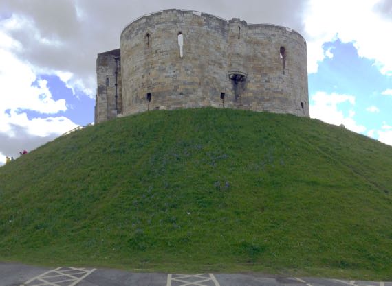
The first castle of York dates to the time of William the Conquerer, in 1068. King John of the Magna Carta stayed here…. Later, in the mid-13th-C Henry III had this version built, in a style that resembles French castles of the time. Its quatrefoil plan is very unusual in Britain. The castle was surrounded by a moat that is long gone. Its land connection was via another moated, walled area, that housed many support functions for the keep.
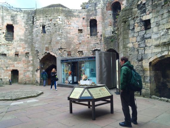
In those days, the interior was roofed over, with two floors. The squarish holes are where the ends of the beams that held the upper floor were seated. Contained in the wall above the entrance gate is a room that’s beneath the small roof that peeks above the wall in this view. When the portcullis was raised, it went into that room.
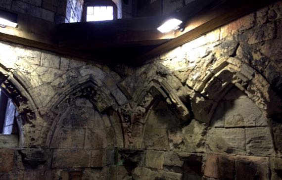
The other function of that room in those days was as a chapel. The room was repurposed multiple times, but the fancy carvings that framed the old window openings remain, battered and mute.
Okay. Food. I often get requests for food pictures. Brit-food isn’t…or usually isn’t…terribly well regarded. I have many photos of Full English Breakfasts, which is the most British “dish” we normally eat. Both of us are getting tired of tomato-y beans (called Beanz by Heinz in the canned version). Also, fish and chips (had this once, in Hastings) isn’t particularly pretty.
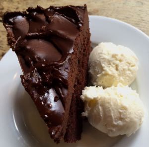
So, instead: dessert! We found this Belgian chocolate cake, lightly heated, with vanilla ice cream from a local creamery, divine. And I spooned away with a view of the sunlit façade of York Minster…really special. We are very lucky.
Posted at 3:08 PM |
Comments Off on (Not new) York
Above is our view from a room that used to be part of the B&B’s family’s compound. When we were here last many years ago, they had gotten a new but short-term lease to continue with the property, but the handwriting was on the wall that they were not going to be able to continue. I think the B&B is now managed by a face-less company, and all the staff we’ve seen are immigrants (which is fine). I’m guessing the property owner (the Duke of I forget what) has upped his income significantly. It’s all impersonal now, no one to share a cup of tea with, and no one to ask if you slept well.
This is the way of the world. I hope that family is okay; they were very nice people.
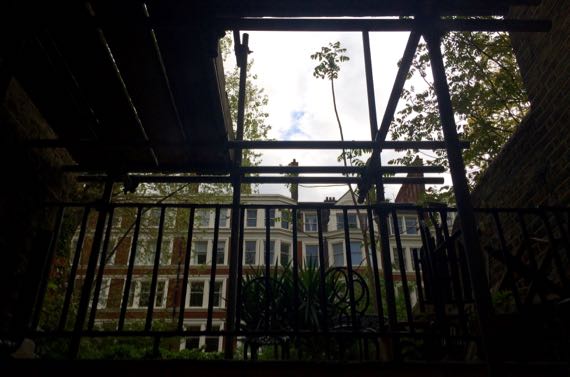
Anyway, our room is in the basement, but in the back of the building, and so facing the back garden. We hear the birds. Also using our airshaft are windows from the kitchen. This morning we heard the chatter of the young Eastern-European? women who do breakfast, starting shortly after 6am. Since we’re jet-lagged, we fell back asleep. However, after the cleanup after breakfast service, the airshaft is ours again, and this is the view. We try to avoid flashing our neighbors when we’re changing.
We had two big missions today, beyond having fun, and that’s on the list everyday! The first mission was to the BBC building, and that’s someone else’s story.
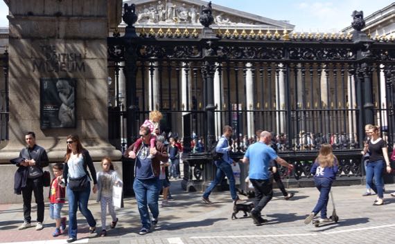
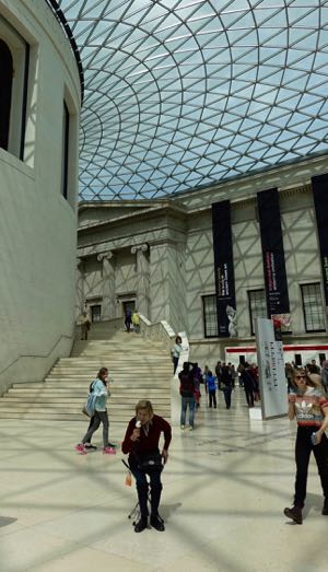
The second was to the British Museum. It’s free and busy busy on Sundays. We joined the crowds coming in the gate, through the photo-zone, and up the stairs into the building. Then, we discovered that the interior courtyard now has a glass roof, which we thought must have been a move inspired by the IM Pei Pyramide du Louvre.
I loved noticing this woman (above right), who set up her cane-chair right at the shadow junction to settle in and enjoy her ice-cream cone. I could not decide if it was a deliberate siting…. I also love this courtyard!
As a result of our crowd-avoidance strategy, we didn’t visit the treasured pieces in the collection that are on display and most discussed. No Parthenon sculptures. No Rosetta Stone.
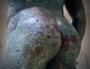
We did look at the Etruscan room. We saw some Greek and Roman sculptures…. Cute butt, eh?
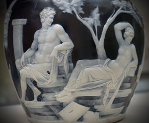
This is a close-up of one of the scenes on the side of the Portland Vase. I never would have sought out this piece, but I enjoyed “finding” it. It’s made like a cameo, in that the vase was made with two layers of glass, the inner dark one and the outer white one. Somehow, craftsmen or a craftsperson carved away much of the white, leaving this scene. I don’t know how someone carves glass successfully, but apparently it involves a gem-cutter’s skills, and modern craftsmen have found it quite a challenge. The Wedgwood company and others made copies or “inspired by” vases.
Apparently this vessel was bought by the British Museum after it was slightly damaged (fire sale price?). Then, in its care, the vase suffered mightily and was broken into many pieces. The restoration was…lacking, and in the late 1980s it was taken apart, cleaned, and reassembled using modern adhesives. Big story on the Museum website.
Posted at 4:15 PM |
Comments Off on London tales
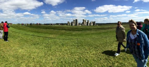
English Heritage (we’re among its newest members) has reorganized access to Stonehenge. One reason this was sorely needed is that the cruise ships dock at Southampton, and passengers are bused to Stonehenge, about an hour each way. So the normal flux of tourists is augmented by rafts of these strange birds….
There’s now a fantastic visitor centre and bus transfer setup to move visitors from a safe distance away for parking and congesting to hobbling distance from the stones. This centre opened in December 2013 (not present on Google satellite view last time I checked), such a change from our 1989 visit. They’ve also channeled foot traffic to a track around the stones that keeps people away from them, yet allows us to see all sides. There’s even a little bridge across the Avenue where it comes into the henge, to better preserve that important feature (postulated to be the main access route). Compare this to the imperiled preservation situation in 1877….
These things do change….
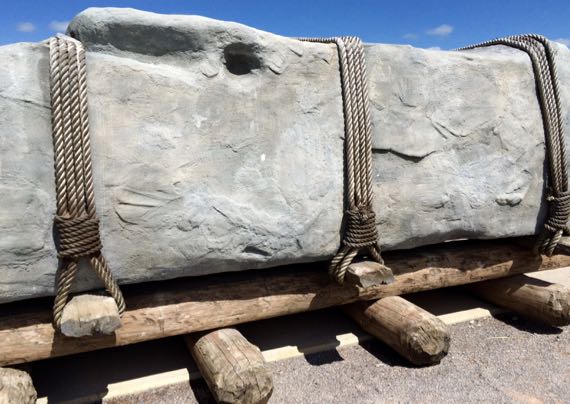
Next to the visitor centre is this display of a life-size model of one of the monster stones that folks moved for many miles to make the stone circles, along with a postulated roller-method for moving the stones along the ground surface. I guess that this is a model explains the solar panel in the top (not shown; yes! seriously!).
I especially liked the room-in-the-round display in the exhibition hall that showed the stone circle viewed from the center, with the sun and stars changing through the annual cycle. I also really liked talking to the archaeologists and having the opportunity to hold real artifacts from Stonehenge, and even a reconstructed Neolithic pot (pieces of a base and some side-wall, all glued together). Loved it!
This ritual landscape is complex and was added to and altered over time. Researchers are still finding new components. Here’s some idea of what’s been recorded. All those green dots are barrows—where someone was buried. This ritual landscape extends north beyond Avebury. Stonehenge and Avebury are over 20 miles apart, as the crow flies.
By the miracle of the internal combustion engine (and I don’t know what other energy sources), we shifted our geographic point of view to the former Londinium. Kinda hard to avoid the Thames and even the Eye.
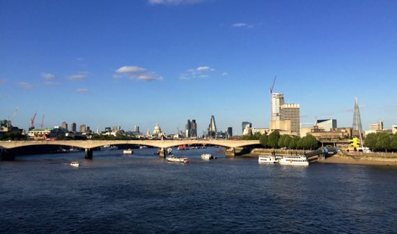
We sat and watched the water traffic and talked about how much wider the Thames is than the Seine in Paris, or, ahem, the Tiber in Rome. A real contrast. Of course, the Thames is tidal at London, and the others are not.
Posted at 5:50 PM |
3 Comments »
Here are your choices: “Soft verges,””Weak bridges,” or “No fly tipping.”
“Soft verges,” as you might guess, refers to the condition of the margin along the blacktop (ahem, macadam) of a road, when that margin is unpaved and ungraveled, and, when it’s been raining recently, like now, muddy, or liable to be muddy, even if it’s grass-covered. So, beware soft verges!
“Weak bridges” is info for drivers. It’s left up to you what to do with that knowledge. As near as we can tell, weak bridges may be…unsafe under heavy vehicles. Note the difference between this notification strategy and one where the sign says, for example, “no vehicles over 30,000 lbs,” or similar. The positon taken by the highway department is quite different….
I’ll let you continue to ponder the last one: “No fly tipping.”
Or perhaps you are more worldly than I, and KNOW what it means….
On to some stories for now….
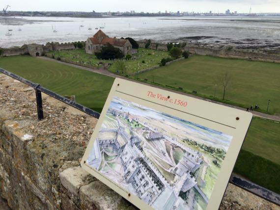
This is a view from the substantially complete keep tower from a 12th-century castle…built inside the walls of a ca. late AD 200s Roman fort. Yes, these are the best-condition walls for a Roman fort standing today. In an odd twist of fate, the fort walls were finished, but the interior occupation was short-lived and not robust. The Romans built this, along with many other fortifications on both sides of the English Channel, to control piracy and brigandage during a period of unrest.
Centuries after the Romans left, and after some occupation by the intervening generations, the keep-tower I’m standing on to take this photo was built to replace the most protected corner of this large compound, along with ancillary rooms and structures. The castle occupies only one corner of the Roman fort. The church opposite also dates to the 12th-C, although we saw a grave with a death-date of about a century ago; it’s still in use. The keep area was modified several times through the Medieval period….
The roof of the keep (modern roof on 14th-C uppermost floor) has a small walkway all the way around, with access via a tight circular stair with worn narrow, pie-shaped stone steps (and a modern rope for a railing). I liked this view, beyond the walls and across revealed tidal flats, at modern boatyards.
On the list of who slept in this castle: King John of Magna Carta fame, who used it as a jumping-off place for his activities in Normandy….
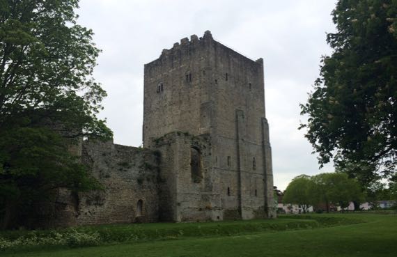
Here’s the keep, anchoring the corner of the Roman fort-wall farthest from the harbor. There’s a moat around the fort, and another moat inside the Roman walls around the castle. THAT’s protection!
The keep was used as a prison in the 1800s, so despite excellent preservation of the Roman walls, the keep endured more alterations.
There’s plenty more known about the history of Portchester Castle, some of it on WikiPee. (I give you the name of this building here at the end, in keeping with the info-at-the-end pattern of the optional title explanations….)
Okay, that’s plenty of distraction. Back to the phrase “no fly tipping.” Here’s the only clue we had: such signs are near dumpsters, like in the back of a grocery store or fast-food restaurant parking lot.
So, is your choice “No fly tipping?”
Posted at 6:36 PM |
3 Comments »