Musings

Tristán de Luna y Arellano statue, Pensacola, Florida.
Hard to imagine what this area was like when Tristán and his crews arrived in 1559, without the high-rise beach housing, planted pines, roads, vehicles, master-planned communities, signage, drainage ditches, fast-food joints, and putt-putt mountains.
Posted at 10:49 PM |
1 Comment »
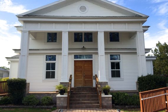
Baptist Church.
The high points of Cedar Key are staked out by various civic-ceremonial structures. The Baptists and Episcopalians got two of them.
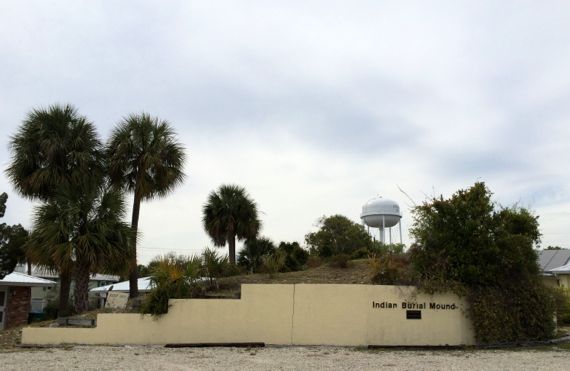
The community got one, and put the water tower there. After all, drinking water is a scarce and valued commodity in these—and many other—parts.
The final peak (such as it is) is capped by an “Indian Burial Mound.” Much of it has been borrowed away, and what’s left looks rather eroded. So you understand what you’re looking at, the retaining wall label clarifies….
Note that an easy stroll around the Key’s streets gave me several flights (registered by the Fitbit), unlike the flats we explored around Crystal River yesterday.
Posted at 6:25 PM |
Comments Off on Closer to…heaven, etc.
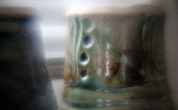
I experimented with That Lens Thingy again. I love these dots on this Gail-cup. Punctates I’d consider calling them, if I were in an archaeology lab. Or maybe not, since the vessel is glazed.
Is punctation situational?
Backnote: I’ve been looking at (drawings of) Copper, etc., Age pottery from I guess you’d call it Southeastern Europe lately. More tall vessels than I’d expect.
Posted at 10:22 PM |
Comments Off on Philosophy of decoration
New geographic term: where was the Roman Province of Pannonia? Turns out, if the info I have is correct, that my grandfather came from what was at one time Lower Pannonia.
The Latin term was from their predecessors in invading and record-creation, the Greeks. Turns out that the people living in the grandfather-area were not the Pannoni (probably), but Illyrians, according to the records (depending); the material culture is more difficult to sort spatially, showing some occupations of one and some of the other.
That is, this area was a cultural and political edge, frontier, or boundary for millennia, as it is today.
Posted at 10:22 PM |
Comments Off on Spatial boundaries

My ignorance is vast.
Today I worked on improving my knowledge about the Roman Empire’s eastern provinces—specifically those of the Carpathian Basin. And their post-Roman history….
Posted at 10:26 PM |
Comments Off on Vast

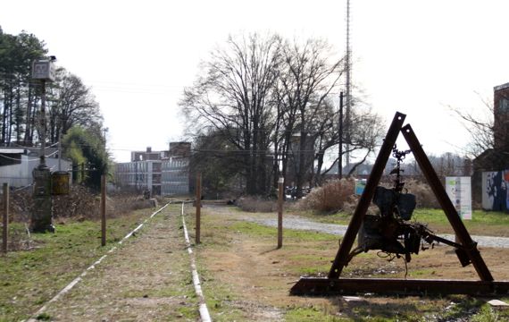
The north half of Jones Bridge over the Chatthoochee has been, um, an archaeological site for over nine decades (if the combo of WikiPee and my math are correct; abandoned 1922), while it was a functioning bridge for a bit less than two decades.
Find the bridge here: 34.00156,-84.23428.
Posted at 9:45 PM |
Comments Off on Crumbling infrastructure

Scary hands…scary smiles….
Actually, if you like fruity sodas, as I recall, Jarritos Mandarin is pretty tasty. And I’m not much of a soda fan….
Archaeology in service of advertising…scary most every time, ¿no?
Posted at 8:09 PM |
Comments Off on Everyone smiles…
View south, immediately east of Kirkwood at Kenyon, in SE Atlanta.
We went for a drive, which is kinda strange since it’s not Sunday, but the sun was inviting and off we went. We wound along old roads (truly; they were there during the Civil War/War of Northern Aggression—and before) near Kennesaw Mountain, and then dropped down to Mableton, then followed the old highway into Atlanta.
We encountered the Beltline ROW north of Memorial Drive, and I was happy to see the Beltline Art is there, too, not just along the developed section near Piedmont Park.
Posted at 10:22 PM |
Comments Off on Beltline is filling in
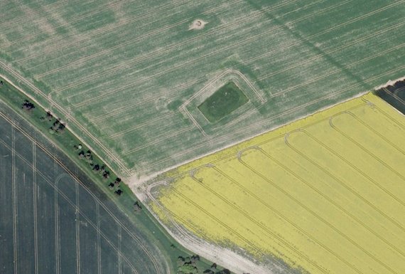
I was globe-wandering today, the cheap way—using Google Earth. These fields are just west-southwest of Stonehenge, and I just loved the colors and textures of the fields and borders, along with the barrows (or whatever), that the farmers avoided.
British archaeology literature often carries mention of crop marks, and Google Earth is an excellent tool for exposing them. Crop marks result from the differential moisture, soil quality, etc. above and around archaeological features (e.g., foundations or building wall bases, fire pits, etc.). The soil variation can be stark or subtle.
In this area around Stonehenge, crop marks and above-ground features are all over the place. Even after centuries of plowing and other degradation. Archaeologists now look at Stonehenge not as a bunch of stones, but as one dramatic feature in a landscape of occupation and use. Which is as it should be. After all, people didn’t just hang at Stonehenge.
Posted at 10:22 PM |
5 Comments »

Did just a few quick errands today, and my ground-alerted eyes found these two, in different parking lots. I found the cross one first (1974), and then the normal one (1984).
I guess they’re my two-cents worth.
(Perhaps misleading) title from The Big Bang Theory (TV show).
Posted at 7:40 PM |
2 Comments »