Musings

Desirable AQI, that is: Air Quality Index, is under 50, but conditionally okay up to 100. Guaranteed terrible for everyone is greater than 300. At the cottage, it’s been 500 for over 24 hours (this capture is from this morning), and 500 is the maximum on the scale. Color-wise, red, purple, and maroon are of escalating intensity, starting at 151. You can tell where the Canadian fires are, in the northwest of this map. If your northern North America geography is sketchy, that water in the north, and east of FireCentral, is Hudson Bay.
Posted at 7:29 PM |
No Comments »

Returning to Georgia, we avoided a traffic blockage on I-75 by taking the old road for a stretch, including passing by Lake Allatoona. Long ago, I spent months finding and recording sites on the land around the lake. Eons ago….

Our traipsing later took us by this urban art. I found the multiple figures influenced by a diversity of styles and subjects quite interesting, especially in their juxtapostion. From left, I see an unfinished face? with goat horns?, somewhat bulbous words/letters, a cat with a crown, a looming serpent, a prehispanic central Mexican-ish figure in profile, a step pyramid, a long-haired woman, and a scythe.
Posted at 9:18 PM |
No Comments »

The low-angle light was especially pretty this morning.

Then, taaah-daaah, we got on the road (OTR). The “marine” layer was thick-ish at The Bridge, and, also, we understand from others who treked north, along Lake Superior at Grand Marais. Since it was present through mid-day, and the sun had long been out, I’d say that’s a persistent layer.

We drove in and out of rain zones….

We even saw a rainbow. Apologies for the snap, but you know they don’t last. I tried to get another shot, and the color had become almost imperceptible.

Ohio has upgraded rest areas along I-75 to have almost lounge areas and museum displays in them.. Outside, there’re signs about native plants, mostly trees, but this is a showy not-tree I don’t remember seeing before (my ignorance is vast). Also, there’s a loop to stroll with many signs to study, I think part of Dolly Parton’s books-for-kids-under-five outreach program somehow (didn’t take the time to walk it—next time?).
Posted at 9:03 PM |
No Comments »
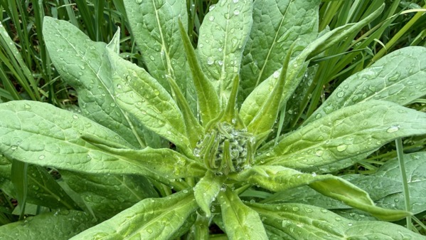
I’ve been watching the development of this distinctive large plant that’s next to the trail to the compost pretty much since we arrived. I was certain I had a shot looking down at it when it was all curled together at our arrival, but: nope. This was 15 June. Deep red flowers
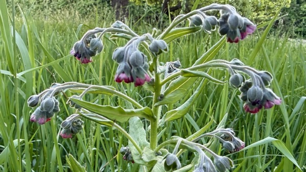
By 21 June, it was far more unfurled. I have no recollection of ever seeing this species before, here or elsewhere.

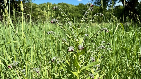
Here it is today, mostly shifted to developing-seed mode from flower mode.
Looking this plant up online, it’s common name is houndstongue, and it’s native to Europe and considered one of the worst invasive plants in this state. Geeze. I guess I should whack it tomorrow before the seeds are viable.
I already did some biomass management this morning, clipping the flowers off the hogweed plants in the swamp north of us about 3/4 of a mile. I didn’t have the energy to dig up the plants, which might really get rid of them, but that removal should halt new-plant generation.
Aha. Found it. This was 6 June.
Posted at 9:10 PM |
No Comments »
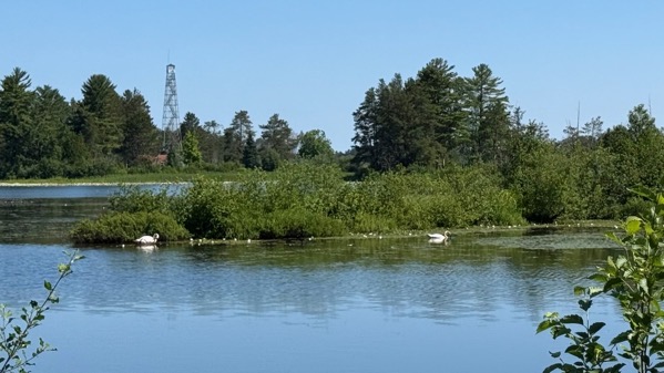
Swans and the old fire tower, closed to the public the last time I walked by it several years ago.
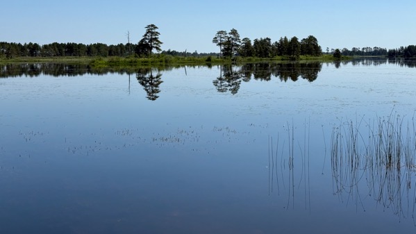
Reflections on still water….
Posted at 9:12 PM |
No Comments »
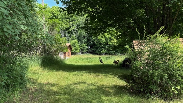
I hypothesize that these are the same two fawns we saw yesterday, here visiting in the early afternoon. And I saw them again several hours later in the same spot.

We’ve been seeing these distinctive footprints on the beach by the dozen…finally figured out they’re made by wild turkeys…which I have neither seen nor heard around the property.
Posted at 8:26 PM |
2 Comments »
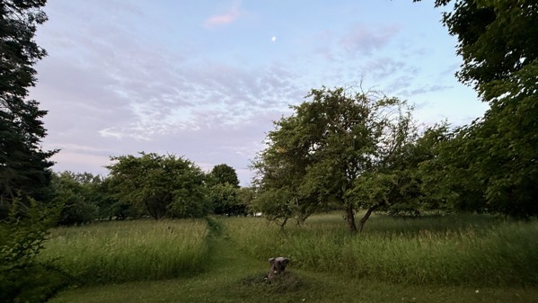
I was up early, and decided the moon needed to be captured, in that digital way we do these days. If you can see an irregularity to the left of the trail above the grass, it is a deer, ears and face peeking through the tallest stems.
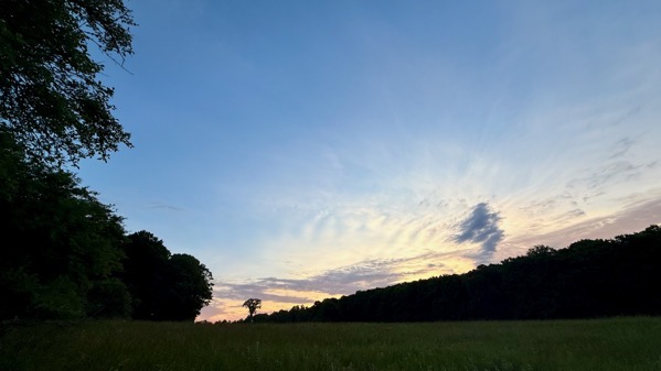
To accompany my “moon shot,” I walked around the other side of the cottage and caught the sky-color to the NNE. This was moments after 6am.
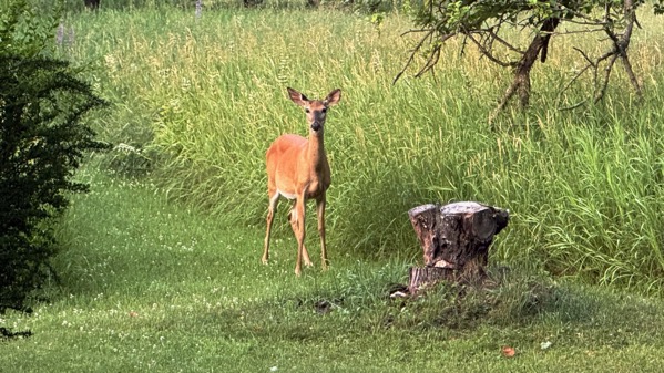
I went back around the cottage, and my grass-obscured amigo/amiga had come out to meet/greet me….
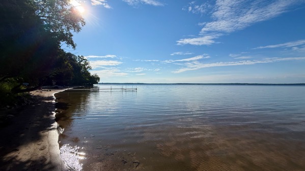
Okay, enough tall tales of moon-above and inquisitive deer, here’s the beach at 9am, all glistening in the early-day sun.
We closed out our holiday with a lovely potluck, great food and fabulous socializing. Once again, odds are I won’t stay awake for the fireworks to start (approaching 10pm?).
A sidenote: while we were chatting with a loooooong-time friend ensconced in a National Forest in Oregon at the end of a trail (but high enough to have cell service) about 7:45pm, two spotted fawns and a doe wandered by, and went down the path you see in the morning deer shots…. Full circle?
Posted at 9:01 PM |
No Comments »
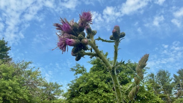
No, this thistle isn’t that tall; I just thought I’d try an up-angle, with the sky as background. Nice cloud patterns.
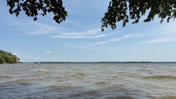
Here’s the view toward sunrise, but in mid-afternoon. You can see the tint of the sand etc. in the water, churned up by the waves.
The best you can say is illuminating, although not particularly interesting.
Posted at 6:51 PM |
No Comments »
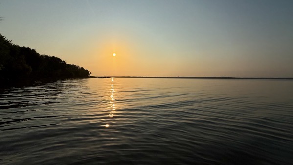
Sunrise. Still humid, hence the haze.

Surprise fish at the shore. Don’t know what kind; not leech!

Illustration of growing apples and apple green, highlighted by the low morning light.
Posted at 7:30 PM |
No Comments »

Did that title catch your eye? What I mean is that the humidity and murkiness evident first thing in the morning (here), and obscuring the far shore, heralded in a hot, moist day, good for reading and low-key activities all afternoon. And sipping ice water…that kind of day-drinking.

My morning beach tour became a leech-hunting expedition. I found the Garish Green Sand Shovel mostly buried in the uppper-beach sand on my first tour. It’s perfect for leech-tossing. The storminess of previous days sent lots of the boneless critters toward the beach, where I pitched them onto the beach, then tossed them to the off-beach vegetation. I returned a bit later to get a second harvest, as I found so many on the first visit. I think the total was two dozen. No lie.
Posted at 5:59 PM |
No Comments »