Musings

This elaborately carved pumpkin had a spotlight, and no other accompanying (or distracting) decorations or artwork. I wonder if that will change in the coming days….
So, are Halloween and Xmas, in their current USofA incarnations, the holidays that consume the most biomass in decorations?
Posted at 10:56 PM |
Comments Off on Elaboration of decoration
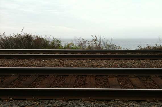
We couldn’t decide whether this was a marine layer or the air is crappy.
Translation: we have reached sea level!
Posted at 8:23 PM |
Comments Off on Elevation drop
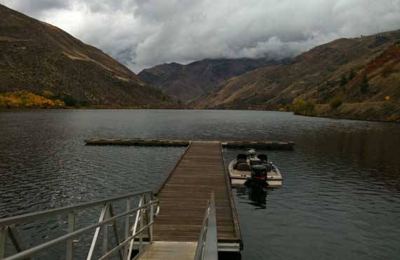
I never figured out how far south up the Snake River the section They call “Hell’s Canyon” extends, but this is upstream of the Hells Canyon Dam, and downstream of the population nexus They call Copperfield, at least on some maps and there on the ground, too.
The weather was working in our favor (mostly), and we made the run from Weister to Copperfield, then up and over (a couple of times), ending up in Joseph. The clouds were sitting on the highest places, and we really didn’t have much direct sunshine, but this was gorgeous territory (as RMJ had already told us!).
In sum, we saw lots of the Snake today (yesterday, too!), and late this aft we also saw pretty much where it flows into the Columbia.
In sum in only two words: rivers and ridges!
The lesson: geeze, we have dammed up a lot of rivers.
Posted at 10:58 PM |
Comments Off on Enjoy your electricity!
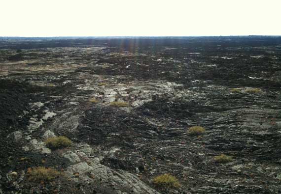
In geologic terms, time is—I can’t say relative, although it is, because it’s too trite—well, confusing. So yesterday was geology-in-the-making, geology-in-motion.
Today, in contrast, was geology in more of a holding pattern, although still geology of the Holocene (if I’ve got it right, we’re still in the Holocene…).
This afternoon we wandered around Craters of the Moon National Monument and Preserve, established in 1924. The park includes the largest primarily Holocene-epoch basaltic lava field, I think, in the continental US of A.
So glad we weren’t there in the heat of the summer, all that black radiating the daytime temps, but in today’s overcast, without direct sunlight, the lava became flat and difficult to judge, especially distances. Loved the spatter cones! (Sorry, photo is of old lava flows that were more photogenic today; can’t imagine this landscape is really like the Moon, though….)
Posted at 11:02 PM |
Comments Off on Moonishness on Earth

Only on rare opportunities do most of us need to spell the word “geyser.” Apparently our word comes from the name of an Icelandic geyser—Geysir—which is in the Haukadalur Valley in southern Iceland. Still, I have to think to get the spelling right, although I saw it on signs many times today!
While we were in the old caldera where Yellowstone’s geyser activity is found—apparently the greatest concentration of geysers in the world!—we saw lots of volcanic features (not cones, although the caldera is considered an active volcano), and, of course, the famous Old Faithful. Here’s what really surprised me about the old caldera: the continental divide loops into it, so that the floor of the caldera has two drainages, one to the east and one to the west. I found this counter-intuitive.
FYI: That’s the caldera rim framing the skyline to the left of the geyser.
Posted at 10:22 PM |
1 Comment »
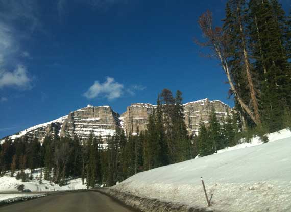
The internet has amazing amounts of current information, but sometimes it’s difficult to find it. So, here’s a bit that will be beyond difficult to find: the pass into Moran Junction from the east (Riverton, Casper), that is, into the Grand Tetons/Yellowstone from the east, here’s the lowdown: big construction project currently focused on what I’d guess to be road widening at the top near the pass (apparently this will continue all winter!). We drove on some horrific but thankfully shallow mud (we now look like we’re driving a white Prius that was splashed with a frappuccino) bypassing the construction equipment, along a stretch that the radio road report said was a “dry road”—or maybe they meant the paved part was dry (it was!)!
On the other hand, despite many many signs warning us to watch for loose cattle (doing what?) and general wildlife, we saw other vehicles, beautiful sunshine, and no four-foots or hoofy creatures or whatever….
Posted at 10:26 PM |
Comments Off on Drive carefully!
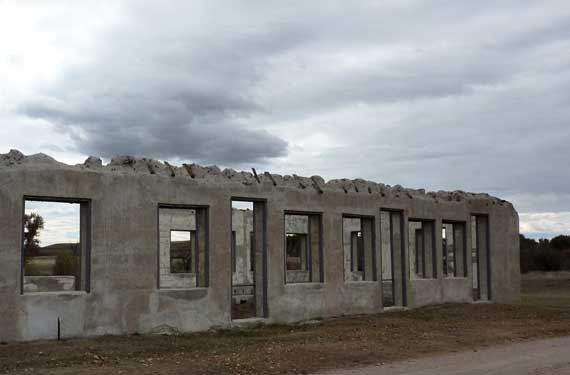
The sky had been pretty darned clear, extending from horizon to horizon as is common in the west, then, as we were arriving at Fort Laramie, the historic fort not the town, the clouds appeared overhead. So we toured the parade ground and open buildings under dramatic swirling greys, catching a few drops as we scurried for the car after checking out “Bedlam,” the boarding house (if I recall correctly) that is the oldest standing historic structure in Wyoming.
This ruin may also have merited the moniker Bedlam, but is properly called the administration building….
Posted at 10:22 PM |
Comments Off on Visiting “Bedlam”
…you’d be home by now!
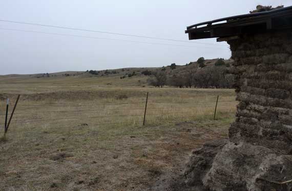
Viewed under homogeneous blue-grey skies, sod house life struck me as rather tedious and grim. In sunshine: perhaps not so much.
This sod house in far western Nebraska is open to the public, with an interior bare of accoutrements and even wall stucco/plaster, and thus hominess. The walls appear to have had two thick layers of sod, but the outer one has mostly eroded away—or maybe it was just double along the lower part of the wall, for buttressing?
As to the roof, it’s been updated, as traditional sod house roofs are no picnic and take lots of maintenance (and leak when it rains). I love that they put enough soil on the metal roof so it looked more like a soddy (although some has washed off), and prickly-pear cactus have colonized it.
Posted at 10:22 PM |
Comments Off on If you lived in a sod house…
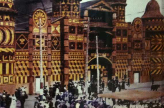
Is this an “Only In America” place?
A building decorated annually with murals made of food?
The Heartland contrives some interesting promotions, then perpetuates them for generations.
You may recognize this building from this historic photo; it’s the Mitchell Corn Palace, originally the Corn Belt Exposition. For more info, try WikiPee or their own (cringe) website.
Posted at 10:22 PM |
1 Comment »
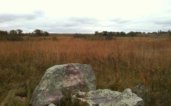
Quite a combo: the quartzite outcrops in the (almost) tallgrass prairie. This is at Pipestone National Monument.
The pipestone is a band beneath a quartzite layer. Both settled out of a long-gone sea. The coarser sands formed into the quartzite, while the finer clays became the pipestone. If I have it right….
Anyway, they still sell the little turtle figurines you may remember from when you visited aeons ago (as I did), but the modeling style has switched to angular. I assume the rounding took too much time, so the artists now just saw out the figure and sand the sharp edges a bit, then move on to the next stone bit.
The fresh snow that came through this morning was mostly melted by the time we walked the Pipestone trail, but the remaining bits of white and the heightened color of the well-watered lichens (both greys and not-greys) made it spectacular, even under pewter skies. The picture makes it look nicer than it was.
Posted at 10:22 PM |
Comments Off on Wandering (ex)tallgrass prairie