Ritual landscape = art
Wednesday, 18 December 2013
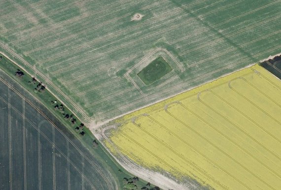
I was globe-wandering today, the cheap way—using Google Earth. These fields are just west-southwest of Stonehenge, and I just loved the colors and textures of the fields and borders, along with the barrows (or whatever), that the farmers avoided.
British archaeology literature often carries mention of crop marks, and Google Earth is an excellent tool for exposing them. Crop marks result from the differential moisture, soil quality, etc. above and around archaeological features (e.g., foundations or building wall bases, fire pits, etc.). The soil variation can be stark or subtle.
In this area around Stonehenge, crop marks and above-ground features are all over the place. Even after centuries of plowing and other degradation. Archaeologists now look at Stonehenge not as a bunch of stones, but as one dramatic feature in a landscape of occupation and use. Which is as it should be. After all, people didn’t just hang at Stonehenge.