Musings
Rainy morning kept us close to the coffee pot, then we mobilized for a “Sunday drive.”
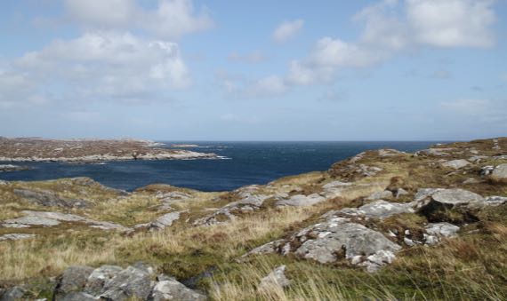
We drove into sunshine and sea-views.
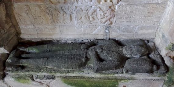
Our route took us to a ca. 1500s church (or it dated to then “originally”), no longer hosting sermons and serious talk. However, several important Jacobite and post-Jacobite MacLeods had themselves planted here…. The black stone of the knight-of-death is from their other home-island, Skye (as I understand it).
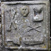
Several grave-markers in this church and church-yard used these symbols. I found it most difficult to get past the crossed long-bones (like femurs). Why did they bother me more than the skull-representations? No answer.
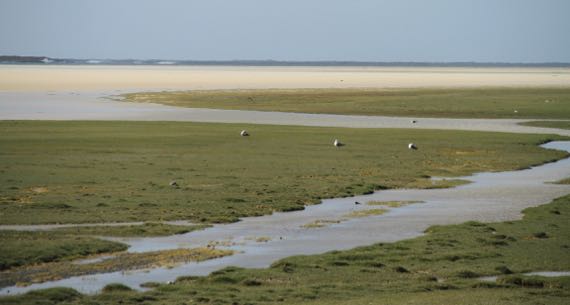
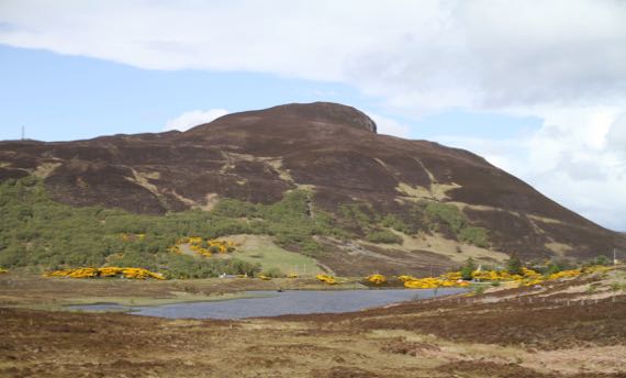
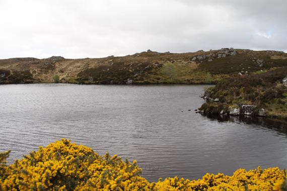
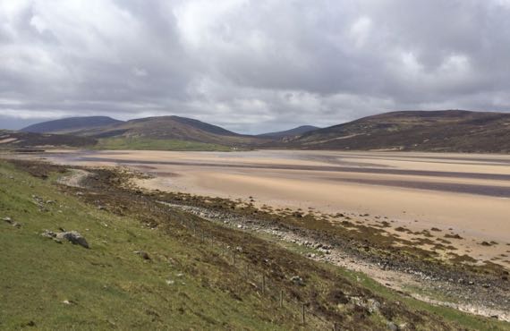
We moved beyond into the land of MaNature, and these tidal flat areas (if that is what they were), along with the shallows tinted by waterborn golden sands, captured my eye.
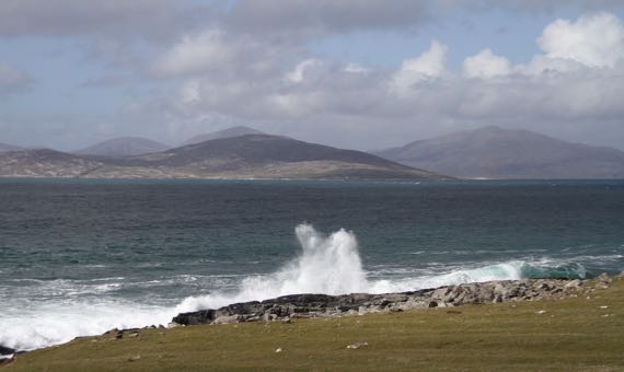
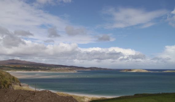
Another bay or so up the road, we found crashing surf and glorious blue waters near-shore….
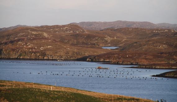
Later, back at our ranchito-of-the-moment, we watched the light change over the mussel-ranchito-of-the-loch…and the moon rise above (not shown).
Lovely day!
Posted at 6:46 PM |
Comments Off on We moved on from the morning’s rain
We moved through the landscape like we were nudge-budging time.
We began with an unexpected tire event…on the OTHER rental car…. Some confusion on my part, as we both, that is each couple, arrived here in a white rental car…. After several attempts, I finally got straightened out…and permission was given for tire replacement/fixing to happen, using a nonspecified contractor…. Then we discovered that the tyre business we could find (TY, G__gle!) in these parts is closed Sat and Sun, so the next phase of the tire fixing event will happen Monday…. The “boys” installed the “real” spare, and the car is back safely in the driveway, awaiting the weekday opening….
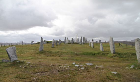
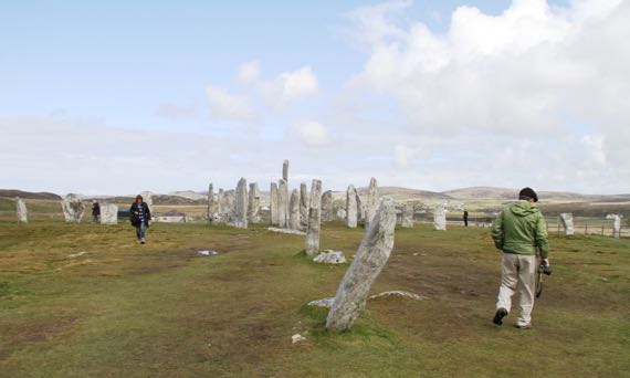
Our first (scheduled) stop was this fantastic four-pointed array of standing stones with a circle of stones and even a burial cairn in the center. What we see today is the result of several hundred years of additions and modifications…. Plus agricultural use as late as fifty (I think) years ago, when this was a potato field (if I have it right).
For me, the space and place was magical in that this hilltop and the laboriously erected stones seemed like a place where peace reigned. My projection? Probably.
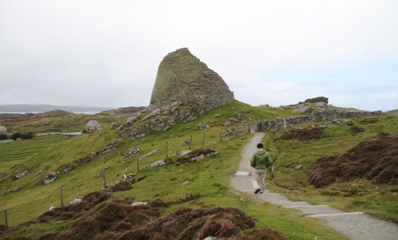
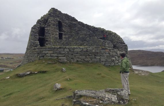
This magnificent circular structure dates perhaps a millennia closer to our own times, but still in the distant past. We read that no one knew the purpose of these huge circular buildings, and we also read about how it contained multiple levels of living spaces, likely used by several…families…. This broch (Friendly Autocorrect: plz don’t change it to broth again!) is huge and within the two-walled enclosure were steps and passages that permitted movement up and down, from level to level.
Very moving. Very different from the standing stones/stone circle….
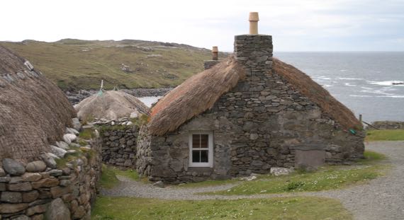
We also visited a blackhouse village (that’s blackhouse not blockhouse, Friendly Autocorrect). The last residents moved out maybe in the 1950s(?), and about 15 yrs ago preservationists began to reconstruct and preserve this cluster of blackhouses. We found displays and people here extremely informative…but I neglected to discover the reason behind the naming…. I heard that previously there were white-houses, hence the name as the structures contrasted in some way. I also heard that the peat fires inside blackened the interiors. Mostly, I just absorbed what it might have been like to live in spaces with your sheep/cattle, to have a dirt floor in your house, and to nearly always have your nostrils filled with the scent of burning peat. My imagination may not match reality.
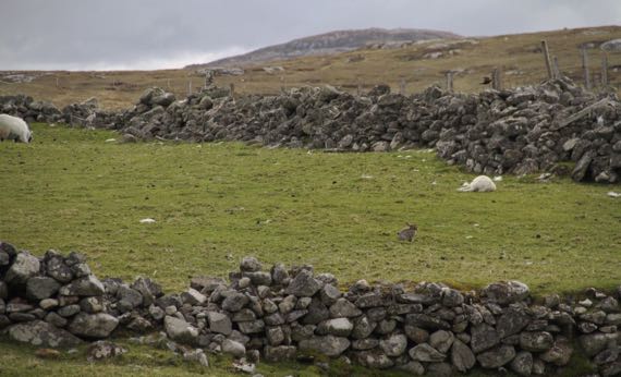
Adjacent to the blackhouse village was a rabbit village. [Rabbit is more central and in the fore-ground than sleeping lamb. Rabbit’s friends and relatives didn’t make this crop….]
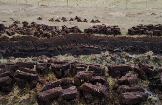
Still trying to figure out the complexities of peat cutting and drying. From my limited understanding, this bunch of peats is in the first stage of the drying process, which may take at least six weeks and can be longer if it’s repeatedly rainy.
Very exciting day all around. Plus, we watched the moon above, and we have seen the loch in front of our rented cottage in the hinterlands become still-surfaced. Given the constancy of the wind, I was very surprised by this…nature-mirror…moment.
Posted at 5:50 PM |
Comments Off on Time changes (noun verb)
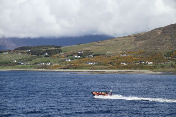
Another day, another ferry ride to an island. NOT yawn! Spotted a much smaller craft sharing our waters….

Found a colorful lighthouse…at the end of the road in one direction.

And a sandy beach in a cove at the end of the road in another direction.
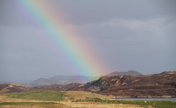
What better welcome to our new housing than this colorful presentation from the sky-deities!
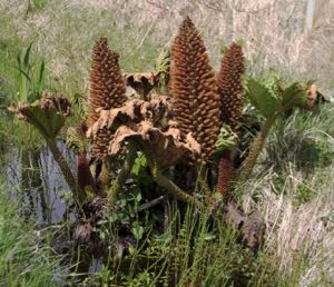
This plant is foreign to me. Found in a marshy ditch, maybe a half-dozen others within several hundred meters. Haven’t spotted it elsewhere. Distinctive. Several of the leaves are damaged, perhaps by frost? The brown pineapple-y features are from this year, not carry-overs from last year’s flowering/fruiting….
Posted at 10:22 PM |
1 Comment »
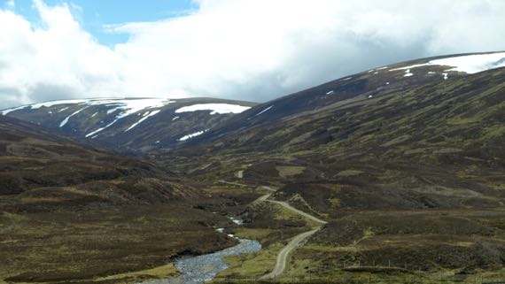
We looped through the northern highlands, watching the clouds come and go, and the landscape change. Here, hidden lakes….
Arms of the sea poaching the land….
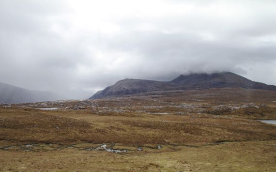
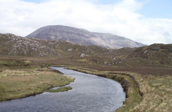
Mountains obscured by clouds, slopes peppered with rocks and cut by rivulets, sometimes with substantial rivers below.
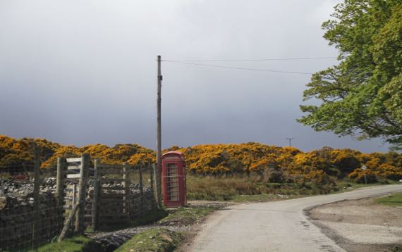
In this land with rare cell coverage, telephone boxes remain in use (“Coins and cards”) at bus stops that the residents of side valleys use to access the outside world….
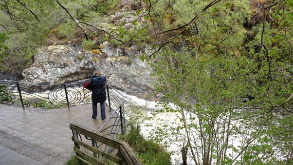
We even visited a good-sized waterfall, the slopes above it colorful with spring wildflowers, grass shoots, and thriving mosses.
We found Ma Nachur’s eye candy everywhere.
Posted at 4:22 PM |
Comments Off on Northern highlands
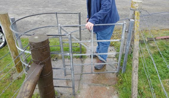
We are frequently entering landscape-spaces that are maintained by four-foots. To keep them in the right zones (aka pastures), we often pass through this kind of gate. I call them nudge-gates in my head, as I don’t know the “real” name. The gate section pivots, and you can only pass through if you pull it, then pivot around it. Since the sheep (mostly), only nudge the gates, they effectively close off passage…and remain in their designated area. Meanwhile, after we pass into the sheep-zone, we must “mind our shoes,” as they say here….
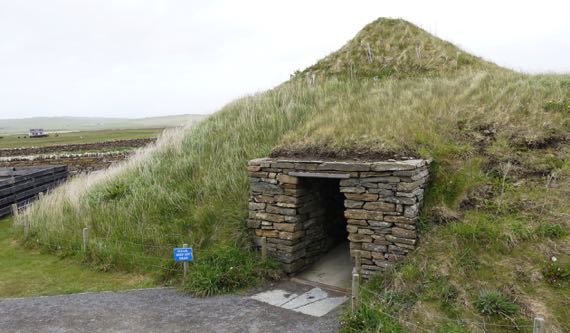
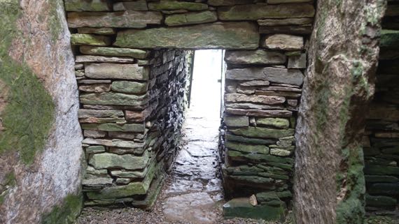
Skara Brae (say scare-uh bray; extra points if you can do the Scottish “r”) is a 5K-yr-old Scottish Neolithic hamlet that was buried by sand dunes perhaps 4500 years ago, and only exposed after a storm in 1850. Parts were being excavated as late as the 1970s. The domestic units are circular stacked-stone structures, entered through a low, covered passageway. The settlement has about six units that were occupied contemporaneously, although it’s atop an earlier set of household units that are unexcavated as that would involve removal of the later ones atop them. Anyway, this is a reconstruction of one of the houses, but without the passageways that lead to neighbor-homes and would have looped around it.
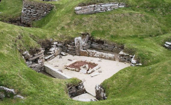
Here’s the real thing, roofless and open to the sky. The sign said that people brought refuse here to pile up around their houses when they built them, which sounded strange to me and I wondered what the archaeology revealed that made that the most plausible interpretation.
The big box in the middle contained the hearth. The chambers around the outside with stacked stone walls were storage costs. The spaces delineated by stones standing on edge are called beds. I would guess that they were filled with vegetation to act as padding/a mattress; I didn’t see an explanation, though…. Built into a side wall are shelving units that are interpreted as for food processing. In the reconstructed unit there were small stone-lined boxes inset into the floor that were interpreted as being filled I assume with sea-water to hold crabs…fresh meat!
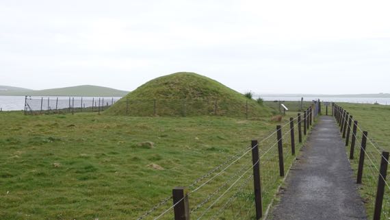
We also visited a chambered cairn. We could not get into the massive Maes Howe cairn, as the tickets are very limited and we didn’t act fast enough. Maes Howe is later than Skara Brae. The chamber inside is huge, and the passageway that leads to it is 36 feet long. This is gigantic earthen architecture. It likely was built for multiple purposes, although it is usually described as a burial mound, as bodies indeed were interred there. [Consider that we describe a Christian church as for services, including weddings and baptisms, when people may also be buried there.]
So, since we couldn’t go to MaesHowe, we went to a smaller chambered cairn that we were able to visit without ticket hubbub, which sits on a peninsula, very quiet (except for the wind).
This one has five chambers in a line perpendicular to the entry tunnel, with the chambers separated by upright stones (compare to mini-standing stones…). You can see the uprights to the left and right of the doorway. One came out from each wall, and you pass between them to move from chamber to chamber. Excavators reported human bones from each of the five chambers. This cairn also offers a great habitat for mold etc, at least during the humid season….
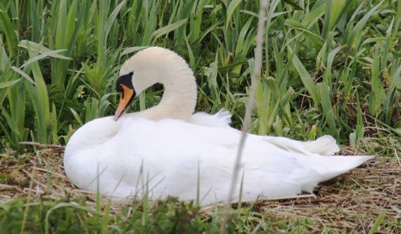
We aren’t just looking at sheep, seagulls, cattle, other marine birds, wandering cats, fishing boats, ferries, and military jets on maneuver…. This is the Guru’s favorite of the swans we’ve seen, and she’s sitting on a giant nest (which matches her size). I think she’s a mute swan (Cygnus olor), but bird IDs are not my specialty.
The rain has kicked up again, and I think I missed my opening to walk…on the other hand, I didn’t get caught out far from the B&B!
Posted at 1:06 PM |
2 Comments »
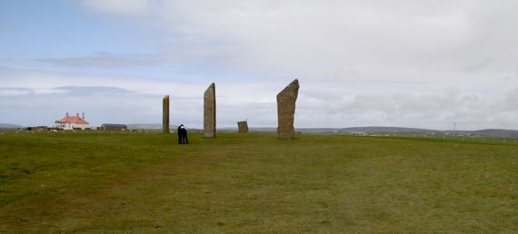
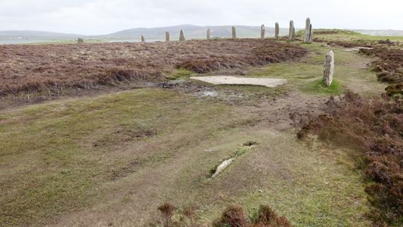
Although some stones are missing and others broken, this ring of massive stones was perhaps the earliest constructed in the British Isles. The henge (encircling ditch/ring made from that soil) is mostly plowed away, but we could see the remains of it. These are BIG stones.
In sum, the Stones of Stenness is an old feature, has nearby alignment stones, and is not a particularly large henge.
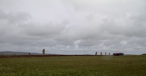
In contrast, the Ring of Brodgar, just over a kilometer away, is huge, one of the largest henge/stone circles in the British Isles, although the individual stones aren’t as broad/tall. The henge is on a slope such that from this perspective I couldn’t see all of them, although the size of the circle is evident…. That’s a large bus-load of high-schoolers to the right.
The rain started when we were half-way to the henge, but by the time we turned back, it had stopped (thank you, Odin or whatever forces smiled upon us). You can get a sense of the slope that this circle/henge is on, and see a cairn to the right, next to and outside the henge.
The Ring of Brodgar was created much later than the Stenness circle. Around these features are single and paired standing stones, larger and smaller cairns, cist graves, and even a village…today called Barnhouse—at least these are ancient features that have been recognized so far….
This was an elaborate ritual landscape, a rival to the Stonehenge area, and in use for a millennium at least. These two stone circles were on two narrow spits of land that point at each other and today are connected by a causeway; they used to be connected by stepping stones, perhaps even in ancient times. They are inland from the open sea, but connected to it by water. In addition, there are some pottery types found here and in southern Britain and Ireland; at minimum, the peoples who made/used these features had some long-distance contact.
This is a special area…. There’s another henge farther north, but no obvious public access. I could see it in the fields; it has a somewhat shallow but very wide ditch, and has been altered by generations of plowmen.
And now for something completely different…this is the view from our room under the eaves (several of our rooms have been under the eaves…). Love the fisher-dude getting out of his wetsuit to hop in his Honda sports car and resume his life on land…. Also, sheep-dots in the distance…. Many people walk their dogs out this road/trail, which seems to go to several WWII gun emplacements(?). BTW, we went to a town the other day that had a plaque that said the British military temporarily emptied the town to use the area to practice for the Normandy invasion….
Posted at 5:41 PM |
Comments Off on Stones, henges…
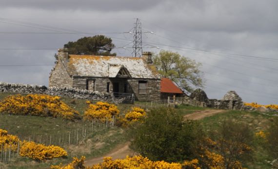
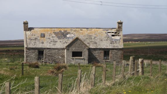
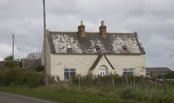
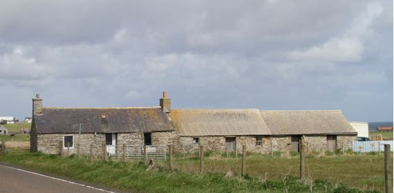
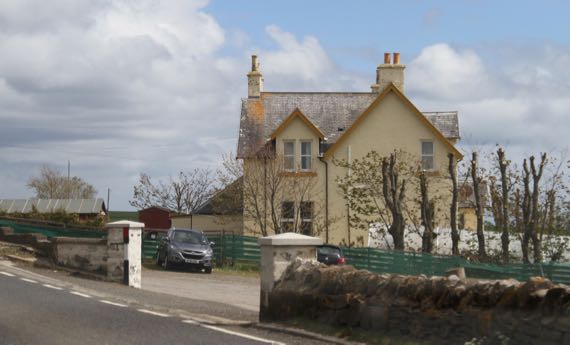
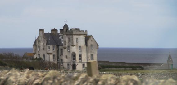
If you lived here, you’d be home now.
Needs work.
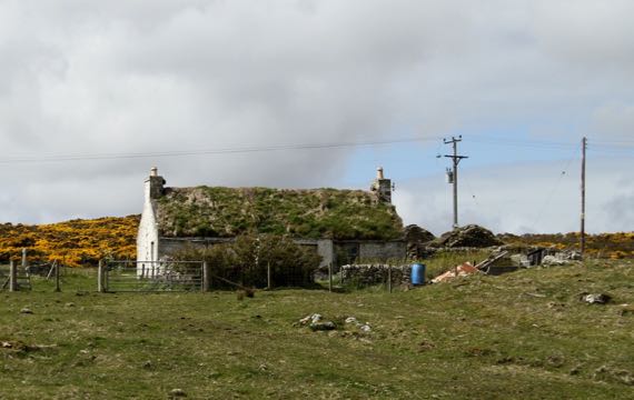
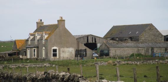
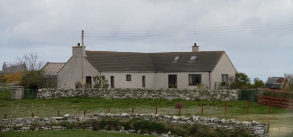
Ready to occupy.
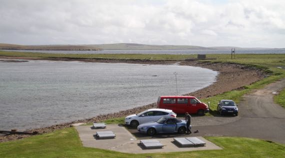
We also took a ferry. Not too much open water….
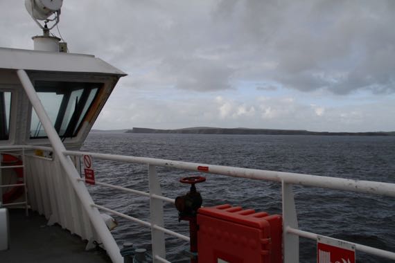
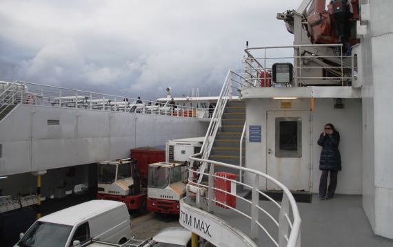
I was expecting the horn to blow at any moment. I’m in the corner because it was rather cool and windy.
The crew loaded those large trucks first. They had to back on, and did it like they’d done it dozens of times before. The crew cinched the trucks down with big chains. No chance they’d shift during passage! For most of the trip, we were serenaded by several car-alarm horns; clearly they had not been calibrated for sea-worthiness….
Posted at 10:22 PM |
Comments Off on IYLHYBHN (aka land…and sea)
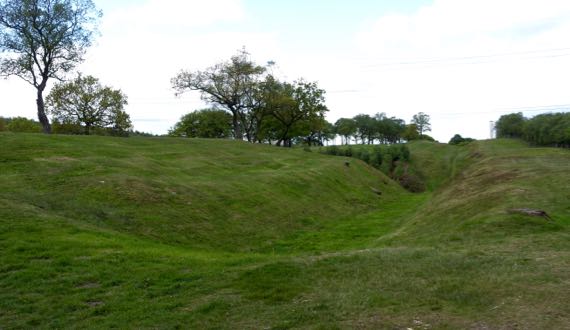
This may be the last about Roman occupation on this trip. This is a turf fort on the Antonine Wall, called Rough Castle. The Romans took twelve years to build this wall, and after eight more years they abandoned it (the forces of political economy…). To the right is the land of the barbarians, with a ditch and rampart in the mid-ground, facing the threats…to the far left is the fort, and I am standing on a gate (I assume; one sign on the whole fort…). This is the second-smallest fort along this wall, and the best preserved. It’s rough, humpy ground surrounded by a ditch, and would be a royal pain to sketch-map with a compass by pacing.
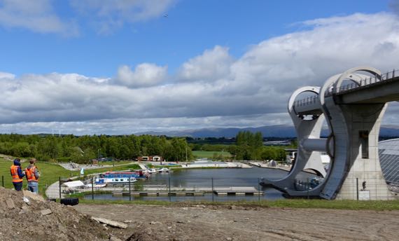
By the time we got to the other side of the hill (roughly speaking), the sun was out, and we found two guys and a drone watching the Falkirk Wheel. This is some major industrial engineering to bring boats up/down between two canals at very different heights. The drone is left of center near the top and the boat is at the bottom ready to enter the lower basin. The arm takes the boat and water on side, with a counterbalance on the other. This lift replaces eleven (I think) locks that used to be used to span the 79–foot elevation change.
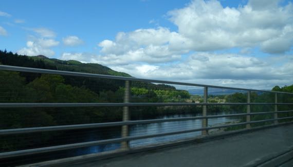
As we climbed, we saw many plantations, including bits of Tay Forest. Some of Tay Forest is old(er) growth…. And rivers, some with rocky beds and rushing water. Elevation….
As we climbed higher, we got above the treeline (or at least where trees have not returned since the last glaciation), into glacier-rounded peaks and valleys, with some snowpack remaining. The dark brown landcover is heather. The lambs up here are much younger than at lower/warmer elevations, and most were hunkered down napping, not gamboling about, as we have seen everywhere else.
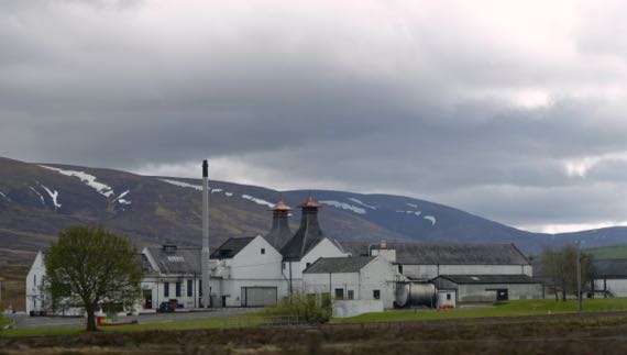
We have driven past several whisky distilleries, but have yet to stop. Crazy, eh?
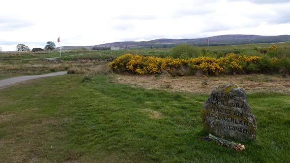
Many men died on this relatively flat moor, properly called Drumossie Muir/Moor, including Scotsmen fighting on both sides. This is where the Blàr Chùil Lodair, or Battle of Culloden, happened beginning about one in the afternoon of 16 April 1746. The Jacobites, who sought to restore their beloved Stewarts to the throne, opened with cannon fire, and English forces answered with their own cannon. As the National Trust for Scotland puts it:
Bombarded by cannon shot and mortar bombs, the Jacobite clans held back, waiting for the order to attack. At last they moved forwards, through hail, smoke, murderous gunfire and grapeshot. Around eighty paces from their enemy they started to fire their muskets and charged. Some fought ferociously. Others never reached their goal. The government troops had finally worked out bayonet tactics to challenge the dreaded Highland charge and broadsword. The Jacobites lost momentum, wavered, then fled.
Hardly an hour had passed between the first shots and the final flight of the Prince’s army. Although a short battle by European standards, it was an exceptionally bloody one.
Culloden was the last pitched battle on the British mainland, and the ramifications for the Scottish people have been immense. The English subsequently sought to suppress ethnic Scottish behaviors, including kilt-wearing, the Scottish Gaelic language, and the clan social structure. The effect of these changes was a depopulation of hinterlands, and disruption of pretty much everything Highland.
This and other rough stone markers were installed in the 19th-C. Archaeologists have used non-destructive, remote sensing techniques to define the areas where bodies were buried in mass graves.
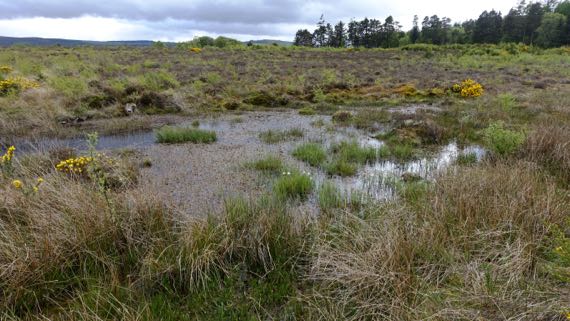
Another problem for the Jacobite troops was that the part of the battlefield they sought to cross was even wetter than today, slowing the advance of a major portion of the line. Indeed, this was a little marsh we found that would have been difficult to slog through.
Managers of the battlefield are encouraging the plant species that were here on the day of the battle, and the moor is turning from pasture into…gorse and grasses, along with wildflowers and other woody plants. One type of feature that was here in 1746, but is mostly gone now, are stone field enclosures…. The powers-that-be are also trying to convince landowners in the preservation area to refrain from tree plantations.
Such are the cycles of land management.
Posted at 4:22 PM |
Comments Off on From violence-bracing to violence
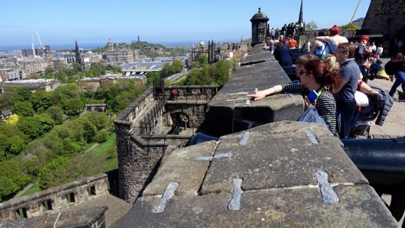
The preferred castle location: defensible, lofty, fortress position. From this massive castle hill, Edinburgh is laid out below, with occupation stretching to the Firth of Forth, where the River Forth melds with an arm of the North Sea. I loved this parapet, and the views.
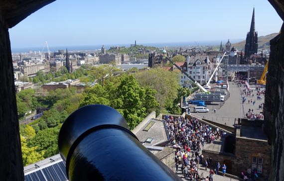
Of course, the cannons also have a great view. BTW, that mass of people to the right of the barrel and far below, sweating in the sun…that’s the line to buy tickets. It’s a holiday weekend…plus for a while, three of the six windows were closed. Sheeesh.
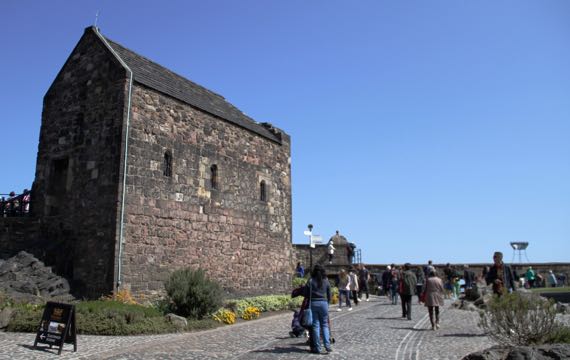
You can see a bit of the volcanic whatever that makes this feature extend far above the surrounding landscape. All the cannonballs and castle-terraforming have not eradicated or covered it. This building is the oldest one standing up here, a chapel dedicated to St. Margaret of Scotland (~1045–1093). It was built by her son, David I, previously mentioned in this space…. One of the fine things Margaret did was establish a ferry across the Firth of Forth. [Now there’s both a railroad and a road bridge.]
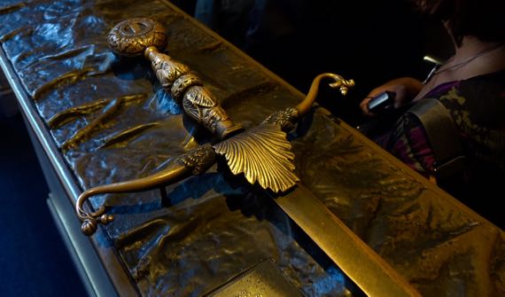
The most moving exhibit for me was our visit to the stronghold within the castle, where the Honours of Scotland are kept. These are the most symbolic objects in the nation. No photos/film allowed, so outside are bronze…not-quite-replicas. This is the claymore/sword (replica), which has a 4.5 foot blade. The real one is a bit more battered, and a bit sharper. Also in the room with the Honours is the Stone of Scone (I’ve seen pronunciation suggestions both as “soon” and to rhyme with done; haven’t heard anyone say it). I wanted to be more excited about this stone, for its history, but I couldn’t get there. The Stone has been used in coronations for something like eight centuries, customarily stored in the chair in which the sovereign sits when the coronation happens. It has a checkered history, and many doubt that this is the original. No matter; it remains very meaningful today. It was in England for recent centuries, and used in coronations there, and finally returned to Scotland in 1996. It’s not pretty, just rough, pitted sandstone, and suffers in comparison to the shiny and glittering sword, scepter, and crown in the same display.
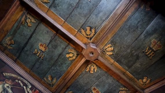
This is the ceiling of the bedchamber of Mary, Queen of Scots. It’s a small room, with nice wood paneling. And a window. And paintings on the walls just below the ceiling. I have no idea what furniture was in this room; there’s just a chair now.
I kept trying to visualize the pre-Scottish fort that was here, and the earlier castle-layout(s). This castle is still in active use, for official activities, for rental, and of course for tourism. Outside the gate, they’re installing a huge seating gallery, using giant cranes to lift large steel I-beams into position. I didn’t catch what it’s for….

Posted at 6:36 PM |
Comments Off on Super-castle!
No, I haven’t tried cullen skink yet. Or haggis. They’re on my to-do (or to-eat) list…. I’m told cullen skink is a haddock and potato soup. I’d call it a chowder variant…. I’m assuming you’ve heard of haggis….
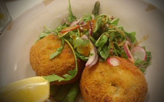
I have tried fish cakes. Three times. They’re small bits of fish mixed into mashed potatoes, then made into cakes that are then deep fried. At least, all three versions I’ve had were done that way. Maybe at home sometimes they’d be pan-fried.
This version is made with cod, and has sorrel bits added for even more flavor. These cakes are served on a bed of asparagus with a wee salad. Yum; meat and potatoes in one dish!
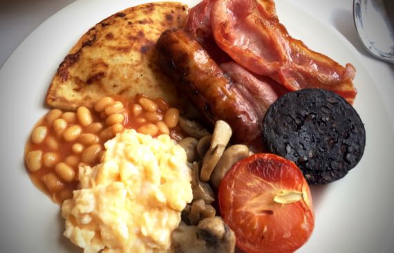
The full Scottish breakfast (toast, tea/coffee not shown) is very similar to the English version. (In fact, shhhh!, I can’t tell them apart.) Some skip the beans. Some have different fried bread options. Some include potatoes in a fried patty, often triangular. Probably, many people have an eew factor over the black pudding (sausage of pig-blood, grain, not sure what else, sliced and I think fried)—but we only had this item offered in northern north-England—not in London.
What I find curious about these breakfasts is the mixture of items…. The broiler-singed tomatoes, for example…they’d be available in pre-hot-house days just in the fall, and not over a long period then. And I think of blood sausage as also harvest food…. And what was the seasonality of mushrooms traditionally? Anyway, when you’re upscale these days, you get all sorts of proteins for breakfast, and a lot of fried on top of that…all together, not super nutritionally. I understand the preferred breakfast used to be kippers. Stinky/strong fish at breakfast time, yum.

This is a Scotch pie. It’s pie crust artfully wrapped around a sausage patty, then baked. It’s about 3 inches across…I guess a variant on the pastie idea.
That’s enough for now; I’m making me hungry!
* S for Scotland.
Posted at 1:37 PM |
1 Comment »