Musings

One way to look at today is that there were pairs…of medieval monastic/church complexes and harbor-cities.
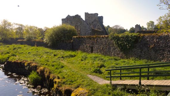
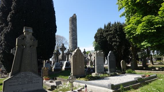
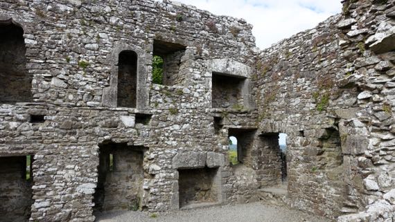
These first two photos are of Kells priory. This one was founded in the 12th C by Anglo-Normans—some of the ruins inside the wall. Then, the wall was added in the 15th C, and the whole thing was attacked in the Dissolution in the 16th C. Anyway, the ritual architectural core is next to River Kings, and the adjacent settlement was on the slope above and the hill to the south.

Here’s another 12th-C cathedral complex in ruins. It was sacked a bit later, in the 17th C, and some well-meaning??? Englishman had the roof removed in the 18th C. You can guess my take on that.
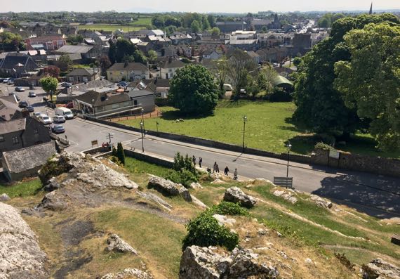
This one, however, is atop a limestone outcrop, very dramatic. It also has a wall, but mostly the defensiveness is due to the bedrock it is built upon. Here’s the view of town from just a few feet from the cathedral ruin.
Such different choices…next to the water and the riverine transportation network vs atop a defensible peak. Supply lines are different. These aren’t far apart in space, and the surviving architecture overlaps temporally….
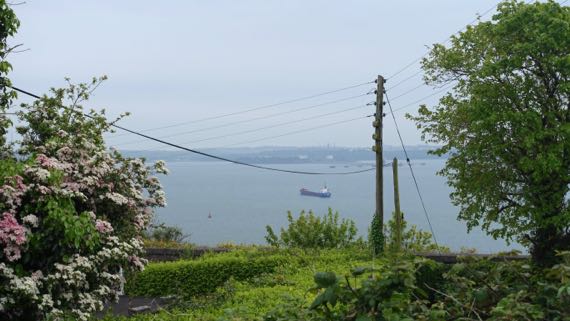
Here’s a view of Cobh harbor. This was the last port of call of the doomed “Titanic,” in 1912. Uncounted Irish set sail from here for the New World, hoping, as is often said, for a better life. I think of Cobh as the outer harbor area in the same estuary as Cork, which is in a more protected location farther inland–but doesn’t have the deep draft for larger “modern” ocean-going vessels.

This is the estuary between Cobh and Cork, and there’s a car ferry that goes between the two cities traversing the River Lee in the shot. Notice how the overcast has set in; we have lost the sunshine we’ve had since we arrived (where’s my raincoat gotten to?).
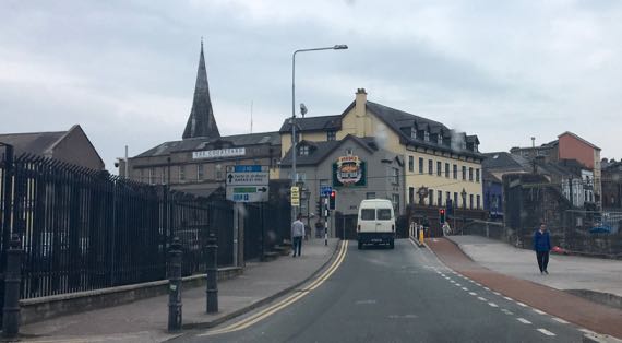
We’re headed south over the bridge that is where the bridge was in medieval times, exiting Cork to the south. The plan of walled medieval Cork survives as narrow streets and bottle-necked traffic. Charming layout, slightly gritty city (or is the overcast skewing my perceptions?).
Ponder these two cities. One (Cobh) is nearer the open ocean and has a deep harbor, an advantage in “modern” times. The other is farther inland, at the farthest downstream that crossing the rivers that forked around the city was relatively easy. Cork was a Viking stronghold far later than most Viking cities in Ireland; the Vikings liked to be inland of the river-mouth, with the security the protected location offered. Archaeologists have found another Viking settlement with ironworking and other crafting even farther upstream, which was unanticipated and suggests that, at least here, the Vikings located activities that required expensive materials even farther inland in an even safer location.
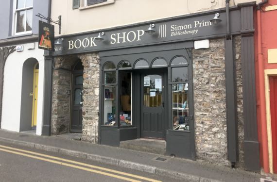
We kept rolling south to Kinsale. I like that this shop offers bibliotherapy. Maybe you’ve heard of it, but I haven’t.
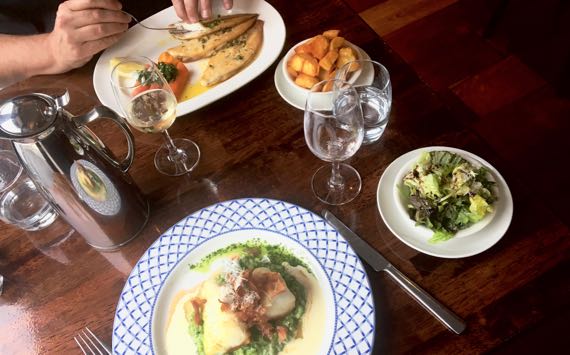
We even had a fancy fish dinner in Kinsale. Delightful and tasty. For dessert, I swooned over my crème brûlée, and the Guru’s pavlova and strawberries was gorgeous and seductive.
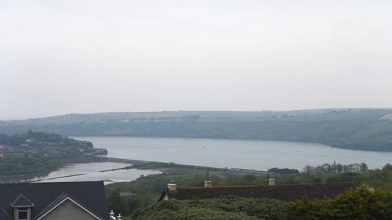
And score another fine B&B for us. This is the view from our room—ignore the overcast….
Posted at 4:29 PM |
3 Comments »
Foreground: ruins of medieval (13th C?) cathedral at Ferns. Five window arches survive on one side, and one on the other. Rear: current mostly 19th-C church.
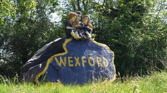
Wexford winsome trio.

Dublin schoolgirls learning about high crosses at heritage park (HP). “Monk” guide did a great job.
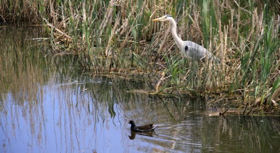
The Guru captured a heron and friend in the crannog’s lake at the HP.
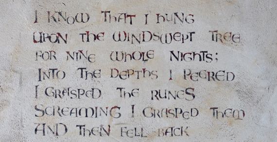
Stenciled quote (lines skipped) from Hávamál on wall at HP.
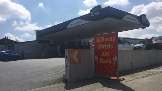
Emo petrol? Killeens swirls?

Tintern Abbey; that is: Tintern Minor abbey. Much modified, but most of “the bones” of what we see is probably 16th C. Used as a residence until 1959.
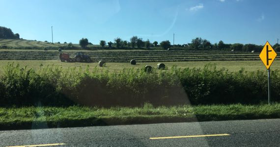
Today was busy-farm-equipment day, including many tractor-rigs on the road. Two days ago, it was paint-your-front-fence day—we saw three being painted and one being pressure-washed‚ none before or since.
I want this label!
The Guru made Droney fly for the third time here.
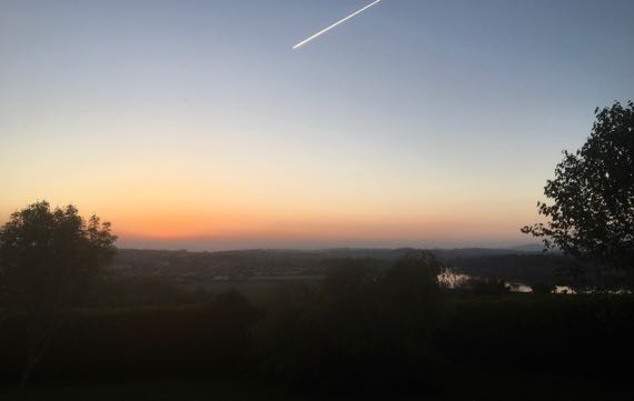
Given that the iPhone darkens a shot like this, you must compensate. I could easily read a book in the ambient light, although it seems darker in this version. This was at 9:02pm. And it’s light out very early, too.
Good night, all.
Posted at 5:07 PM |
2 Comments »
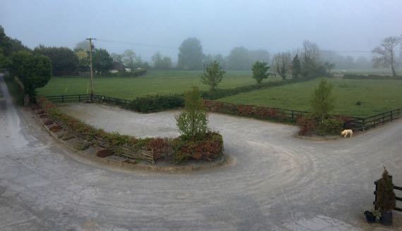
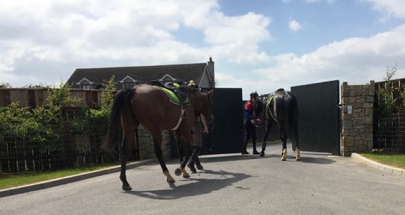
This morning, fog shrouded the horse farm where we stayed last night. Love the dog on patrol.
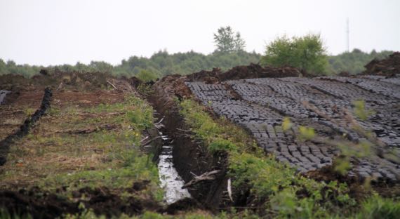
As we rolled out, we came across another mechanized peat harvest area. I think the depth of the drainage ditch indicates how deep the harvest of peat will extend. Across the road, it looked like at least six feet (vertically) had been removed. Now there’s a national movement to clean up the air by limiting coal and peat burning in residential and noncommercial buildings.
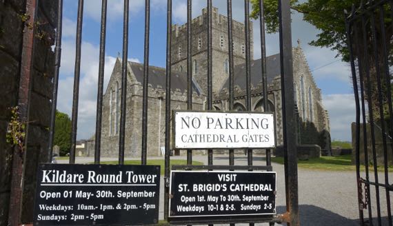
We made our first stop at St Brigid’s Cathedral in Kildare. Brigid lived from ~453 to 523. She founded a monastery here in ~480. This building dates to 1223, and has substantial 19th-C reconstruction. There’s an odd rectangular area outlined by a low wall in the churchyard that is called the Fire Temple (rebuilt last in 1988, I read), marking where it’s believed that nuns kept an eternal flame going to honor St Brigid. It’s somewhat like Rome’s Vestal Virgins, no?
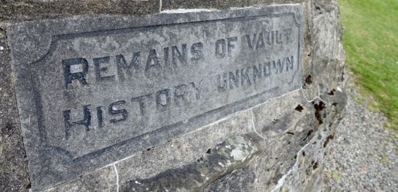
Loved this sign on a strange nubbin of architecture—Remains of Vault…History Unknown.
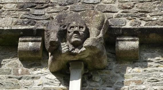
I could not figure out this grotesque downpipe detail on the church. Aviator goggles? Bull or cow around the neck?
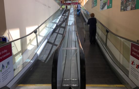
Next stop: Tesco for “triangle” sandwiches and snacks. I was astounded that patrons must “stay right” on the travelator. This is a drive-left country…although pedestrians may pass right or left…adding to my confusion.
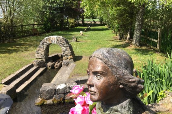
Just south of Kildare is a pilgrimage destination, St. Brigid’s well. It’s relatively elaborate. We had to wait on a busload of pilgrims (from Texas, from what they said) to walk past our parking space before we could exit along the narrow lane.
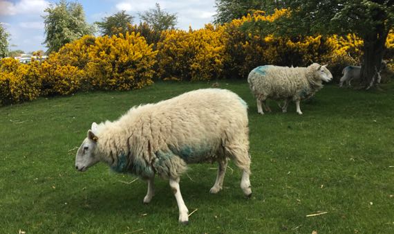
These sheep are browsing on The Curragh. Curragh means race-course. In ancient times it was a common. Much of the time it was used as sheep pasture, but also as a general rendezvous for mustering military forces. The earliest reference dates to the
10th C, and old documents indicate an óenaig (periodic fairs, wake games) was held here. So, it was a multipurpose space not owned by a particular person. What’s left of The Curragh has a formal racecourse where the Irish national races are held, a military base, and still has grazing sheep. The Luftwaffe bombed it on 2 Jan 1941.
Part of The Curragh also has stables, etc., of the Irish National Stud, where Thoroughbreds are bred; the facility includes several gardens (why?).
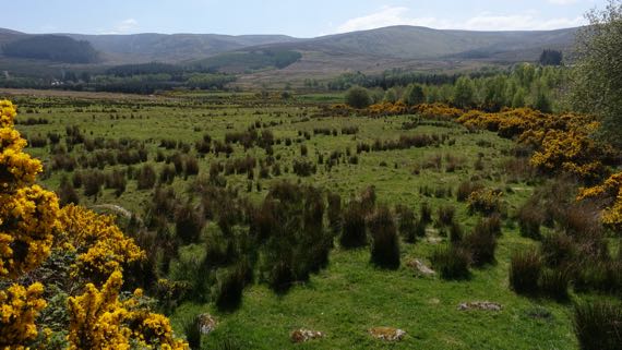
Next, we headed into the Wicklow Mountains! We went through Wicklow gap (near here), 478 meters. This looks very like moorland in Scotland and England.
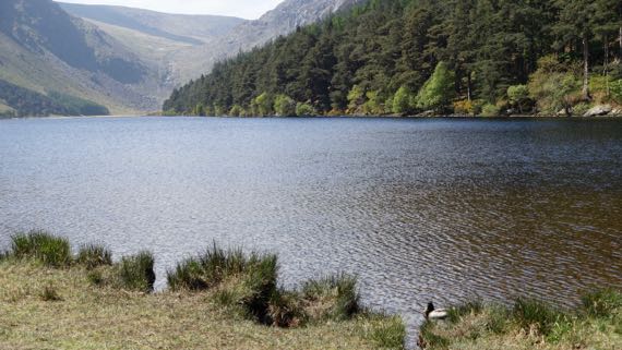
The east side of the pass descends to Glendalough, or Gleann Dá Loch meaning valley of two lakes. This is the larger, upper lake. I’m facing the main drainage into the lake. Note Mr. Mallard. Mrs. Mallard is busy feeding in the reeds and not showing herself.
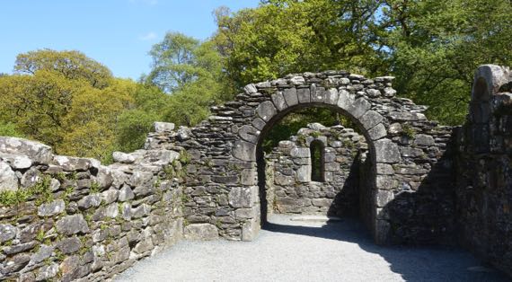
There’s a huge monastic complex here, well known and heavily visited—an easy day-trip from Dublin. We saw many school-kids, high-school age, and heard them speaking Irish Gaelic. This was the 11th-C Reefert Church, way off to the west from the core of the monastic complex. I quite enjoyed this ruin as we visited it alone, no hubbub of visitors in this area of old trees and bird-calls.

I found many of these wildflowers with trifoliate compound leaves. I know it’s the common wood sorrel (Oxalis acetosella), but for today it’s the shamrock (generally accepted to be a clover).
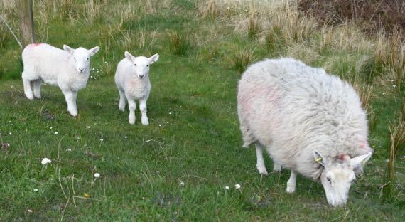
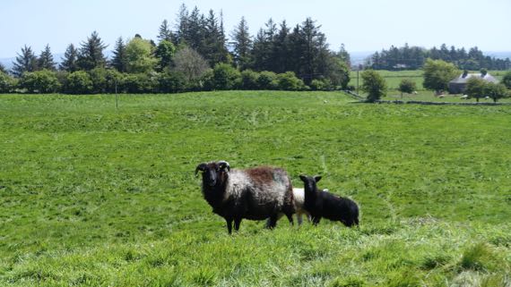
We also made a loop up to Sally Gap, the next pass north of Wicklow. We found these half-grown lambs and their momma enjoying the heights and dining on the roadside grass. Most of the “wild” vegetation is gorse and heather, so this is the best grazing. The heights also have many peat-harvest scars.
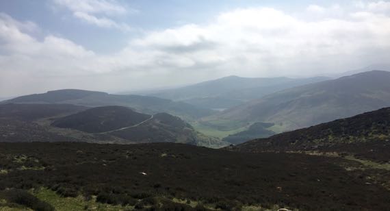
This is the view back toward Glendalough. We found the haze denser with the elevation and think the late afternoon hour also contributed to it. Stunning.
Posted at 2:42 PM |
2 Comments »
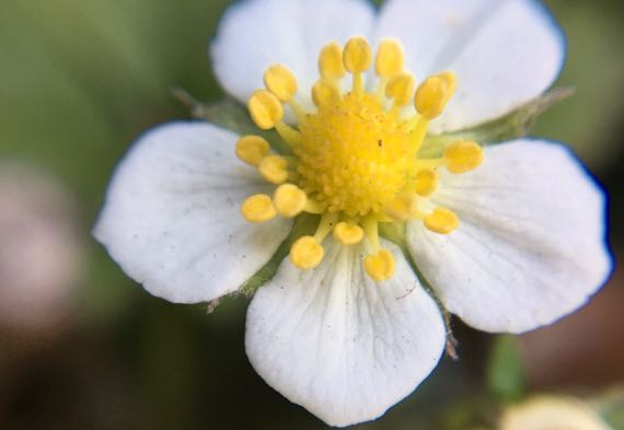
I told the Guru I wasn’t going to write much today…so, mostly photos. Wild strawberry.

Holsteins arriving at fence at end of new pasture area. Bawling. This is atop an early medieval place of major importance called Uisneach. The scale of the hilltop with scattered features was difficult to grasp even standing there. Just think of it as the cattle site.
Our access to the hilltop passed by this somewhat mysterious cattle management structure.
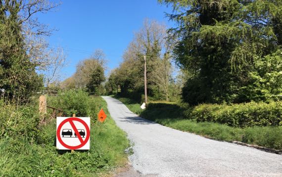
I laughed that someone thought it necessary to mark this one-and-a-half lane road with an aon scoitheadh sign—no passing.
I’m standing on another major architectural feature. Me and this momma sheep and her two babes, one black, one white. Think of it as the sheep site. The formal name is Rathcroghan.
I guess this one might be the person site? It’s called Rathra, and I think this is an old field boundary cutting through the early medieval ring fort. It has two pairs of wall-ditch combos to my left and right. Also you can see a barrow mound just visible over the walls to my left. Darned exciting.
We laughed at this sign. Crappy snapshot, however.

We stopped at the famous monastery ruin named Clonmacnoise. Here’s a view of the oldest structure here (foreground), called Temple Ciarán. It dates to the 8th/9th C, and is considered among the earliest mortared stone shrine chapels in Ireland. That’s the Shannon River in the background; there was a bridge across it as early as ~804. The Guru sent Drony on a mission here getting a great view of a nearby 1214 Anglo-Norman motte-and-bailey castle ruin on the riverbank.

We happened upon turves of peat drying. These are regular shapes from mechanized harvesting. Several (parts of) bog people have been found during such operations.

This abandoned factory is the town of Clara. We spotted another one, too. On the way into town, we drove by the ruins of a monastery. St Brigid founded the original wooden monastery, records indicate. Clara seems pretty resilient; keep on biking.
Posted at 4:27 PM |
Comments Off on Aon scoitheadh
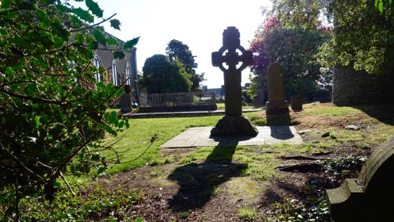
It’s Sunday, so perhaps somehow fitting that we should begin today’s excursion at a churchyard. Another high cross…more burials. Flowers.
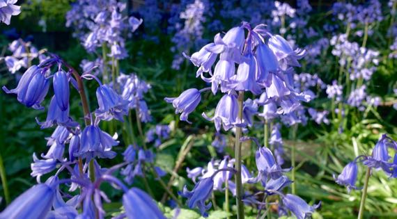
Bluebells, in this case.
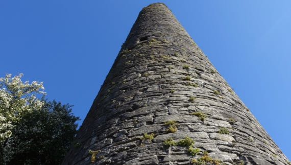
This is the highest hill in Kells, and the oldest building remaining in the compound is the round tower, most of which still stands. Everyone seems compelled to point out that while most such towers have four window-openings at the top, this one has five—one for each of the main roads leading into town (and away from it, duh).
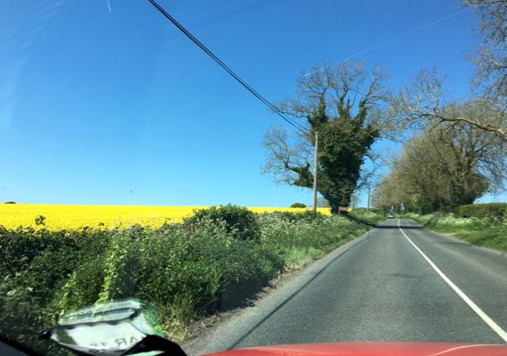
And, we’re off again. Colors—canola yellow flowers, red car, green vegetation, grey road. Yeah, a snapshot.
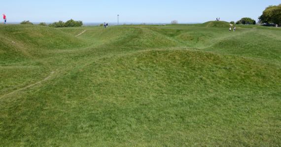
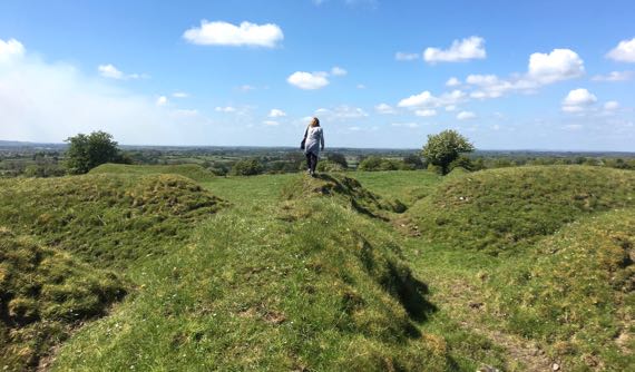
This is some of the earthworks at Hill of Tara, commonly called Tara, just as Margaret Mitchell used it in “Gone with the Wind.” Too much complicated archaeology to even broach it. Take it merely as intricate visual candy, and admire the ancient ones who planned and created this.
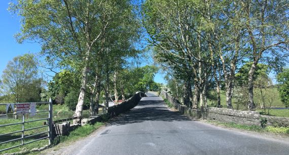
Here’s a little swoopy stone bridge over a river/creek.
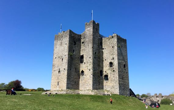
This is the keep of Trim Castle; it’s the largest Anglo-Norman castle on this big island. It was here by 1175, replacing an earlier wooden fortified structure. Life hustled and bustled in the area surrounding the keep and within the curtain walls (completed ~1200)—craftsmen and servants, knights and merchants—and stables, a lime kiln, and so on. The castle offered sufficient security that the town outside the walls became substantial.

Loving these little ferns that have taken hold in the castle wall. And are degrading it.
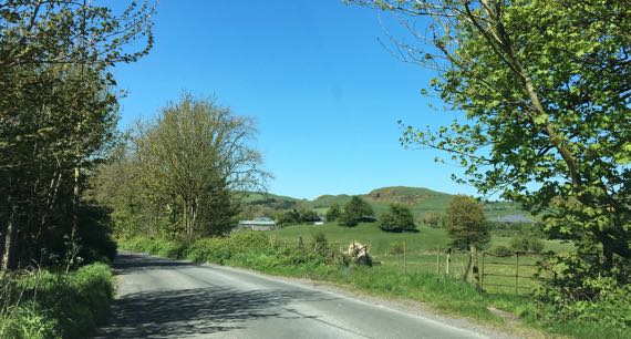
We push on. We are looking for hills. Aha! There are some! We’re still in the Boyne Valley, but we’re inland and nearing the edge of the catchment.
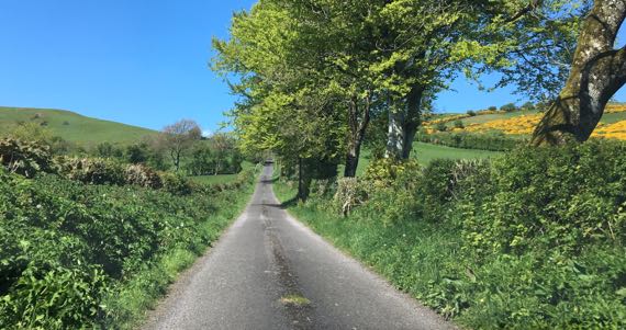
Off on a “leetle” road. I’d call it a lane. With grass overtaking the center.
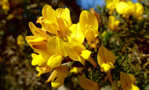
And, off to the right: gorse! Here’s a cluster of gorse blossoms close up.
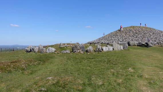
We climbed a little hill this morning at Tara. This one, with some of the Loughcrew cairns atop, requires much more effort. And, on the summit: another Neolithic passage tomb. Signs around it urge “No Climbing.” The accent of every person I heard climbing the mound: Irish. It’s their patrimony…. We stayed on the ground surface. Plenty to see from this hilltop—you can get a hint of how high we are by the distant view in the horizon to the left. Sunny and gorgeous. Beautiful day.
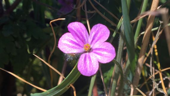
I don’t know what this flower is called; I found it in the hedgerow as I stopped to catch my breath.
Posted at 1:10 PM |
Comments Off on Sunday drive

Today’s tale begins with giant Neolithic passage tombs, that is soil and stone burial mounds. First, we went to Knowth, then Newgrange. Both are part of the ritual landscape we call Brú na Bóinne, as it’s along the Boyne River. The landscape as currently mapped is 2000 acres and some 40 passage tombs. We visited the two largest only, and nobody really addressed the rest (some discussion in the visitor centre displays). We went by bus on timed, guided tours (hustle, hustle), first to one, then the other. We got to stand in a modern room inside the periphery of Knowth, and to go through the passage into the central room in Newgrange (wow!). No photos in the latter.
Here’s Knowth being excavated. The central tumulus is huge, and it has many satellite mounds. Two of the small ones were constructed before the big one. The first part of the big one was built was the middle of the interior, and the passage.

Here’s our tour group strolling among the little satellite mounds; you get an idea of the scale. The upright stones (and many other building materials) came from some distance away; this civic-ceremonial architecture was wanted.
We had an opportunity to scramble down into a souterrain, so of course I did. It’s an underground passage that was used to store food and to hide from invaders. They are much later than the Neolithic. And dusty. That’s because the weather is sunny (and breezy), and coming from Europe. When the wind comes from the west: blustery and rainy. We have fingers crossed that the sun continues. We are so lucky.
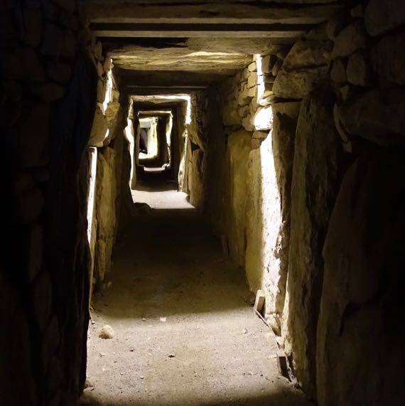
We had an opportunity to see in the passage at Knowth. It’s a very long ways to the center of the mound!
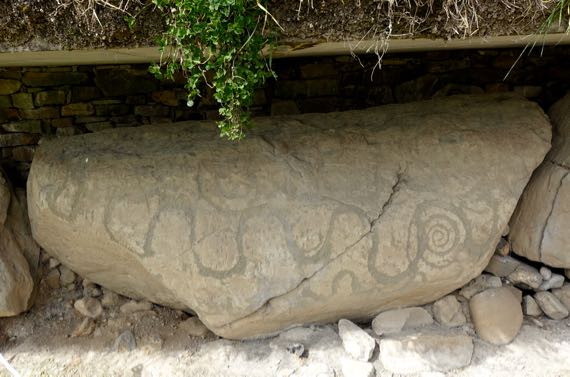
Around the outside of the mounds are stones with a face outward that was carved/pecked, I think every one, although not all are in good enough shape to see the designs. Here’s a sinuous line, with other figures. The “roof” above the stone is modern protection. When the mound was in use, it was in the weather.

This is Newgrange. If Knowth was huge, this mound is gigantic. It had architecture around it, but not the cluster of smaller mounds Knowth had. The pecked designs in the rocks are similar to those at Knowth but the proportions of types are different.
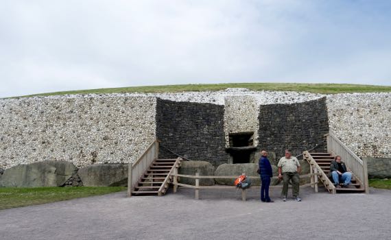
This is the entry to the Newgrange passage. It looks like there’s a bar across it horizontally. There are actually two passages. The lower one is the one people used; the upper one is for the sunlight at dawn for about six days at the winter solstice in December. They faked it for us—very impressive.
The white stone with cobble facade is for real. It is old and the quartz stones came from the Wicklow Mountains some distance away. The black stones are part of a modern remodel they did to permit visitors to enter the passage. The black stones are machine-cut so no one will make any mistakes about their antiquity. The giant stone that is sideways across the entrance was found there; it was put in place before the mound was constructed, as were the stones lining the passage, roofing the passage and interior spaces, etc. This building took generations to finish?

There’s a model of the interior of Newgrange in the visitor center, where you are allowed to take photos. This is the ceiling. It’s a high space, much less confining than you’d expect. The passage, however, is narrow, and the floor slopes up as you walk, waddle, or crawl in.
Okay, enough with the ancient ancient. This is the cemetery at Monasterboice, originally a monastery founded in the early 6th C. I’m not sure of the date of the round tower, but the two churches that are here (small) date to the 14th C. Monastery operations moved to nearby Mellifont in the mid-1100s.
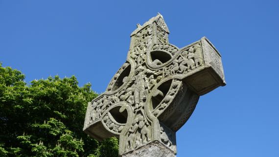
The grounds of Monasterboice are known for the three high crosses here. High crosses are huge, very outsized, which makes for a large canvas for bible stories. The tops tend to look like a little building, or a reliquary.
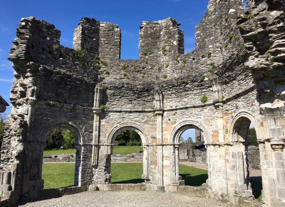
And here’re the remaining walls of the magnificent octagonal lavabo at the Mellifont abbey complex. The building was for the monks to ritually wash their hands. We are told.
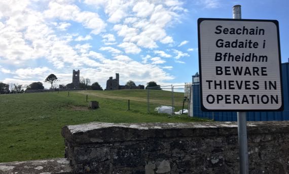
On to another abbey ruin. This is Slane, on the Hill of Slane. And whatta hill! We saw this sign at Monasterboice and Mellifont, too. And this one and Mellfont had a nice pile of freshly broken auto glass. We are nervous. And nothing is visible when we leave the car. Except, I noticed, a banana.
Here is a corner of the main building. Such views the occupants had! Same as the Neolithic people at Knowth and Newgrange.
And now we and our little red VW (takes unleaded not diesel) are ensconced in B&B number one, just outside Kells. The Kells with the name attached to the illuminated manuscript we debated visiting, but didn’t. Probably it was not made by monks from Kells, however.
Posted at 3:53 PM |
2 Comments »
There’s a lot of new in central Dublin, but plenty of retro in original form. Loved this sign, and its reflection
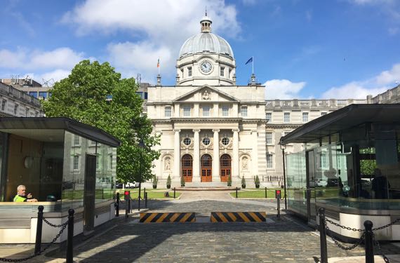
Dublin has hosted many forms of national and pseudo-national government, much of it preserved in the names of buildings. This one is still in use. It holds the office of the Taoiseach and his staff. Taoiseach is an Irish word; the guards out front said we should say tee-sachk—a bit guttural at the end, although they acknowledged that they were from different parts of the country and pronounced the word a bit differently.
The Taoiseach is the leader of Ireland, its head of government. Sometimes the position is translated as prime minister, but even in Britain he’s the Taoiseach. In Irish, the word means leader or chieftain. Ireland has an upper and a lower house of Oireachtas (essentially, parliament). The lower house, or Dáil, elects the Taoiseach. The Taoiseach can dissolve the Dáil at any time, although the term of office of Dáil members is five years if that does not happen. Think you’ve got it? There’s also a President, elected every seven years. These variable terms of office must make political maneuvering very complicated.
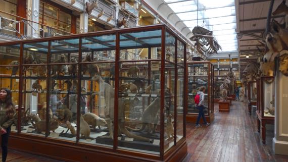
Our next stop was the Dead Zoo, the retro museum of natural history. It’s crammed in a lovely historic building, with those large glass display cases holding often unnatural assortments of critters. We could only visit the lower two floors; the upper two floors have insufficient fire escapes for public safety.
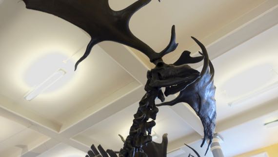
This was labeled Giant Irish Deer. Giant I get. The bones are black because they were recovered from peat—peat the anaerobic preserver of organic remains. The antlers are massive. The species ranged across the northlands of Europe/Asia, but for years the Europeans knew the Irish specimens…so the modifier was added, inaccurately.

You may have read about hedgehogs or seen a shoe brush/cleaner shaped to imitate one. This is an…uhem, real one. Stuffed and real. Those upper bristles are stiff-looking. Nearby on this wall was a sturgeon. All sturgeon in British waters are technically the property of the king—or this was true when the yellowing label was made.
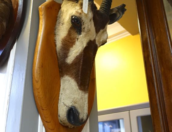
I do not remember seeing this style of taxidermy mammal-head mount before. The flat profile strikes me as…very odd. This specimen was labeled gemsbok. You may know it as an oryx. Especially if you do crosswords/play Scrabble. I just read that thousands of them live within the boundaries of the White Sands Missile Range military installation in New Mexico. Invasive species?
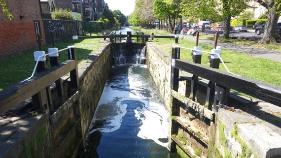
Back out in the sunshine, we strolled along the Grand Canal. So pretty. Mallards feeding. People crossing the locks. Birds chirping. People seated on benches.
This canal has 43 locks, five of them doubles. I like locks. Construction of the canal began in 1756; and it was not until 1804 that the first boat was able to traverse the entire length. This is lock C3. The water level changes quite a bit, no?
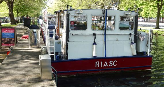
Here’s a party canal boat, meekly waiting dockside for the next group of revelers.
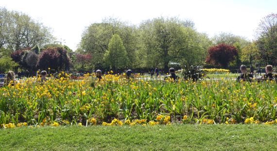
We stopped in the sunshine in St Stephen’s Green, a lovely park. The flower bed across from us was a long, low ridge, reducing the people on the next row of benches to heads above the yellow flowers (canola? and pansies).
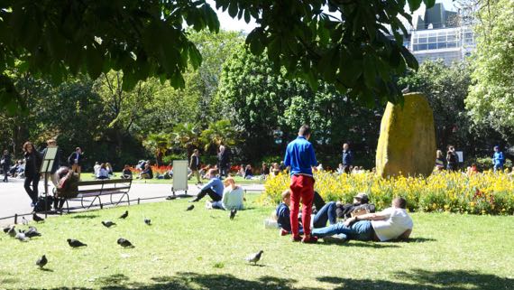
And here by our exit gate, we found pigeons and picnickers, cooing and chatting.
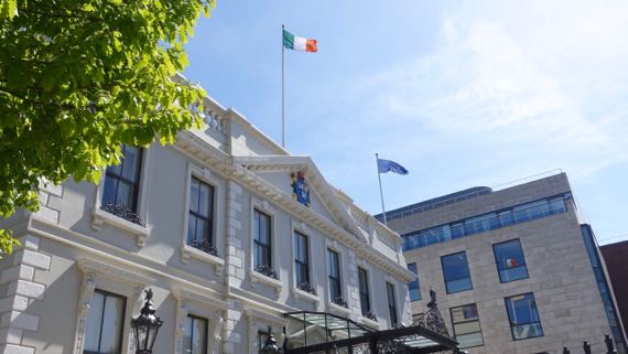
This is Mansion House. Ireland’s First Dáil convened from 1919–1921, subsequent to the standard election in 1918 for Irish members of the English Parliament; that election was in mid-December. The political party Sinn Féin won the vast majority of the 105 Irish seats; Sinn Féin vowed radical means of achieving Irish self-rule. They became known for violence, but they also tried political negotiations.
Instead of going to London, all MPs were invited to convene the First Dáil, a major move in the shift to self-rule. They met here, in the round room of Mansion House, which is set back from the front wing you see here. That first day the Dáil ratified the 1916 Proclamation of the Irish Republic we saw the other day, proclaimed the Irish Declaration of Independence, and adopted the Dáil Constitution.
Mansion House had been the official residence of Dublin’s Lord Mayor since 1715. The Lord Mayor in 1919 was Laurence O’Neill, also an independent MP. Thus, the new national government and the city government of Dublin overlapped in membership and official space. Mansion House likely felt more Irish and independent of England than many spaces the First Dáil could have met. And safer.
Posted at 1:30 PM |
Comments Off on Dead zoo and imposing government buildings
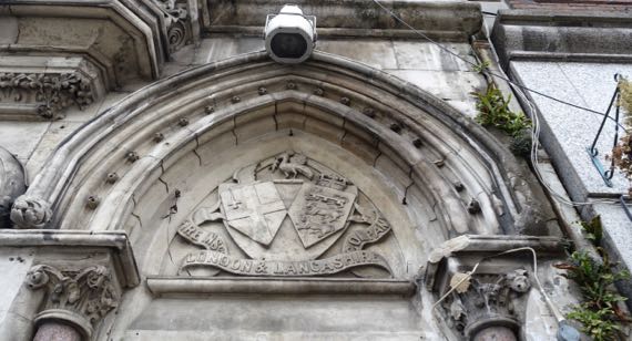
Of course, what I noticed first were the plants growing in the wall-cracks. Next I noticed the pierced spheres. I don’t know what they represent. They’re in a line following the pediment arch and also on the “points” of the Corinthian column details.
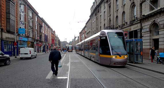
This street is perpendicular to O’Connell, and the tram right-of-way is functioning here. Such a contrast to the upheaval on O’Connell.
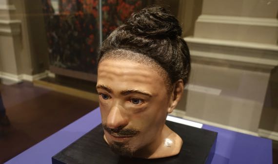
First stop: the National Museum of Ireland—Archaeology. Here’s a reconstructed bogman with his fancy hairdo. The poor fellow (gruesome death) was found during mechanized peat harvesting, and was about 25 yrs old. He’s called Clonycavan Man (Early Iron Age, 392–201 BC).
Mr. Clonycavan’s hairdo is fascinating. The zone along the hairline were cut short, and the rest of the hair was long and twisted and affixed to the top of his head. It was held in place with a substance that included pine resin and plant oil; the resin could not have come from Ireland, and instead came from the Iberian Peninsula or what is now France. We know from other exotic items that there was trade during this era along the western European Atlantic façade, so this is not entirely unexpected. After all, cosmetics frequently incorporate rare and foreign materials (think ambergris and frankincense).
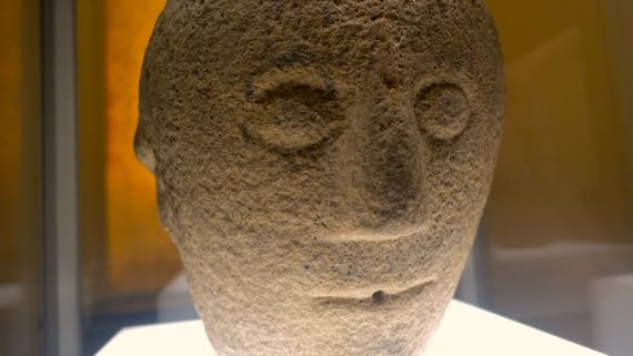
Contrast reconstructed Mr. Clonycavan with this stone face, dated to the 1st or 2nd C AD. The stone has three faces, carved so evenly spaced that if you eye one face dead on, you can’t tell the other two faces are there (you can see a hint of another face on the left margin because I viewed this one slightly obliquely). This is the only face with the hole between the lips. The label gave scant information, and nothing about the context of the triple-face-stone.
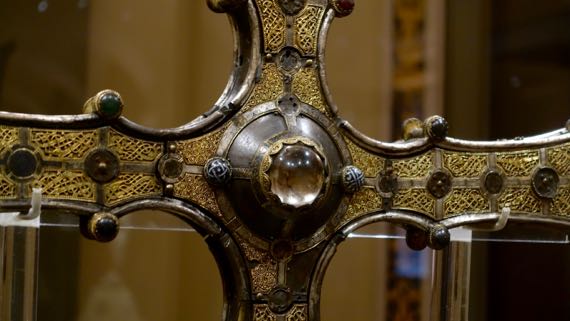
Jumping forward again in time, this is a close-up of the medieval Cong Cross. It was made to house a piece of the true cross acquired in 1122 by Toirrdelbach Ua Conchobair (1088–1156), who had unified Ireland (or most of the people of the island, and at least nominally), in ~1120. The cross is of oak wood covered with sheets of brass, and overlaid with elaborate filagree decorations and set with cast brass and enamel hemispherical bosses. At the enter of the cross is a rock crystal, and the piece of the cross was set behind it, so that I suspect it acted in part as a magnifying glass, but also obviously as protection. The filagree is in what is called the Scandinavian Late Urnes style, very curvy and ornate, and requiring considerable craftsmanship to create. The cross was made to be socketed onto a pole and used as a processional cross. The cross was first installed at the church at Tuam, then moved to nearby Cong Abbey.
Both the wood-fragment and the cross symbolized the piety and legitimacy of the king, and united the civic-ceremonial realms. Often, one or more brothers or sons of such kings were priests, further controlling the two spheres of leadership. If Cong seems a strange word for Irish, it’s a corruption of Cúnga, referring to the narrowing of the river at this location—the abbey was actually built on a small island, with constricted river-courses flanking it.
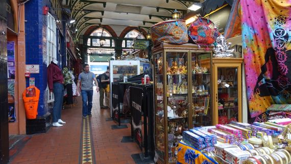
Leaving the museum, we moseyed on through a casual shopping arcade, with all manner of items available from informal booths. Zero purchases.
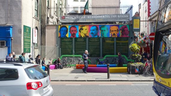
We spotted this memorial to the 1916 Easter Rising, a particularly bloody week in the violence that ultimately lead to Irish Independence, which achieved constitutional legitimacy in 1922. It opened on the centenary of the Easter Rising, in 2016. The central blue face is that of James Connolly, who had the press and newsprint that was used to print the Proclamation of the Republic, which was a trigger event for the Rising. We saw an original yesterday at the Print Museum, very yellowed as it was light-weight acidic paper; only 30 are known to have survived of the 1000 printed.
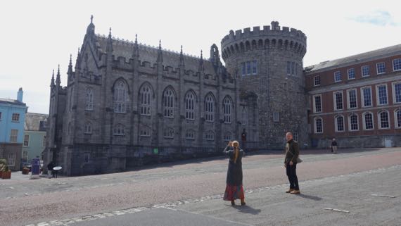
This is the last rise to the east gate into Dublin Castle; the area is called the Lower Castle Yard. Castles are built on prominences (either natural or artificially enhanced, doncha know.) The round tower is the last of the medieval towers to survive, not only of the castle, but in all of Dublin. The medieval castle had four substantial corner towers (this is one), a pair of smaller towers flanking the north gate, the only entrance, and a single smaller tower opposite the gate.

Flanking this building are two present gates to the castle courtyard (Upper Yard; foreground). The one on the right, now shrouded to contain construction debris and mask the workers, is often seen in movies, etc., and is the principal ceremonial entrance. A female figure holding a pair of scales surmounts it. The clock-tower building is called Bedford Tower and dates to the 1750s, along with all the Georgian-style buildings facing the yard. In this yard, the English soldiers marched and paraded, as this was this was the seat of English administration of Ireland.
During the Rising and in the years that followed, this was the citadel of the British military in Ireland and the residence of the British viceroy/chief governor. In Jan 1922, the British leader, Lord FitzAlan, the Lord Lieutenant, accepted a signed copy of the Anglo-Irish Treaty from Michael Collins, a key negotiator and dominant leader of the Irish movement, and leader of the Provisional Government. The Lord Lieutenant then declared that the Provisional Government was in control, the castle was surrendered, and that the final steps in the transfer of power would follow. This made Collins effectively Prime Minister. The story goes that when Collins arrived and stepped out of his car, the Lord Lieutenant noted that he was seven minutes late. We are told that Collins replied, “We’ve been waiting over seven hundred years, you can have the seven minutes.”
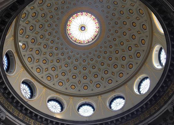
Just NNE of the gate, and below, is the Dublin City Hall; here’s the interior of the rotunda. I could see its curves on the outside, so of course I had to check it out. Unlike the library reading room, this was empty of people except for two tourists resting their feet by sitting in folding chairs standing encircling the base of the rotunda.
The building was built over the decade from 1769 to 1779. The architect originally intended the central skylight to be open, as it is in the Pantheon, but: Ireland/rain. The building was then the Royal Exchange, functioning essentially as a marketplace for businessman making transactions—for the exchange of paper and not goods. Dublin’s city government bought the building and remodeled to be the city hall in the early 1850s.
Irish rebels (from the British point of view) held this building during the Easter Rising, so were extremely close to the British citadel; most of the building’s occupants were female clerical workers subjected to a 12-hour siege by British troops.
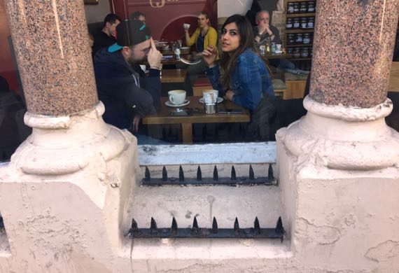
I took this picture of the “no sitting” spikes because they were so…uncompromising. This attracted the attention of this café-ista duo.
BTW, don’t count on any more double-posts like I did yesterday. Anyway, this one is wordy enough for two….
Posted at 2:58 PM |
Comments Off on Of artifacts and independence
Our first destination…well, mine turned into take a nap. Apparently, a solid nine hours overnight was not enough. Time change triumphed.
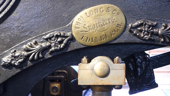
Renewed, we headed southeast to the National Print Museum. They don’t have much space, but they have quality machines and displays. This is a printing machine that Thomas Long made, copying one made by George Clymer, called the Columbian Printing Press. Clymer worked in Philadelphia.

Long even copied Clymer’s eagle counterweight. I checked, and it’s a faithful copy. Both Clymer’s and Long’s look too long-necked to me. More like a vulture?
The museum is in the former Beggars Bush Barracks, now repurposed for an array of offices, etc. This is where in January 1922 English troops handed over control to the new provisional Irish government. It was a big deal in the history of Irish Independence, of course, the exit of the English military (which had plenty of Irish troops). This is the main gate, looking out at the civilian world.

Heading back to the core of town, we crossed the Grand Canal. There was a marsh-edged creek here. This canal goes all the way west to the River Shannon, and it transformed the transportation network when it operated. I have read that the last working barge used it in 1960.
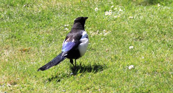
We had planned our visit to the Printing Museum, but didn’t plan a next stop. We decided to head toward the Library I saw on my Google Maps, as I remembered that’s where the Kells manuscript was. En route, we passed through Merrion Square, a lovely park. We saw several magpies (love the blue feathers).

And this statue, labeled Grattan. I tried to be a wag and allege that he was a potato magnate.
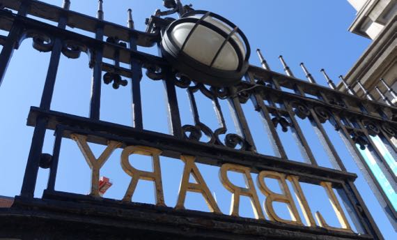
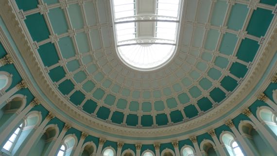
The gate leading from the sidewalk to the National Library of Ireland has this imposing label. And this is the roof of the reading room. I wasn’t supposed to take it. I was looking up at the gorgeous architecture, and not at the signs. Oops. I don’t know how they could control all the readers working on their laptops and keep them from surreptitiously using their laptop cameras. Not my problem.
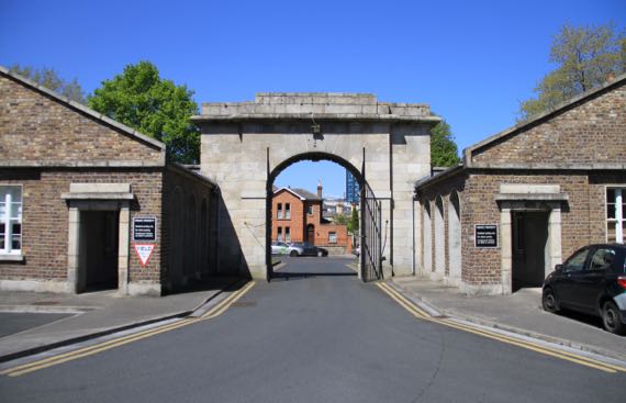
So, interesting as it was, that was not the right library to accomplish our mission. Turns out the Kells library is a Trinity College building. We headed over. Note the line, so obvious as we got close to the right library and the right doorway. And a ticket is a substantial €11. We sat in the sun for a while, like hundreds of others, pondering the decision to enter for a long hour or to keep walking. We decide to continue our stroll: sunshine.
Our route cut through the maze of narrow streets that must be an old medieval neighborhood and is now called Temple Bar.
This is Mr. Temple (1555–1627). He built a house here on reclaimed land (previously a marsh along the Liffey), on a street soon called Temple Bar. The Bar refers to a point of land just above water, as in the phrase “sand bar.” Now, of course, there’s no Temple house, and there is a tavern with Irish folk music acts…and many other bars. And no trace of a marsh.
As we moseyed on, we found this unintentional Irish street art installation.
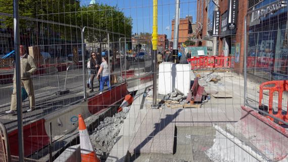
Our neighborhood is a scramble of construction zones. The project is to install new tracks and sidewalks for the trams. Meanwhile, there are bus-only lanes, lanes that have been repurposed for pedestrians, and little room for construction workers, pedestrians, or vehicles. Most of Dublin’s population seem to get around on buses, on foot, with a solid sprinkling of bicycles and delivery trucks. Everyone seems very tolerant and patient with the complexities of the current street navigation irregularities. Especially the jay-walkers.
We are headed to the room to take off socks and shoes and elevate the tired dogs. Naturally.
Posted at 3:12 PM |
2 Comments »
After I made yesterday’s post, we took a nap, then recognizing that we may not always have sunshine here on the Emerald Isle, and that it would likely help us make the time change, we headed out for a late-day stroll along the River Liffey Quay.
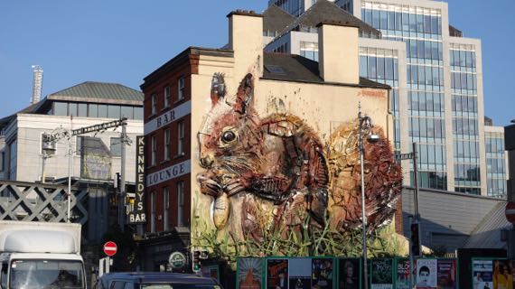
We found giant squirrel art, which looks like it was made of scrap, then painted. Very effective. And large.
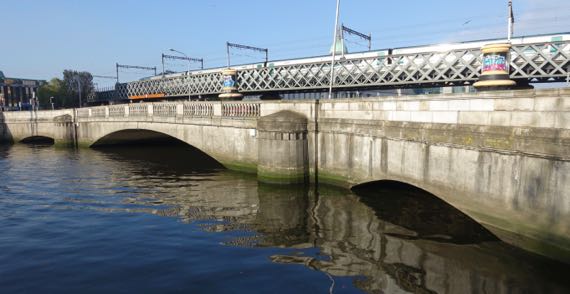
We decided we thought the water marks on the bridge indicates the level is fairly high. Nice reflections. Yes, that’s a commuter train track crossing above the road.
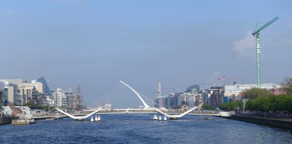
These swoop supports are for two different bridges. The low pair is in the foreground (Sean O’Casey Bridge). The single high one is for a bridge farther downstream (Samuel Beckett Bridge).
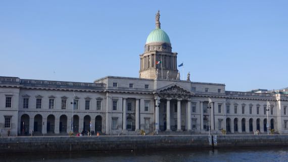
This is Dublin’s Custom House, built in 1791. Imposing.
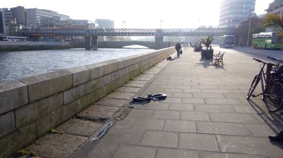
Returning on the north bank, we noticed that a low flood wall has been added to the quay-side, so that the substantial iron hooks can no longer be used by moored vessels. Changing use of space, from industrial/commercial to pedestrian.
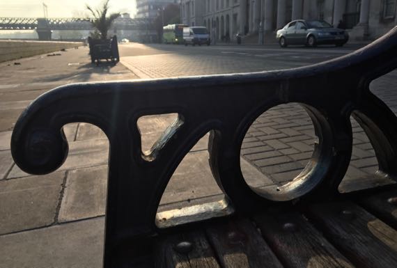
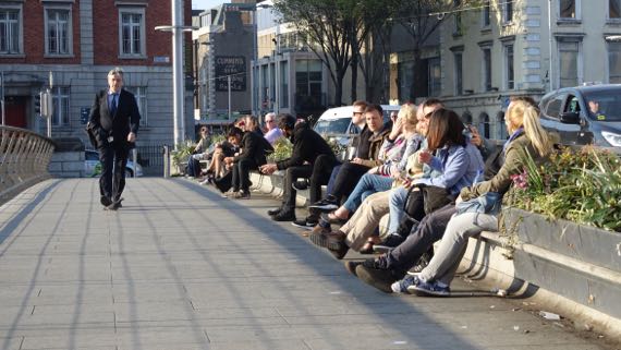
One of my favorite shots of the stroll. We enjoyed the sun from this bench, just us, though, unlike the first image of a benched crowd.
Posted at 2:05 PM |
Comments Off on Liffey stroll last evening