Time code
Monday, 6 September 2010

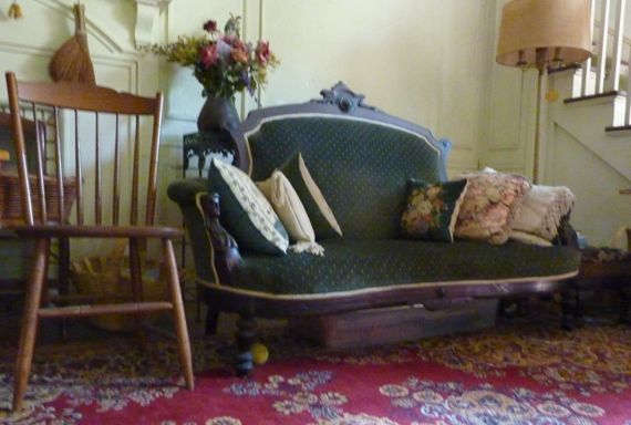
Doesn’t this architecture (and setting) just scream New England?
Love the color, too, but a city-person choice rather than a farmer choice, I think….
From the weekend….
Monday, 6 September 2010
Doesn’t this architecture (and setting) just scream New England?
Love the color, too, but a city-person choice rather than a farmer choice, I think….
From the weekend….
Friday, 20 August 2010
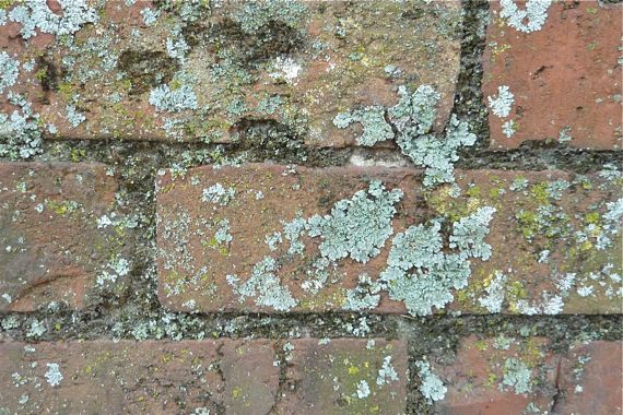
Frame your yard with a low decorative brick wall. Positon one section under the shade of a modest magnolia. Revisit in several years. Look for shade- and moisture-loving colonists. Grab a cold one. Come back in several more years. I’m wondering how old this particular colony is, maybe three decades?
Now you know how lichenometry works.
Wednesday, 28 July 2010
Today’s pop-up shower came early and surprised me. Usually they arrive in the mid- to late-afternoon. Today’s was noon-time-ish.
When I checked the garden early, however, it was still damp from Monday’s evening downpour, yet I’m very glad to have more precipitation. Still, most of the tomatoes are being lost to squirrels and black scummy mildewy nastiness that gets inside them.
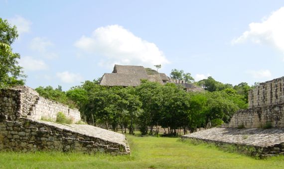
So, to distract you (and me!), here’s a picture of Ek’Balam, a famous lowland Late Classic Maya archaeological site on the Yucatan Peninsula. I was there seven years ago today. In the foreground is the ballcourt. Beyond the trees is the highest structure in the civic-ceremonial center, and is the part of the settlement where tourists are welcomed. The residential area, however, expanded outward, I dunno how far.
Sunday, 18 July 2010
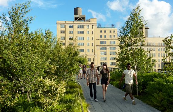
Back in the 1930s, New York separated trains from the streets along its west side by building thirteen miles of elevated tracks to reduce the accident count and improve delivery efficiency. The tracks opened in 1934, and especially moved foodstuffs.
By the 1950s, long-distance trucking was reducing the flow carried by the elevated trains. In 1980, the last train rolled; it carried frozen turkeys.
Today, the remaining elevated route is a park called High Line; the first section opened last summer.
Gotta mention the water tanks. Survey the New York skyline and you will see them, and many will look like ancient wooden technology made like huge barrels. Are they still commonly made? Installed?
Saturday, 17 July 2010

Nothing heavy on this Satt-ah-dee night, but here’s a castle I found while perusing the landscape in Google Earth. I love that you can see the terracing below the lower castle wall. Note the defensive shape of the main wall. As always, where are the storage rooms for food, water, ammunition? That’s the problem with holing up; you need supplies….
Friday, 9 July 2010
Today’s main event: American Museum of Natural History.
The entry hall is named after Teddy Rooooosevelt, and is dominated by a dinosaur skeleton and the sound emanating from the congregating hoardes—ooh, let me rest my feet—yesterday in the park about did me in!
I had two sections I wanted to hit. My mistake was checking anything out along the way.
I had heard the revised human origins hall was very well done. My takeaway: excellent.
The posted hominid “family tree” even includes two species of Ardipithecus!
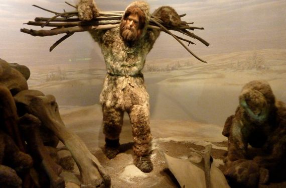
And I was eyeball to eye socket with a Neanderthal skeleton (or replica thereof) for a while. Thinking. Contemplating humanity, I suppose.
This diorama, however, is of Eurasian Ice Age Homo sapiens, those folks of the Far North who used mammoth bones as building material.
Thursday, 8 July 2010
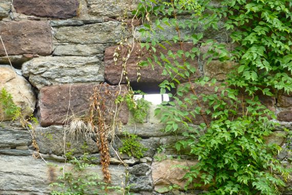
Daylight through a gun port, high in the wall of a fortification in the northern part of Central Park, NYC.
Wouldn’t you know that if I spent the day wandering in Central Park, I would find a ruin? Well, it’s not a crumbly ruin, but, still, it’s an abandoned building. Locked away and secured. And so: essentially a ruin.
Of what?—you ask (if I’m lucky)….
A fort once stood in what is now the park. I had no idea.
This ruin dates to the War of 1812, and was remodeled later.
Extra credit: what were the “sides” in the War of 1812? What was the dispute?
Monday, 28 June 2010
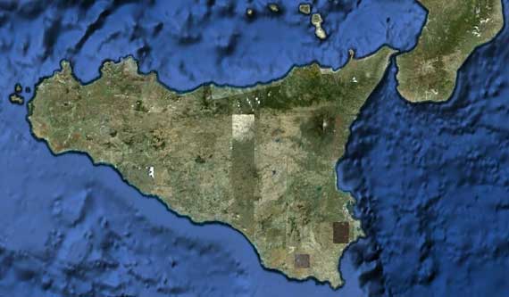
I spent most of today thinking about and researching the Bronze Age on this island*. I know this reads like I’m loopy, but mostly I’m wiped out.
* And yes, north on this Google Earth screen-grab is “up.”
Monday, 7 June 2010
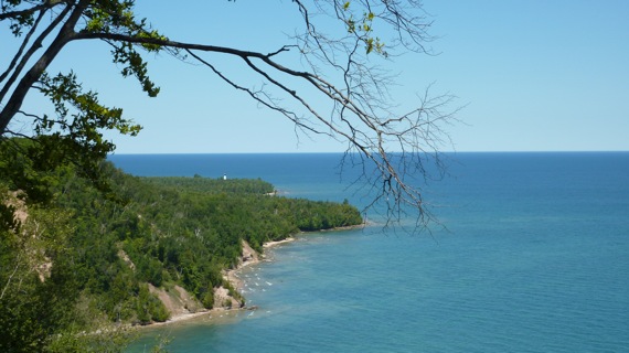
We took a hike this aft from the Log Slide westish to Au Sable Point Lighthouse (that white dot on the other side of the point in this view). We descended (then ascended on the return trip) down, by my count, three lake stages, but I don’t know the geology beyond that. All that is in a National Lakeshore—your tax dollars at work!
GGumee: thank you HWL.