Musings
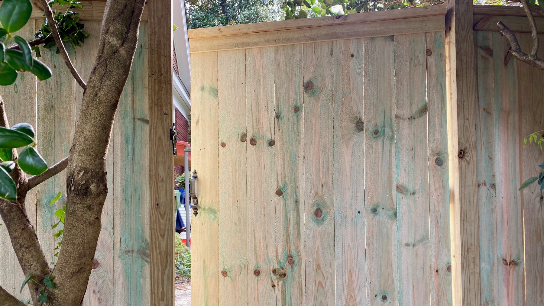
I’ve been watching this project progress over the last week-plus, and today I found a new fence and gate. I suspect after this the gate will repose closed.

Elsewhere I found a reflective birdbath, autumnal mode.
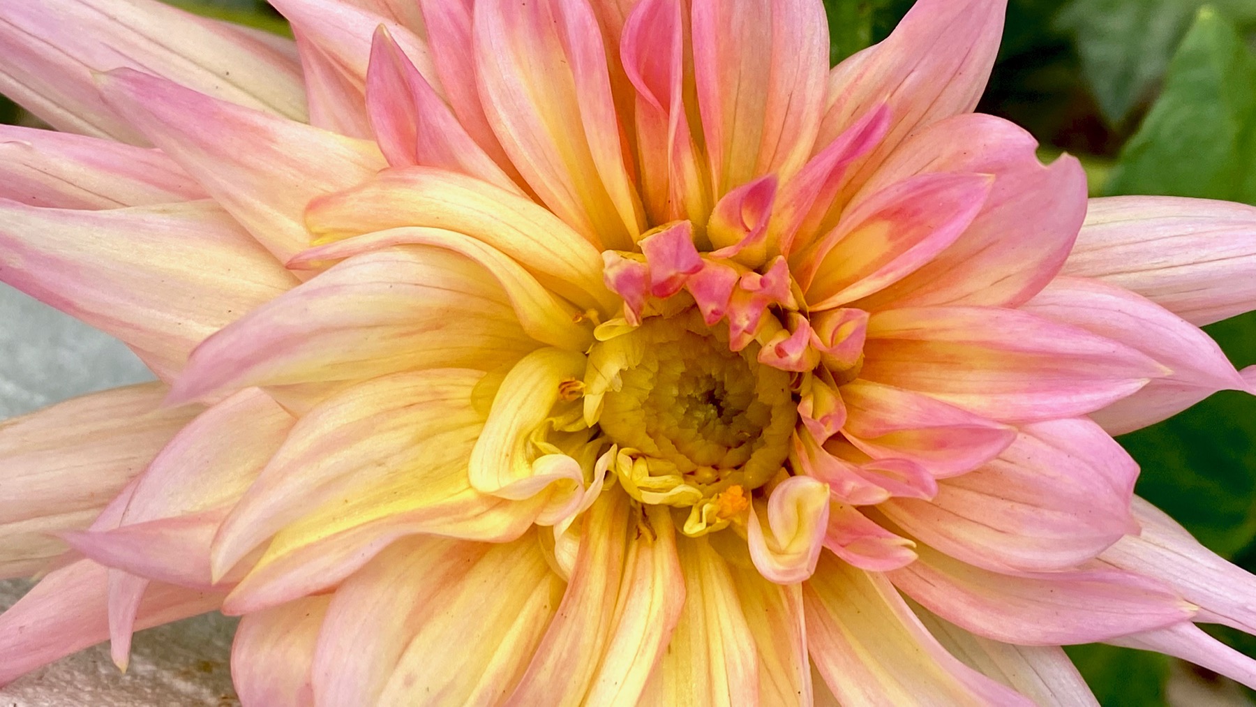
Love dahlias. We’ve got a torrent of rain at the moment, so I’m guessing by tomorrow: no pretty dahlias any longer.
Posted at 7:24 PM |
Comments Off on Fading green
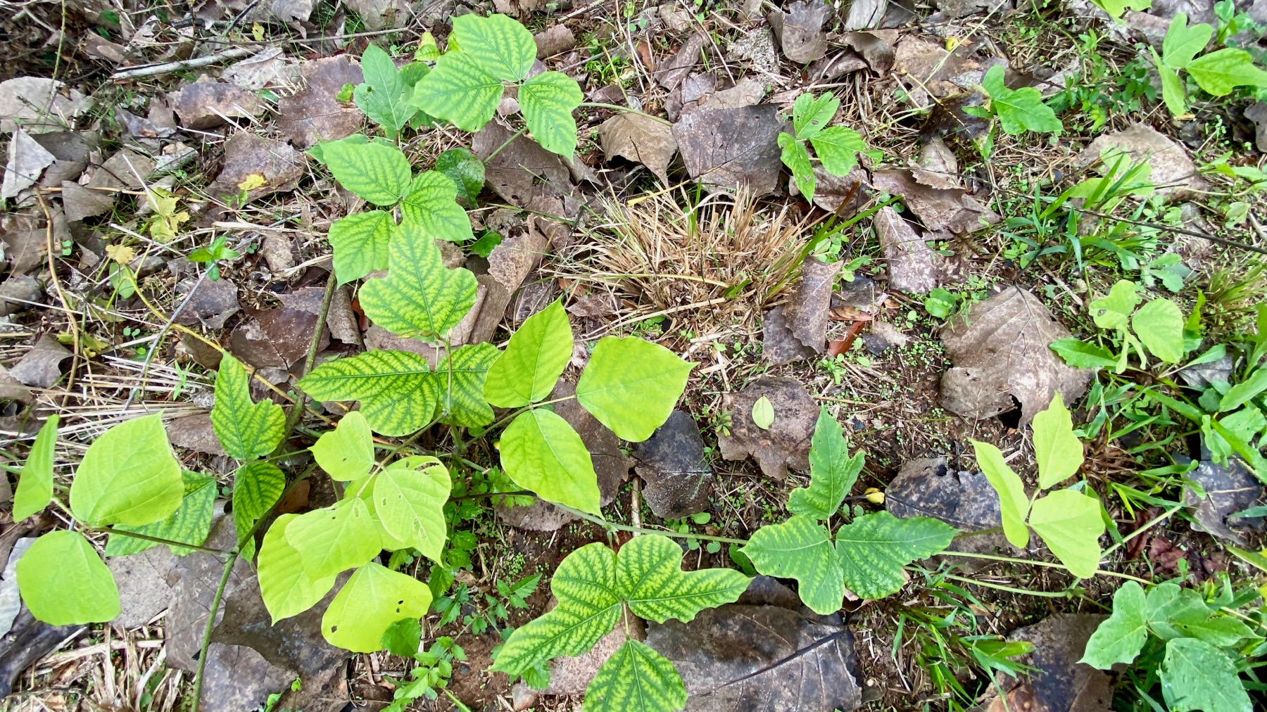
“Leaves of three, let it be.” But, no, not that species this time. Say: kooood-zoooo.
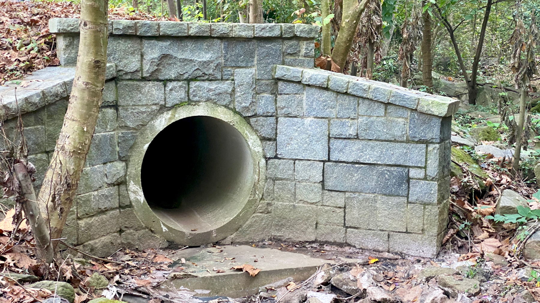
Entrance to the underworld? [Caves, etc., being a portal to the underworld is relatively common in mythologies around the world. BTW.]
Posted at 5:23 PM |
Comments Off on For real
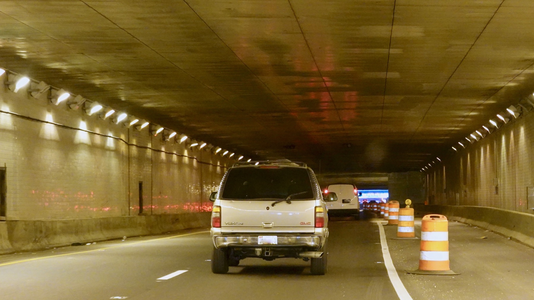
Urban travel today is likely to involve routes underground, whether you are in a vehicle or afoot. A tunnel in the central civic-ceremonial zone of WashDC.
Ronald Reagan building parking/security team joke.

A rose to you for getting through the traffic.
How many US citizens under the age of, what?, 40? know what this is…that it’s not just an aesthetic combo of shapes and colors. Often, in my (limited) experience, the eraser would solidify and the bristles would get bent before the eraser was used up.
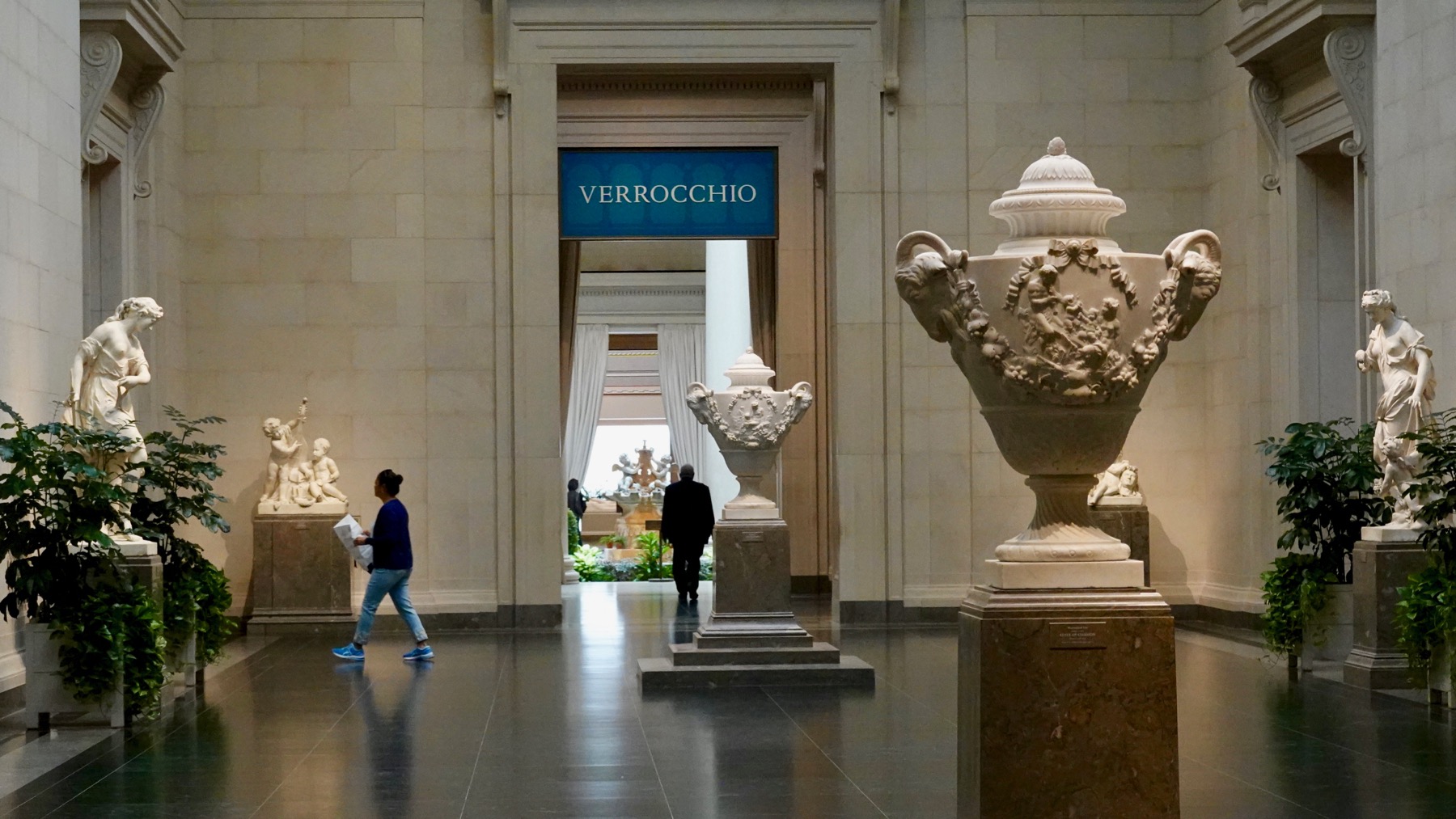
Our first stop: the Verrocchio exhibit at the National Gallery of Art. Verrocchio has many names in the literature (WikiPee indicates his birth name was Andrea di Michele di Francesco de’ Cioni), but most cognoscenti refer to him as merely Verrocchio, referring to the goldsmith he trained under, poor guy. He was an accomplished goldsmith, architect, painter, and sculptor. One of his mentees was Leonardo da Vinci.
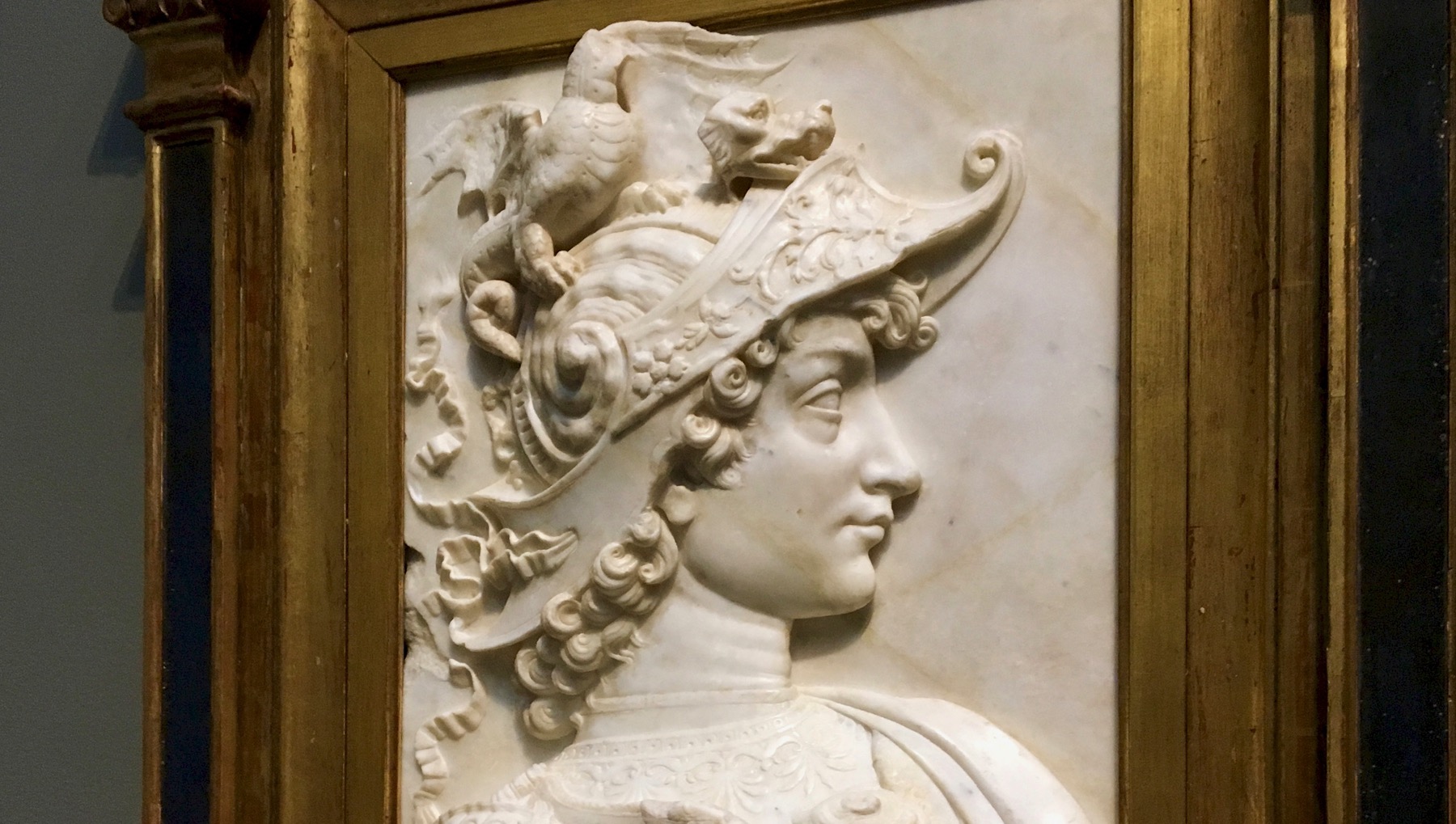
Verrocchio’s Alexander the Great. Is that a dragon on your head, sir?
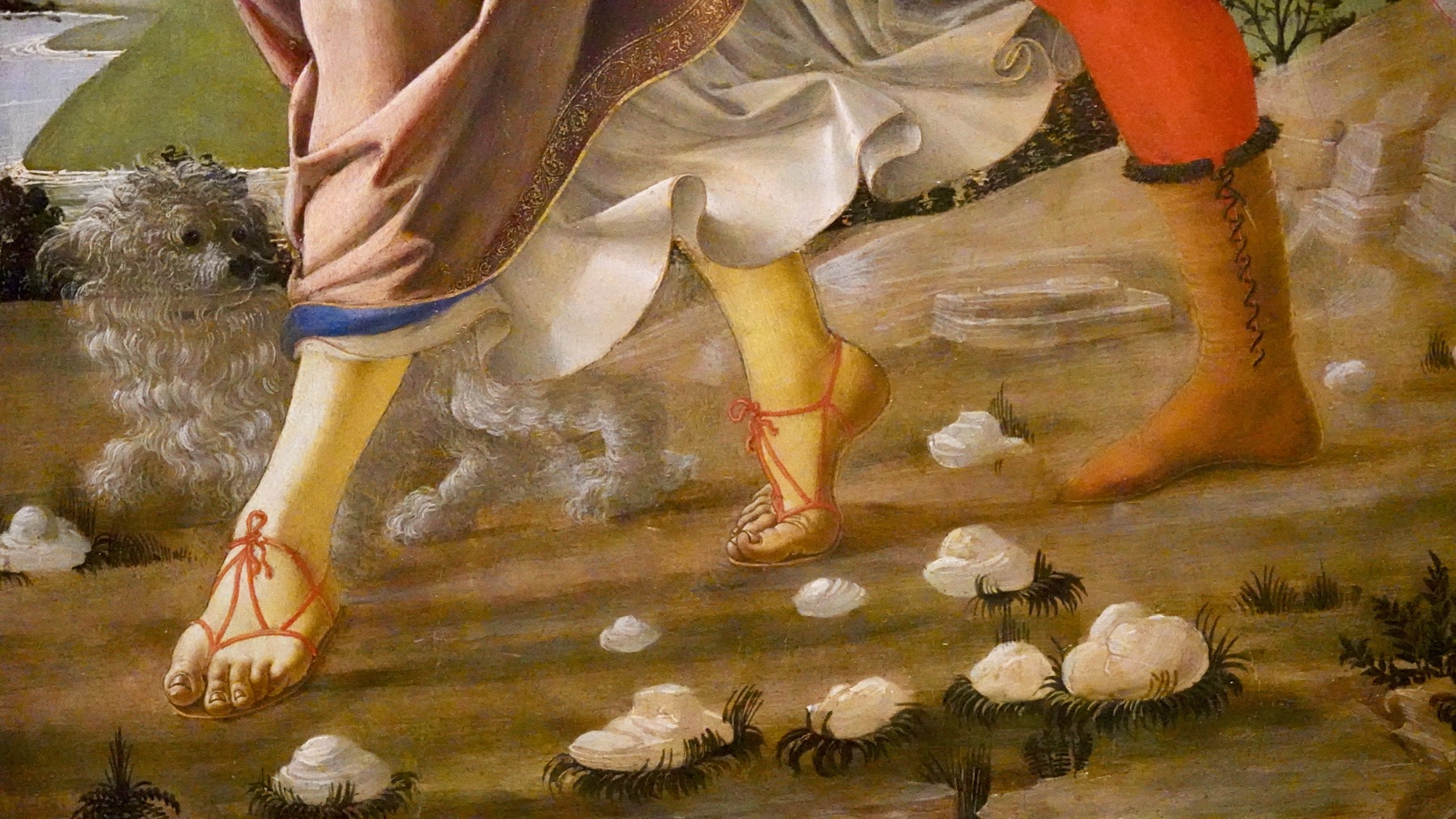
Love the sandal strap details. Many art historians think Leonardo painted the ghostly terrier.
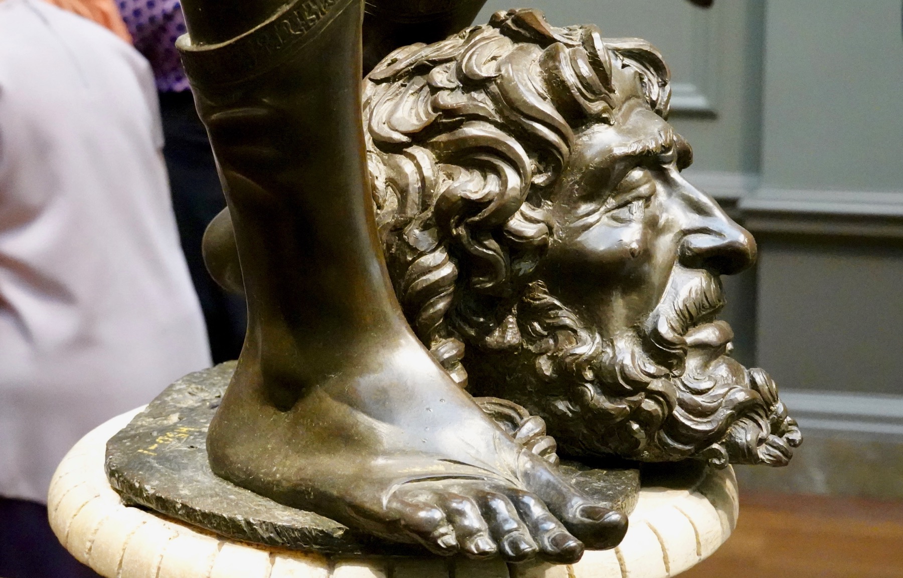
This is Goliath’s head with David’s foot in Verrocchio’s version of the same moment as the famous Donatello statue of David. We saw the latter in Florence; I like both. Again: footwear detail.
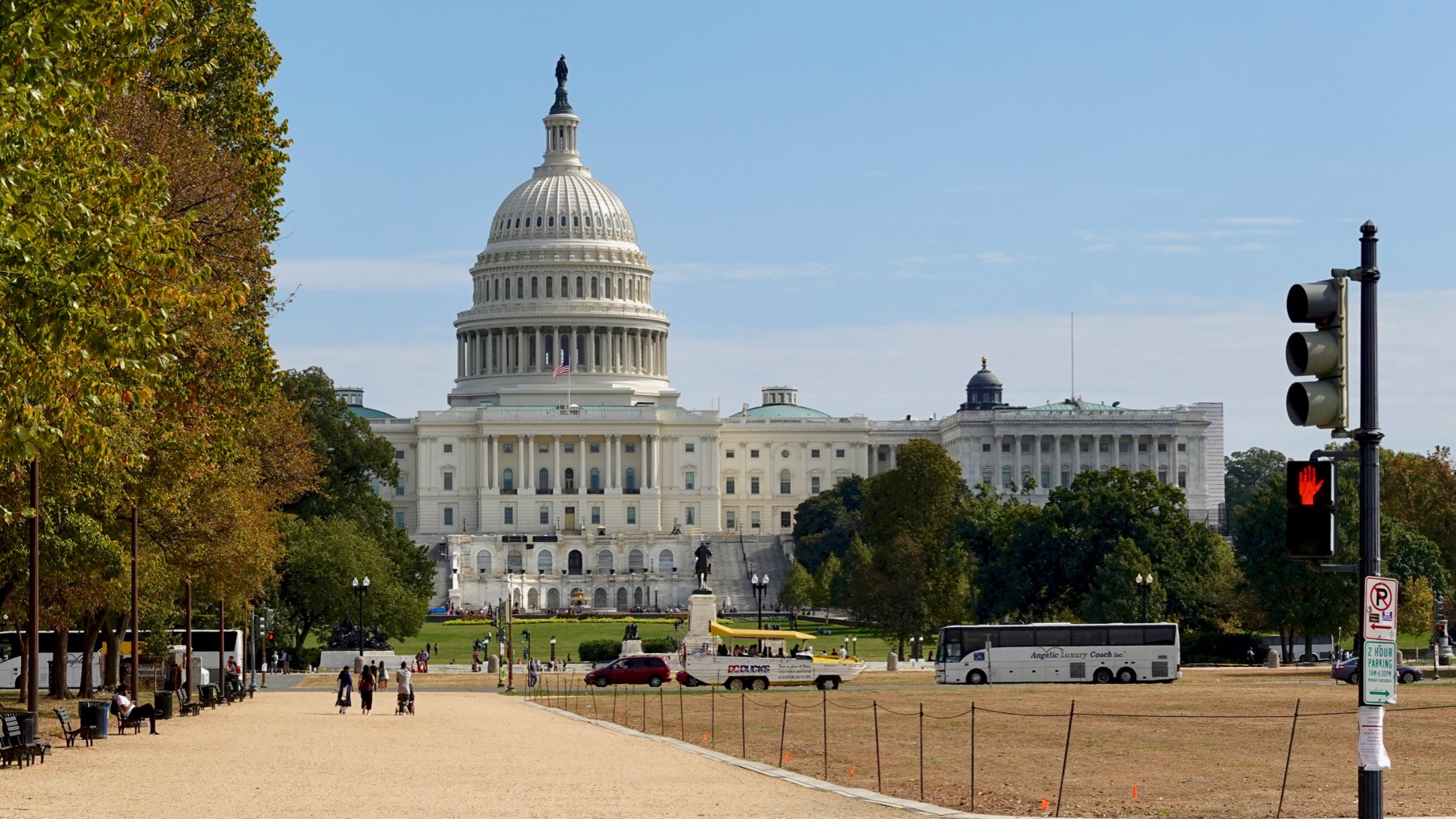
We got lunch in a downstairs museum café, and headed to the mall. Left: view of Capitol Hill. We went that way last time. We went the opposite way this time.
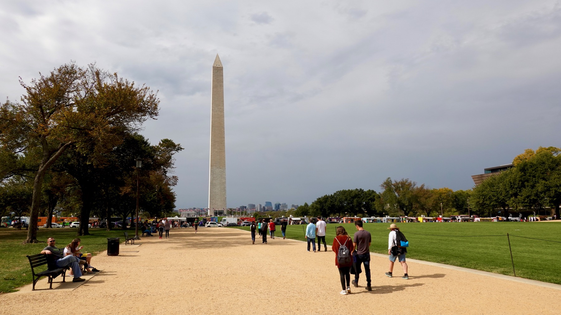
Toward the Washington monument, all sparkly clean and open for business again.
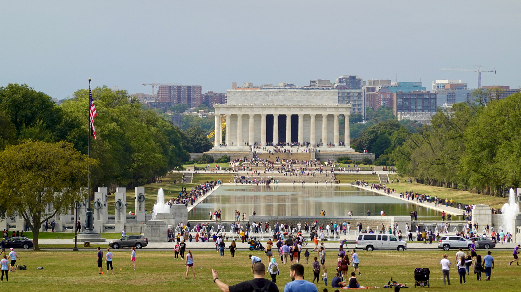
And from the hill at its base, we could see our quarry, the Lincoln Monument. But first, at this end of the Reflecting Pool, the WWII Memorial.
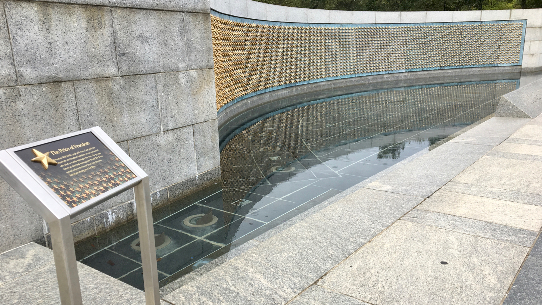
Sobering to see over 4000 stars here, each representing 100 American war dead.
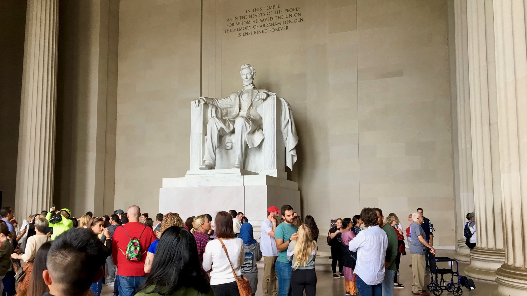
We climbed out, paralleled the pool, and worked our way through the crowds up the steps and into the main room of the Lincoln Monument, which the Romans would have called a cella. Many old guys in wheelchairs…this weekend’s groups of Honor Flight members and their attendees. One group whose members we kept encountering were from “Flag City,” Ohio.
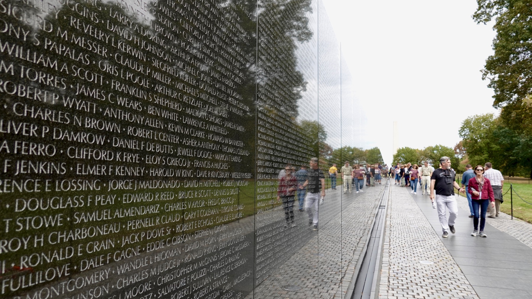
We tore ourselves away from the Abe and visited the Vietnam Maya Lin wall. Sobering also. It’s all about the names, each life lost.
Enough malling, we headed back to our parking garage. [Ended up with 16K steps for the day. Outdoor mall-walking.]
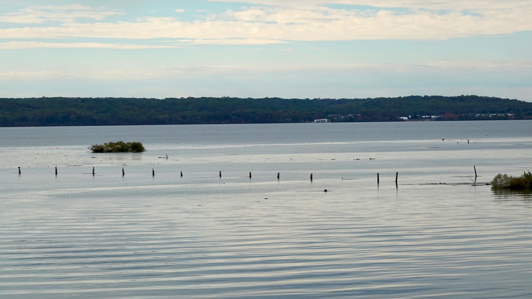
The “island” out there is a sunken ship. There are over 230 of them in shallow Mallows Bay, on the Maryland side of the Potomac, a bit downstream and opposite Quantico. Look at GooSatView and see how many you can count. Many are steam ships and many date from WWI.
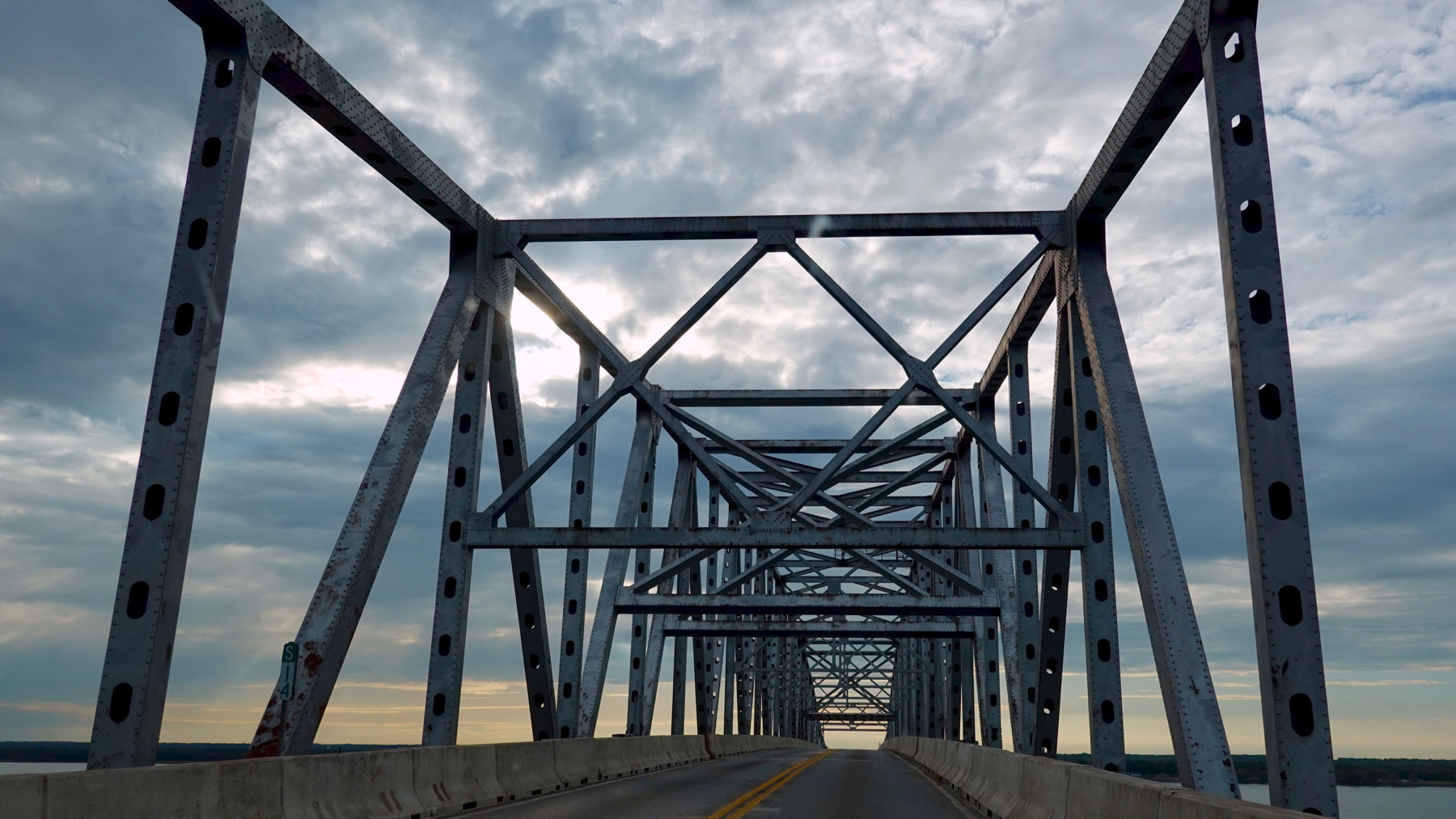
We paid $6(!!) to cross this bridge over the Rappahannock, the next big river south of the Potomac, both flowing into Chesapeake Bay. The beams are pretty, and the light was nice, but I prefer the bridge that spans the two peninsulas way NNW of here, plus the crossing is cheaper.
Posted at 9:27 PM |
Comments Off on Mall walking plus
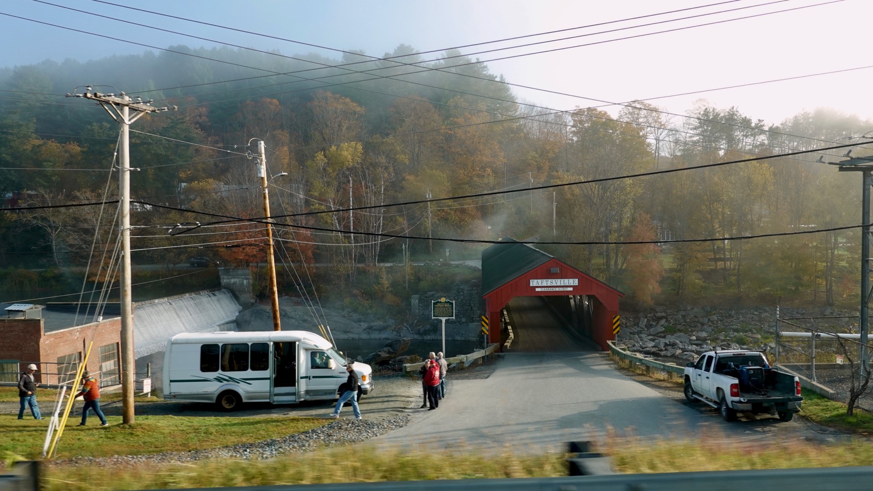
Taftsville Covered Bridge, with autumn complement of leaf-peepers….
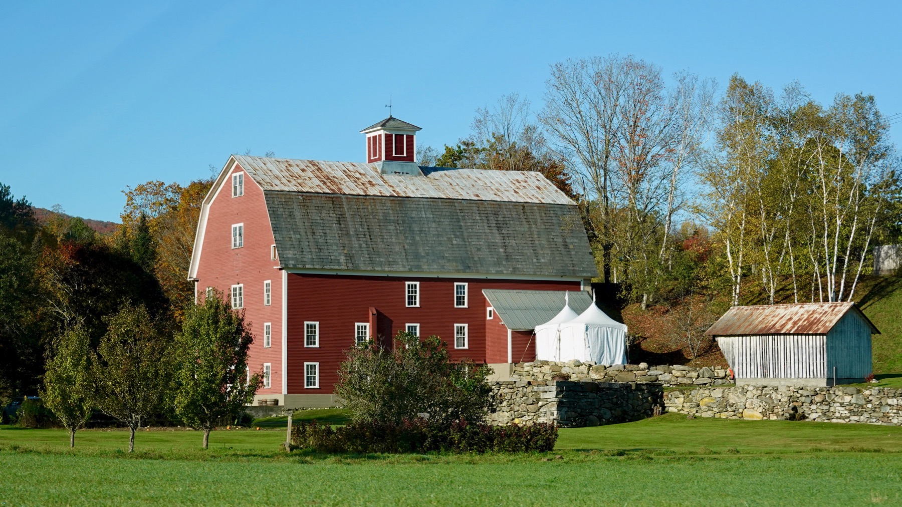
When no longer farming, used a large quaint barn, barnyard as event space.
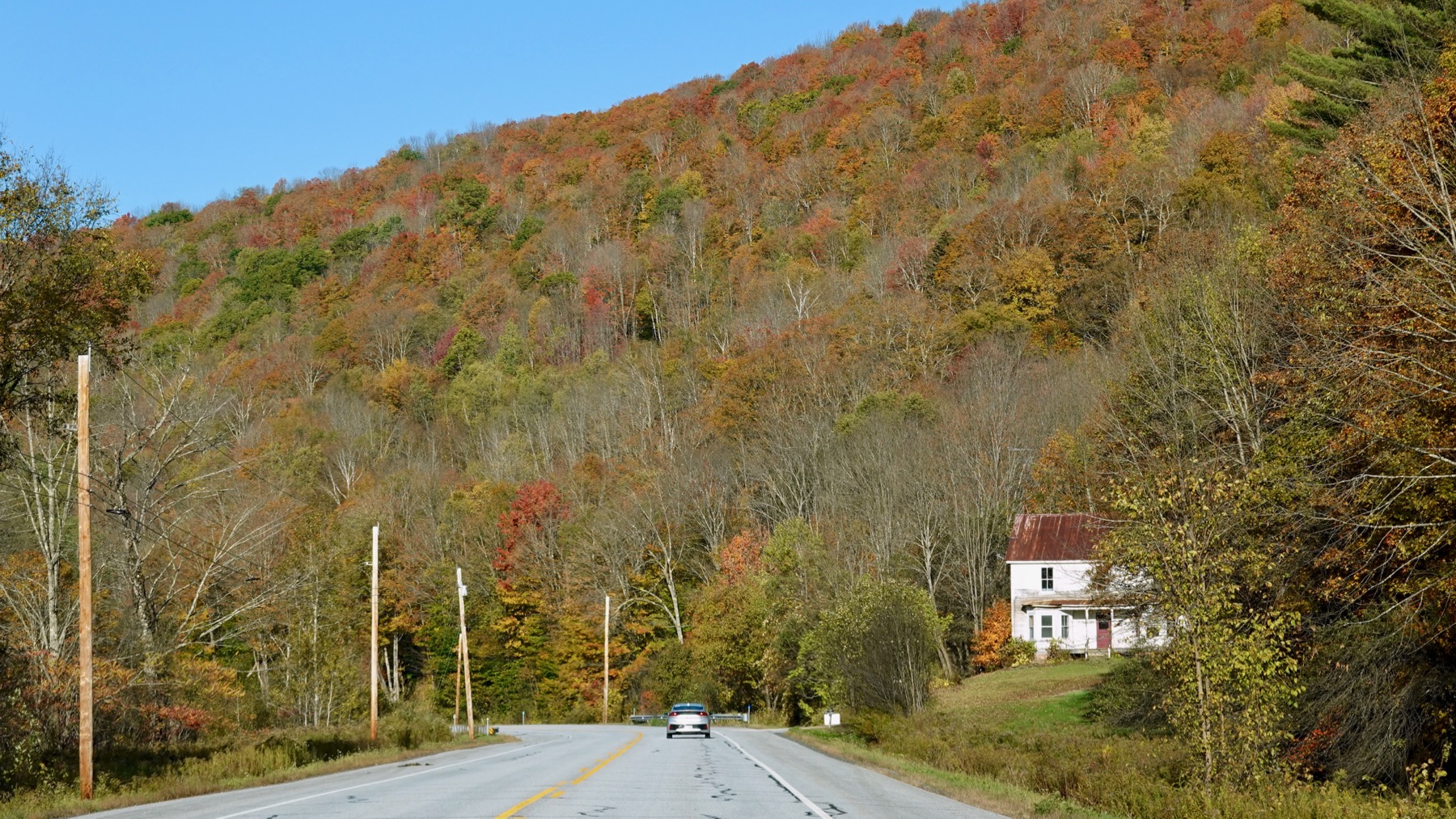
Fall color mosaic varies. We are westbound here—nice light.
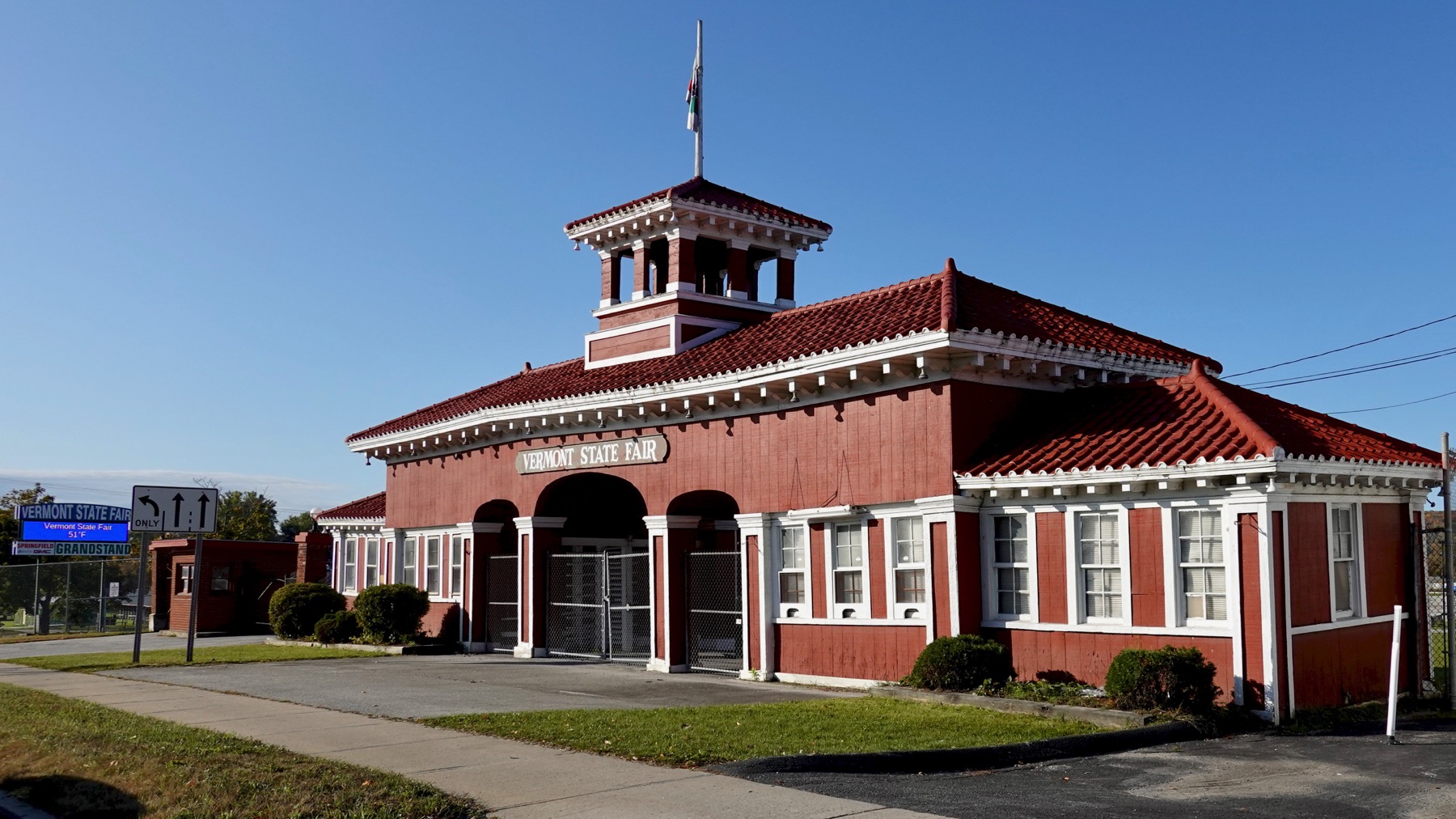
Main gate, Vermont state fair, with ginger breading.
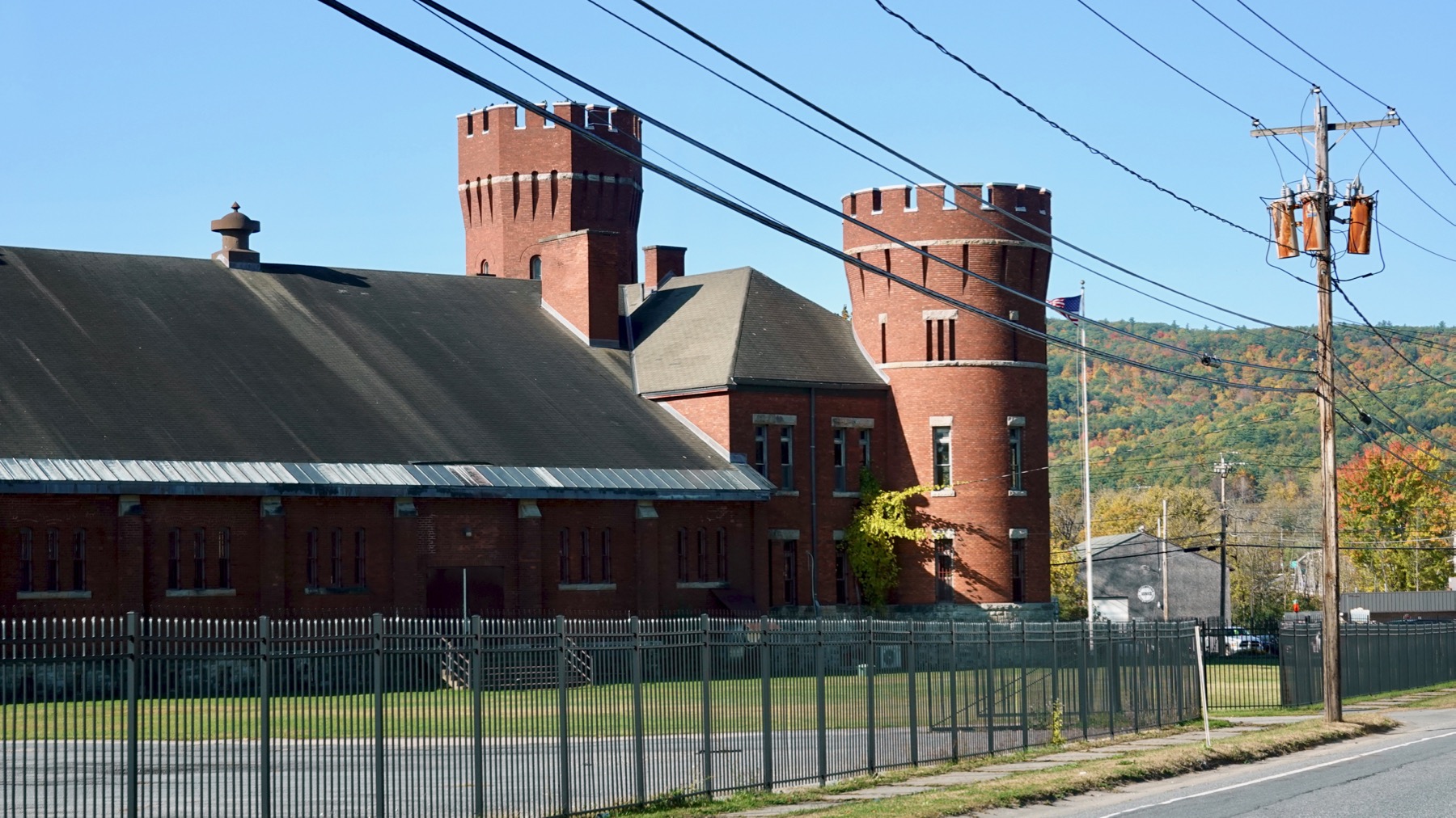
Armory with asymmetric towers.
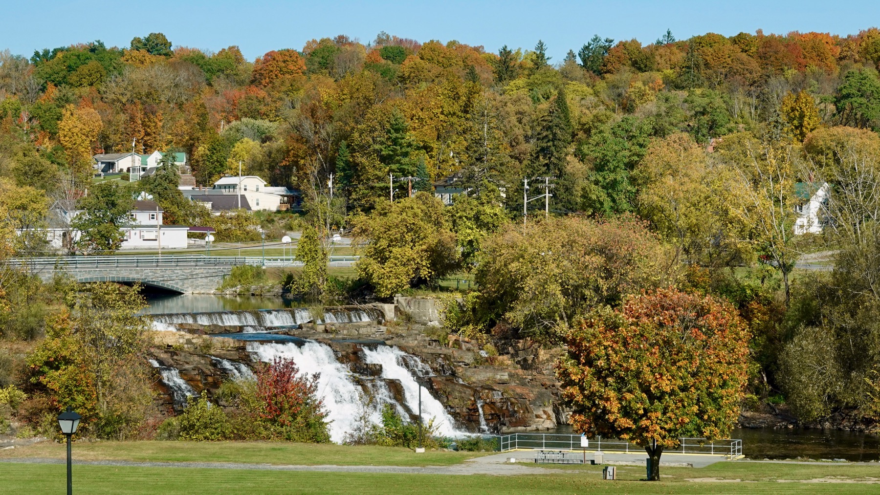
Ticonderoga’s mill dam. There were at least two mills on the river, both long gone.
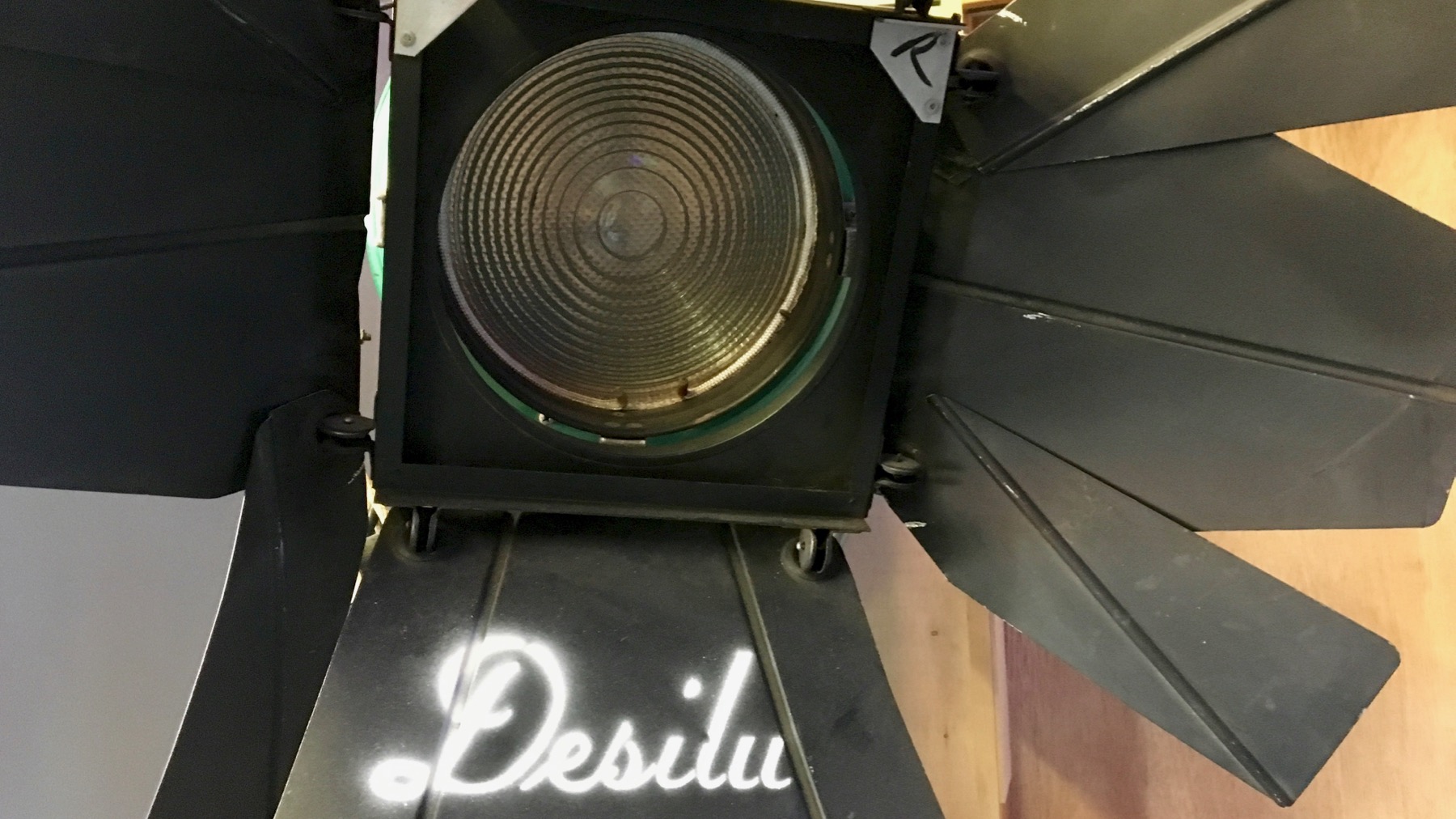
Lucille Ball was the backer of the original Star Trek; her money, exclusively as I understand it, got the pilot made, then a second pilot made with new actors, and on the air. She and Desi were divorced by then, but the studio name stayed, and she ran it.
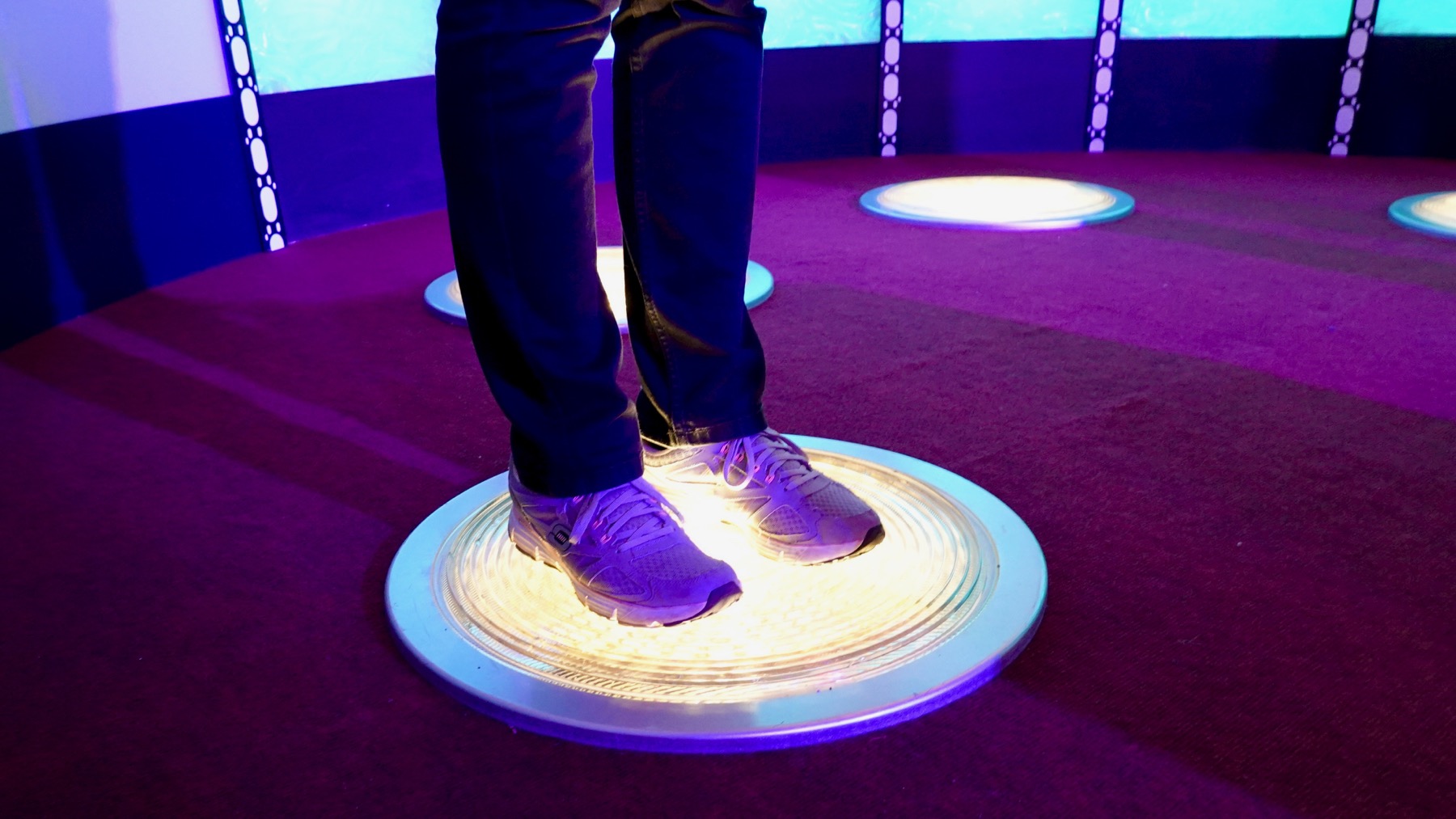
Modern transporter footwear.
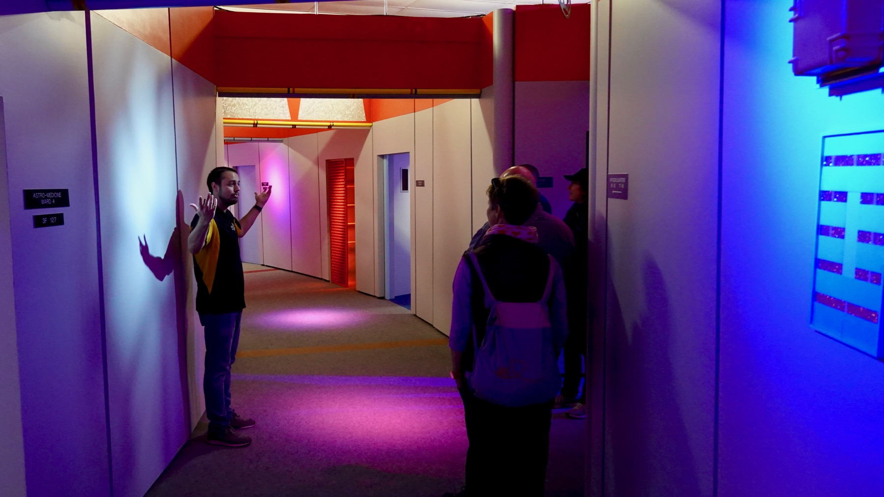
Magic hallway—Drew, our guide, said that was the filming term. The arc was long enough that actors could walk/run-and-talk for a bit before reaching the end.
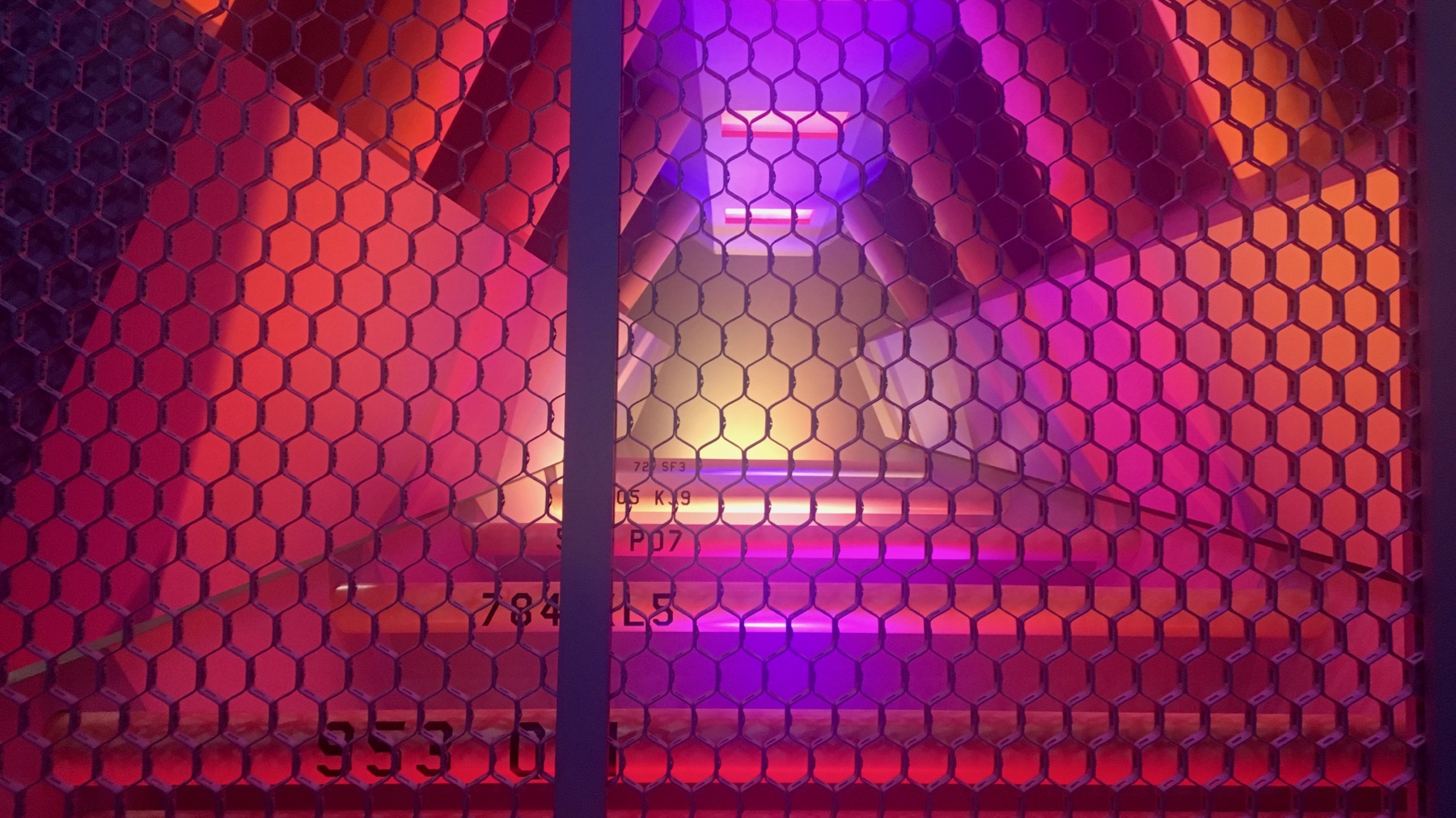
Warp core.
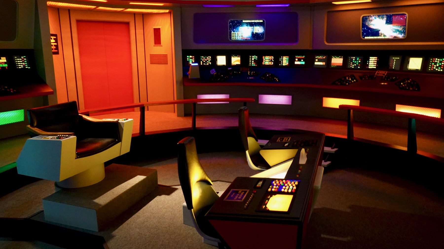
Bridge of the Enterprise.

Traditional double bridge.
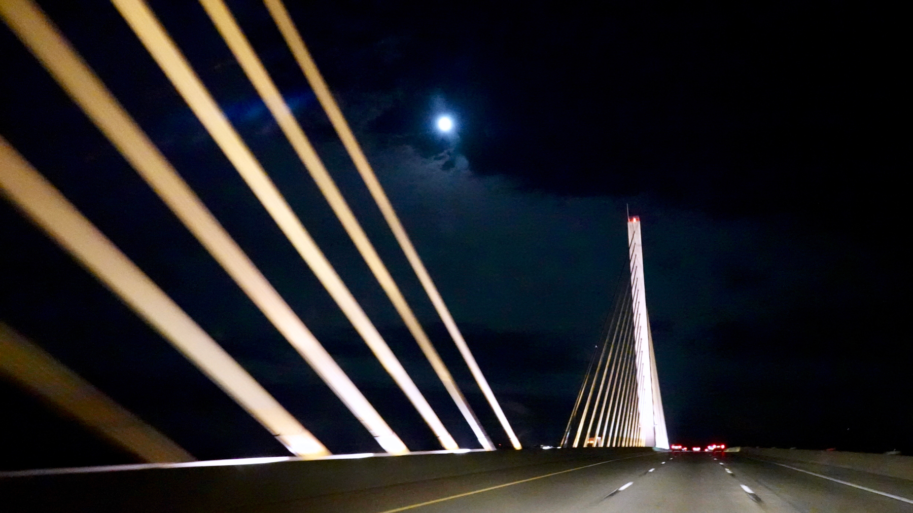
Modern highway bridge.
Apologies for late/”10:22pm” post; we had a l-o-n-g drive yesterday and I was pooped/too busy navigating.
Posted at 10:22 PM |
Comments Off on Built environment, especially bridges
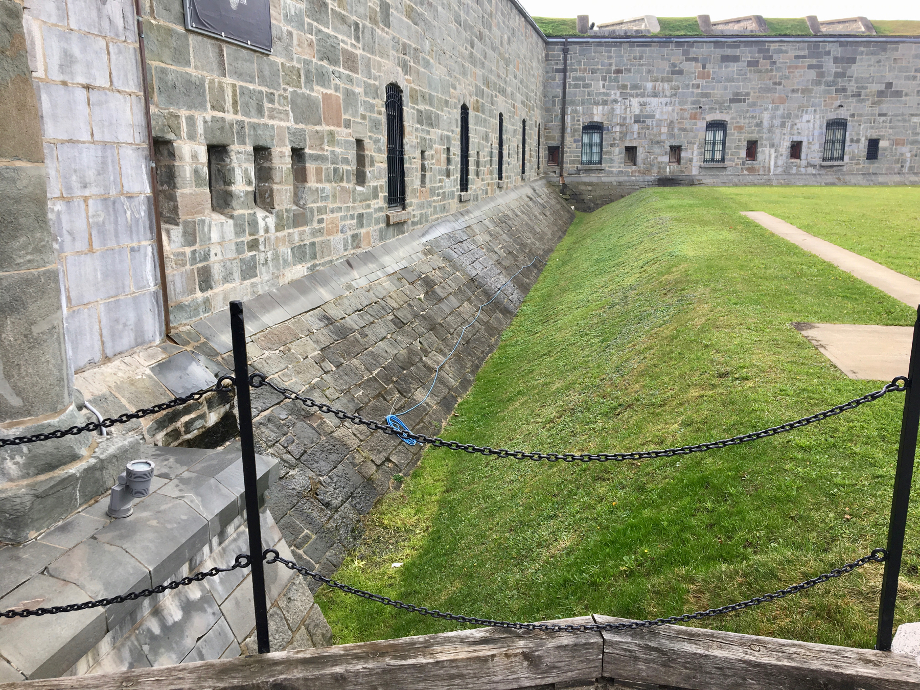
After a nice walk through the trees on a boardwalk high above the St. Laurence, we popped out by La Citadelle de Québec. We opted to look from the entry gate and not take the tour. You can’t wander around because this is still an active military base, plus it is the official residence of the Queen of Canada, who is also Queen of England, and I’m sure rarer than rarely visits, let alone stays in the Citadelle. Apparently electrification is important to the mini-moat around the exterior wall.
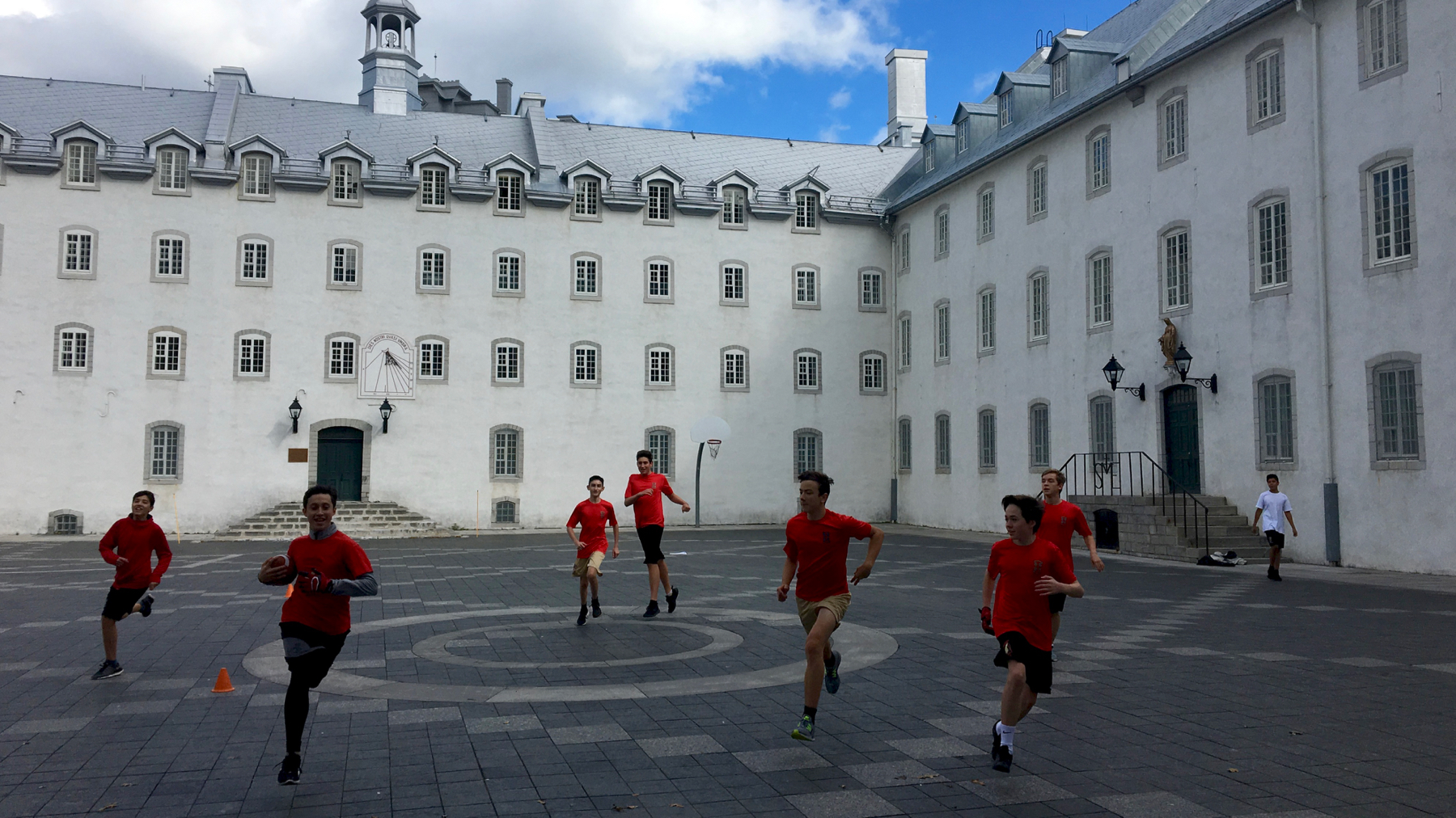
This is known as the Children’s Courtyard, within the Petit Séminaire de Québec, a Roman Catholic secondary school. Turns out where I was standing was the goal. The young man (second from left) stopped just in front of me and extended his foot toward me, tapped his toe immediately in front of my feet (no fudging!), and quickly and simultaneously deftly turned to continue the game. I really felt like a darned tourist, right in the way of real life.
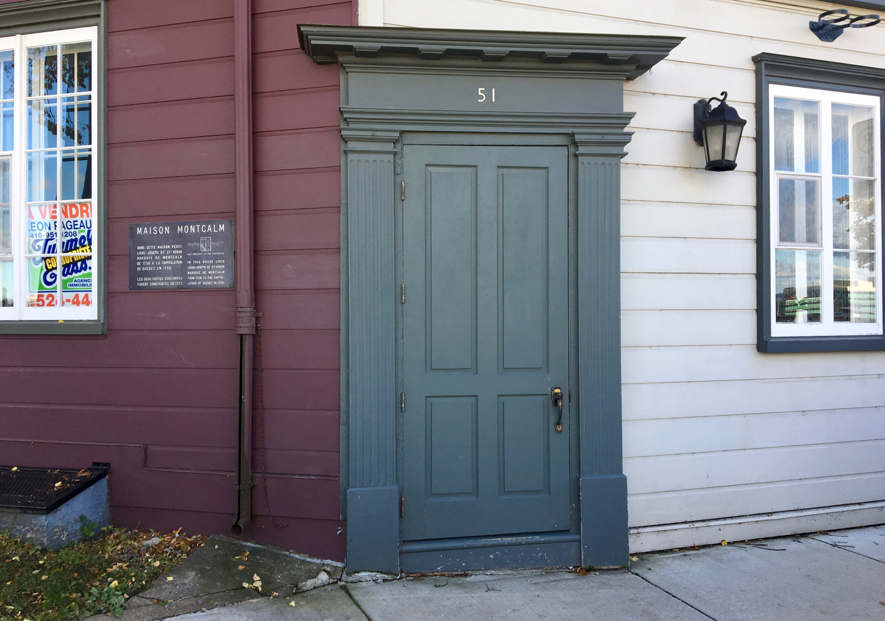
On the slope as we worked our way down from the heights, we found this door. It’s not on a straight wall, and is not flush with either wall, the dark or light one. Rather strange. It is 51 Rue des Remparts, and is for sale. Across the street are two cannons. Who wouldn’t want to live here? Plus the plaquette notes that this was the home of Louis-Joseph de St-Verán, Marquis de Montcalm. You may know him from Québec history from the phrase Wolfe and Montcalm, referring to the leaders at the Battle of the Plains of Abraham here in 1759—both died from wounds they received in that battle.
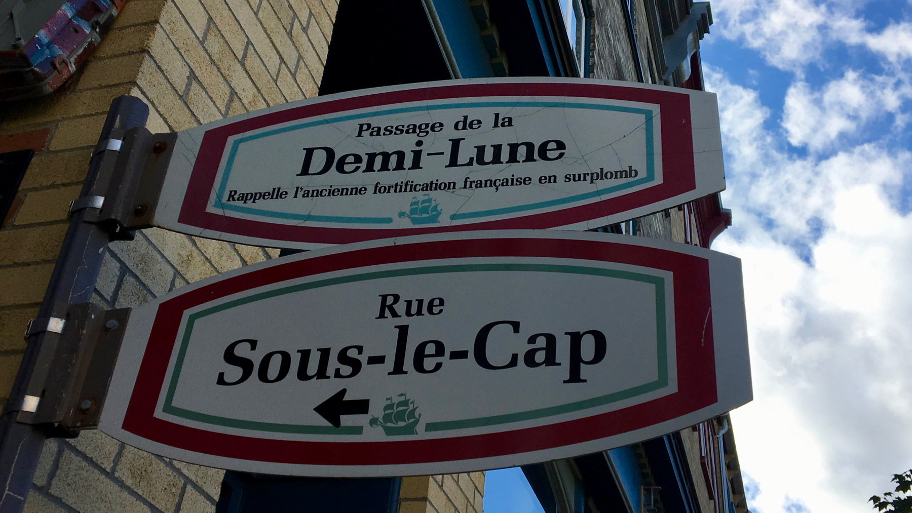
Of course, demi-lune means half-moon, literally. Maybe that’s what it means here. However, on the open highway, it indicates a place where a driver can make a 180 and reverse direction. This meaning doesn’t quite make sense here?
Demi-lune is one of my words for this trip. Another is vitesse. It’s another driving term. It means speed. Vroom-vroom.
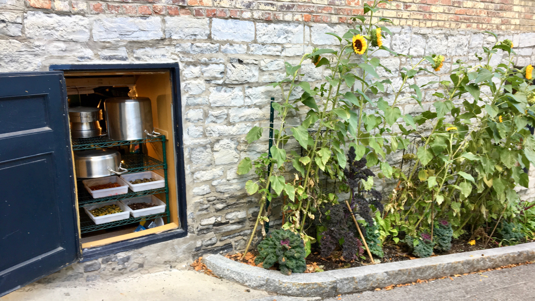
Kitchens get hot. Kitchens in ancient buildings are retrofitted in awkward ways. Thus, they are often cramped, with poor ventilation. Apparently, that’s the case here. Not only is this portal a vent, it’s a storage area for a rack of bins of food. No lie. Without plastic wrap or any other dust/fly protection over the bins. We did not eat here.
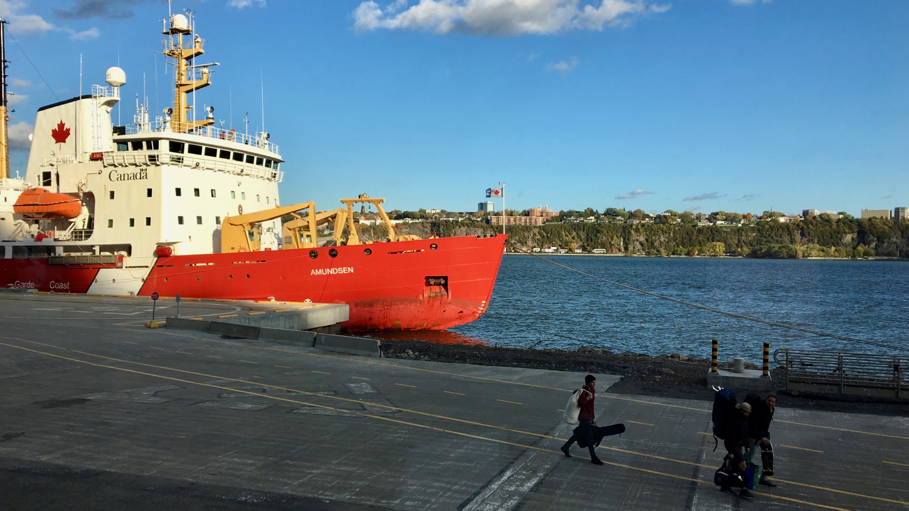
Coast Guard ship Amundsen. Monitors fisheries, and perhaps does research. Dramatic late-day light.
We ate in the lower town. Yum.
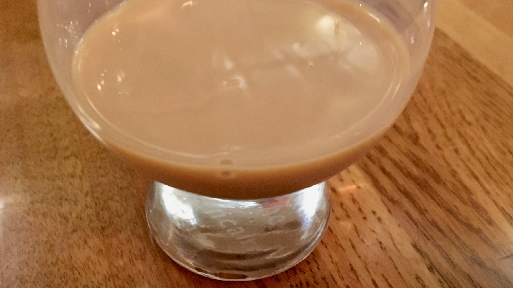
Nothing against the many fine foods and beverages I consumed today, but this was hand’s down the best: a maple syrup whiskey cream liqueur. A gift from our dinner waitress. The maple flavor was exquisite. I didn’t ask the brand, but a prominent one is Sortilège…with Canadian whiskey, of course. WikiPee says French Canadians call this miracle beverage eau de vie d’érable. Heaven in a glass.
Posted at 9:25 PM |
Comments Off on A day in Québec City
Many bridges usually mean many rivers, or at least, vertical terrain change. Here it is rivers.
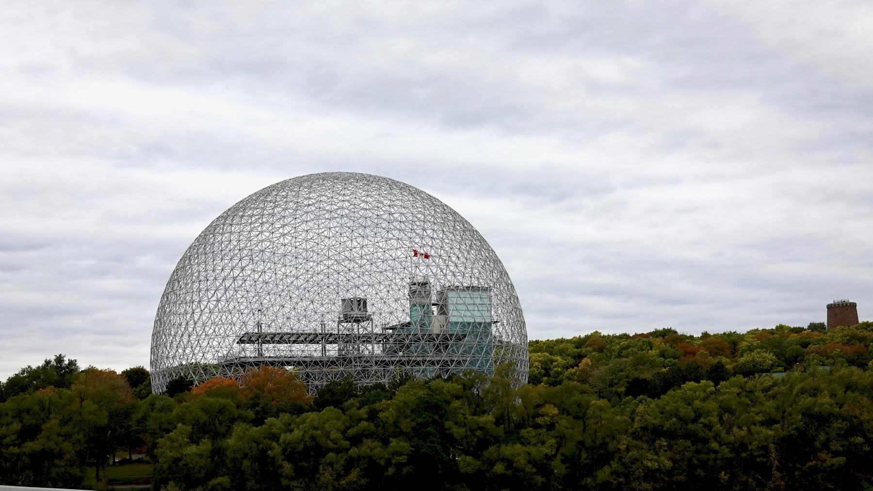
And bridges may lead to islands. Saint Helen’s Island was enlarged and modified for Expo 67. Most of the buildings are gone, and this is one large park. The iconic American Pavilion has become the Montréal Biosphère. Don’t know about the castle structure to the right—water tower?
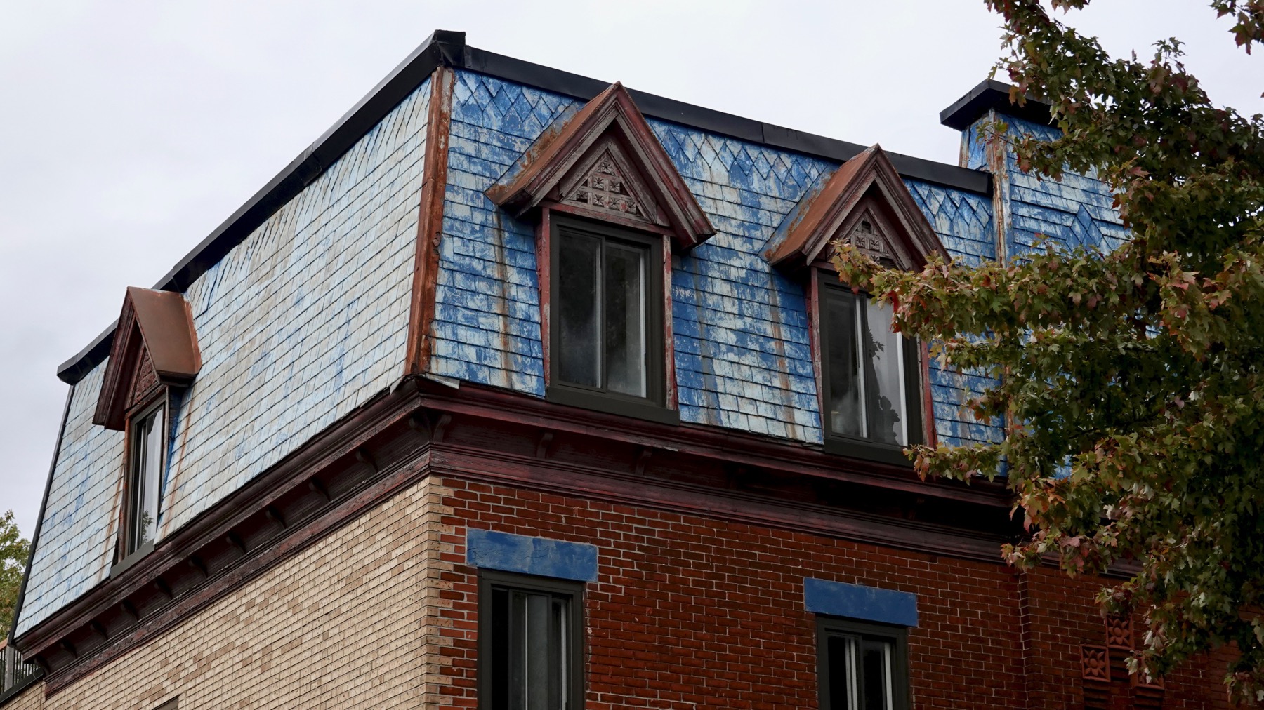
Blue? Nice touch. Is this a mansard roof—or merely mansard-like?
Like the ice warning sign behind the handlebar.
Elsewhere we saw a truck watering the street. My guess it’s part of the horse clean-up strategy.
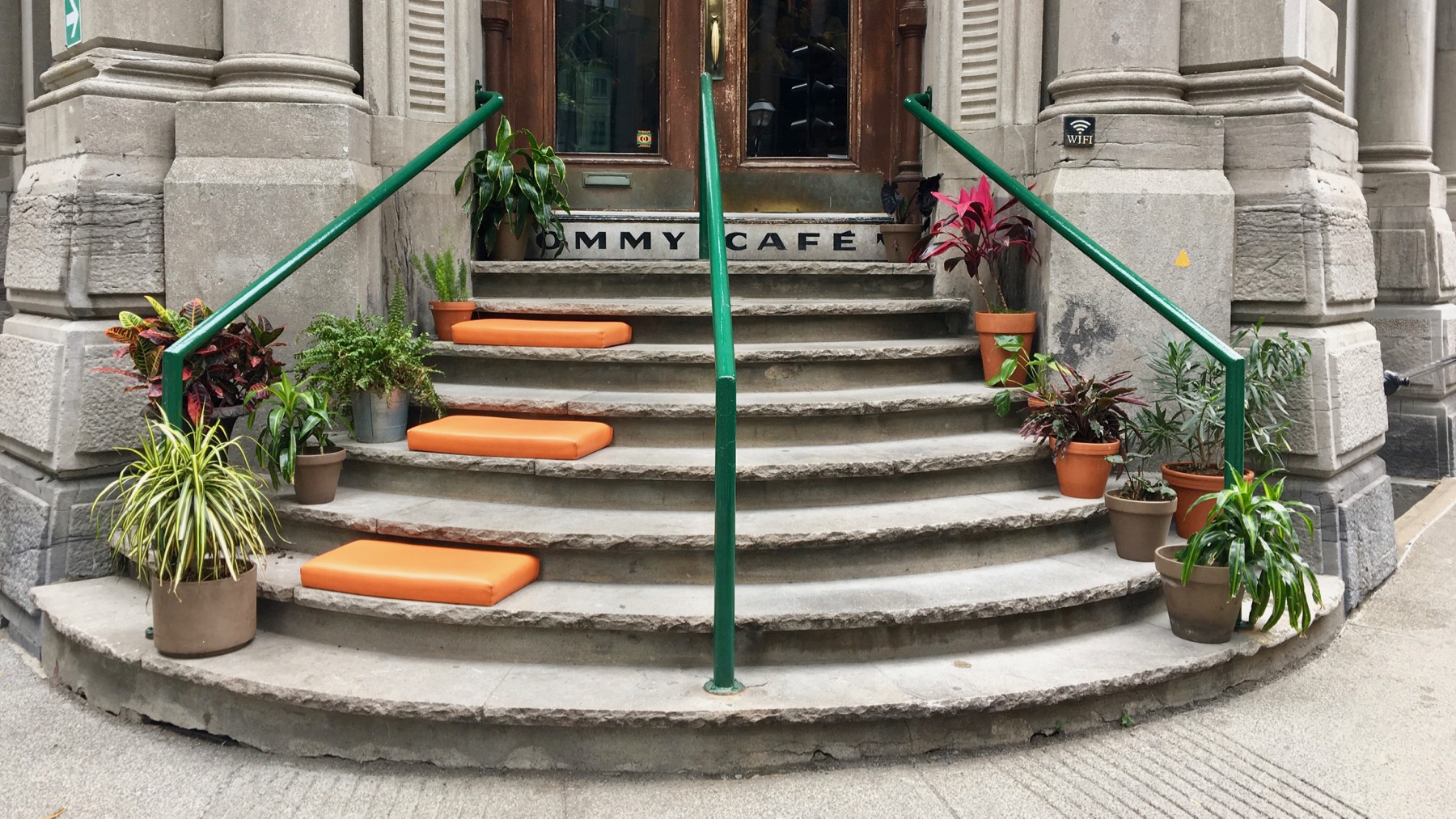
I think only the right door is in use, and the café has kindly offered seating for the unused half of the steps. This is in the old-town area.
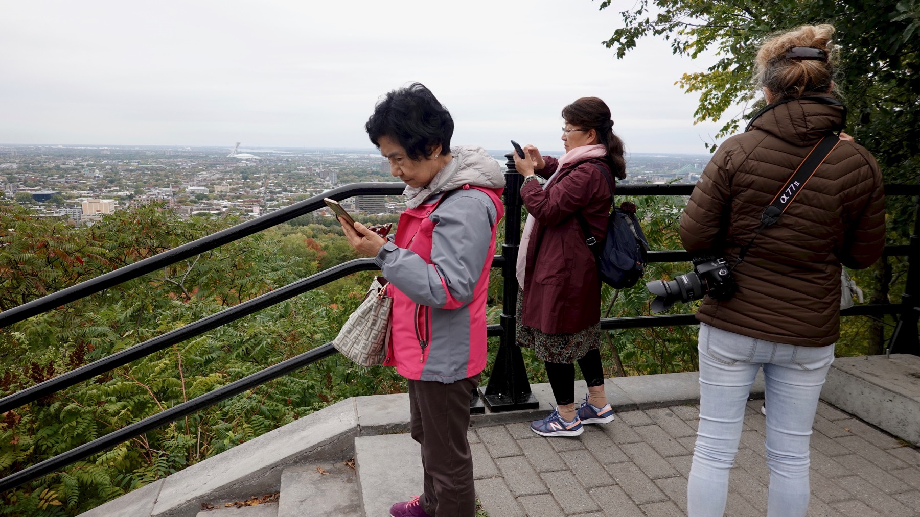
Overview drama: who can post to social media first?
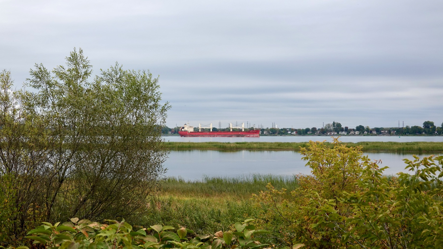
That was a sample of our Montréal morning. We followed the Ottawa River downstream, taking a side tour of the large Île Saint-Ignace. Flat, duh. Many summer cottages with some age on them (small), and a few large, new ones. Considerable active farmland, especially soy, maize, and cattle grazing. And channels the river has abandoned.
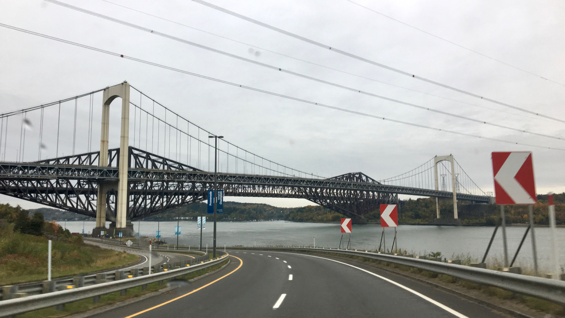
You are seeing two bridges visually conflated. Makes for an appearance of strange engineering.
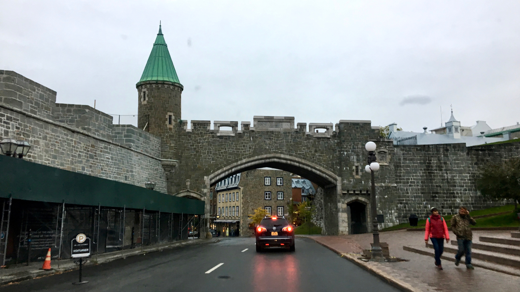
Haven’t seen a medieval-style city wall in a while. Welcome to old Quebec.
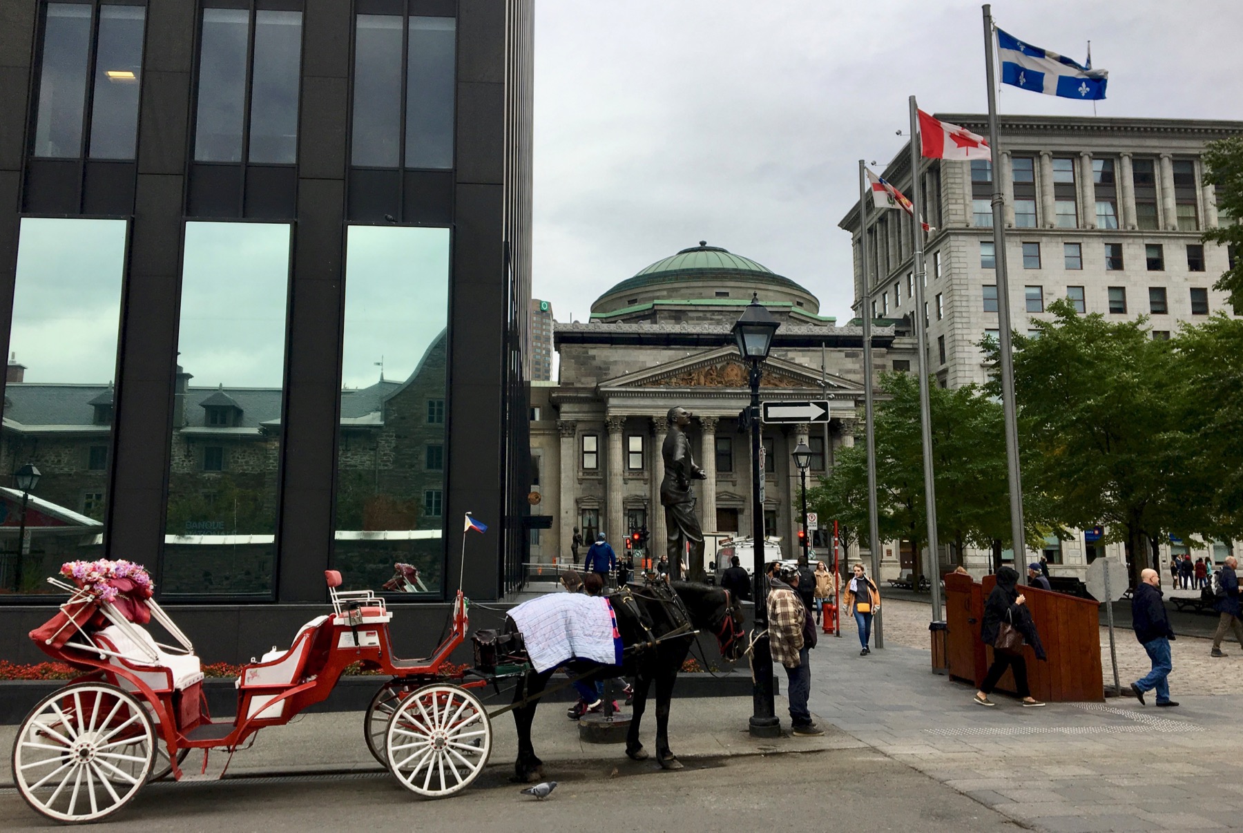
That statue left of center in the distance is of Samuel de Champlain. Colonialism honored.
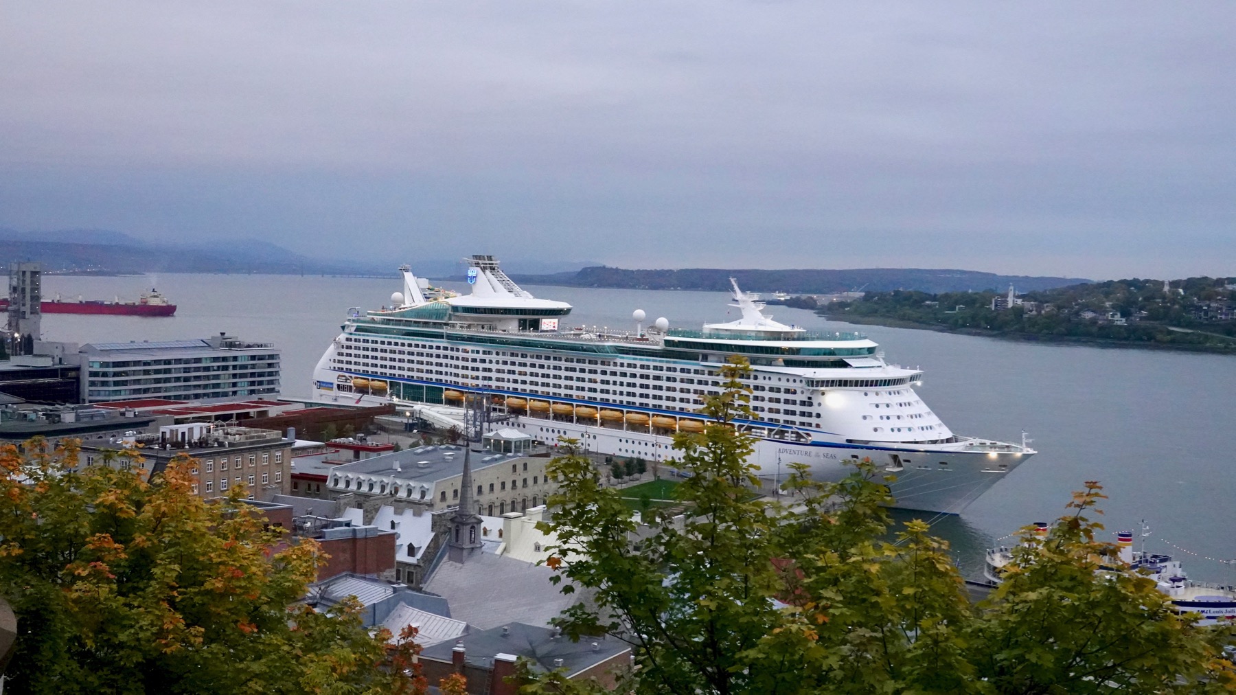
I am becoming not-a-fan of cruise-ship towns. This mammoth vessel had a giant screen on that upper deck displaying moving images constantly, because, why look over the railing at real life? Or at the clouds above?
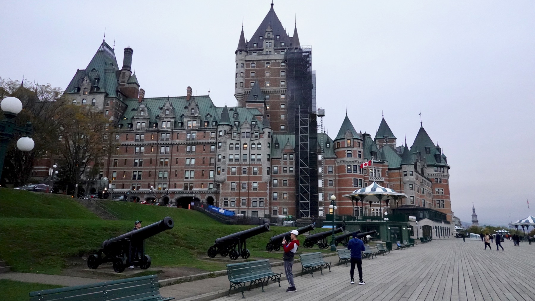
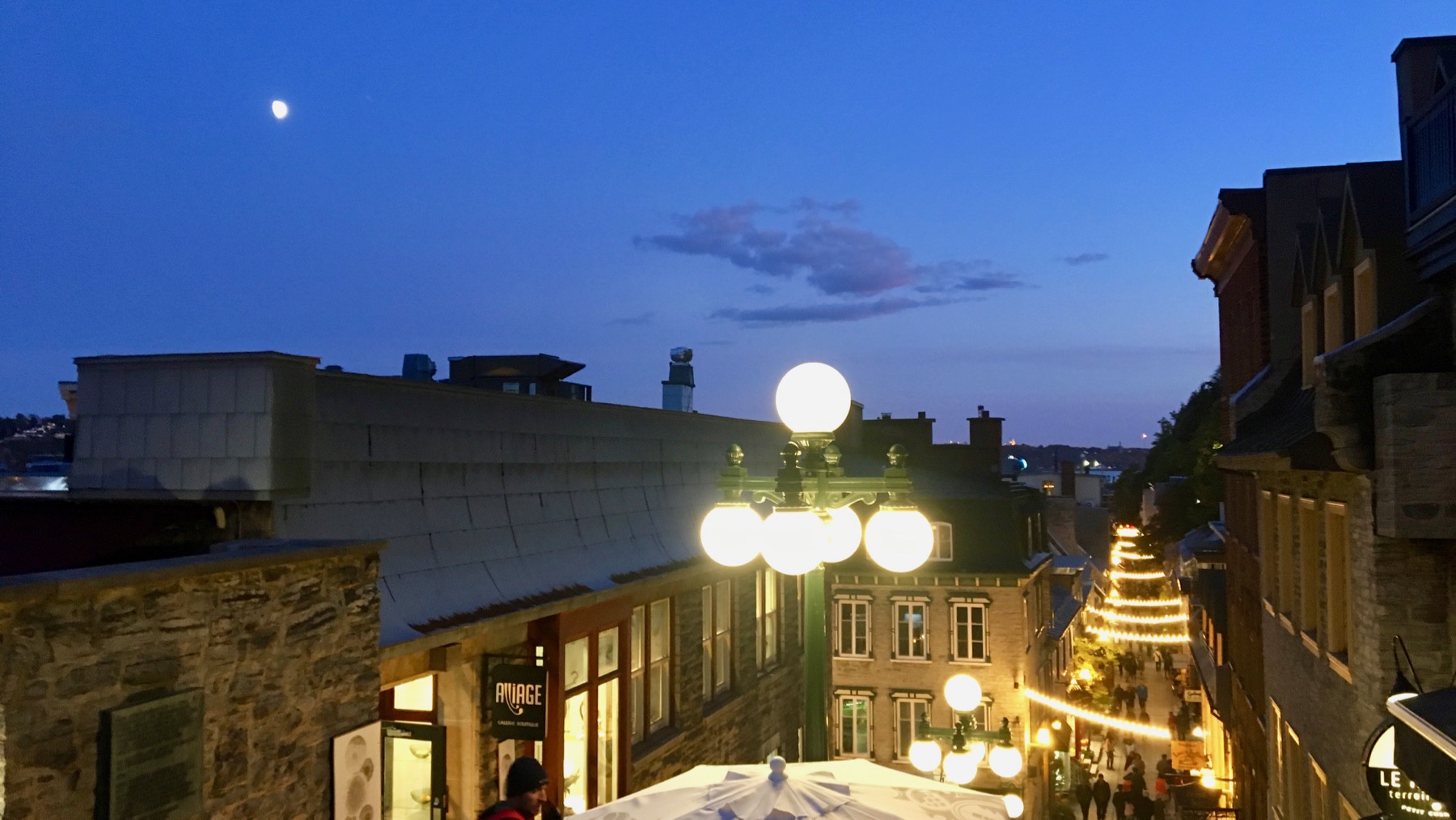
This is the famous Frontenac (now Le Château Frontenac), and we are standing on the Terrasse Dufferin, which amounts to a huge, high-elevation boardwalk. I expect we’ll follow up on the views we got through portals in the decking to excavated building remains below at the other end. This end has cannons and a closed-for-the-season toboggan ride with three lanes. And a fort above.
Posted at 10:22 PM |
1 Comment »
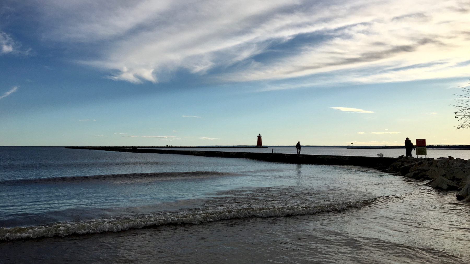
Lighthouse from afar.
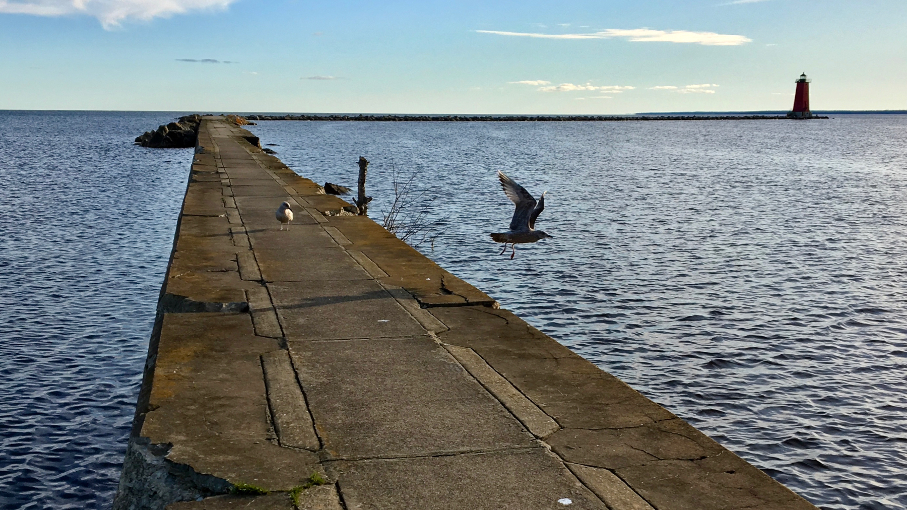
Approaching.
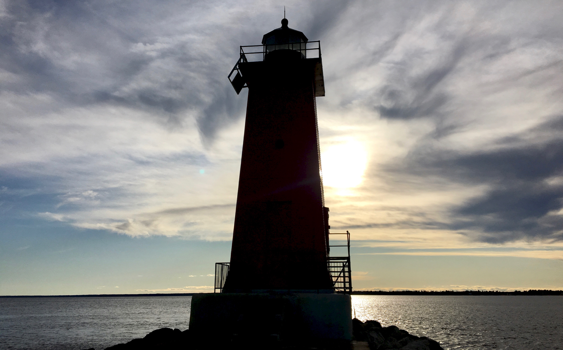
Very backlit.
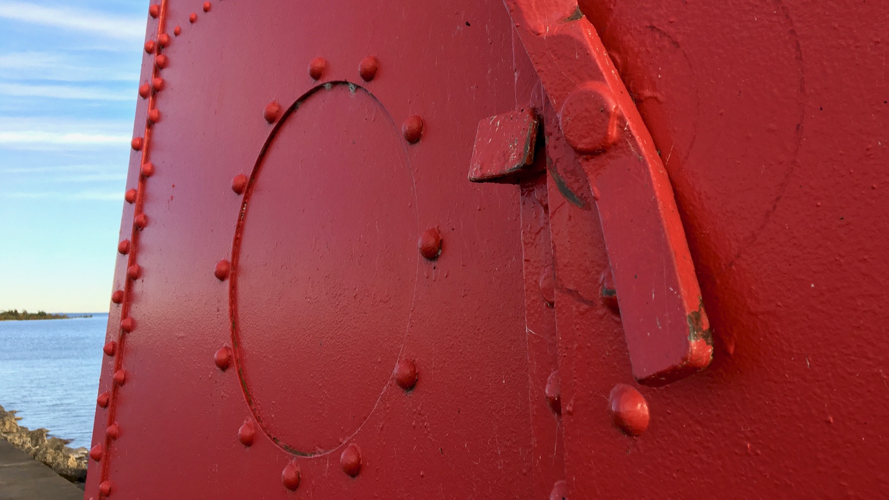
Yes, it’s very red.
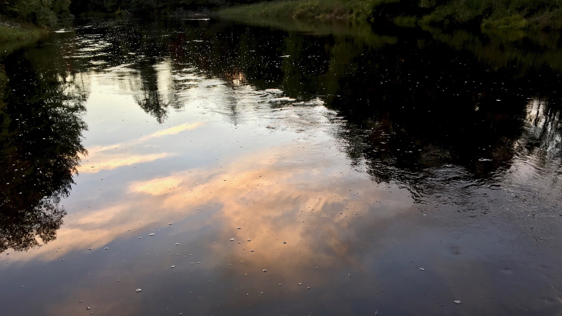
Bonus shot: sunset sky reflected in Manistique River at Mead Creek.
A small sample of this water winter wonderland. Without the winter. For now.
Posted at 10:17 PM |
Comments Off on Manistique lighthouse
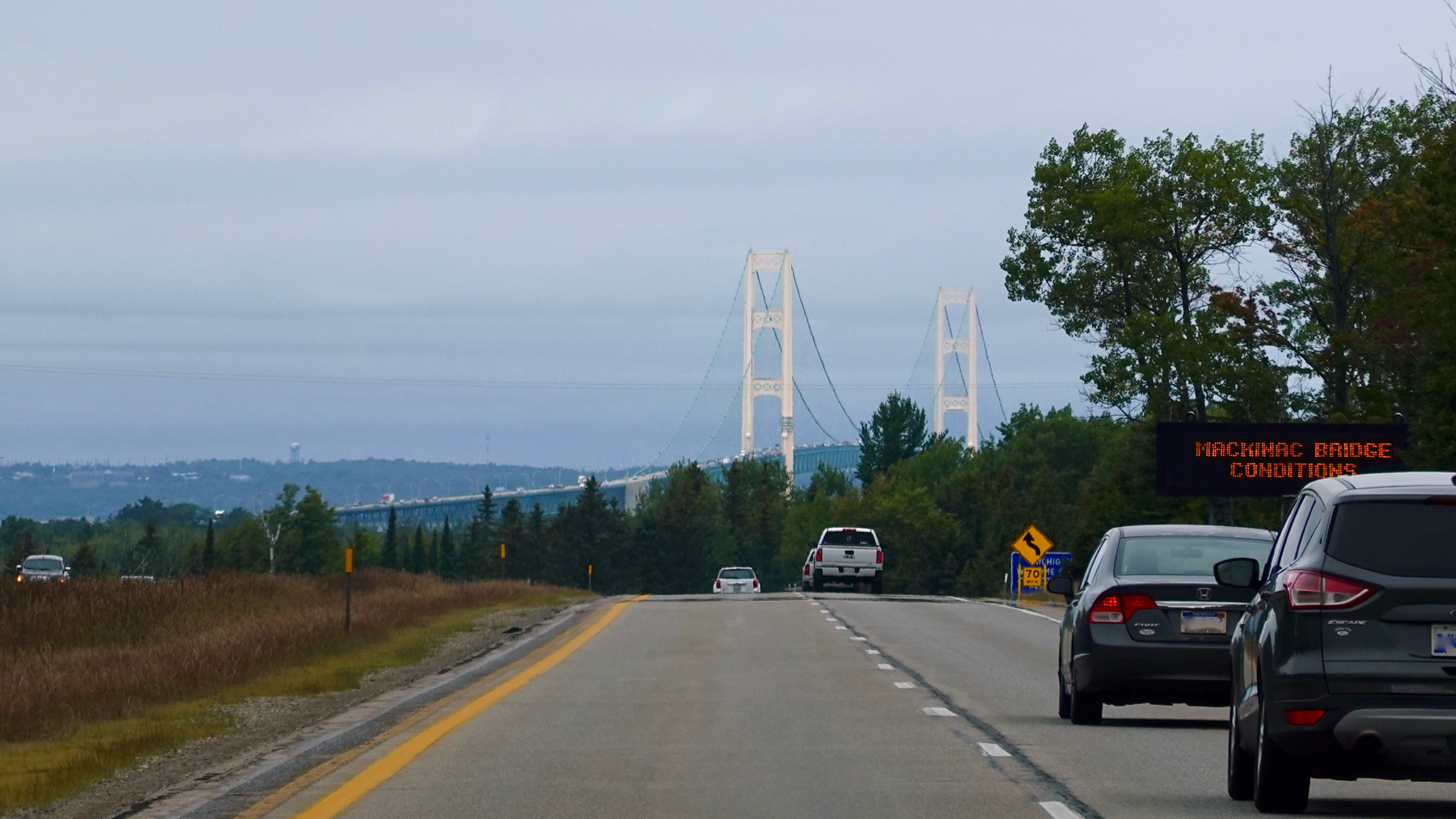
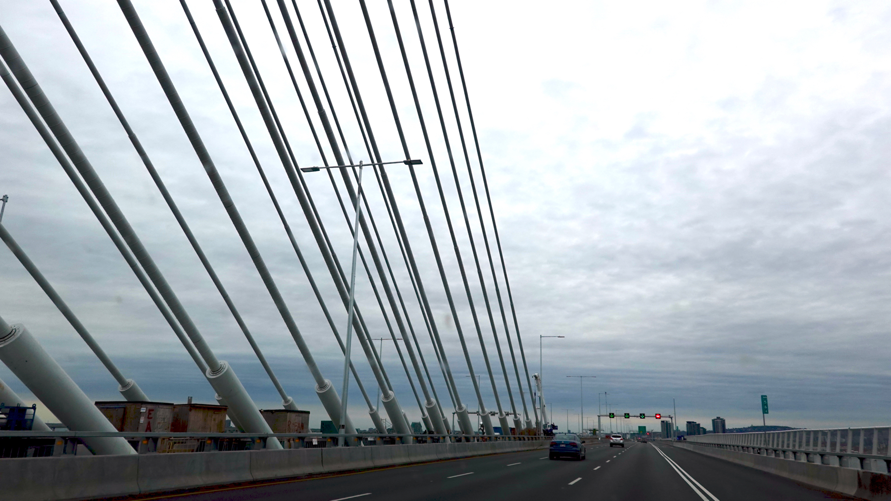
In my youth, we’d compete (if we remembered in time) to see who would spot The Big Bridge first as we motored along from the south. Because of the hilly terrain, the tall pylons effectively “hide” for quite some time.
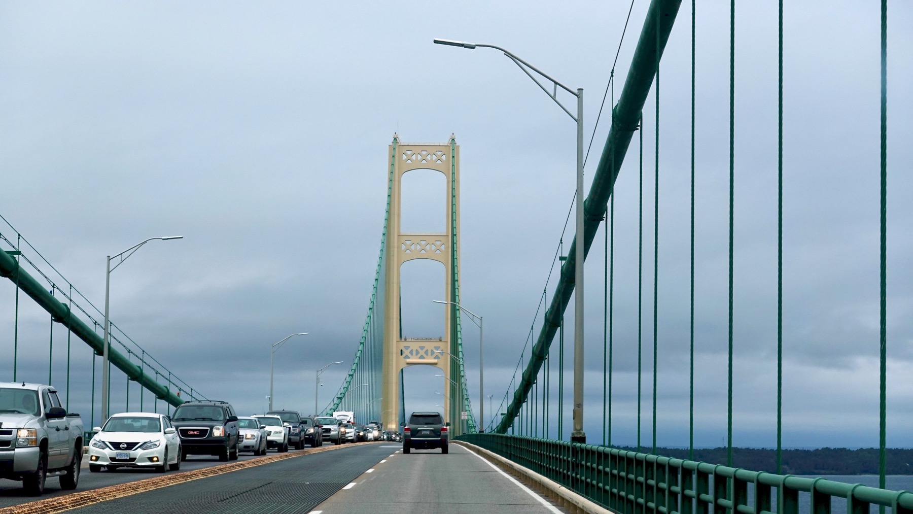
Were we ever glad we were northbound today. I’d been monitoring traffic info on my smartphone, and I’m pretty sure northbound had this problem about three hours before we got here. Whew!
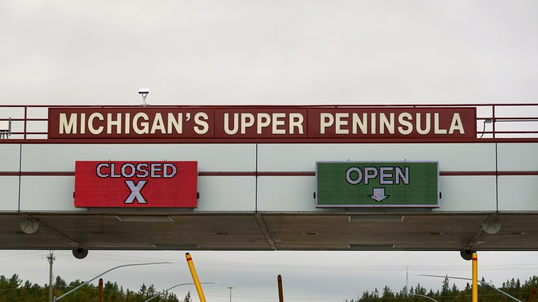
Big payoff sign! The colorful ones aren’t referring to the peninsula, but the toll booth immediately below. Speaking of closed, the DOT is replacing a river/creek bridge* west of The Big Bridge, and all westbound (non-local) traffic had to go north to get west—only a few alternate routes in this swampy low-population** area. This closing just began this week—after the big summer-end holiday—and will continue for a mere six weeks or so. Must be a modular/pre-manufactured bridge.
* For those in-the-know, this roadwork is in addition to the seemingly unending revisions to the Cut River Bridge, where traffic can pass on one lane and is controlled with red/green lights.
** Low people density. High populations of mosquitoes and many other living things.
Posted at 7:23 PM |
Comments Off on Infrastructure (bridge-talk)
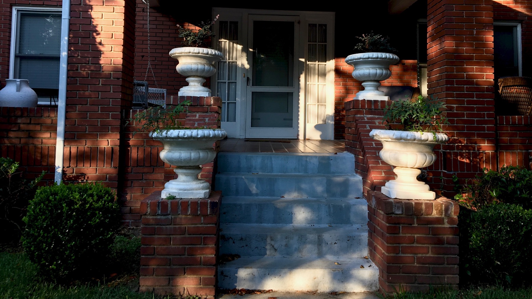
Do you figure this is a household where someone says, “Hey, honey, it’s sunny out and I gotta paint those seee-ment vases today!”
Serious vase decoration, there. I have been remiss in learning architecture terms, and cannot come up with the names of these flat spots to the sides of the staircase. Seems like a term I should know.
Posted at 9:35 PM |
Comments Off on Shrug

Hidden in an alley…

…and out in broad daylight.
* Title: TY to the Guru.
Posted at 4:58 PM |
Comments Off on Portals*