Elevation drop
Tuesday, 20 October 2009
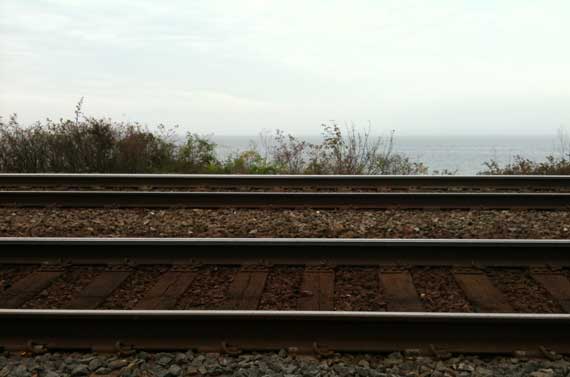
We couldn’t decide whether this was a marine layer or the air is crappy.
Translation: we have reached sea level!
Tuesday, 20 October 2009
We couldn’t decide whether this was a marine layer or the air is crappy.
Translation: we have reached sea level!
Monday, 19 October 2009
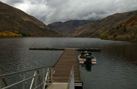
I never figured out how far south up the Snake River the section They call “Hell’s Canyon” extends, but this is upstream of the Hells Canyon Dam, and downstream of the population nexus They call Copperfield, at least on some maps and there on the ground, too.
The weather was working in our favor (mostly), and we made the run from Weister to Copperfield, then up and over (a couple of times), ending up in Joseph. The clouds were sitting on the highest places, and we really didn’t have much direct sunshine, but this was gorgeous territory (as RMJ had already told us!).
In sum, we saw lots of the Snake today (yesterday, too!), and late this aft we also saw pretty much where it flows into the Columbia.
In sum in only two words: rivers and ridges!
The lesson: geeze, we have dammed up a lot of rivers.
Sunday, 18 October 2009
In geologic terms, time is—I can’t say relative, although it is, because it’s too trite—well, confusing. So yesterday was geology-in-the-making, geology-in-motion.
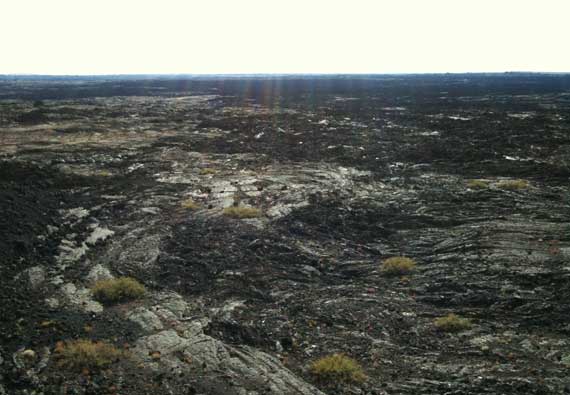
Today, in contrast, was geology in more of a holding pattern, although still geology of the Holocene (if I’ve got it right, we’re still in the Holocene…).
This afternoon we wandered around Craters of the Moon National Monument and Preserve, established in 1924. The park includes the largest primarily Holocene-epoch basaltic lava field, I think, in the continental US of A.
So glad we weren’t there in the heat of the summer, all that black radiating the daytime temps, but in today’s overcast, without direct sunlight, the lava became flat and difficult to judge, especially distances. Loved the spatter cones! (Sorry, photo is of old lava flows that were more photogenic today; can’t imagine this landscape is really like the Moon, though….)
Saturday, 17 October 2009

Only on rare opportunities do most of us need to spell the word “geyser.” Apparently our word comes from the name of an Icelandic geyser—Geysir—which is in the Haukadalur Valley in southern Iceland. Still, I have to think to get the spelling right, although I saw it on signs many times today!
While we were in the old caldera where Yellowstone’s geyser activity is found—apparently the greatest concentration of geysers in the world!—we saw lots of volcanic features (not cones, although the caldera is considered an active volcano), and, of course, the famous Old Faithful. Here’s what really surprised me about the old caldera: the continental divide loops into it, so that the floor of the caldera has two drainages, one to the east and one to the west. I found this counter-intuitive.
FYI: That’s the caldera rim framing the skyline to the left of the geyser.
Friday, 16 October 2009
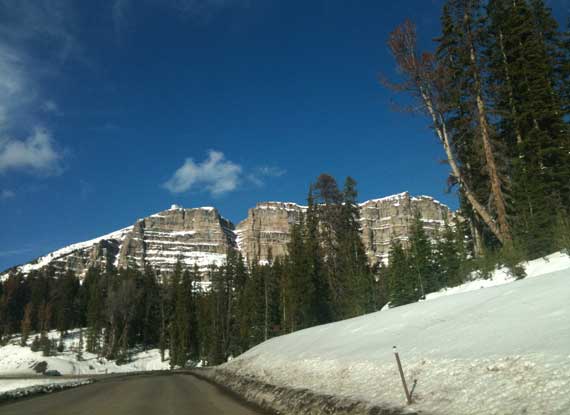
The internet has amazing amounts of current information, but sometimes it’s difficult to find it. So, here’s a bit that will be beyond difficult to find: the pass into Moran Junction from the east (Riverton, Casper), that is, into the Grand Tetons/Yellowstone from the east, here’s the lowdown: big construction project currently focused on what I’d guess to be road widening at the top near the pass (apparently this will continue all winter!). We drove on some horrific but thankfully shallow mud (we now look like we’re driving a white Prius that was splashed with a frappuccino) bypassing the construction equipment, along a stretch that the radio road report said was a “dry road”—or maybe they meant the paved part was dry (it was!)!
On the other hand, despite many many signs warning us to watch for loose cattle (doing what?) and general wildlife, we saw other vehicles, beautiful sunshine, and no four-foots or hoofy creatures or whatever….
Thursday, 8 October 2009
Whatta treat! Today we returned to the Hurricane River mouth and Au Sable Point Lighthouse area, this time walking down to the light. Eastbound, we went along the beach for a ways, until the waves chased us back to high ground. We also checked out the shipwrecks. Fun!
Monday, 5 October 2009

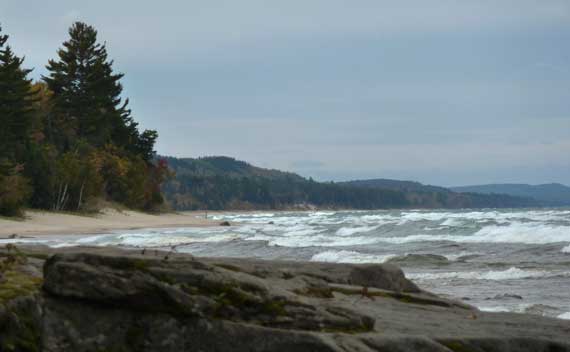
Today we dodged raindrops and caught various views of Gitchee-Gumee, including at this spot by the breakwater/pier at Grand Marais. The weather patterns have given us dramatic skys, and that’s putting it mildly. However compelling the clouds have been, I found myself gently plopping the camera in the sand for eyeball-to-eyeball shots of the pebbles on the wave-washed beach. Finally, I did get the focus and framing right, but here I record my early brave attempts. Hopefully this photographic mania will pass quickly. After all, isn’t a rock just a rock?
Friday, 4 September 2009
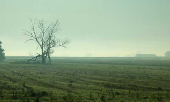
We left amidst moderately dense groundfog across southern Michigan and northwestern Ohio. This down in Ohio, with the rising sun across the fields. Fortunately, we saw no accidents, but it was soupy enough that I thought it a bit dangerous. We stayed off the Interstate, routing via Ottawa, and I don’t know if that was wiser or not.
Wednesday, 2 September 2009
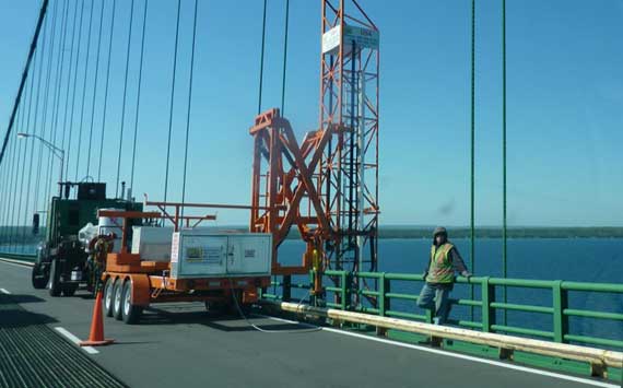
We crossed the Mackinac Bridge this morning, in bright sunshine unlike our most recent southbound crossings, when it was rainy. We saw many crews busy with activities that were often unclear as we zoomed by. I assume they’re preparing for the famous Mackinac Bridge Walk, which has been held every Labor Day since 1958, the first after the Bridge opened, and the only time people can walk across. Some lucky people also get a chance to run across, I hear….
Monday, 31 August 2009

Even at something like 8:30 this morning, the ground fog made the terrain quite pretty. You can also see the surface ups-and-downs since The Farmer (also of Chelsea) bush-hogged the miscellaneous woody growth and milkweeds that were infiltrating the good grass.
We also heard through the gardener grapevine that this morning some low spots around Newberry had frost overnight. Yes, in August.
* No, not really….