Musings

We played hooky from our responsibilities and chores, and went leaf peeping. Here’s the view to the piedmont as we climbed into the mountains…many leaves intact, some green, some not.

We looped around through the mountains and stopped at a cemetery on Angel Drive. Touching address. Dramatic, colorful plastic flowers on most graves. Abundant fluffy leaves.

We climbed up to Winding Stair Gap. Fewer leaves at elevation. Beautiful and sunny. This was the highest we got.
Posted at 8:04 PM |
Comments Off on Rain predicted for tomorrow
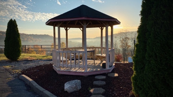
The motel that brought us to this spot: in need of updating. Their problem: the “bones”/structure of the property: unalterably lacking. Yet…the view: wow.
Credit to the management for tending to what they can.

Here, the valley-mountain topography offers a beautiful morning-moment that we don’t see in the UP or at home. A supremely unimpressive motel, and a terrific Appalachian morning-view.
Posted at 7:01 PM |
Comments Off on Reaching for…(not perfection)

With the exception of a delightful interlude in A-Squared, we have been logging mile….

…iterspersed with rest area stops. During those I found a few dramatic sunlight moments. Or semi-dramatic. These were both in Ohio.
Posted at 6:33 PM |
Comments Off on Light along the way

Single best visual find in months: the icy cap on these wee mushroom caps. What texture! What subtlety! What ephemera!
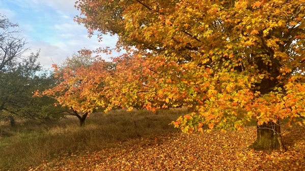
This, on the other hand, is mostly a color mosaic. I’m amazed how many leaves are still on the tree, and still colorful, with that blanket of the fallen foliar fragments.
Posted at 9:16 PM |
Comments Off on Floral organics

We’ve gotten a fair amount of rain and snow over the last two days, yet the precip hasn’t been constant. Still, the water level in the swamp is up markedly.
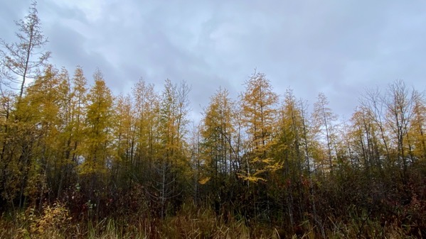
In other swamp news, the tamaracks are turning golden. They are deciduous conifers and have needles, or plant parts that look like needles. They aren’t as large as leaves, so they produce a cloud of color around the trees.
Posted at 6:44 PM |
Comments Off on Swamp changes
This has been one of my favorite shots this year to get at the progression of the autumn leaf color changes. There’s so much less green than five days ago, and the leaves are blown onto the road.
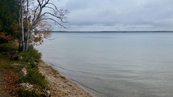
And this is the lake from the beach, always a go-to shot for me. It often portrays/offers a kind of peace, I think, despite cold raindrops (not really rain, just drops—and not mist).
Yesterday afternoon, I started a fire in the wood stove (which, it turns out, is a coal model, by Kenmore), and with no good keeper wood (only damp pine), I loaded it and left it to burn itself out even before we went to bed. I think the temperature indoors reached almost ninety big F degrees, and the walls and floor were thoroughly warmed. Even with outdoor temps in the upper thirties overnight, the indoor temp only dropped to sixty-six by the stove by the time I got up (late, about 7:15). Today, we’ve used our small electric heater, and are comfy.
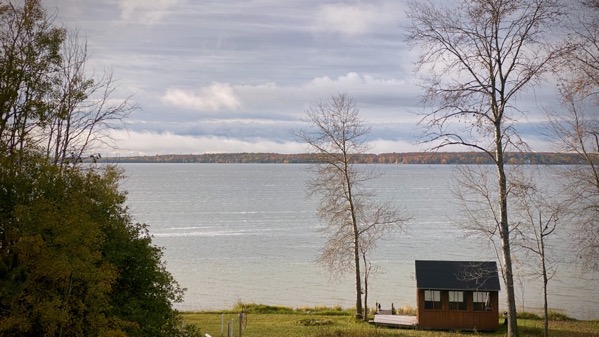
Sunshine visited us several times (vaguely present in first photo), and rain drops blew around periodically—an unsettled fall day. We’re looking at closing up the cottage and leaving on Friday. In the meantime, snow is predicted overnight although we’ll see if it gets cold enough at elevation; otherwise it’ll be rain, as it has been during the daytime.
Posted at 5:39 PM |
Comments Off on We shall see
Sometimes oft-repeated sayings are a bit off the mark. Around here, you often hear a version of “if you don’t like the weather, wait five minutes.” Or an hour, or a few hours. This is a valid observation, including the variable time-frame.

Those white striations on the lake-surface above? Ice bits. Likely from a quiet bay to the west—berg-lets coasting by. And in this photo, two hours later and from our beach, all cool, but not frozen—no mini-bergs. [We didn’t even have a frost, on land, at our place. The threat of winter is real. And pending.]
Posted at 8:40 PM |
Comments Off on Just wait

This density of apples under the apple tree suggests they’re not tasty, as in: the deer are not eating this tree’s product. [Yet.]
Because the deer are sure eating apples with abandon. And browsing grass. They are piling on calories as the weather turns cool, then cooler.
Hypothesis: this tree was planted to be a pollinator. No one left to ask about this, meaning mostly The Botanist, I suppose.
Posted at 7:30 PM |
Comments Off on Clue apples

Overall update: the maple still has green and yet has dropped many leaves.
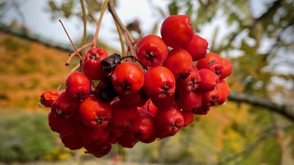
Found these rowan berries when I was out for a stroll, assessing the outdoor chore situation for before we leave (currently looking at next Wednesday, although the weather prognosticators often change their tune).

Speaking of chores, I pruned back this woody honeysuckle earlier. Now that most of the leaves (they’re small) have fallen, I can see that the branches are populated by many interesting flora. [How many species here? My guess is at least five….]
Posted at 5:04 PM |
1 Comment »

Most of the day was windy and overcast, with spitting rain. Then, a miracle—sunshine as I was beginning to fix dinner. No, it didn’t last, yet it brought a glow to the evening.
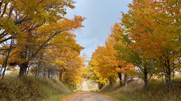
When I walk or drive through this alley, I enjoy it every time. The yellow-golds are now (mostly) ascendant.
Posted at 9:20 PM |
Comments Off on Autumn alley