Ferny
Thursday, 20 April 2023

I found this oblique golden morning light at nine, which seemed late to me…perhaps because I have no firm natural sense of the time zone I’m in (at the moment).
Thursday, 20 April 2023
I found this oblique golden morning light at nine, which seemed late to me…perhaps because I have no firm natural sense of the time zone I’m in (at the moment).
Wednesday, 19 April 2023

I’m still parsing an article* in the NYTimes about the pieces of the kylix that curators at the Met began collecting in the 70s. Over the years the Met obtained pieces from multiple art dealers.
A kylix is a kind of stemmed drinking cup. This one is made of terra cotta and thirteen inches in diameter. It has a nice decoration of a man and woman partying in a circular panel on the interior. The exterior has a band of multiple male figures, described as older fellows chasing younger guys.
The last fragment of the kylix arrived at the Met in 1994, and the restored vessel was on display until last fall, when the Manhattan DA’s office seized it as a looted item.
As near as I can tell, the prevailing opinion is that the vessel was intentionally broken, and the pieces essentially funneled to the Met’s purchasers and curators. This is not the only vessel in the Met’s collection that may have received this treatment.
Remember: to archaeologists pottery contributes to a complex story, while to art historians pottery has aesthetic, and, yes, monetary value—even broken, when an intact vessel would be worth more, the pieces have monetary value.
* The article is “The Kylix Marvel: Why Experts Distrust the Story of an Ancient Cup’s Rebirth,” dated today, by Graham Bowley and Tom Mashberg.
Tuesday, 18 April 2023
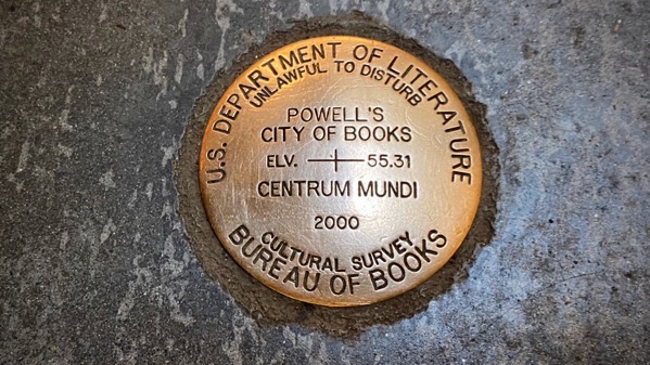
How many times have I been in Powell’s and not noticed this? Actually, there are several staircases, and this is on the landing of just one, so it can honestly and easily be missed.
I just checked their website, and the bookstore dates back to 1971. I think the first time I entered its doors was in 1979.
Our country might well be improved if we had a Department of Literature.
Monday, 17 April 2023

Dry-tolerant yucca in Santa Fé.
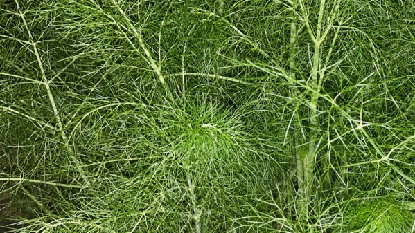
Moist, juicy fennel in ATL.
Of course, you can also nurture yucca in ATL.
Saturday, 15 April 2023
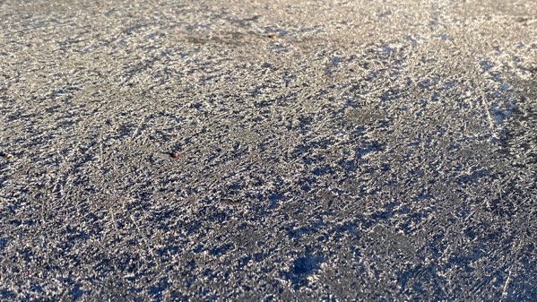
Frosted morning.

We drove away from the mountains. We did see a herd of perhaps three dozen pronghorns about a half hour after this stop. This was the only antelope sighting on our eastbound leg.

Busy wind farm.

It’s so windy here in western Oklahoma that the rest stop garbage cans have tie-downs, and it’s that windy today. This is better than in TX, where the “rest stops” had neither garbage cans nor toilets. [Ick warning: they were toxic waste sites that reeked of urine and were festooned with trash that was small enough or heavy enough that it didn’t blow away.]
Friday, 14 April 2023

I began my afternoon perambulation here, as it is close to our hotel.

That’s a Rail Runner Express on the right, with the active track to the right of it. The parked train must be a backup? I don’t know what the deal is with the blue-purple train, decorated in a pseudo-graffiti style from nose to tail.

Feeling like I had “done” the depot area—now a Saturday Farmers’ Market—I proceeded into a residential area…
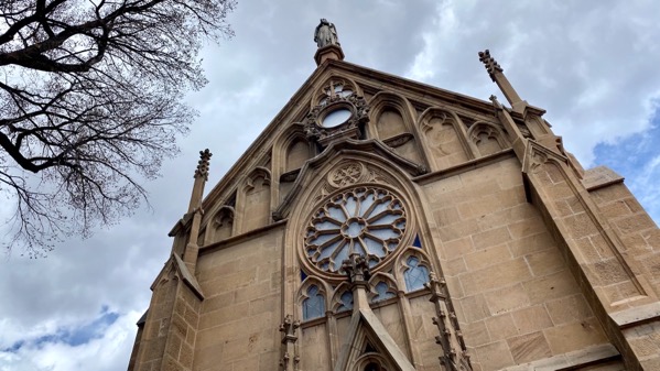
…and then looped to the central plaza area. This is the Loretto Chapel (privately owned)…
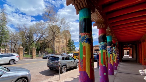
…and this is the active Catholic cathedral basilica.
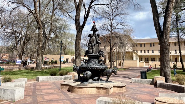
Looking at the churches, followed by this “Settlers Monument” (2003), by sculptor Donna Quasthoff (1924–2021), I could not help but think about the arrival and “good works” of the Catholic priests and Euro-American settlers, who upended the lives and health and cultures of the people who lived in this area. Notice how the incomers are atop their beasts of burden and invasive species. Kinda creepy and definitely an ethical downer. I’m glad it was sunny and that we had leftover red-chili ribs for dinner to cheer me up.
Thursday, 13 April 2023
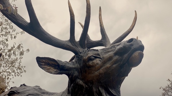
Came across this apparently life-sized elk statue posing street-side. I “say” apparently because I’ve never been this close to an elk before. Heavy overcast made for strange lighting.

This lighting, however: fabulous. It lasted not even two minutes….

Dear friends treated us to a tasty dinner, and yummy as it was, the conversation and camaraderie was even better. These ribs were roasted with a red-chili paste just before serving; never had anything quite like this. Show-stopping. The waitron said the recipe is on the restaurant website. I looked; it’s not—their secret…I understand.
Wednesday, 12 April 2023
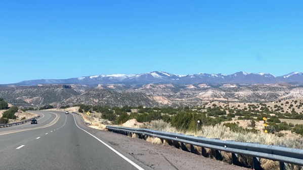
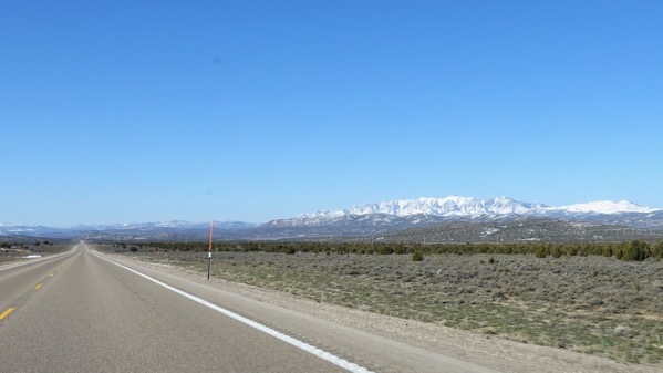
We headed toward mountains, not difficult to do. Note plenty of snow.

We crossed the Río Grande. Note plenty of water aka snow melt.
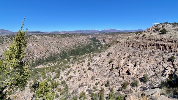
We stopped at an overlook to see the canyon of the Rito de los Frijoles, aka Bandelier National Monument,
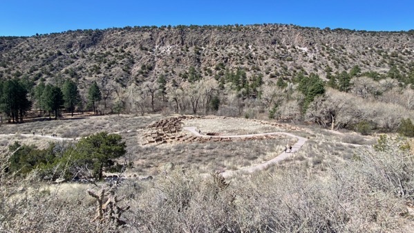
The main community on the flats is Tyuonyi, extensively excavated between 1909 and 1912, including 242 rooms. I cringe at the thought of the data that was destroyed and discarded. These walls are reconstructions.

This is Long House, which extends along the base of this wall for quite some distance. In some places the rooms were three deep. The rows of holes were the sockets for roof beams, called visas.
If you look very closely on the slope above the model, you will see walkways, stairs, and ladders that reach the big cave, aka Alcove House, just to the right of center and far above the model’s left shoulder.

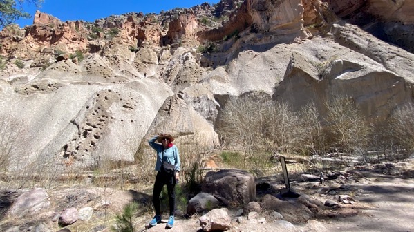
This view makes the “trail” look more vertiginous than it is. If you visit, remember that ladders are easier to go up than to descend, IMHO.

The view from Alcove House. I was so lucky to be there by myself for about five minutes.

Back on the return trail along the creek, note the good flow of water and the logjam. We counted at least five big logjams, and all new foot bridges across the creek. The rangers were too busy for me to ask when the storm was that brought down the many trees and washed them downstream.

On the way back, we stopped at the Tesuque Village Market, which is indeed a market, but also a restaurant and bakery. We indulged in their key lime pie…lovely, just the right tartness.

We returned to Santa Fé on the Old Spanish Trail, which is winding and scenic. I find these fences particularly picturesque.
Tuesday, 11 April 2023

Looking back at a high range in Arizona. Despite a quick flirtation with Mountain time when we creased Idaho, we’ve been waiting and waiting to escape Pacific time. All but one county in Arizona stays in PacTime, according to info on the web.

Aha! The lovely New Mexico Visitor’s Center architecture imitates a kiva or hogan, I’m guessing. Off in a room with several rows of spaced chairs, I listened to Robert Redford’s dulcet tones describing Chaco Canyon ritual architecture. I found it another reason to be happy to be in New Mexico!

A dramatic geological feature…. We also drove through quite a run of malpaís, or nasty angular broken old lava flows that would be terribly difficult to walk through. [Yes, that’s a Starbucks lid in reflection.]

Finally, we got a view of the Sandía ridge, which looms over Albuquerque. Temps in the 80s.

After a quick visit with friends we’ll see for a longer visit later in the week, we turned north, finally reaching the Santa Fé Mountains backing…drum roll: Santa Fé…our home for the next few days. Temps about 15° lower than in ABQ.

Someone’s carefully chosen special dessert. Yum.
Monday, 10 April 2023

I arose not quite as early in the dawn sequence as yesterday, yet the golden-yellow tones are lovely.
Still saw a few snow-caps as we motored south, and they tapered off as we continued.

Without a doubt, the most dramatic landscape was at White River Narrows.
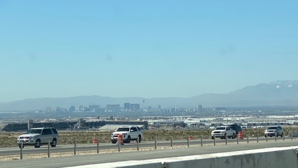
After long miles of a downward trending road (which lead to overall mileage of 53mpg, at a speedy pace), we ended up creasing Las Vegas. We saw no meadows.

Yeah, we made a burger stop, which happened to be in the middle of the lunch rush. Wow, what a crowd, including dozens of vehicles in the drive-through lane. They even sent a guy out to take orders from those in line.

Back out in the country, we saw several solar panel fields. This one almost looked like a lake. In contrast, in the city, we passed dozens of housing units, almost zero with solar panels. I can’t fathom the logic.

We did get several glimpses of the reservoir called Lake Mead, and the level is low low low, just as you may have read.

After crossing into Arizona, in contrast to this morning, we drove on a generally rising trajectory (mileage was a hammered 42mpg).
There was roadside rotten snow coming into Flag (much diminished from our westbound leg), but none around the hotel.
Unexpectedly, our hotel had a two-plug electrical charger. The car is now fully charged and moved away from the charger. The other space has a handicapped parking logo on it, so I can’t imagine it gets used frequently.