Musings
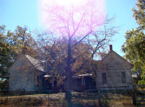
Driving through a place, and maybe stopping and walking around a bit, you get an impression of what the place is like now, and something of its past. A year ago, we were walking around Greenville, PA, in the northwestern part of the state. My overwhelming impression was of a community undergoing economic and demographic contraction, yet trying to keep the downtown from total disintegration.
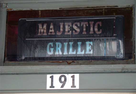
What wasn’t apparent, of course, were little historical details, such as who wandered into this long-standing and still-operating restaurant on the main street downtown. Fortunately, we have the vast resources of the internet, which says that the inventor of a parachute (like a funky umbrella) used by WWI pilots, lived here and worked as a coal miner. It seems a good bet that he visited the Majestic* once or twice.
* Not to be confused with the Majestic Diner, on Ponce, here in ATL, which has been open since 1929 and serves a mean breakfast.
Posted at 5:10 PM |
Comments Off on Who ate here?
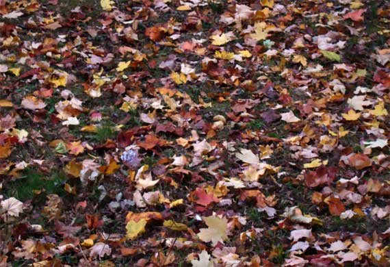
The leaves, they are a-falling. In step with the financial markets?
Posted at 10:22 PM |
Comments Off on Visual mosaic
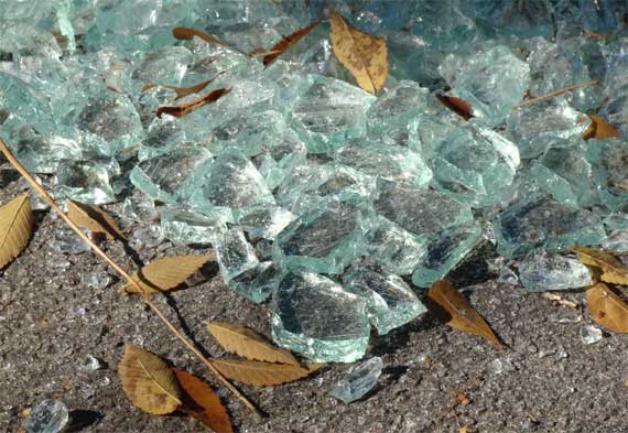
When I first saw this shatter, it was scattered across two lanes, generated I suspect during a late-night event where neither party called the cops. When I took this picture a day later, it was all in the gutter, glistening in the sunshine.
And, flipping through channels with less promising programming, I have learned I should worry about blood sludge. Gad, and I thought it was seasonal affective disorder or something….
Posted at 10:22 PM |
Comments Off on Dangers abound!
Lake Clara Meer’s levels are nearly two feet below normal full. That’s low.
So we have a Pres-Elect (already with his first press conference successfully conducted), and he’s already announcing appointments/hirings (or at least Rahm Emanuel as Chief of Staff). Since he’s not in office, how do they get paid and out of what budget? I assume there’s some mechanism for this, but I haven’t heard mention thereof.
BTW, have you noticed that the more formal media is now calling him Mr. Obama? Even though he’s a Senator. Protocol JCB & I assume….
Posted at 4:14 PM |
8 Comments »
Many of the still-standing old houses across the countryside are empty. Many more are now gone, leaving a few tall trees and abandoned vegetation, unless the house site has been bulldozed and turned into pasture or field or pine plantation.
Serendipity dragged us out of the house to drive a triangle in the central Georgia Piedmont. We made a beeline to just west of Athens, then commenced our wander. We scrutinized the Georgia Atlas, and chose the smallest roads that we hoped were paved, since the unpaved roads are pretty dry and dusty in this drought….
We dropped south to Eastville, crossed the Apalachee River at North High Shoals (ex-textile mill town), meandered down to Bostwick, and scooted into Madison. Madison is famous for its lovely residential antebellum architecture; accounts vary on why the Union army didn’t burn the town, as they did many others, when they marched through on their way to Savannah in 1864.
From Madison, we turned west. You have your choice of four parallel routes. The newest is Interstate 20. The old highway it replaced is US-278 or the Atlanta Highway. That one superceded the Dixie Highway. The oldest road, following an Indian path, is the Hightower Road. Hightower is a corruption of the same Cherokee word that Etowah is. Additionally, it is possible the Hightower footpath followed a Late Pleistocene megamammal trail.
Hencequently, we set off along the Hightower route, but it disappears frequently. We went through Dorsey and Rutledge, through Social Circle (where we thought of Nell, whose maternal ancestors lived here, I think), and on to Jersey. I had never noticed Jersey on the map before. West of Jersey we found the historic Gum Creek Court House (they use four words), high on a well-mown hill. Then we did a little detour down and up the Haynes Creek valley (well on the sides of it), then found the Hightower Road again, and followed it over to Norris Lake. Never had heard of Norris Lake. Looks like some places here are second homes, like an old resort community with some architecture upgrades.
We crossed the Yellow River and immediately encountered sprawl, more precisely, the Georgia International Horse Park, which was built for equine and mountain biking events during the 1996 Olympics. From there we were in suburbia, and we made a beeline for home, looping around the north side of Stone Mountain.
We didn’t take many photos, but here’re a few:
* Sorry to get your hopes up, Marquis, but this isn’t about a bike race….
Posted at 7:31 PM |
5 Comments »

That’s 349 for Obama (the funky question mark)….
Points to the media for impressive graphics showing an impressive win at the top of the ticket, and some close races downticket. The above table is from the New York TImes, and the headline/blurb that I stuck on top of it is from the Washington Post, and was up early this morning. Our country is facing economic nastiness, to say the least. The Pres is our leader, yes, but then there’s Congress. And there’s only so much $$ in the budget (which has also shrunk with the lastest “turmoil”), and it can only go so far.
I couldn’t resist a couple of calculations…. States with 10% difference between the total vote counts for the two candidates controlled 383 electoral votes, meaning most state contests were not that close. They went either for one candidate or the other—STATEwide; locally is another story. Also, the states Obama won had an average of 12.1 electoral votes, while the ones McCain won had an average of only 7.5 votes, and only four of his had 10 or more votes. Note that these states had total-vote differences of less than 5%: Ohio, Florida, Montana, Indiana, North Carolina, and Missouri; they controlled 87 electoral votes.
For more wonderful spatial graphics, visit maps and tables on the webpages of CNN, New York Times, or the Washington Post.
Posted at 12:13 PM |
3 Comments »
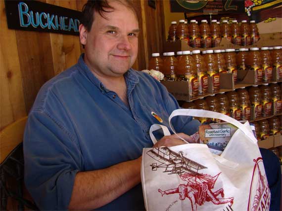
You didn’t know he was running, didja?
He won the $25 gift bag from TJs.* They loaded up a reusable bag with goodies—all seemed like newer products.
We now have a free way to try Israeli couscous, blackberry tea, citrus-flavored thirst quenching drink, three cheese tomato pasta sauce, a Lumpy-Dumpy bar, flakes of dried ginger, and several other products. Surely, we’ll dig into the microwave popcorn tonight!
Now that wasn’t the total excitement of our trip to TJs—read more as you “flip through” the pictures….
* You get to make an entry in the weekly drawing each time you make a purchase and have your own bags. In contrast, our local Whole Foods gives you a dime refund per bag used.
Posted at 3:21 PM |
2 Comments »

We figured there were about 200 people in line (including at the voting booths) when we arrived at 9:10 am. Folks were pretty quiet, reading or doing stuff with iPhones. I only heard one person talking on the phone. I love our polling place at the Ponce library; there were discard magazines and books set out for those in line to browse!
It took about an hour to get to the voting booth. Long ballot, with 3 amendments, multiple judge slots (most unopposed), and miscellaneous homestead exemptions (by locale). I went over the summary carefully to make sure the electronic machine (apparently) was registering what I intended. We didn’t walk around to the opposite side of the building to see if the line was longer or shorter when we left.
So, with all the early voting (both absentee and in-person) can we really call this Election Day? Maybe Polls-Close Day? Or Ballot-Counting Day?
Posted at 10:56 AM |
3 Comments »
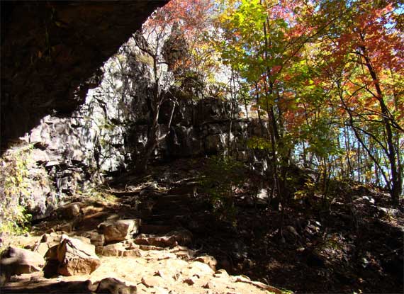
Okay, KW, here ya go: a picture series from yesterday’s hike.
BTW, the image above is looking through the not-falls—the drought and general autumnal conditions mean there wasn’t enough water to make even a trickle over the outcrop….
Posted at 9:44 AM |
3 Comments »

We went to NW Georgia for today’s big adventure. We parked at the Keown Falls picnic area—lovely, under the trees—and ascended to check the falls (dry), and ascended further, to the top of Johns Mountain. Then we followed the trail south along the spine of Johns Mountain, then, well, as Bill said, it’s all downhill from here.
We found the fall color glorious, brilliant in full sunshine, with few leaves fallen. Spellbinding in every direction….
We took advantage of the picnic area to down some calories, both solid (mmmm good salsa!) and liquid.
Part of our route followed the Pinhoti trail, which, I have now learned (courtesy of the internet—scroll down for map), apparently is the longest foot trail system in GA, and extends into AL for another 136 miles. It connects with other trails to make a walking trail from FL to Canada. So they say.
Georgia mountain woods, in my experience, lack many rodents, birds, and larger critters relative to other North American woods I’ve spent time in. Today was no exception. Our most exciting critter sighting: several busy dung beetles.*
* Get this: one of my recent birthday cards referred to dung beetles….
Posted at 7:51 PM |
6 Comments »

