Musings
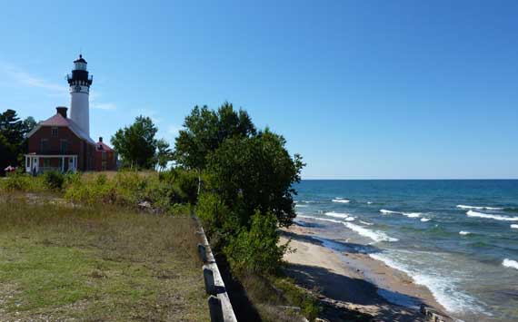
Of the many things we did near the Fox River, Kingston Plains, and Grand Marais, the headliner had to be walking out to Au Sable Point Lighthouse under a glorious cloudless sky. Very few skeeters, too!
On Gitchee Gumee, readmore here.
Posted at 10:22 PM |
2 Comments »
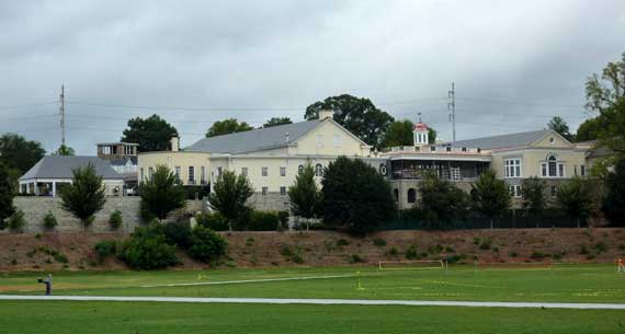
PDC here stands for Piedmont Driving Club*. Apparently it was founded in 1887, for driving about the grounds, particularly the racetrack that is now Piedmont Park’s Active Oval (foreground). This year there’s been lots of construction going on there to upgrade the social and athletic facilities, especially along the Park margins, where I could keep tabs on it as I walk—well, on the exterior walls.
Perhaps more pertinent in this photo is the swirling grey sky. Soon after I took this, the drizzle began, which was fine until it became rain—that’s a personal perspective, though, because the plants and water table are probably in better shape because of the precip.
* PDC also stands for, variously, primary domain controller, Portland Development Commission, Professional Developers Conference, Public Disclosure Commission, and Pacific Disaster Center—and that’s just from the first few Google search finds.
Posted at 11:29 AM |
Comments Off on PDC upgrade
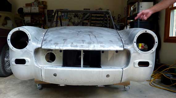
There’s a lively interest in certain circles in car stuff down here in the Deep South, although it’s not as pervasive as I’ve encountered in the Midwest. Remember, after all, that stock car racing is an outgrowth of prohibition-era moonshine deliveries to, among other places, Atlanta’s thirsty, from stills in the southern Appalachians….
This aging, bug-like British body has just had the paint removed by a process that sounded like sand-blasting, although with baking soda, not sand. It’s more delicate than sand, I hear.
This car’s driver is now known as “Matte Silver”—at least by those who know him well….
UPDATE: followup footnote with tomorrow’s post….
Posted at 5:13 PM |
2 Comments »
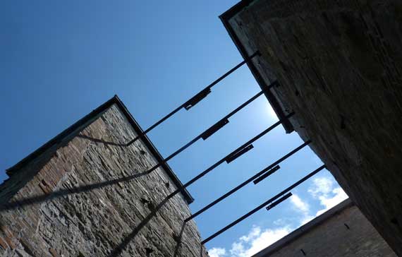
Okay, here’s a standard view of the same architecture as I posted yesterday. Today we prepared for tomorrow’s changes, so looking backward is not inappropriate. Or I could show one of a bazillion pictures we’ve taken of the dog fetching a stick thrown out in the lake….
Posted at 10:22 PM |
3 Comments »
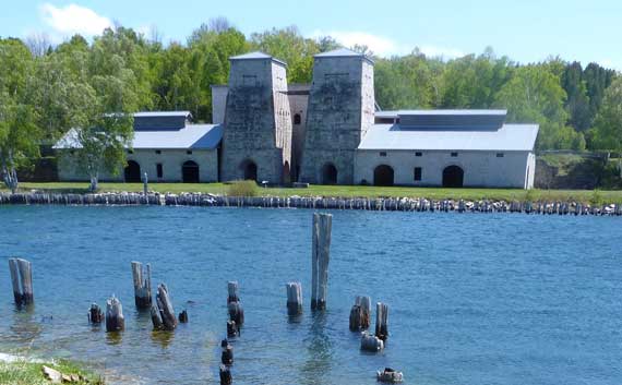
Ah, ya gotta love industrial archaeological sites—at minimum, they can be so compelling to photograph. Somewhat dicey morning weather turned into a windy and brilliant afternoon, and we happily floated across Kitch-iti-kipi, then walked around the ghost town of Fayette, down on the verdant Garden Peninsula.
Posted at 10:22 PM |
Comments Off on Touristing, eastern UP style

We capped a long day of substantive presentations with The Unveiling Ceremony! The ArchaeoBus apparently has good vibes, since the rain held off until after the festivities….
Posted at 10:22 PM |
Comments Off on Busy day (with ritual)
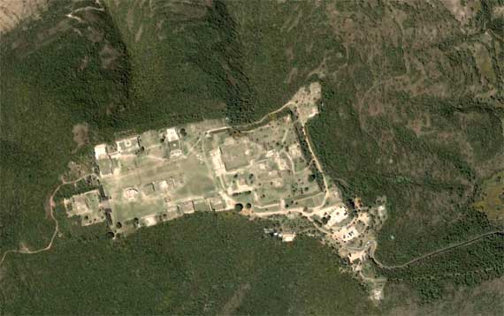
One thing about the SAAs, most people throw up a Keynote (or that other MS format), and since archaeology has a lot of spatial variables, there’re often maps. Well, they used to be maps, hand-drawn back in the old days; now a GoogleMap or two creeps in….
Note that the cleared area on this image had just civic-ceremonial architecture—no normal residential area. Some of that was on the terraces that sprawl down the slopes, mostly toward the top and right of the frame (no, north is not “up”). When this was a vibrant community a millennia ago, it extended outside this image. It was BIG. Uh, scale? Those rectangular things are tour buses on one of the whitish patches toward the lower right….
I had a good idea today—at least I’m pretty sure, even now, that it’s a good idea. That makes today a superb day!
Posted at 6:39 PM |
Comments Off on Is there GoogleIdea?

I just discovered New Coke Bottles….
Ah, material culture change…. I guess I don’t get out much. Or when I do, I’m not in the soda aisle at the groc store….
Conference news: I missed seeing the lovely Oralia because she’s suffering tooth problems. I’m sad. But I did see her hubby and get caught up a bit.
Conference news: Overwhelmingly, across the Maya lowlands, the “collapse” (whatever that is) preceeded the Maya drought you hear about. It’s hard to evoke cause-and-effect, therefore. And, prime-movers are out. At least with this example of sociocultural change.
Posted at 5:02 PM |
4 Comments »
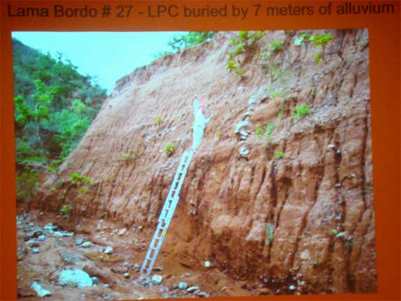
This gully is in the Mixteca Alta, which I’ve written a bit about here.
So, while much of the world was going about its business, I was cooped up inside an architecturally insipid hotel downtown listening to interesting and not so interesting papers on archaeology. Last night’s crop was really good, today’s more mundane….
The picture is of a “slide” someone put up (in these days of Keynote and it’s awful MS imitator, they’re no longer slides, but what to call them?), showing a huge erosional gully. The ladder is 4 m tall—that’s 13 feet. And the soil at the height of the guy standing on the ladder was deposited maybe AD 1400, so all that soil above his head was deposited in the last 500 years, then the whole mess suffered the erosion that made the eroded face we’re looking at. If that makes sense. (The soil at the bottom dates to about 7500 BC or so. That’s one heck of a lot of soil when you consider there’s a whole modest valley with this kind of deposition!)
Lesson: if you’re going to take away the vegetation in a mountainous region with friable soils, either maintain the ground surface or watch it wash away. There’s no middle ground.
*…and somewhere nearby I’m sure there’s plenty of red soil eroding (whosh!), too….
Posted at 9:14 PM |
Comments Off on As I write this, it is raining…*
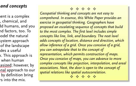
I’ve been working on a White Paper. Just to be well, that way, I boxed some text and made the background not-white.
I got the info summarized in the box from:
Golledge, Reginald G., Meredith Marsh, and Sarah Battersby. 2008. A Conceptual Framework for Facilitating Geospatial Thinking. Annals of the Association of American Geographers 98:285–308.
I did mention this is a drafty draft so far, didn’t I?
Posted at 6:27 PM |
2 Comments »