Illustrator map-making
Tuesday, 20 February 2007
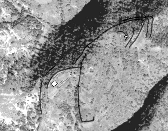
What you’re looking at here is a moderately high-resolution aerial photo (more or less) of an eroded hill-peak down in the Mixteca Alta (see this page), with some shapes drawn on it (thank you Illustrator). The shapes variously represent temple-mounds (the white squares), residential terraces (those long shapes rather like bacilli), and retaining walls (the long grey wide lines).
The whole mess is a map of a residential and civic-ceremonial architectural cluster slopped across a ridge, part of a now-abandoned community that extended across a spider-shaped set of ridge tops beyond the portion shown here, and had several thousand residents in its heyday. Occupation spanned the Classic and Postclassic (roughly), but now the hilltop is pretty eroded making discerning the architecture not only difficult while standing there, but hair-pullingly difficult if you’re trying to make this map—my task for today!