Musings

I jokingly said this street art was Abe and Mr. Sweater. Turns out it is something like Abe and the Common Man. Common Man being white guy in cable-knit sweater. Nothing against white guys or sweaters. But.
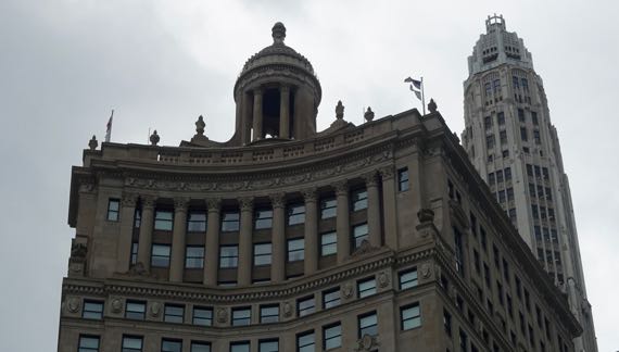
We took a fantastic architectural boat tour, and this was across from our dock. The somewhat unexpected rooftop open-air circular temple can be rented for special occasions.

Our boat went out to the lock that prevents the Chicago River from dumping into the lake—its natural flow—but did not leave the river. Such a great view west of the skyline.

The grass-edged landform to the right was where the Euro-Americans first settled here. They heard the Indians saying something that they distorted into “Chicago” thinking that was the name of the spot. Turns out the Indians were commenting on the marshy vegetation—stinking onions. Or so our wonderful guide said.
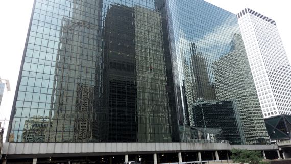
Even more than the building in the previous shot, this one was designed with a plain façade meant to reflect what was around it.
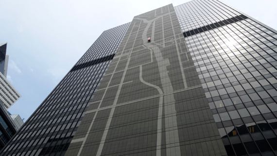
This one, on the other hand, has a stylized map of the rivers. That red “bench” feature way up there indicates the location of this building, a “you are here” marker.

Spotted on our way back from deep-dish pizza engorgement….
Posted at 11:07 PM |
Comments Off on River view

Sometimes urban infrastructure is in your face. Or above your head. Hanging out.
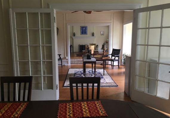
In our hundred-year-old apartment, things are far more genteel. This view is through the dining room and across the library and through the living room to the fireplace. BIG! To the right from the library is a balcony over the front door of the building, and to the right of the living room is a sun room.
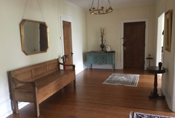
And this is the entry hall. The entry. Only.
Lovely!
Posted at 6:43 PM |
1 Comment »
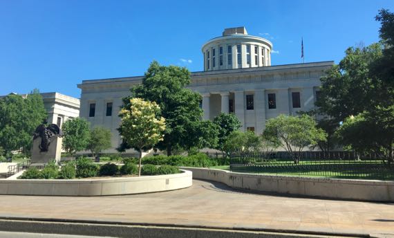
The story I heard about Ohio’s dome-less capital is that the state ordered then couldn’t pay for its dome, which then was sold to Georgia. Certainly, this building looks like it’s missing verticality.
I didn’t set out to have an Ohio theme today, but that’s what I have the best pictures of. Busy day, with lots going on.
I can also mention that somewhere on US2, the “new” car hit 10K miles. It was 7:54am, and the temperature outside was 51°F and the average gas consumption for all those miles clocked in at 58.0 mpg. That wasn’t all the fuel; we also plugged in for an electric boost for quite a few of those miles.
Near Parkersburg WV are several bridges across the Ohio River. This is a newish one.
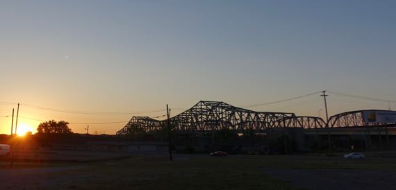
This one’s a bit older; the vehicle bridge is closer to me, and the railroad bridge is behind it.
Posted at 9:28 PM |
Comments Off on Ohio subset of our day
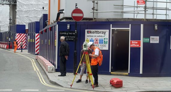
Coffee-sipping view. Accuracy underway.
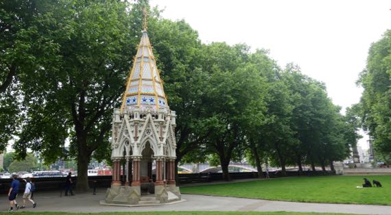
This dates to 1835, and honors the emancipation of slaves in 1834, erected by MP Charles Buxton. The fountain inside doesn’t seem to function any longer.
We spent our energy today on Art, presented first at Tate Britain, then at Tate Modern.
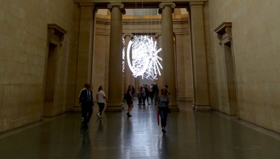
This neon installation by Cerith Wyn Evans, and commissioned for this space this year. It’s called “Forms in Space…by Light (in Time).” Wyn Evans says it addresses flows of energy….
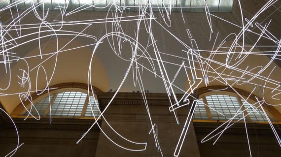
View from below of one section of “Forms….”
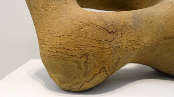
Detail of “elbow” of Henry Moore’s “Recumbent Figure,” 1938. It’s of Green Hornton stone, which to me is shades of brown.
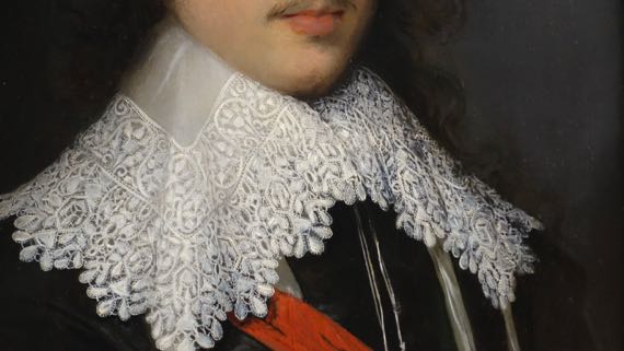
This is the lace collar of “Portrait of an Unknown Gentleman,” by Cornelius Johnson, 1629. I admire the skill it takes to make this detail seem so real.
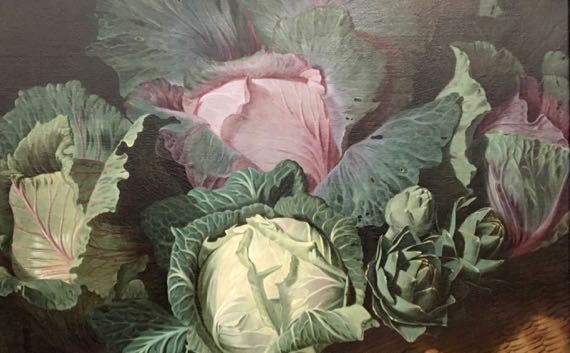
Ditto—so real-looking. Cabbages are part of Nathaniel Bacon’s ~1620–1625 “Cookmaid with Still Life of Vegetables and Fruit.”
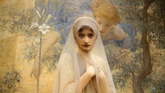
Compelling face by Arthur Hacker, 1892, “The Annunciation.”
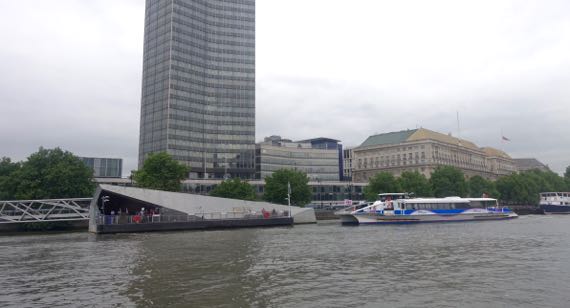
We took a vessel like the blue-and-white one up-river to the Tate Modern.
En route, we saw Big Ben tower from a vantage point we’ve never enjoyed before.
Wouldn’t you know that I’d find architecture-like modern art compelling? For shame, I didn’t note the artist/title/date.
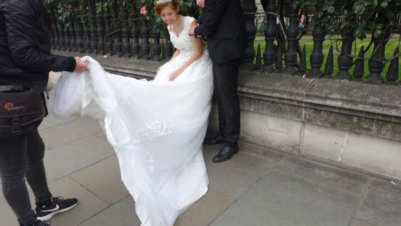
We headed back toward our bags, stashed at last night’s hotel, along Fleet Street, then Strand. I assume this was a wedding photo, but it could be a fashion shoot.
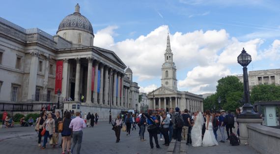
We found Trafalgar Square busy with tourists and people just off work. More bride-outfits. In the central background is St Martin-in-the-Fields, which in the 1500s was in the fields between London and Westminster; however, much of this building dates to the early 1700s. It is the parish church of the Royals and Number 10 Downing.
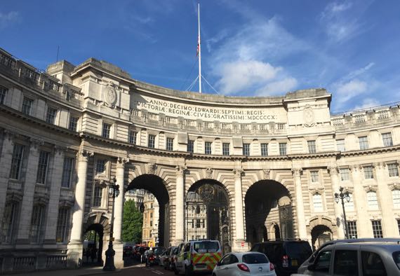
Great light on the Edwardian Admiralty Arch. Note flag at half mast (squint), honoring the dead in Manchester.
Posted at 5:46 PM |
2 Comments »
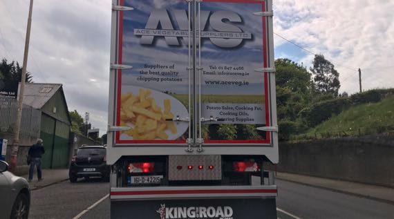
We had a last drive across the countryside in eastern Ireland, first Northern then Republic. AVS on this truck stands for Ace Vegetable Suppliers. The left promotional phrase is: Suppliers of the best quality chipping potatoes. I was ready to leave chipped potatoes behind (for a while only; potatoes are sacred food to me). And, in the process, leaving Guinness. Sigh.
Along our drive we saw this pedestrian bridge just before we crossed the vehicle bridge…our last crossing of the Boyne.
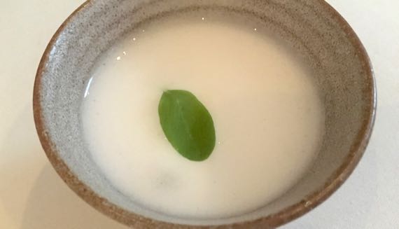
Once on the ground in GB, we took the train into London from the airport and unwound for a bit, deciding to eat our evening meal in a “good” place. Turns out we went for super-fine. We picked three courses and we were presented with seven different food offerings, several with multiple tastes. This was the palate cleanser after the main course. It had a soft cucumber sorbet (I think) on the bottom, with gin and tonic foam on top. I don’t know what kind of leaf decorated it.
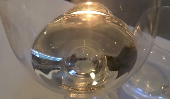
I even splurged and had a glass of Moscato with dessert. Yum. Yup, we changed our dining style!
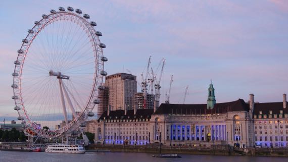
We walked down to pay homage to the Thames after we ate, and to let our courses and not-courses settle.
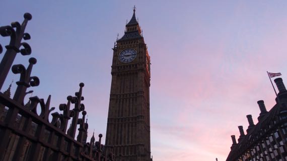
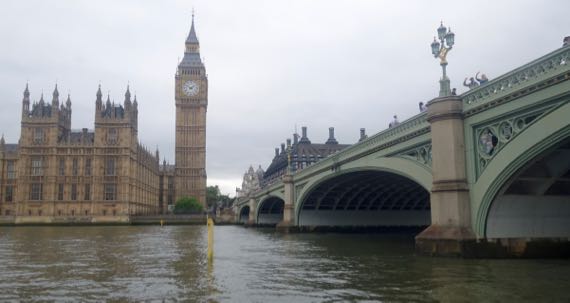
We caught the 9pm ringing of Big Ben, as it turned out. This was a few minutes later, after we’d admired the river and communed with a perfect light breeze.
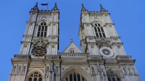
These are the towers of Westminster Abbey. They seem creamier/lighter-colored than I remember, but that’s probably just my lousy memory. [I have spared you many photos of the upper bits of buildings silhouetted against the sky; I’ve been rather obsessed with them this trip.]
Posted at 5:20 PM |
Comments Off on Gin and tonic foam
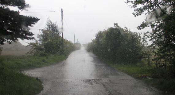
Kinda overcast when we set out. We did have spots of sun and showers, the perfect set-up for a mellow day.
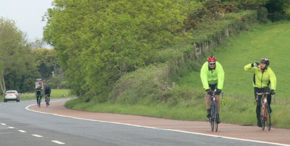
We came across a bike race with dispersed riders soon after we hit the road. Some were wearing bright anoraks…thankfully, they were going the other way.
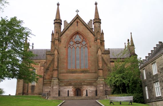
It’s Sunday, so here’s the Church of Ireland Cathedral in Armagh. The RC Cathedral also honors St Patrick. The Archbishops of both sects are here and both are Primates of All Ireland (if I have it right). Armagh is historically far more of a center than it is today.
We still don’t know how to say Armagh. (Is it guttural?)
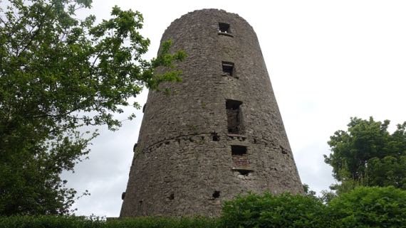
We found this six/seven-story ruin up Windmill Avenue, and indeed it was a windmill perhaps two centuries ago. No access; it’s fenced off. No informative signage.
Due west of Armagh is the pre-Patrick religious center, Navan Fort, properly Emain Macha. Folks don’t use much Irish around here, but the instructional materials at this location prefer the Emain Macha name.
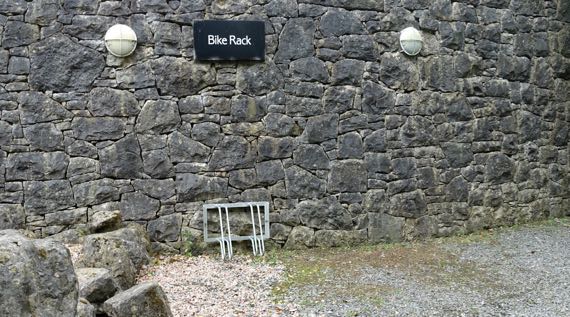
Good thing the bikers weren’t headed here. This bike rack has a limited capacity.
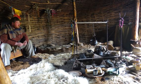
We began with a visit to an Iron Age house, reconstructed and populated with this warrior, Fergus, and a bard named Sanka. Great fun!
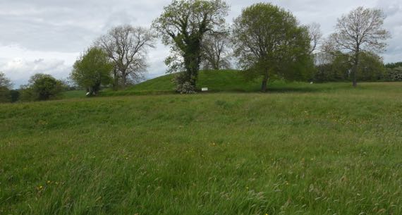
The most unexpected thing that archaeologists discovered about these ritual features atop the hill is that the bump in the distance was the location for a series of timber structures. The largest, indeed the largest Iron Age ritual structure known in Europe, was built in 94BC (based on tree-ring dating). Before this hill became a ritual/construction site, a different hill was favored. Of course, later, the geographic ritual focus of the people living in this area moved to Armagh.
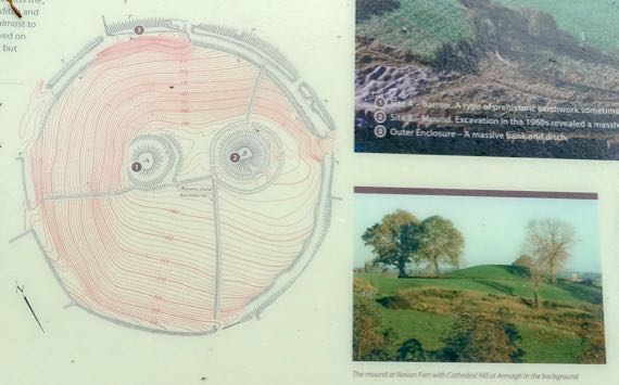
This topo map may be helpful. I am standing on the left, lower feature (#1), and looking toward the right, major feature (#2). The white signs outline the outside of the hill outside of the ditch that encircles where the enormous soil-covered timber structure used to stand.
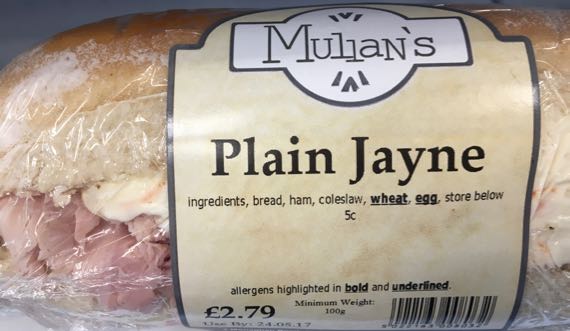
Lunch time: would you like a Plain Jayne sandwich, ham and cole slaw? (Did not buy.)
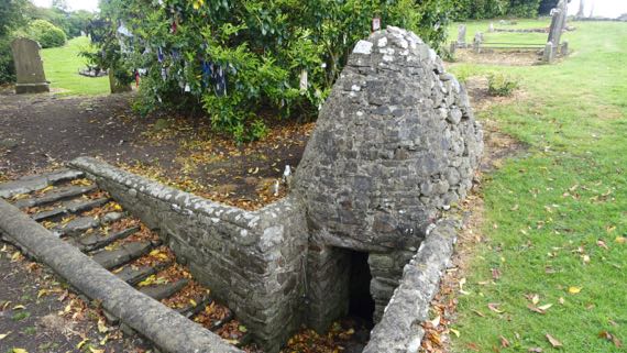
We moved on to the remains of a medieval motte-and-bailey castle (eroding; not pictured) and to the adjacent ruined church and graveyard. This is on the Hill of Faughart, believed to be where St Brigid (~451–525) was born and brought up. If she didn’t live on this ridge-nose, I’m pretty sure she must have come here. If, indeed, she was from what is today called the Hill of Faughart. Anyway, this dipping well is associated with St. Brigid. Leaving the rags tied to the tree is part of ritual visits here.
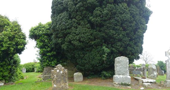
The church walls are beneath the ivy at the far left and left center of this photo, left of the dark green evergreen. Just to the right of that dark green juniper? is a “flat” grave. The marker records that Edward Bruce (~1280–1318), brother of the Scottish king Robert the Bruce (Roibert a Briuis) is buried there. He died from wounds received in a battle in the lowland below this ridge nose.
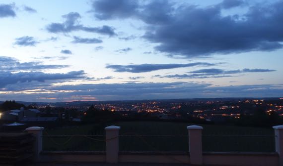
This is last night’s sunset, a bit prettier than the one tonight, and appropriate as we bring this chapter of our lives (trite trite) to a close and get those stray belongings packed into checked baggage, rather than in separate containers that can be stashed in the car, ready to be dragged into the next B&B.
Posted at 4:52 PM |
Comments Off on Last full day

We spent most of the day at a 170-acre living history village-and-rural-area that is paired with an indoor museum of transportation. We began in the rural area. At least a half-dozen stone cottages in different styles and dates offer the opportunity to think about heating/cooking with coal or peat turves and living in close proximity to farm animals. One cottage (no photo) even had a byre at one end and family space at the other—with no wall in between; maybe it was only used seasonally, however.
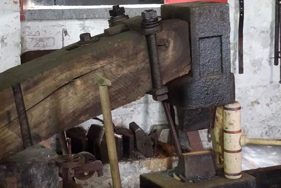
We enjoyed a long chat with a spade-smith; he makes spades, not shovels (shovels are for loose materials). This is his water-powered trip hammer. 3K pounds of pressure per smack. No water flowing to make it trip today….
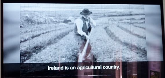
And this is a shot from a 1940 news-reel/documentary about spade and shovel making in the town of Monard, County Cork. With water power and coal-fired forges. Laborers worked six days a week. On the seventh they went to church, played gambling games, and played music and danced. Ireland had a great diversity of spade and shovel types. Over a hundred, and then many different sizes of each. Diversity.
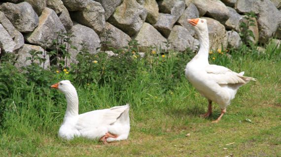
John tried a bullfighter move with these geese. No horns involved, thankfully, just hissing.
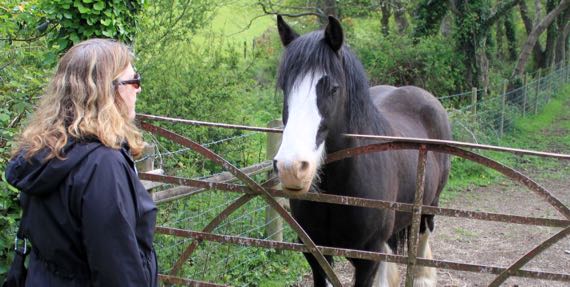
Me, I had a chat with this horse (we think in a field next to the museum property).
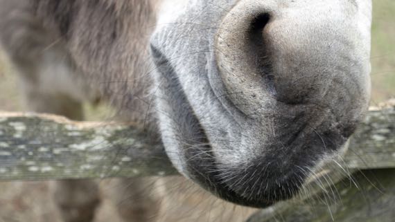
And we both had a moment with this donkey. One lady looked around for grass-not-nettles and fed her a small handful. Happy day for the donkey.
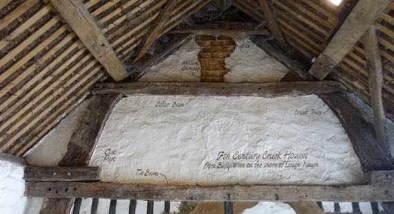
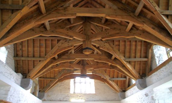
This wall is cut-away and labeled to highlight the crucks—those curving beams that go up from the ground and support the roof beams. I think folks used ropes to bend trees to make the needed shapes. Crucks were also used in ship-building.
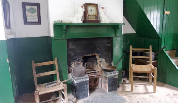
Here’s the fireplace in one apartment in a row of village/urban row-homes with this small room downstairs, two teensy bedrooms upstairs, and a tiny yard out back with a water closet and coal bin, and a bit more room for washing laundry, etc. I thought this is the kind of place where TB would have spread quickly.
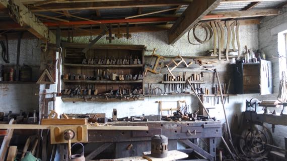
Look at the rows of tools etc. in this carpenter’s shop.

Next we went across the highway to the Transport Museum. Of course, we started with trains. This is the shamrock detail on the County Donegal Railways seal.
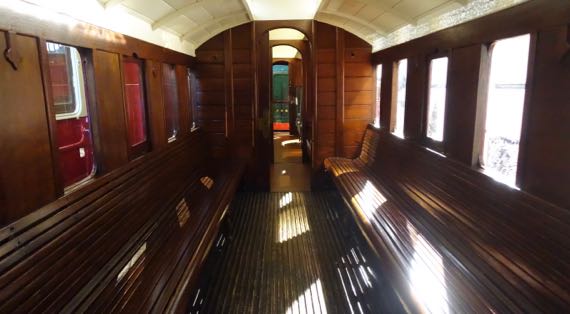
Here’s the third-class area on a train carriage. They had to pass a law in Ireland to make the railways put roofs and sidewalls on third-class spaces. They used to be like riding in a cart—just relatively low side walls, with riders fully exposed to the weather.
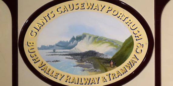
Loved this stylized image of Giant’s Causeway and the cliffs that frame it even today. I think I read that this began to be a travelers’ destination in the 1700s. !!
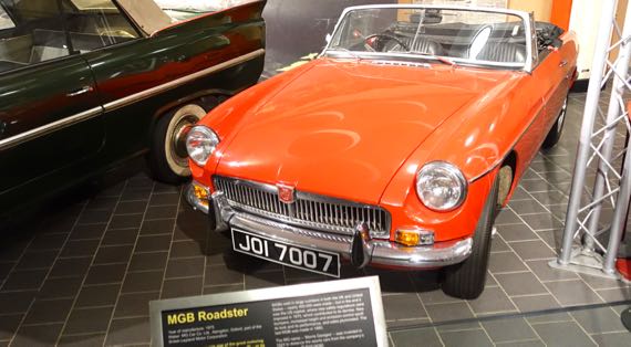
Cars, too! An MGB Roadster, 1975 model.
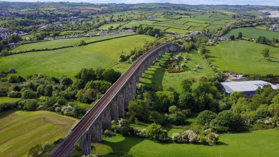
Droney made two short runs, and the Guru captured the lovely shadow from this long railroad bridge during the first one.
Posted at 4:48 PM |
Comments Off on Tired of ruins?
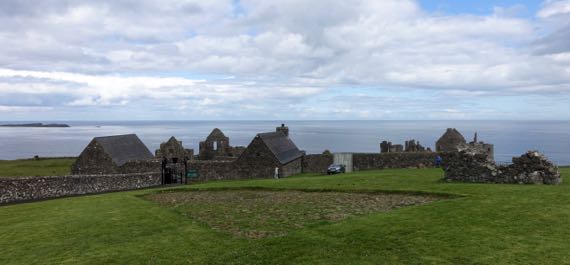
This is the inland side of a promontory fort location, very defensible. The construction here dates to the same period as Donegal Castle that we visited yesterday. Visually, it looks quite different because the stuccoing (perhaps not the technical term) is gone here and not in Donegal. Anyway, the foreground is the original cobble street, discovered below the modern sod. Around me, the photog, are archaeological remains of the village that was outside the castle. This castle, far right and distant, was built/occupied by MacQuillans and then MacDonnells, Scottish landholders and traders. The village had a substantial Scottish merchant population, numbering nearly 300. There was an earlier castle here dating to the ~1200s. I suspect there may have been an earlier occupation, too….
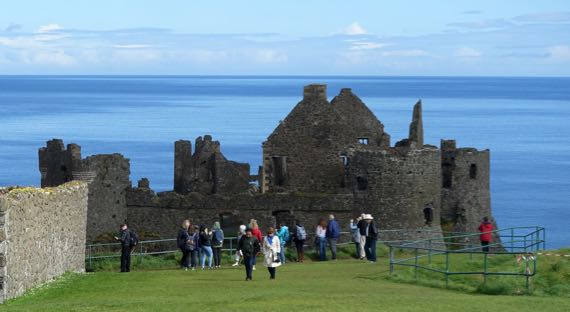
We arrived just after two big busloads of tourons. As we made our way to the ticket booth, we realized they were not entering the castle, only standing at the fence. Yay for the logic of bus-tour scheduling (?).
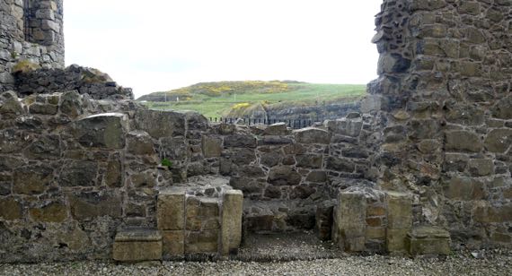
We took many detail shots of the castle and its setting. This is the remaining bottom portion of a fireplace surround, and the view through the hole in the wall of the next peninsula, covered with pasture and gorse. Strangely, it was not windy.
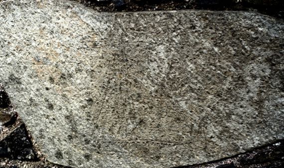
I’ve messed with the photo settings in an attempt to bring out an etching of a late medieval Scottish galley. Perhaps easiest to spot is an upright triangle, representing the sail, I think. At the bottom are a pair of horizontal lines indicating the ship, with a line of dots along the upper line. Perhaps you can see the upturned ends to the left and right.
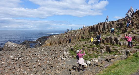
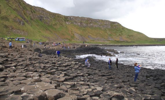
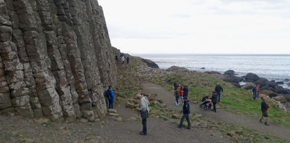
We went on east to a geological feature called Giant’s Causeway. It’s a basalt formation of hexagonal columns, broken and weathered on the tops. There are several folk tales about the formation; track them down if you like fanciful stories.
This view is back at the bus turnaround. Many people take the bus down, or more likely back (uphill). We walked both ways. My fitbit has been giving me in excess of 100 flights per day over the last 10 days; not today, unexpectedly.
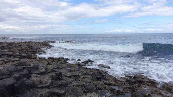
We spent some time watching the waves crash near the end of the formation, soaking in the sunshine. Just lovely.
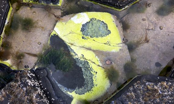
I found this tide pool with its brilliant green-yellow whatever-it-is. There are conical shells, too—barnacles? I don’t know much about sea-critters.
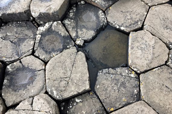
Here’s a top-down view of the columns. Love the slight distortion of the geometrics.
Here is a stand of the columns. So dramatic.

We spotted several dandelions along the return route to the parking lot, and even a few buttercups (I think), with flies camped out on them. In contrast, white flowers were bereft of flies. What’s the deal?
We made a quick stop at the Old Bushmills Distillery. We thought about taking the tour, but it was priced at £8/person, and we decided to pass. Even if it included a wee tasting at the end.
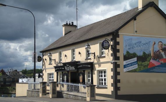
Here’s your daily pub shot. This is the Wild Duck in Portglenone. The town is on the River Bann, which connects the large freshwater lake called Lough Neagh to the sea. Vikings sailed up the Bann, and spent the winter of 840/841 at the monasteries at Antrim and Ardboe. Subsequently, they made camps other places around the lake from which they raided elsewhere in the interior of this part of the island.
Posted at 4:37 PM |
1 Comment »

Even before we left the B&B, we’d had sun, sprinkles, overcast, repeat. That was the pattern throughout the day. As we rolled down the road early on, we spotted a cloud sitting atop this ridge. By the time we got to the end of it, the cloud had lifted. Sunshine!
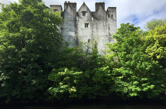
First stop: Donegal Castle. One part is 15th C; another is 17th C; the whole was refurbished in the early 1990s. For several generations this was the seat of the O’Donnell leaders. The town has encroached upon all but a small area immediately adjacent to the castle. In the foreground here is the River Eske.
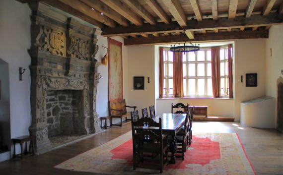
The Great Hall has been partly furnished. The fireplace surround is 16th-C, installed when the Brooke family owned the castle; they did many modifications/upgrades.
The room above the Great Hall has these fantastic beams supporting the roof. The engineering seems similar to that of covered bridges, etc.

Several days back we started seeing rhododendrons in the roadside vegetation. The Guru discovered that they’re an invasive species here. Beautiful flowers, however.

We passed by Killybegs harbor, a hive of activity on the docks, and moored boats and ships, plus sailboats. I think these two are fishing vessels, but that’s a landlubber’s hypothesis.
This is the first big highway sign that we noticed that did not have the English place-names paired with the Irish. Still haven’t overheard people speaking Gaelic very often.
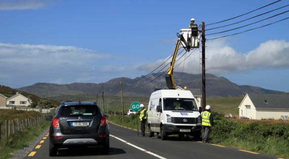
We think this is fiber-optic installation. We spotted over a dozen yellow trucks that were part of the installation crew, we thought. It will be a big change to this rural area of County Donegal. Note mountain in the background.
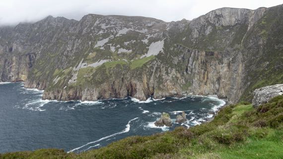
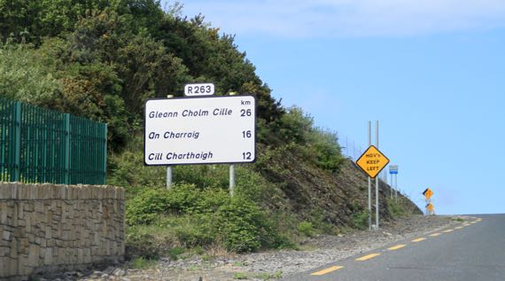
From Carrick (An Charraig on the sign above), we took a side road out to this viewpoint for the seaside cliffs of Slieve League (Irish: Sliabh Liag). These are twice as high as the famous Cliffs of Moher, at just a fuzz under 2K feet.

We returned to Carrick to turn north toward (eventually) Derry and Northern Ireland. This place is called John the Miner’s Central Bar. FYI.
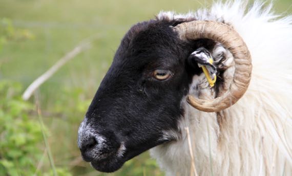
Rolling along, only a few times we’ve driven in open range. Usually, if sheep are on the road, they have escaped through the fence. I think that was the case with this one and her several buddies (not pictured).
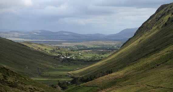
What a view as we passed down the northeast side from Glengesh Pass (translation: Glen of the Swans). Don’t those rounded flanks reek of glaciation?
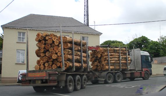
We’ve seen a few log trucks. The logs seem short compared to what we’ve seen in the USA. They come exclusively (or nearly so) from tree plantations.
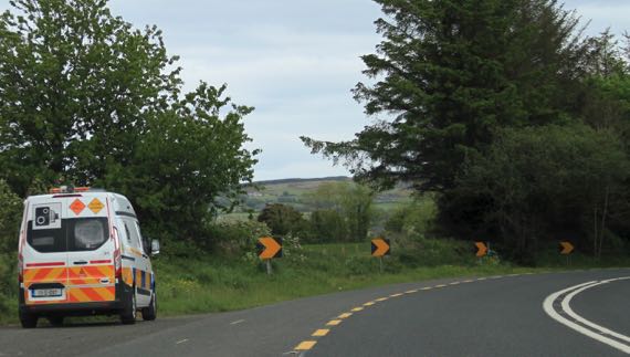
It behooves you to notice these buggies. That camera sign may look like a quaintly historic model; however, it signals a speed check/trap. They used to have installations along the roads, but now there are just vans randomly deployed. There aren’t many, as this is the second one we’ve spotted.

Droney took to the air at Grianán of Aileach, a reconstructed stone fort just west of Derry (officially Londonderry), but on a high spot in the Republic. This view is toward the southwest, so it’s all the Republic of Ireland.
Another rainstorm hit as we crossed the international border. Can you see the change in the pavement in the foreground? That’s the border. How will it change with Brexit?
Soon, the rain had stopped and soon after that the sun was out. We have been very lucky with good weather on this trip.
Posted at 4:40 PM |
Comments Off on Watch the weather change
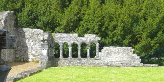
Another day, another religious complex in ruins. Here’s one corner of the cloister interior at Cong Abbey. The Irish is Cúnga Fheichín, meaning St Féchín’s narrows. The narrows refer to the river, I’m guessing. The waterways around the abbey go underground and appear braided. Complex, anyway.
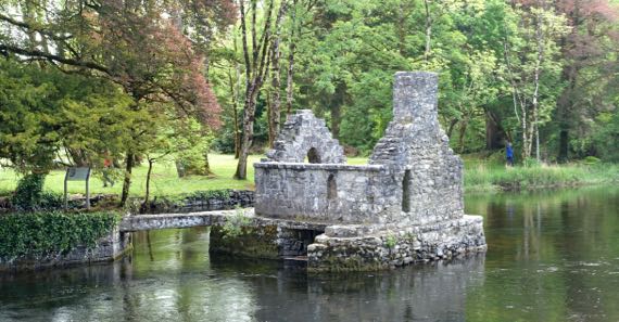
This “fish house” is an unusual surviving monastery feature. My understanding is that the underneath had a net hung inside it, and the fish were retrieved through a trap door in the floor. The area around Cong is where “The Quiet Man” (1952) was filmed–John Wayne and Maureen O’Hara.
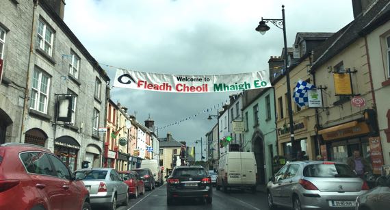
This banner over the street in Ballinrobe says: Welcome to (you got that part, I’m sure) Music Festival Mayo. Mayo is two words in Irish—Mhaigh Eo—which means yew trees, and yew trees are loaded with sacred qualities, very special. Oak trees, too.
Lots of place-names begin Bally– or Balli– like this. The Irish is Baile and it means town, although GooTranslate indicates it means home, also. Interesting cultural implications of that.
Also, place-names that end in –more in English may be from the Irish mór, which means big. Toponyms are such fun!
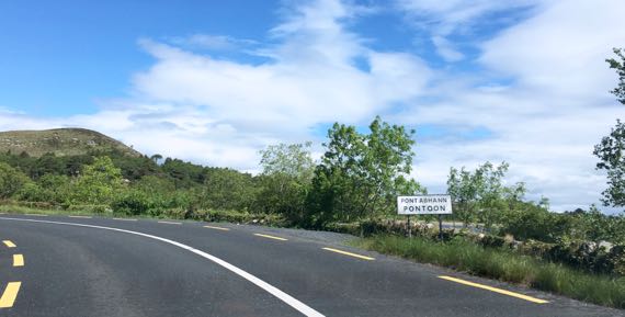
It seems the English mimics the Irish Pont Abhann in some abstract way, as Abhann means river/fluvial and has a different sound than “oon”. Another linguistic abuse by the English….
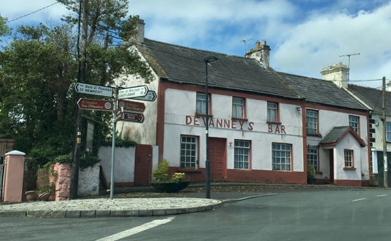
Just liked the way this looked. I couldn’t tell for sure if it is still open.
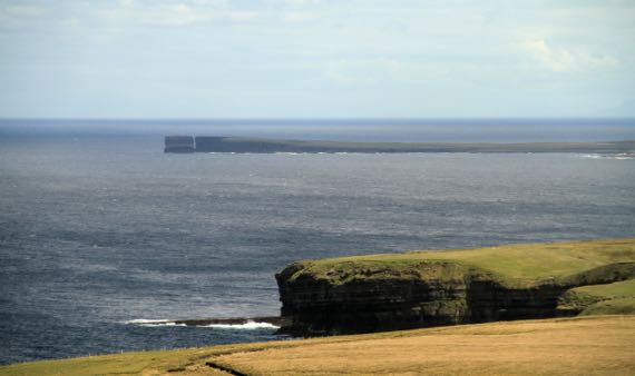
That haystack at the end of this peninsula is Dun Briste, meaning broken fort (fort in the sense that this point is naturally fortified by being almost surrounded by the sea; broken is obvious). The English name highlights something totally different; it is Downpatrick Head.
This row of stones exposed from where the peat buried it was a fence-wall thousands of years ago, built by people who cut the forest to begin farming here six millennia ago. Why did peat form here? Scientists aren’t certain, but the current hypothesis is that by cutting the trees, it changed the soil chemistry and created an iron-rich layer that kept the water table high and meant that any plants had to be tolerant of the iron-rich condition to grow, which favored heather and sphagnum and the like. They grew and died and new offspring grew in the same spots, and the moisture and repeated generations meant peat could form.
The large size of the fields and the pollen that has been identified as contemporaneous with the field walls indicate that the fields were pastures, used for cattle and not crops. Very interesting.
Can you guess that it was windy windy windy when we visited Ceíde Fields? Can you guess that is Ceíde pronounced kay-ja? Yup, no “d” at all.
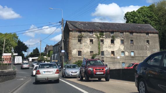
I’m pretty sure this is an abandoned factory. Not all ruins we note are darned old.
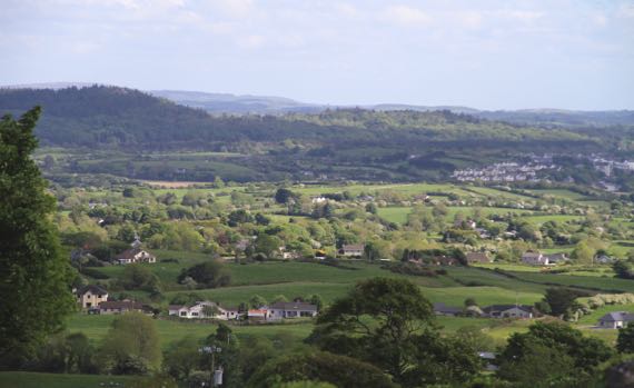
Another high view of the velveteen green, this time with more trees and houses. This is near Sligo, from the flank of the mountain called Cnoc na Riabh, meaning hill of…well, knowledgable people argue about of what. Cnoc is hill, no doubt about it. I keep trying to come up with a Cnoc-Cnoc joke….
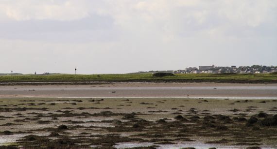
And here the tide is out in Sligo. The Irish name of the river (originally) and the town is Sligeach, meaning abundant shells, meaning the river was rich in shellfish, and maybe fish in general. Don’t know about now.
Posted at 3:52 PM |
Comments Off on Irish lessons, subtly