Musings

We’re supposed to have a front come through overnight, so windy storms, perhaps (hopefully?) weaker than the other weekend that caused us to need four large trees removed. Whew. Still, before the winds, somehow a fading camellia blossom found its way to our front steps this afternoon.
Posted at 8:52 PM |
Comments Off on Relocated by wind

These plants, decorative in this area, mystified me (with my northern mental database) until I found them labelled somewhere. Now, I know them to be relatives of artichokes…sporting rather elegant dagger-leaves-of-green.
Posted at 10:13 PM |
Comments Off on Relatives

We’re coming out of a run of cold days, and we’re headed for some lovely warm days before cold rolls in again. The warmth is enough to get the pollen going, in a bit of an ironic twist.
Posted at 8:42 PM |
Comments Off on Ahhh-chooo

At 9:30 this morning, the leaner was still rooted to the ground—ish.

By early afternoon, the top was removed and both the leaner and the one that fell away from our house were mostly removed.

Shortly before the guys closed down for the day, the leaner’s stump was removed, and the one that fell was merely a stub of a sump.
The elegance and carefulness of the work crew was something to behold (pardon the passive voice).
Posted at 9:00 PM |
Comments Off on Chainsaw ballet

Despite today’s gustiness…

…the tree guys climbed high, tied off this direction and that, fired up chainsaws, and took down two trees. I was surprised to see how much core rot one of them had…. Happily, they have a plan to remove the tricky, leaning, good-sized tree tomorrow
Posted at 9:07 PM |
Comments Off on Removal underway

The “possible five inches” of rain turned out to be about two-and-a-half, which is far less…dangerous. Even more exciting: the sun came out almost all afternoon.
Posted at 8:26 PM |
Comments Off on Sun…wheee
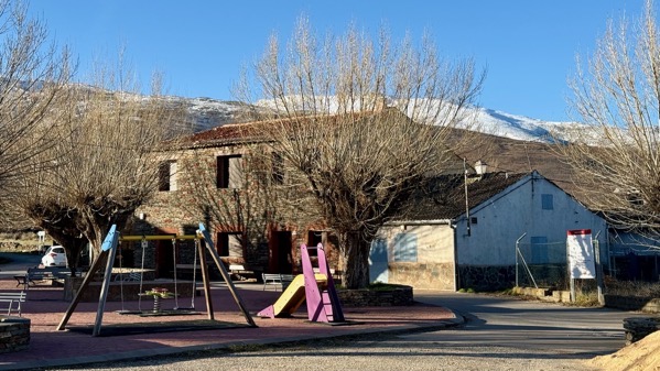
Our departure…leaving from beneath the looming, snow-dusted Sierra de Ayllón, amid ice-crystals…mostly melted when we got going (lots of sun exposure).
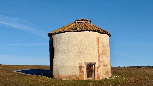
We came upon these round structures in/near several towns, but I couldn’t figure them out. They seem clearly for storage, and the roof is vented, yet there’s only one door, and it’s small. My guess is they’re something to do with grain production…mystified.
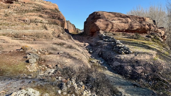
Our first stop was Tiermes, which was a large CeltIberian fort that allied with Numancia (and others), and held out against the Romans for longer than other places (probably routed about 133 BC). The Romans remade the settlement, adding homes, a large aqueduct, a forum, temples, and more. The sandstone hill also had earlier Neolithic and Bronze Age occupations. Here’s the southeast gate; all the gates to Tiermes that I saw had a bend like this…I assume offering an additional level of security.
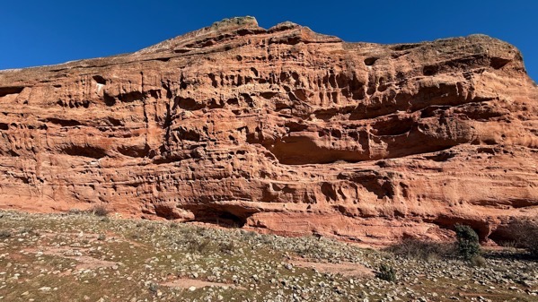
The southern face of the hill is mostly a wall of sandstone. The horizontal rows of holes held beams that made ceilings and floors of multi-story structures.
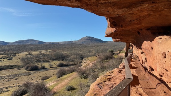
Here’s a look along the aquaduct from where it (presently) goes into the hill. This is just to the left and above the last photo.
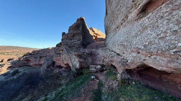
This is the west gate, surely more eroded than when Romans and their CeltIberian predecessors used it…or maybe this was just a Roman gate.
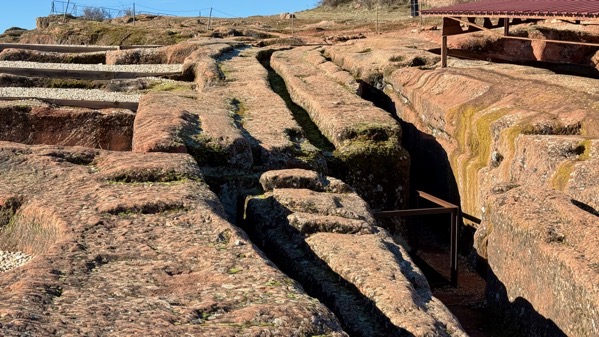
The wheels of carts dug into the soft sandstone, and later eroded into deep trenches.
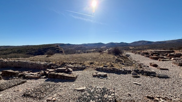
That vegetated (grassy?) area is the Roman forum. These photos do not do justice to the huge area of this settlement, and I mean huge in pre-Roman CeltIberian times especially. My walking track was almost two miles, and I missed some highlights. Of course, I have not seen the excavation reports, which may describe many unused (often trash-collecting) rooms, as often happens for Puebloan settlements in southwest North America.
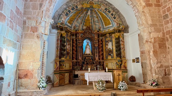
Our last stop on the present Tiermes property was to step inside this Romanesque chapel/church, probably built in the late 12th C. I don’t know the date of the interior. There’s no longer any town nearby and I don’t know if there are scheduled services any longer.
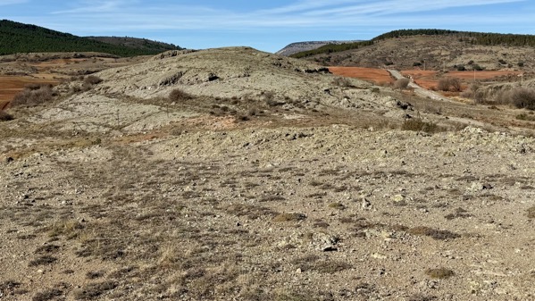
Our next place of interest was the Cerros volcánicos de La Miñosa, a very small area that constitutes an unusual micro-environment.
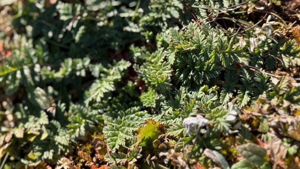
One species typically mentioned is Erodium paularense, or the Paular geranium. This might be it. Interestingly, a few hundred meters away archaeologists have recorded six Paleolithic (meaning early) sites…perhaps because the ancients obtained something important to them from the volcanic zone. Dunno, just hypothesizing.
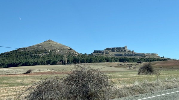
The pointy hill has a Castro atop, and the other is a Castillo. Off to the right on the slope below the Castillo is the Medieval (as in: most of the central buildings date to…) town of Atienza.
That’s enough for today. Tiermes remains among the most amazing pre-Roman/Roman sites I’ve yet seen.
Posted at 2:31 PM |
Comments Off on Best for last?
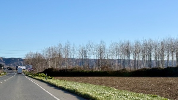
This is maybe the third time we’ve seen a stand of these silver-barked trees. Dunno what they are…mystery arboles.
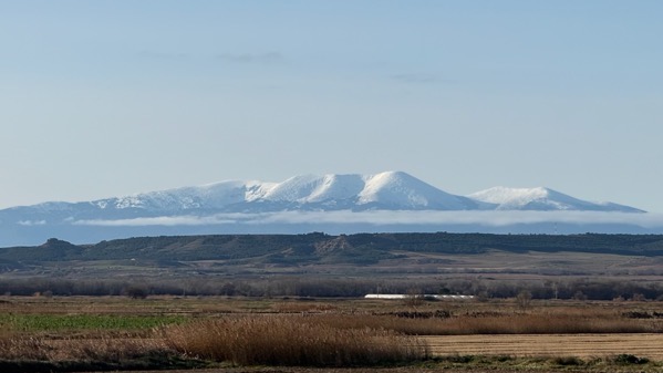
I’ve confirmed that this is Moncayo.
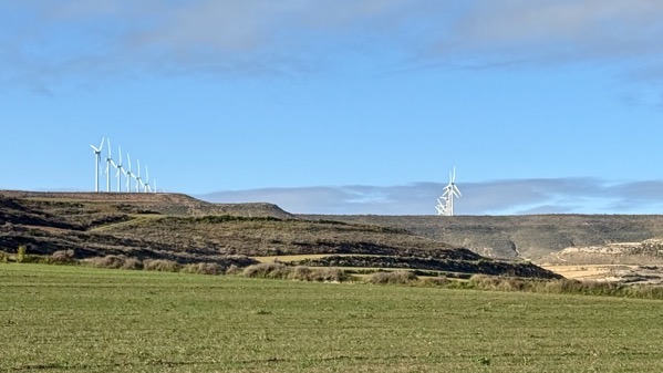
Wind turbine alignments. I’m trying to get my photographic fascination with them out of my system. Round hay bales can grab your eye this way, too.
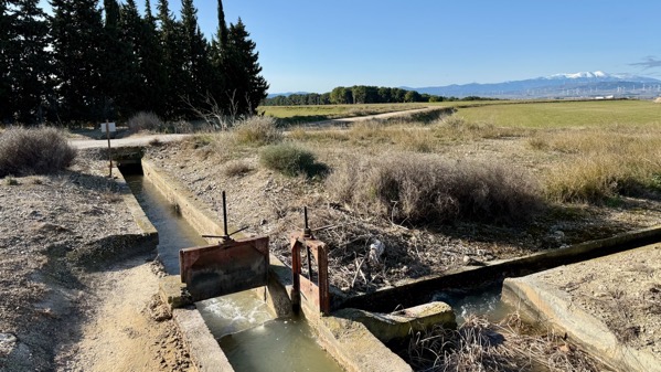
We’ve seen plenty of large and small irrigation ditches, but rarely the valves. Here’s a split, where the flow is being directed two ways.
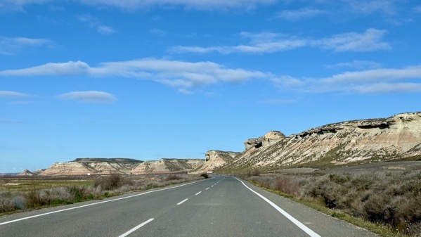
One of our goals today was to get a look at a large eroded area, or badlands, that is a park called Bardenas Reales.
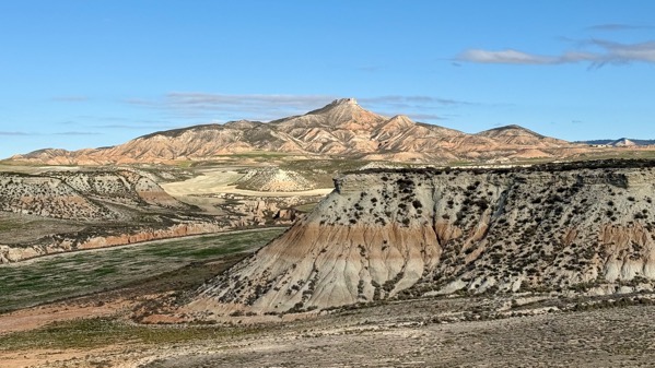
We did find one place with a road we could safely try to get into (or towards) the heart of this sculpted landscape. You can see we didn’t get far, as farmed fields remain.
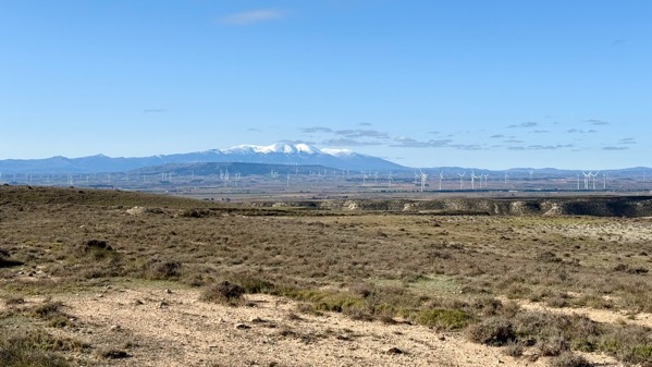
We partly circled Moncayo yesterday, and completed the loop today.
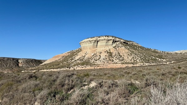
One more eroded landform.
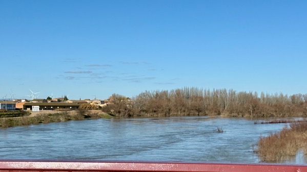
I finally got a shot of the Ebro when we crossed it. I think this is normal spring elevated levels.
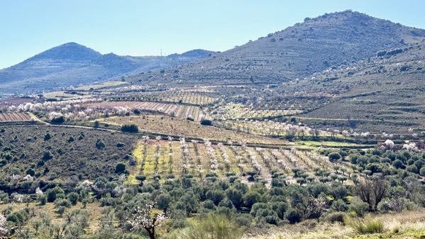
We cut through a “corner” of the lower slopes of the Moncayo massif, and found what must be a relatively warmer area, as many orchards flaunted blooming trees. My guess was peaches or apples, but I couldn’t parse the tree shapes and figure out the species.
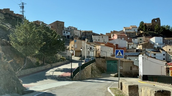
We went through/by many little towns. Amazingly, most had parked cars and evidence of active residents. I cannot figure out the economic support for these scattered villages.
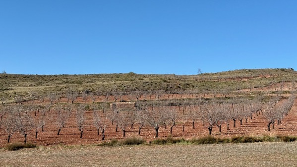
Later in the day, I became fascinated with the variations in soil color…this is rather brick red, and the trees are not yet blooming (February, remember…snow on elevations, remember?).
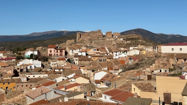
Castle ruins above larger small town…note the white lenses in the far distance behind the jagged walls…Moncayo massif, again.
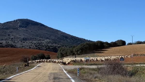
I counted one man and one dog with this substantial sheep herd. As we continued up the road, it was evident that they’d come down it for at least a mile. Transhumance underway? Earlier in the day, we saw a smaller herd, controlled by a man with a loaded mule and four dogs. Spring is springing for shepherds.

This is the second fox we’ve spotted. Neither was much concerned with our presence.
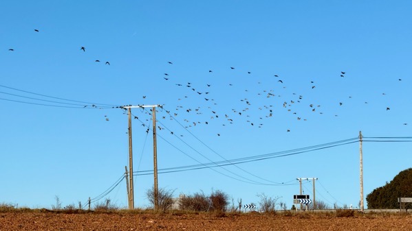
I just encountered a description of wheeling clouds of birds as resembling the billowing robes of a genie. As shown….
Posted at 3:30 PM |
Comments Off on Circumnavigation, etc.

Wind turbines on horizon. Strange color balance (through windshield).

Frost patterns…one shady place we saw frost as late as 11:30am.

Flags, bell tower.

Storks, backlit.

Horses, also backlit, with frost, tracks.

Medieval rock graves, Revenga.

Medieval rock graves, Regumiel. They antedate the 12th C church built partially atop them.

Medieval rock graves with ice skim, Duruelo. Some sources say this trend in this area, the Upper Arlanza Basin, say these graves are 7th/8th C. Others say 8th–10th C.

Stand-alone snow-capped mountain, perhaps Moncayo.

Wind turbine array, with Pyrennees in far distance and Ebro basin between.

Rioja territory grapevines.

This is the part of the Roman city of Graccurris, founded 179 BC, that has been “reconstructed.” I could make little architectural sense of what seemed to me to be mostly a wasteland. Of course, there was significant Medieval occupation here, too….

Largest church in Alfaro, essentially modern Graccurris.

Smaller Alfaro church.

Fuzzy moon out our hotel window, a few minutes ago.
Posted at 1:57 PM |
2 Comments »
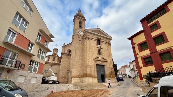
We took the long way back to our room after breakfast (the short way was maybe a dozen doors away), and the maze of streets brought us by the church, and the door was open!

So we looked in. Two priests and fifteen parishioners. What a surprise to see that oval ceiling and pantheon-like dome. A bit of digging (you know where), and I see that the building, Iglesia de San Pedro Mártir de Urrea de Gaén, was designed by Agustín Sanz (also the contractor for construction), with the building completed in 1782. The unusual layout was allowed by the church’s patron, 9th Duke of Híjar, Pedro de Alcántara de Silva Fernández de Híjar. A very progressive design.

We drove quite a ways, trying to absorb a bit about the always changing landscape. Here’s a lovely valley.
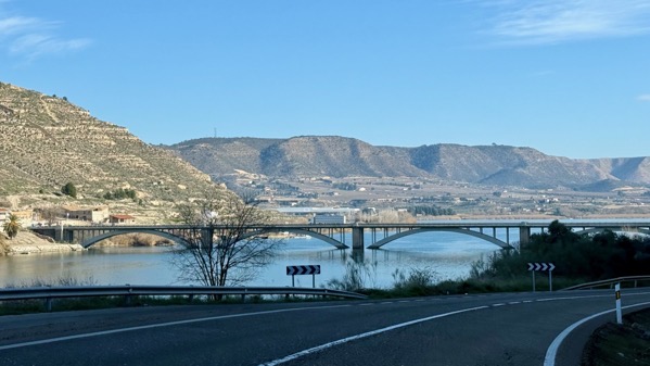
We reached our first crossing of the Ebro River, the major river of northeastern Spain. It’s south of the Pyrenees (duh), and flows east-southeast with a large, roughly triangular basin that I think was a breadbasket in Roman times. It eventually turns south and cuts through some low mountains, before reaching the Mediterranean at Tarragona. We will spend perhaps almost half of this trip in the Ebro basin. [Map on WikiPee here.] The area along the river is called the Ribera today. Shortly after crossing this bridge, we entered Catalonia, where we’ll stay for the next eight-ish days.
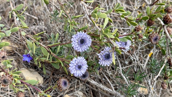
On our hill-climb to the first yacimiento ([archaeological] site) of the day, called in the literature Sebes, I spotted these flowers, mostly old dried out, but not this specimen. The one to the left is different. I don’t recognize either.
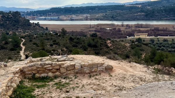
The heydey of Sebes was the Early Iron Age (7th C BC, and thus pre-Roman), when I think the best place in town was up here, but structures were on many terraces below the hilltop. Here’s the view of the Ebro from the high-point.
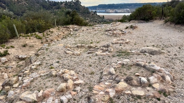
On a lower ridge-nose, the Sebes people put their dead beneath these careful rings of stones. Long before the Romans, people in Iberia put their dead outside their communities, but close by.
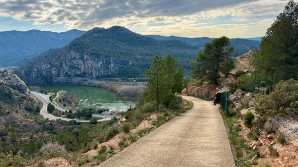
That ridge-nose off to the right and barely visible has the ruins of a later Iron Age settlement, high (as you can see) above the Ebro. The name for it today is Sant Miquel de Vinebre, so not an indigenous term that the Romans recorded before they ousted the inhabitants in 44 BC. Further parsing the photo, you can see the geological bottleneck to the left, which allowed this site to control passage up the Ribera, and the arable lands to the right or west-northwest and out of the photo.
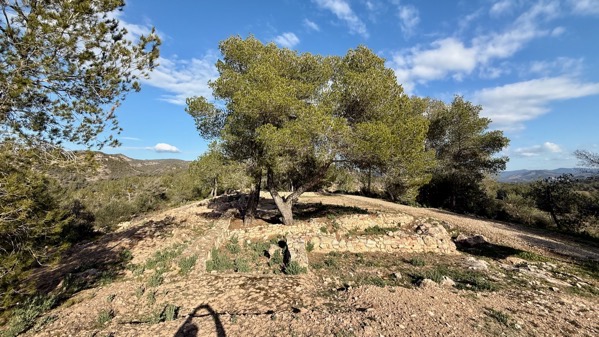
This site is typically referred to as El Molar for the adjacent town. John says the community’s business is dentistry, but the WikiPee indicates it’s agriculture (olive and almond orchards, plus some vineyards). This site dates to the Late Bronze Age/Early Iron Age (so earlier than the two above), and is along a narrow N-S ridge. Most of the excavation was a century ago, so we have far less data than if had been opened up in the last several decades. However, excavators did save some funerary artifacts of copper and lead. Interestingly, this site is in a mining area that produced the lead, but not the copper, although copper is known from the area. Instead, the copper was from southeast Spain, mostly from the Linares mines of Jaén, and, to a lesser degree, from mines in the Almería province. So I read.

We reached Catalonia, an autonomous community (Spain has 17), not a province. Here’s another bridge across…the Ebre, Catalan for Ebro. Our second Catalan word befits language learning in a Catholic region, and is creu, meaning cross. Poking around the internet just now, I learned that in Catalan, the name is Catalunya. Now up to three words!

Note the three balconies of laundry (I gotta include some cultural anthropology)—and one without—perhaps preparing for the weekend?
Posted at 2:26 PM |
Comments Off on On to Catalunya