Musings
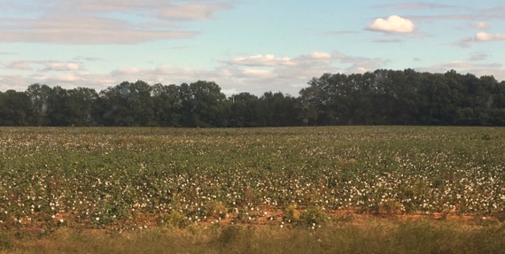
We took the fast road getting out of BigTown, then hit the back roads for some scenic, on our afternoon jaunt to LittleTown aka Athens.
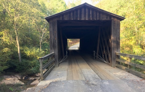
After the cotton field of red clay, we visited this covered bridge, notable for not having steel reinforcement beams underneath it, yet still carrying traffic. It does, however, have a steel (aka “tin”) roof.

This is the Town lattice truss style of construction, and the pegs holding the beams/planks together are formally called trunnels. [Auto-correct wants that to be tunnels…which is #NOTright.] The bridge was moved here from another location in 1924, and I don’t know if the planks were numbered then or later….
In LittleTown, we saw family and had some good laughs, ate pizza, and commiserated about this #growinOLDstuff, creak-ouch.
Posted at 10:38 PM |
1 Comment »
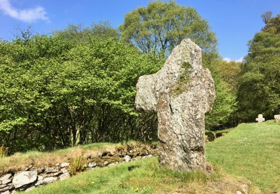
Weathered cross supporting moss and lichens, in Reefert Churchyard near Glendalough monastic complex, County Wicklow, Ireland. Photo from May 2017.
This cross is in the churchyard of Reefert Church; the name is an anglicized corruption of Righ Fearta, meaning burial place of the kings. There was probably a church here before the present one, which is in ruins and probably dates to the 10th/11th C. Perhaps the hazel tree grove that surrounds it has similar antiquity.
Graves here include seven leaders of the Ua Tuathail clan. You probably would recognize the name as O’Toole—more anglicization. One of the 12th C Ua Tuathail’s associated with this church was Lorcán, aka Saint Laurence O’Toole (1128–1180), who became Abbot of Glendalough in his 20s and Archbishop of Dublin in his 30s.
Posted at 5:57 PM |
Comments Off on Eroded cross
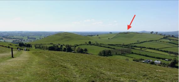
View west from Carnbane East area of the sizable Loughcrew Cairns complex, in May 2017. Arrow points to Carnbane West hilltop. The bumps are cairns.
Among the eclipse hoopla, you may have read that a stone in Ireland has petroglyphs that may constitute the world’s earliest known record of an eclipse. The stone is in a large stone monument in the Loughcrew Cairns complex, and probably dates to about 5K years ago. It is one of many stone mounds on the hilltop west of the hilltop that’s open to the public, where I was standing to take this photo. The hilltop we visited, Carnbane East, had at least six obvious cairns on it.
The cairn is more properly a passage tomb, oriented so that the sun can shine in the passage and illuminate carefully placed stones usually on the solstice. And, yes, with human remains.
The designers and builders of these monuments clearly were aware of astronomical minutia, so an eclipse would have been in their wheelhouse. Whether the spirals and circles some consider the record of an eclipse are just that, I don’t know, but it certainly seems possible.
Posted at 6:34 PM |
Comments Off on Minutia from me to you
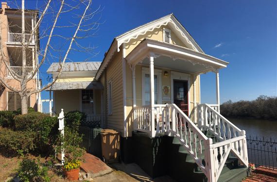
From February….
Before Selma had the Edmund Pettus bridge across the Alabama River, there was a bridge here. The bridge tender/toll collector and his family lived in this small house on the Selma end of the bridge. He was on duty 24/7, and had to manually/mechanically rotate the north span to let large vessels pass.
Posted at 10:22 PM |
Comments Off on River life
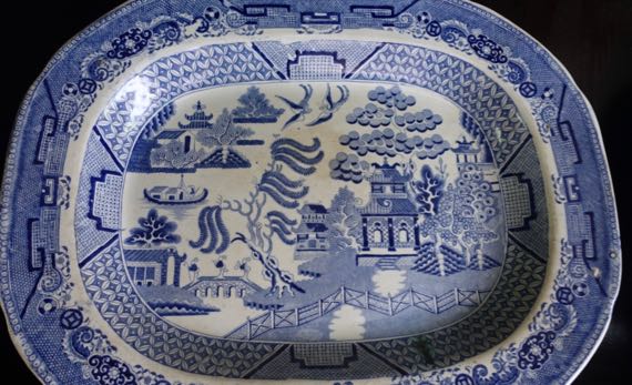
A bit creepy to hear that Salvador Dalí’s mustache survives on his embalmed face. Bit gross, too.
No idea why that occurred to me as I began to compose this….
Posted at 7:07 PM |
3 Comments »
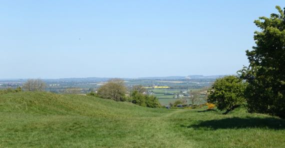
Here’s a wee trip down memory lane, in this case the approach avenue from the north leading south up to the crest of the Hill of Tara, or Irish: Cnoc na Teamhrach. In Ireland. This spring.
The ancient chronicles discuss an over-large banqueting hall at this civic-ceremonial center, and for well over a century this sloping feature was long called the Teach Miodhchuarta, commonly translated as Banqueting Hall, but more precisely translated as circular house of the (mead-) feast. The chronicles date to far later than the Neolithic, but that doesn’t mean they don’t record information of earlier antiquity (presuming continuity).
While I’m sure there were over-large wooden buildings elsewhere on this hill, this wasn’t the banqueting hall of the legends.
Some call this a cursus, a linear ritual complex of ditches and mounds that dates to the Neolithic period, and I’d accept that. The name derives from the linear Roman athletic race courses, which the Neolithic cursuses resemble, but to think the use is the same is inaccurate. Not for races. Avenue is a better label.
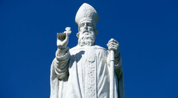
This hill is still a locus for rituals and ceremony. Here’s a St Patrick statue, and there’s an active cemetery and church honoring the saint on the hill-flank.
Okay. Enough Memory Lane.
Posted at 9:17 PM |
Comments Off on Thinking back: Hill of Tara

I jokingly said this street art was Abe and Mr. Sweater. Turns out it is something like Abe and the Common Man. Common Man being white guy in cable-knit sweater. Nothing against white guys or sweaters. But.
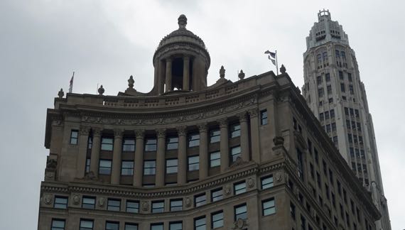
We took a fantastic architectural boat tour, and this was across from our dock. The somewhat unexpected rooftop open-air circular temple can be rented for special occasions.

Our boat went out to the lock that prevents the Chicago River from dumping into the lake—its natural flow—but did not leave the river. Such a great view west of the skyline.

The grass-edged landform to the right was where the Euro-Americans first settled here. They heard the Indians saying something that they distorted into “Chicago” thinking that was the name of the spot. Turns out the Indians were commenting on the marshy vegetation—stinking onions. Or so our wonderful guide said.
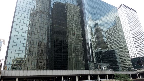
Even more than the building in the previous shot, this one was designed with a plain façade meant to reflect what was around it.
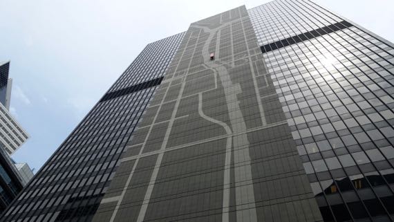
This one, on the other hand, has a stylized map of the rivers. That red “bench” feature way up there indicates the location of this building, a “you are here” marker.

Spotted on our way back from deep-dish pizza engorgement….
Posted at 11:07 PM |
Comments Off on River view
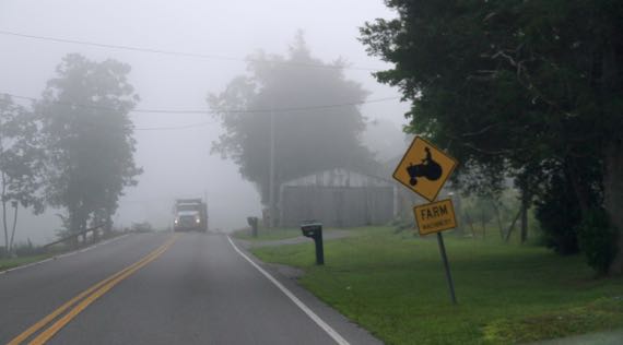
Today was a storied day. Too many stories to tell them here, in fact. The morning started in the clouds, or, more precisely, the clouds descended to the ground…creating lovely, muted light. Okay, one story. Sometime after this shot we drove a winding road through a narrowed valley, decorated every so often by flanking, blooming banks of orange lilies. It was named Frog Level Road. When it’s tough, the frogs go low, and burrow deep in the mud. And this valley was low for the area, meriting the reference.
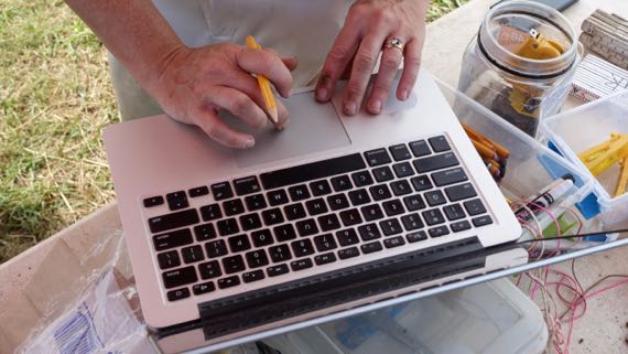
Our next big adventure was to see M’s field school winding up their season. This is when the largest area is exposed and the “most” has been revealed by weeks of hard work in the merciless sun. It is the pinnacle of science!

Science also can look like this. It’s a cord-marked sherd, meaning that when the clay was still plastic and partly dry, someone took some rough cord material and pressed it into the clay to make a surface decoration. This is an easy method to originate and potters all over the world have used it.
Anyway, the stories unfolded. A shower to clean the sweaty, grimy body. A big download of pictures. A party at a lovely home on a hill, a gift to the crew that we were allowed to join. Finally, we crashed, spent and happy and enjoying the wafting air-conditioned breeze in the hotel room. A few fireworks outside as I was falling asleep; or did I dream that in a fog of exhaustion.
Posted at 10:22 PM |
Comments Off on Whatta day!
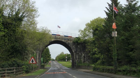
Kinda overcast when we set out. We did have spots of sun and showers, the perfect set-up for a mellow day.
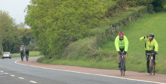
We came across a bike race with dispersed riders soon after we hit the road. Some were wearing bright anoraks…thankfully, they were going the other way.
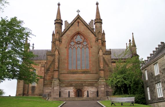
It’s Sunday, so here’s the Church of Ireland Cathedral in Armagh. The RC Cathedral also honors St Patrick. The Archbishops of both sects are here and both are Primates of All Ireland (if I have it right). Armagh is historically far more of a center than it is today.
We still don’t know how to say Armagh. (Is it guttural?)
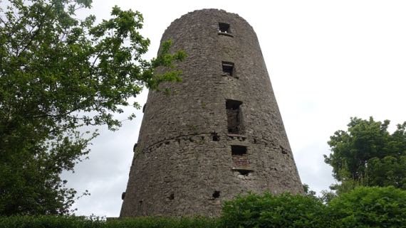
We found this six/seven-story ruin up Windmill Avenue, and indeed it was a windmill perhaps two centuries ago. No access; it’s fenced off. No informative signage.
Due west of Armagh is the pre-Patrick religious center, Navan Fort, properly Emain Macha. Folks don’t use much Irish around here, but the instructional materials at this location prefer the Emain Macha name.
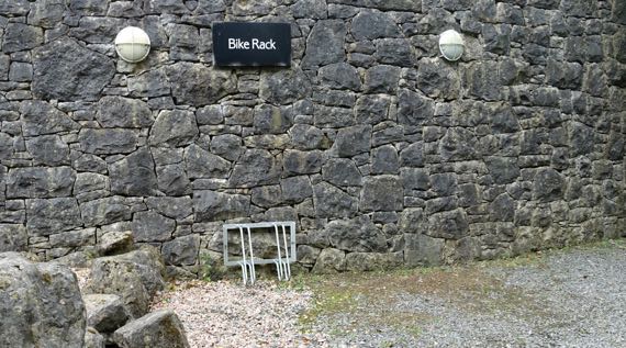
Good thing the bikers weren’t headed here. This bike rack has a limited capacity.
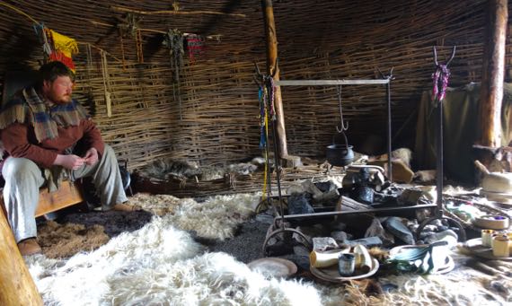
We began with a visit to an Iron Age house, reconstructed and populated with this warrior, Fergus, and a bard named Sanka. Great fun!
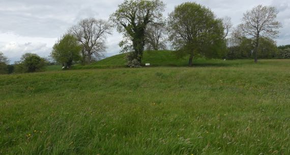
The most unexpected thing that archaeologists discovered about these ritual features atop the hill is that the bump in the distance was the location for a series of timber structures. The largest, indeed the largest Iron Age ritual structure known in Europe, was built in 94BC (based on tree-ring dating). Before this hill became a ritual/construction site, a different hill was favored. Of course, later, the geographic ritual focus of the people living in this area moved to Armagh.
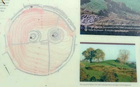
This topo map may be helpful. I am standing on the left, lower feature (#1), and looking toward the right, major feature (#2). The white signs outline the outside of the hill outside of the ditch that encircles where the enormous soil-covered timber structure used to stand.
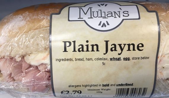
Lunch time: would you like a Plain Jayne sandwich, ham and cole slaw? (Did not buy.)
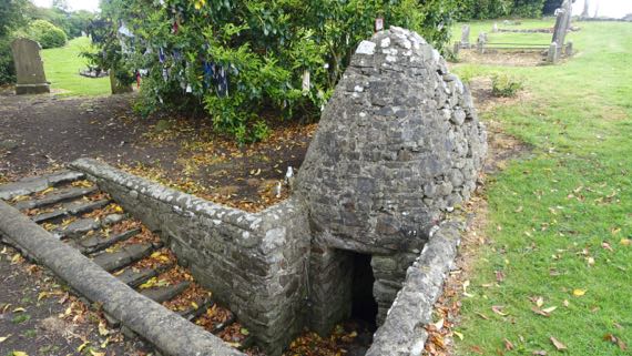
We moved on to the remains of a medieval motte-and-bailey castle (eroding; not pictured) and to the adjacent ruined church and graveyard. This is on the Hill of Faughart, believed to be where St Brigid (~451–525) was born and brought up. If she didn’t live on this ridge-nose, I’m pretty sure she must have come here. If, indeed, she was from what is today called the Hill of Faughart. Anyway, this dipping well is associated with St. Brigid. Leaving the rags tied to the tree is part of ritual visits here.
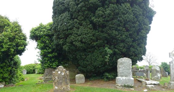
The church walls are beneath the ivy at the far left and left center of this photo, left of the dark green evergreen. Just to the right of that dark green juniper? is a “flat” grave. The marker records that Edward Bruce (~1280–1318), brother of the Scottish king Robert the Bruce (Roibert a Briuis) is buried there. He died from wounds received in a battle in the lowland below this ridge nose.
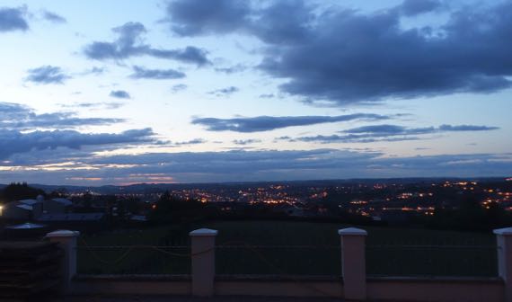
This is last night’s sunset, a bit prettier than the one tonight, and appropriate as we bring this chapter of our lives (trite trite) to a close and get those stray belongings packed into checked baggage, rather than in separate containers that can be stashed in the car, ready to be dragged into the next B&B.
Posted at 4:52 PM |
Comments Off on Last full day

We spent most of the day at a 170-acre living history village-and-rural-area that is paired with an indoor museum of transportation. We began in the rural area. At least a half-dozen stone cottages in different styles and dates offer the opportunity to think about heating/cooking with coal or peat turves and living in close proximity to farm animals. One cottage (no photo) even had a byre at one end and family space at the other—with no wall in between; maybe it was only used seasonally, however.
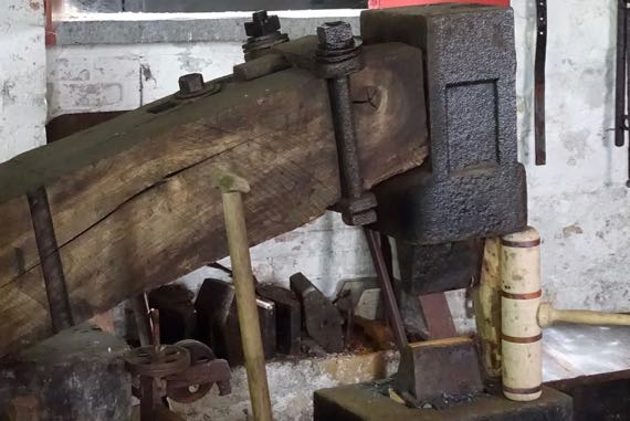
We enjoyed a long chat with a spade-smith; he makes spades, not shovels (shovels are for loose materials). This is his water-powered trip hammer. 3K pounds of pressure per smack. No water flowing to make it trip today….
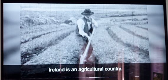
And this is a shot from a 1940 news-reel/documentary about spade and shovel making in the town of Monard, County Cork. With water power and coal-fired forges. Laborers worked six days a week. On the seventh they went to church, played gambling games, and played music and danced. Ireland had a great diversity of spade and shovel types. Over a hundred, and then many different sizes of each. Diversity.
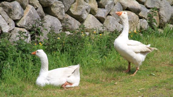
John tried a bullfighter move with these geese. No horns involved, thankfully, just hissing.
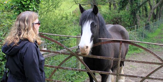
Me, I had a chat with this horse (we think in a field next to the museum property).
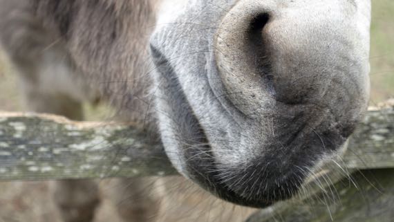
And we both had a moment with this donkey. One lady looked around for grass-not-nettles and fed her a small handful. Happy day for the donkey.
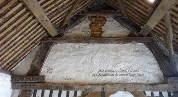
This wall is cut-away and labeled to highlight the crucks—those curving beams that go up from the ground and support the roof beams. I think folks used ropes to bend trees to make the needed shapes. Crucks were also used in ship-building.
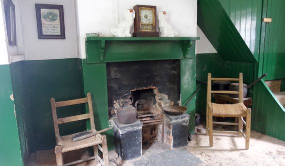
Here’s the fireplace in one apartment in a row of village/urban row-homes with this small room downstairs, two teensy bedrooms upstairs, and a tiny yard out back with a water closet and coal bin, and a bit more room for washing laundry, etc. I thought this is the kind of place where TB would have spread quickly.
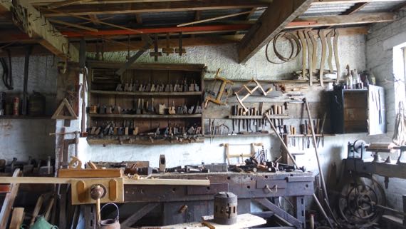
Look at the rows of tools etc. in this carpenter’s shop.

Next we went across the highway to the Transport Museum. Of course, we started with trains. This is the shamrock detail on the County Donegal Railways seal.
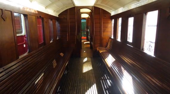
Here’s the third-class area on a train carriage. They had to pass a law in Ireland to make the railways put roofs and sidewalls on third-class spaces. They used to be like riding in a cart—just relatively low side walls, with riders fully exposed to the weather.
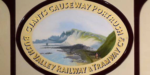
Loved this stylized image of Giant’s Causeway and the cliffs that frame it even today. I think I read that this began to be a travelers’ destination in the 1700s. !!
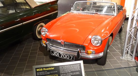
Cars, too! An MGB Roadster, 1975 model.
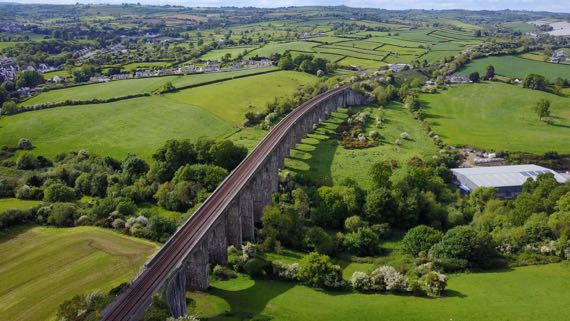
Droney made two short runs, and the Guru captured the lovely shadow from this long railroad bridge during the first one.
Posted at 4:48 PM |
Comments Off on Tired of ruins?