Musings
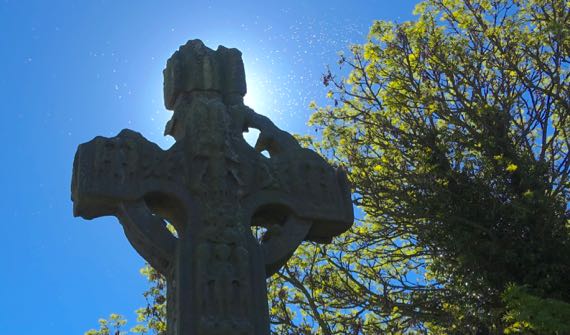
I thought this was our “last” high cross of the trip, and then we saw a replica in a museum. Does that count?

Also at Ardboe (no ruins of the monastery that was here), we found grave monument setters at work, and this lilac. Can you see the white spots in the first photo? And a couple of flies in this picture? Many bugs…a hatch. They weren’t house flies. Still annoying, however.
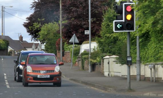
Haven’t noticed L-shaped stoplights before….
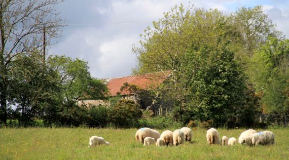
Strange that all these sheep turned their tails toward us—and they have tails. Lots of that here, but plenty are docked.

Last stone circles of the trip. These are the Beaghmore group.
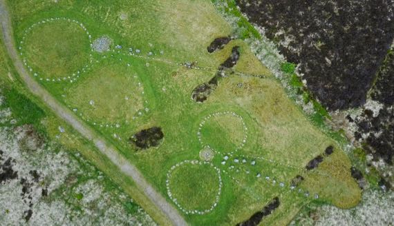
JCB and the drone captured some fine shots. This is just part of the area of circles, alignments, cairns, etc. Further, this valley is peppered with stone features. And without a doubt more are undiscovered beneath the peat. The peat is covered by brown and grey vegetation in the drone photo.

On to the last ring fort occupied into the 1600s. This is a famous spot, as one of the last Gaelic kings (sub-king I’d say) was inaugurated here in 1593; his name was Aodh Mór Ó Néill. Aodh is Hugh in English. Mór means great. Aodh would have called this place Tulach Óc; today it’s Tullyhogue. Someone lived here in a wooden building into the 1600s. This is the entrance and the original entrance probably required a Z-shaped path between wooden palisades.
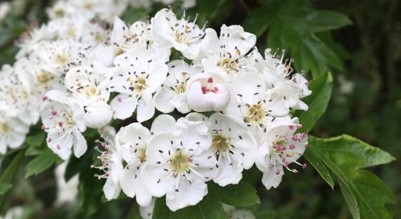
We’ve been seeing these blooming hawthorns everywhere—down hedgerows and here at Tulach Óc. The scent is strong.
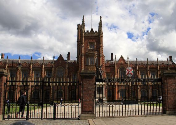
In Belfast! Here’s the formal façade of Queens University Belfast.
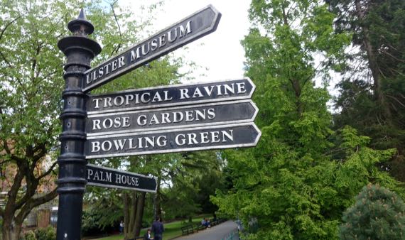
Next to the core buildings of the Univ is the Ulster Botanic Gardens.

This is the door to the Palm House. The plants were ho-hum. There was a HOT room, that made my chest feel compressed.
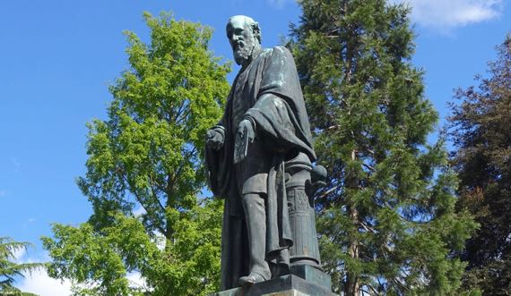
A metal Lord Kelvin stands inside the main entrance to the BotGarden.
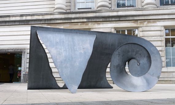
This is a sculpture outside the Ulster Museum.
Just periodic overcast, no sprinkles. Is this really Ireland?
Posted at 4:17 PM |
Comments Off on Winding things up
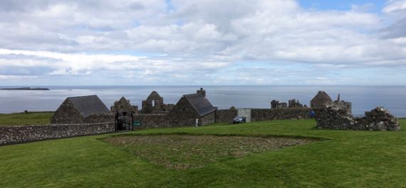
This is the inland side of a promontory fort location, very defensible. The construction here dates to the same period as Donegal Castle that we visited yesterday. Visually, it looks quite different because the stuccoing (perhaps not the technical term) is gone here and not in Donegal. Anyway, the foreground is the original cobble street, discovered below the modern sod. Around me, the photog, are archaeological remains of the village that was outside the castle. This castle, far right and distant, was built/occupied by MacQuillans and then MacDonnells, Scottish landholders and traders. The village had a substantial Scottish merchant population, numbering nearly 300. There was an earlier castle here dating to the ~1200s. I suspect there may have been an earlier occupation, too….
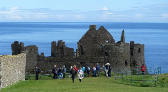
We arrived just after two big busloads of tourons. As we made our way to the ticket booth, we realized they were not entering the castle, only standing at the fence. Yay for the logic of bus-tour scheduling (?).
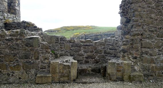
We took many detail shots of the castle and its setting. This is the remaining bottom portion of a fireplace surround, and the view through the hole in the wall of the next peninsula, covered with pasture and gorse. Strangely, it was not windy.
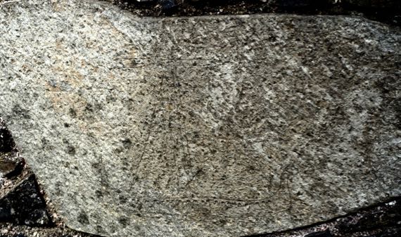
I’ve messed with the photo settings in an attempt to bring out an etching of a late medieval Scottish galley. Perhaps easiest to spot is an upright triangle, representing the sail, I think. At the bottom are a pair of horizontal lines indicating the ship, with a line of dots along the upper line. Perhaps you can see the upturned ends to the left and right.
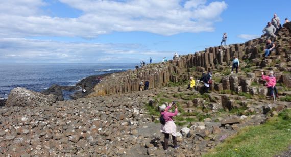
We went on east to a geological feature called Giant’s Causeway. It’s a basalt formation of hexagonal columns, broken and weathered on the tops. There are several folk tales about the formation; track them down if you like fanciful stories.
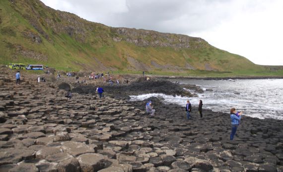
This view is back at the bus turnaround. Many people take the bus down, or more likely back (uphill). We walked both ways. My fitbit has been giving me in excess of 100 flights per day over the last 10 days; not today, unexpectedly.
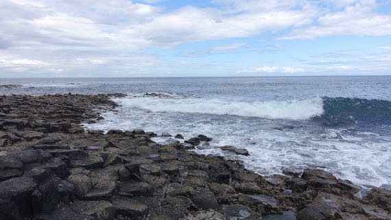
We spent some time watching the waves crash near the end of the formation, soaking in the sunshine. Just lovely.
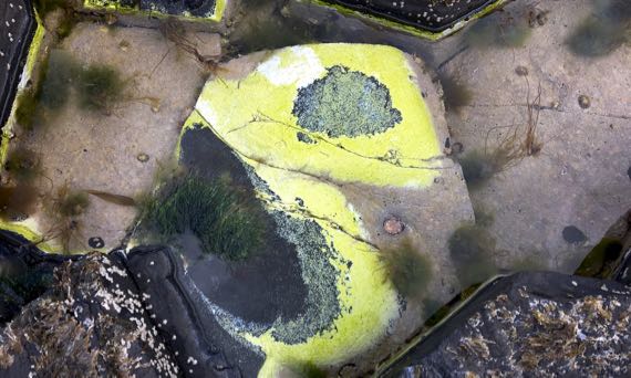
I found this tide pool with its brilliant green-yellow whatever-it-is. There are conical shells, too—barnacles? I don’t know much about sea-critters.
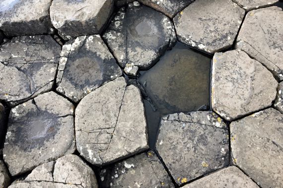
Here’s a top-down view of the columns. Love the slight distortion of the geometrics.
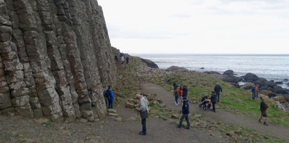
Here is a stand of the columns. So dramatic.

We spotted several dandelions along the return route to the parking lot, and even a few buttercups (I think), with flies camped out on them. In contrast, white flowers were bereft of flies. What’s the deal?
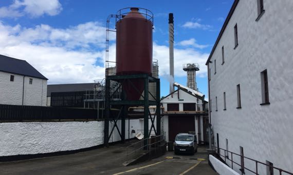
We made a quick stop at the Old Bushmills Distillery. We thought about taking the tour, but it was priced at £8/person, and we decided to pass. Even if it included a wee tasting at the end.
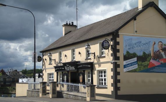
Here’s your daily pub shot. This is the Wild Duck in Portglenone. The town is on the River Bann, which connects the large freshwater lake called Lough Neagh to the sea. Vikings sailed up the Bann, and spent the winter of 840/841 at the monasteries at Antrim and Ardboe. Subsequently, they made camps other places around the lake from which they raided elsewhere in the interior of this part of the island.
Posted at 4:37 PM |
1 Comment »

Even before we left the B&B, we’d had sun, sprinkles, overcast, repeat. That was the pattern throughout the day. As we rolled down the road early on, we spotted a cloud sitting atop this ridge. By the time we got to the end of it, the cloud had lifted. Sunshine!
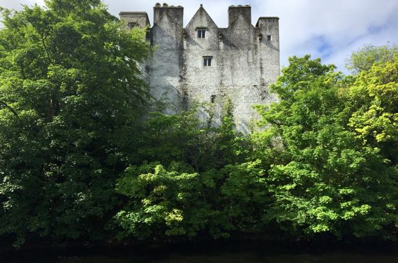
First stop: Donegal Castle. One part is 15th C; another is 17th C; the whole was refurbished in the early 1990s. For several generations this was the seat of the O’Donnell leaders. The town has encroached upon all but a small area immediately adjacent to the castle. In the foreground here is the River Eske.
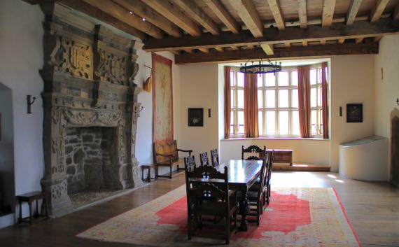
The Great Hall has been partly furnished. The fireplace surround is 16th-C, installed when the Brooke family owned the castle; they did many modifications/upgrades.
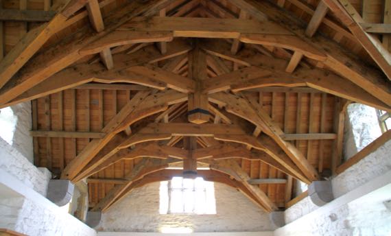
The room above the Great Hall has these fantastic beams supporting the roof. The engineering seems similar to that of covered bridges, etc.

Several days back we started seeing rhododendrons in the roadside vegetation. The Guru discovered that they’re an invasive species here. Beautiful flowers, however.

We passed by Killybegs harbor, a hive of activity on the docks, and moored boats and ships, plus sailboats. I think these two are fishing vessels, but that’s a landlubber’s hypothesis.
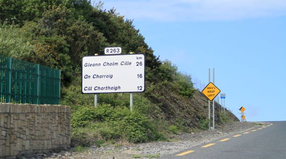
This is the first big highway sign that we noticed that did not have the English place-names paired with the Irish. Still haven’t overheard people speaking Gaelic very often.
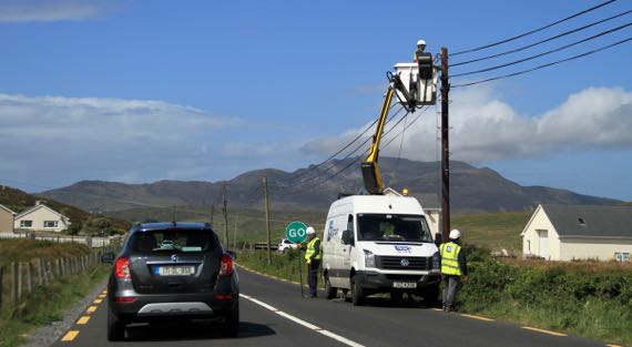
We think this is fiber-optic installation. We spotted over a dozen yellow trucks that were part of the installation crew, we thought. It will be a big change to this rural area of County Donegal. Note mountain in the background.
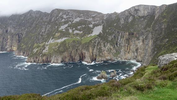
From Carrick (An Charraig on the sign above), we took a side road out to this viewpoint for the seaside cliffs of Slieve League (Irish: Sliabh Liag). These are twice as high as the famous Cliffs of Moher, at just a fuzz under 2K feet.

We returned to Carrick to turn north toward (eventually) Derry and Northern Ireland. This place is called John the Miner’s Central Bar. FYI.
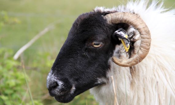
Rolling along, only a few times we’ve driven in open range. Usually, if sheep are on the road, they have escaped through the fence. I think that was the case with this one and her several buddies (not pictured).
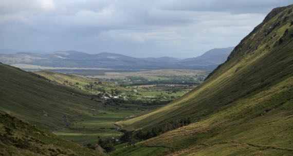
What a view as we passed down the northeast side from Glengesh Pass (translation: Glen of the Swans). Don’t those rounded flanks reek of glaciation?
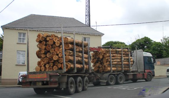
We’ve seen a few log trucks. The logs seem short compared to what we’ve seen in the USA. They come exclusively (or nearly so) from tree plantations.
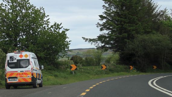
It behooves you to notice these buggies. That camera sign may look like a quaintly historic model; however, it signals a speed check/trap. They used to have installations along the roads, but now there are just vans randomly deployed. There aren’t many, as this is the second one we’ve spotted.

Droney took to the air at Grianán of Aileach, a reconstructed stone fort just west of Derry (officially Londonderry), but on a high spot in the Republic. This view is toward the southwest, so it’s all the Republic of Ireland.
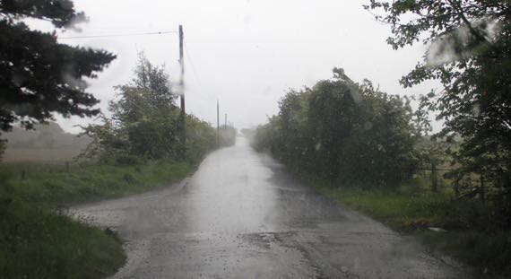
Another rainstorm hit as we crossed the international border. Can you see the change in the pavement in the foreground? That’s the border. How will it change with Brexit?
Soon, the rain had stopped and soon after that the sun was out. We have been very lucky with good weather on this trip.
Posted at 4:40 PM |
Comments Off on Watch the weather change
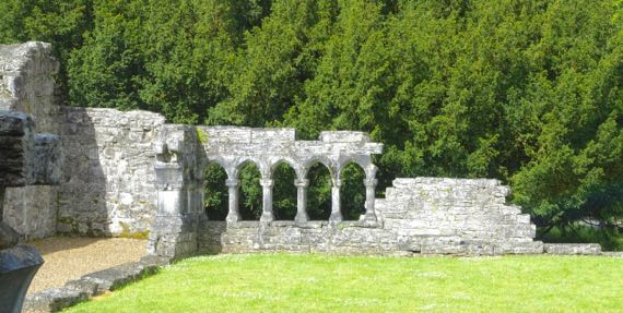
Another day, another religious complex in ruins. Here’s one corner of the cloister interior at Cong Abbey. The Irish is Cúnga Fheichín, meaning St Féchín’s narrows. The narrows refer to the river, I’m guessing. The waterways around the abbey go underground and appear braided. Complex, anyway.
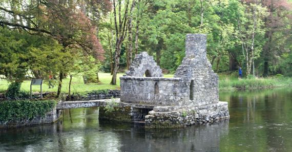
This “fish house” is an unusual surviving monastery feature. My understanding is that the underneath had a net hung inside it, and the fish were retrieved through a trap door in the floor. The area around Cong is where “The Quiet Man” (1952) was filmed–John Wayne and Maureen O’Hara.
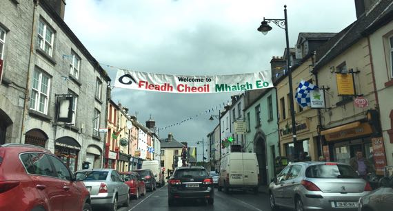
This banner over the street in Ballinrobe says: Welcome to (you got that part, I’m sure) Music Festival Mayo. Mayo is two words in Irish—Mhaigh Eo—which means yew trees, and yew trees are loaded with sacred qualities, very special. Oak trees, too.
Lots of place-names begin Bally– or Balli– like this. The Irish is Baile and it means town, although GooTranslate indicates it means home, also. Interesting cultural implications of that.
Also, place-names that end in –more in English may be from the Irish mór, which means big. Toponyms are such fun!
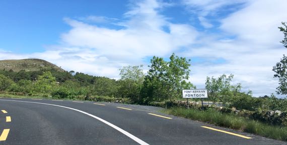
It seems the English mimics the Irish Pont Abhann in some abstract way, as Abhann means river/fluvial and has a different sound than “oon”. Another linguistic abuse by the English….
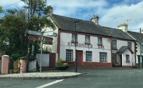
Just liked the way this looked. I couldn’t tell for sure if it is still open.
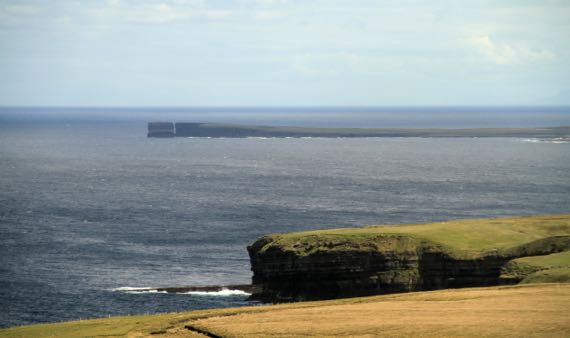
That haystack at the end of this peninsula is Dun Briste, meaning broken fort (fort in the sense that this point is naturally fortified by being almost surrounded by the sea; broken is obvious). The English name highlights something totally different; it is Downpatrick Head.
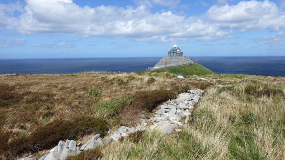
This row of stones exposed from where the peat buried it was a fence-wall thousands of years ago, built by people who cut the forest to begin farming here six millennia ago. Why did peat form here? Scientists aren’t certain, but the current hypothesis is that by cutting the trees, it changed the soil chemistry and created an iron-rich layer that kept the water table high and meant that any plants had to be tolerant of the iron-rich condition to grow, which favored heather and sphagnum and the like. They grew and died and new offspring grew in the same spots, and the moisture and repeated generations meant peat could form.
The large size of the fields and the pollen that has been identified as contemporaneous with the field walls indicate that the fields were pastures, used for cattle and not crops. Very interesting.
Can you guess that it was windy windy windy when we visited Ceíde Fields? Can you guess that is Ceíde pronounced kay-ja? Yup, no “d” at all.
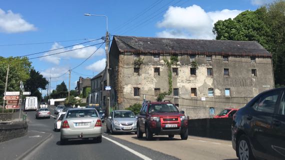
I’m pretty sure this is an abandoned factory. Not all ruins we note are darned old.
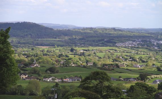
Another high view of the velveteen green, this time with more trees and houses. This is near Sligo, from the flank of the mountain called Cnoc na Riabh, meaning hill of…well, knowledgable people argue about of what. Cnoc is hill, no doubt about it. I keep trying to come up with a Cnoc-Cnoc joke….
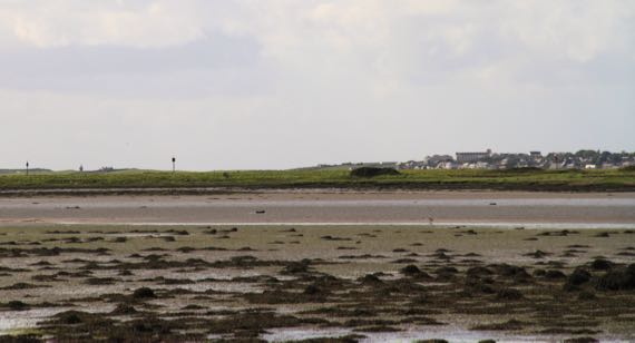
And here the tide is out in Sligo. The Irish name of the river (originally) and the town is Sligeach, meaning abundant shells, meaning the river was rich in shellfish, and maybe fish in general. Don’t know about now.
Posted at 3:52 PM |
Comments Off on Irish lessons, subtly
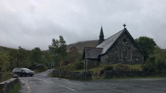
We awoke to soft rain. High on a hill/mountain, this church was still below the clouds.
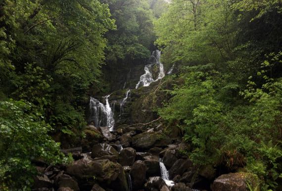
On the other side of the mountain, we checked out a waterfall. There are several along the “edge” of this landform. We walked in rain to check it out.
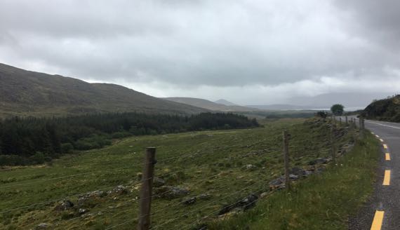
And, farther down the peninsula, we could see out over the ocean was clearer than where we were driving.
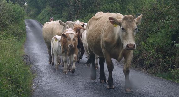
Down a narrow lane, we waited for the cowherd-ess to move her charges along. Moo.
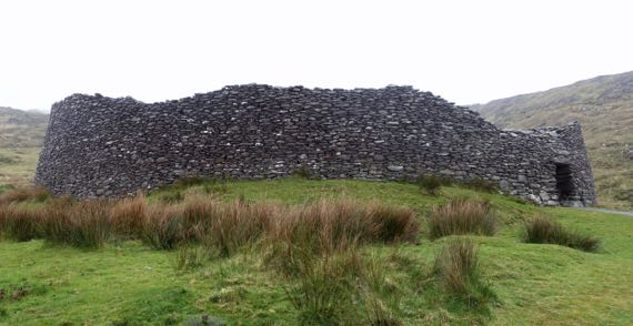
And, at the end of the road…a stone fort. These date to the early Christian through late medieval periods, in general.
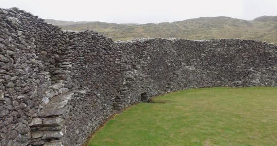
The stones are stacked carefully, with sloping walls interior and exterior, and the space between filled with chips and smaller stones. In the interior, the stones are set to allow easy ascent. No building remains survive inside Staigue Fort.
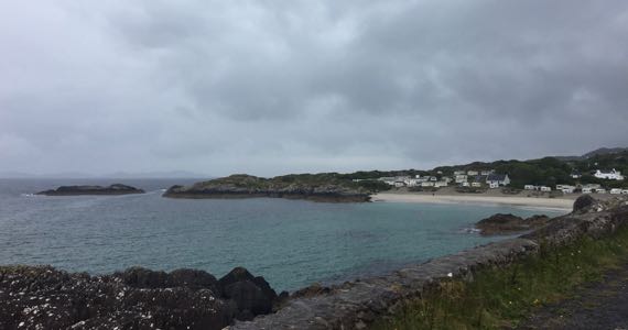
Downhill, we found striking blue waters in this harbor in the Brackaharagh townlands.
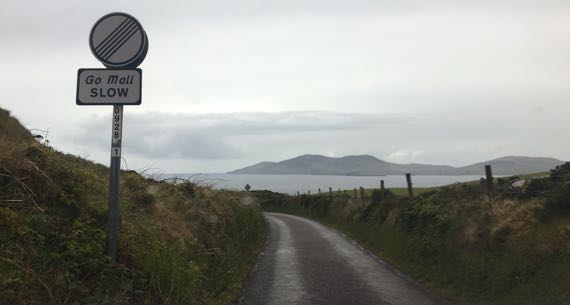
Off on another narrow side road, heading for Loher stone fort…. Go mall is Irish for slow(ly).
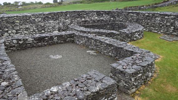
Inside this fort, partial walls of several buildings survive.
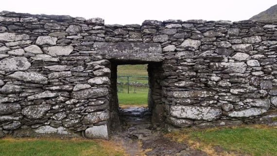
The interior of the fort slopes so that water drains out the single doorway. This seems true of all of these stone forts.
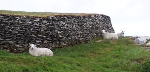
A bit more of a drive and a bit of a walk, and we stroll through sheep to Leacanabuaile stone fort. This one has wide walls with turf atop.
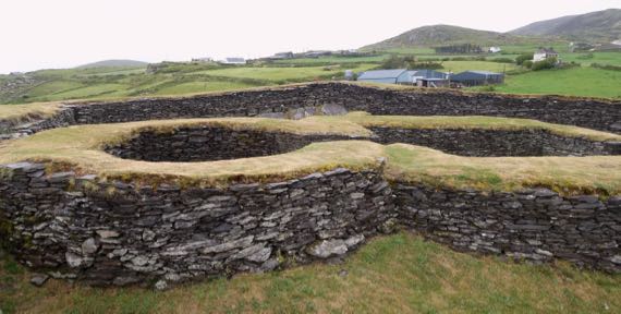
Same for the interior building ruins…. This two-room building had a square-ish first room and a round interior room.
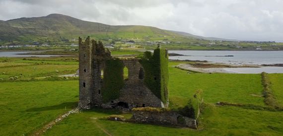
Droney and the Guru took this photo of Ballycarbery Castle. It’s huge. Note that the sun is out! The ivy covering the walls is old, with a substantial “trunk.”

This is the “trunk” structure of the ivy on the right end of the building in the drone shot. Maybe “substantial” is too tame to describe this proliferation.
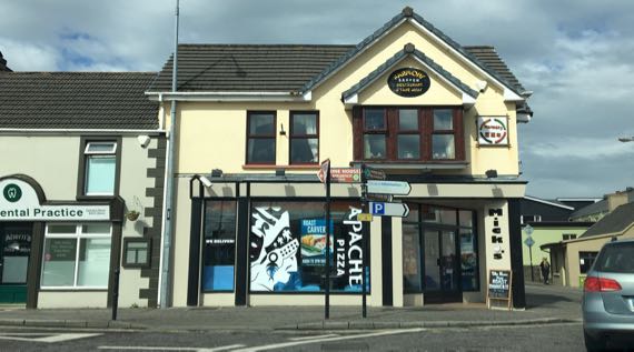
Apache pizza? Cross-cultural food? Find this culinary treat on the traffic circle in Killorglin.
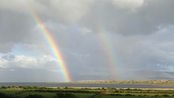
Modest B&B tonight. Spritely owner looks to be in her early 70s. She has lived here all her life. In this building. Brought up here. Modified to be a B&B by her carpenter/builder husband. And this is our view. An hour later we got fierce rain for about four minutes.
Now darkness is descending.
Posted at 4:45 PM |
2 Comments »

One way to look at today is that there were pairs…of medieval monastic/church complexes and harbor-cities.
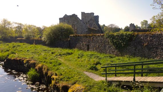
These first two photos are of Kells priory. This one was founded in the 12th C by Anglo-Normans—some of the ruins inside the wall. Then, the wall was added in the 15th C, and the whole thing was attacked in the Dissolution in the 16th C. Anyway, the ritual architectural core is next to River Kings, and the adjacent settlement was on the slope above and the hill to the south.

Here’s another 12th-C cathedral complex in ruins. It was sacked a bit later, in the 17th C, and some well-meaning??? Englishman had the roof removed in the 18th C. You can guess my take on that.
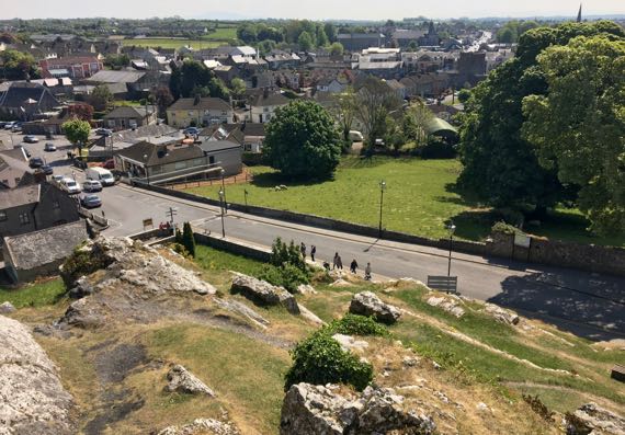
This one, however, is atop a limestone outcrop, very dramatic. It also has a wall, but mostly the defensiveness is due to the bedrock it is built upon. Here’s the view of town from just a few feet from the cathedral ruin.
Such different choices…next to the water and the riverine transportation network vs atop a defensible peak. Supply lines are different. These aren’t far apart in space, and the surviving architecture overlaps temporally….
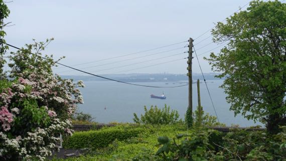
Here’s a view of Cobh harbor. This was the last port of call of the doomed “Titanic,” in 1912. Uncounted Irish set sail from here for the New World, hoping, as is often said, for a better life. I think of Cobh as the outer harbor area in the same estuary as Cork, which is in a more protected location farther inland–but doesn’t have the deep draft for larger “modern” ocean-going vessels.

This is the estuary between Cobh and Cork, and there’s a car ferry that goes between the two cities traversing the River Lee in the shot. Notice how the overcast has set in; we have lost the sunshine we’ve had since we arrived (where’s my raincoat gotten to?).
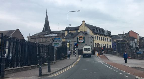
We’re headed south over the bridge that is where the bridge was in medieval times, exiting Cork to the south. The plan of walled medieval Cork survives as narrow streets and bottle-necked traffic. Charming layout, slightly gritty city (or is the overcast skewing my perceptions?).
Ponder these two cities. One (Cobh) is nearer the open ocean and has a deep harbor, an advantage in “modern” times. The other is farther inland, at the farthest downstream that crossing the rivers that forked around the city was relatively easy. Cork was a Viking stronghold far later than most Viking cities in Ireland; the Vikings liked to be inland of the river-mouth, with the security the protected location offered. Archaeologists have found another Viking settlement with ironworking and other crafting even farther upstream, which was unanticipated and suggests that, at least here, the Vikings located activities that required expensive materials even farther inland in an even safer location.
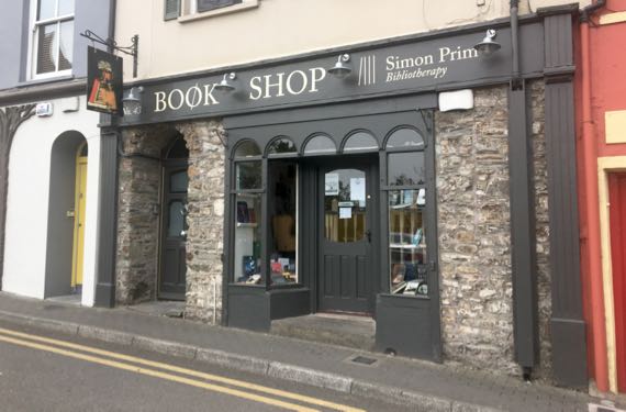
We kept rolling south to Kinsale. I like that this shop offers bibliotherapy. Maybe you’ve heard of it, but I haven’t.
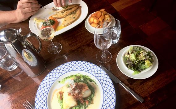
We even had a fancy fish dinner in Kinsale. Delightful and tasty. For dessert, I swooned over my crème brûlée, and the Guru’s pavlova and strawberries was gorgeous and seductive.
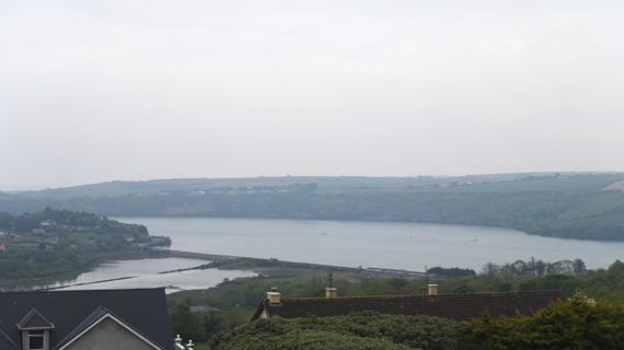
And score another fine B&B for us. This is the view from our room—ignore the overcast….
Posted at 4:29 PM |
3 Comments »
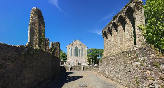
Foreground: ruins of medieval (13th C?) cathedral at Ferns. Five window arches survive on one side, and one on the other. Rear: current mostly 19th-C church.
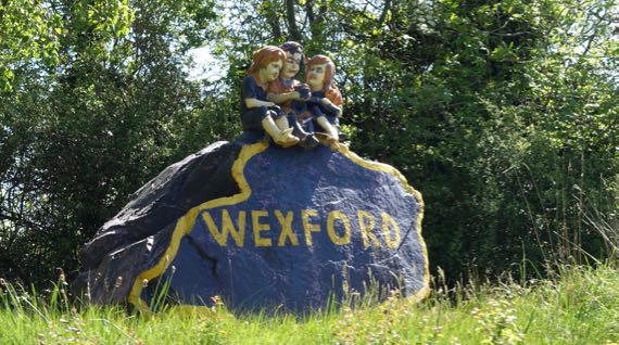
Wexford winsome trio.

Dublin schoolgirls learning about high crosses at heritage park (HP). “Monk” guide did a great job.
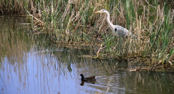
The Guru captured a heron and friend in the crannog’s lake at the HP.
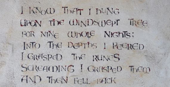
Stenciled quote (lines skipped) from Hávamál on wall at HP.
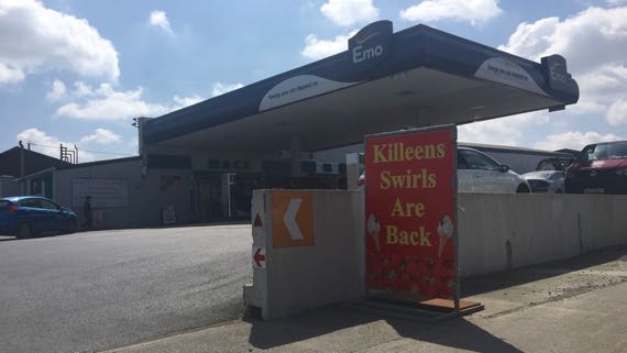
Emo petrol? Killeens swirls?

Tintern Abbey; that is: Tintern Minor abbey. Much modified, but most of “the bones” of what we see is probably 16th C. Used as a residence until 1959.
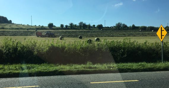
Today was busy-farm-equipment day, including many tractor-rigs on the road. Two days ago, it was paint-your-front-fence day—we saw three being painted and one being pressure-washed‚ none before or since.
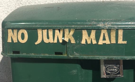
I want this label!
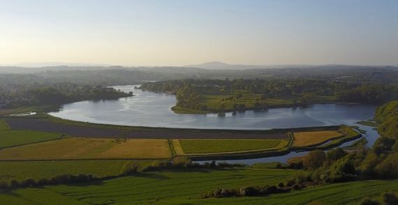
The Guru made Droney fly for the third time here.
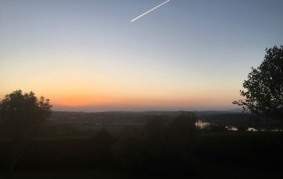
Given that the iPhone darkens a shot like this, you must compensate. I could easily read a book in the ambient light, although it seems darker in this version. This was at 9:02pm. And it’s light out very early, too.
Good night, all.
Posted at 5:07 PM |
2 Comments »
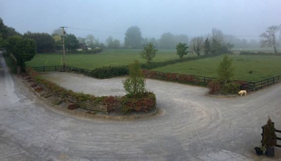
This morning, fog shrouded the horse farm where we stayed last night. Love the dog on patrol.
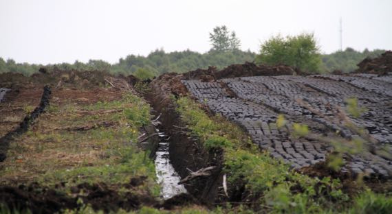
As we rolled out, we came across another mechanized peat harvest area. I think the depth of the drainage ditch indicates how deep the harvest of peat will extend. Across the road, it looked like at least six feet (vertically) had been removed. Now there’s a national movement to clean up the air by limiting coal and peat burning in residential and noncommercial buildings.
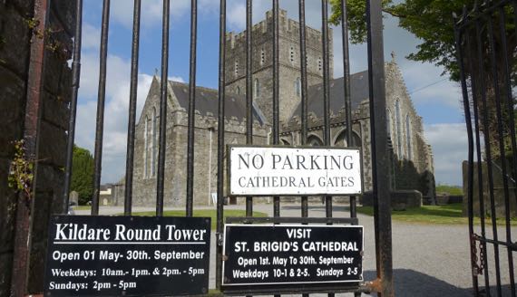
We made our first stop at St Brigid’s Cathedral in Kildare. Brigid lived from ~453 to 523. She founded a monastery here in ~480. This building dates to 1223, and has substantial 19th-C reconstruction. There’s an odd rectangular area outlined by a low wall in the churchyard that is called the Fire Temple (rebuilt last in 1988, I read), marking where it’s believed that nuns kept an eternal flame going to honor St Brigid. It’s somewhat like Rome’s Vestal Virgins, no?
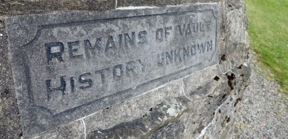
Loved this sign on a strange nubbin of architecture—Remains of Vault…History Unknown.
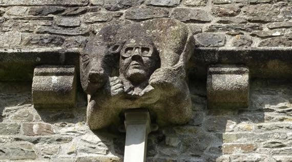
I could not figure out this grotesque downpipe detail on the church. Aviator goggles? Bull or cow around the neck?
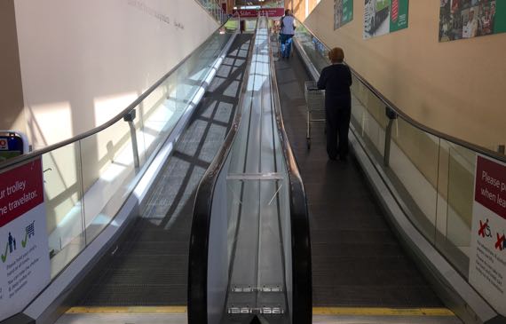
Next stop: Tesco for “triangle” sandwiches and snacks. I was astounded that patrons must “stay right” on the travelator. This is a drive-left country…although pedestrians may pass right or left…adding to my confusion.
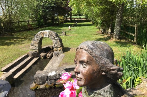
Just south of Kildare is a pilgrimage destination, St. Brigid’s well. It’s relatively elaborate. We had to wait on a busload of pilgrims (from Texas, from what they said) to walk past our parking space before we could exit along the narrow lane.
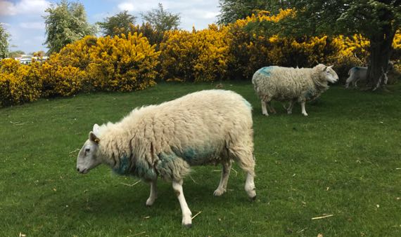
These sheep are browsing on The Curragh. Curragh means race-course. In ancient times it was a common. Much of the time it was used as sheep pasture, but also as a general rendezvous for mustering military forces. The earliest reference dates to the
10th C, and old documents indicate an óenaig (periodic fairs, wake games) was held here. So, it was a multipurpose space not owned by a particular person. What’s left of The Curragh has a formal racecourse where the Irish national races are held, a military base, and still has grazing sheep. The Luftwaffe bombed it on 2 Jan 1941.
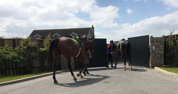
Part of The Curragh also has stables, etc., of the Irish National Stud, where Thoroughbreds are bred; the facility includes several gardens (why?).
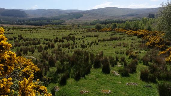
Next, we headed into the Wicklow Mountains! We went through Wicklow gap (near here), 478 meters. This looks very like moorland in Scotland and England.
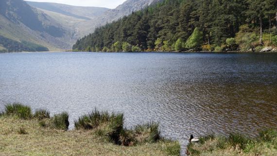
The east side of the pass descends to Glendalough, or Gleann Dá Loch meaning valley of two lakes. This is the larger, upper lake. I’m facing the main drainage into the lake. Note Mr. Mallard. Mrs. Mallard is busy feeding in the reeds and not showing herself.
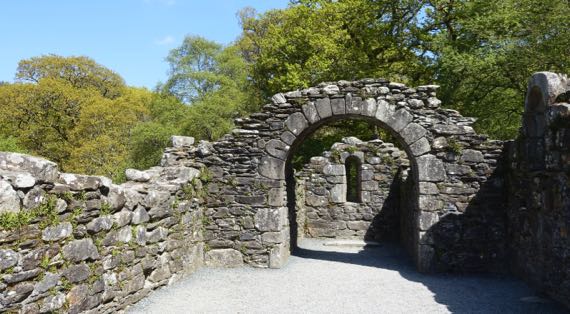
There’s a huge monastic complex here, well known and heavily visited—an easy day-trip from Dublin. We saw many school-kids, high-school age, and heard them speaking Irish Gaelic. This was the 11th-C Reefert Church, way off to the west from the core of the monastic complex. I quite enjoyed this ruin as we visited it alone, no hubbub of visitors in this area of old trees and bird-calls.

I found many of these wildflowers with trifoliate compound leaves. I know it’s the common wood sorrel (Oxalis acetosella), but for today it’s the shamrock (generally accepted to be a clover).
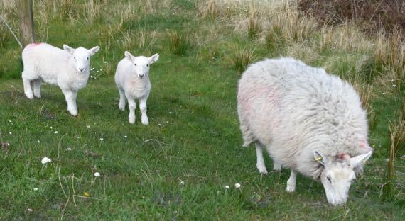
We also made a loop up to Sally Gap, the next pass north of Wicklow. We found these half-grown lambs and their momma enjoying the heights and dining on the roadside grass. Most of the “wild” vegetation is gorse and heather, so this is the best grazing. The heights also have many peat-harvest scars.
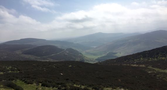
This is the view back toward Glendalough. We found the haze denser with the elevation and think the late afternoon hour also contributed to it. Stunning.
Posted at 2:42 PM |
2 Comments »
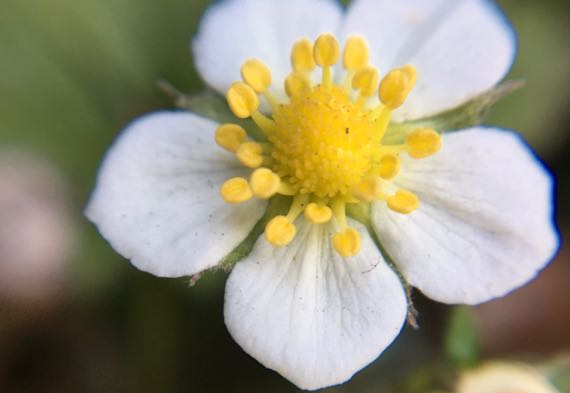
I told the Guru I wasn’t going to write much today…so, mostly photos. Wild strawberry.

Holsteins arriving at fence at end of new pasture area. Bawling. This is atop an early medieval place of major importance called Uisneach. The scale of the hilltop with scattered features was difficult to grasp even standing there. Just think of it as the cattle site.
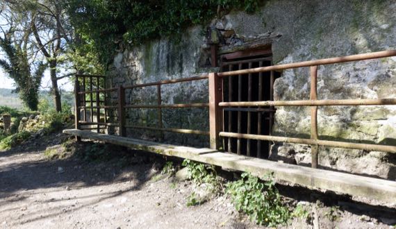
Our access to the hilltop passed by this somewhat mysterious cattle management structure.
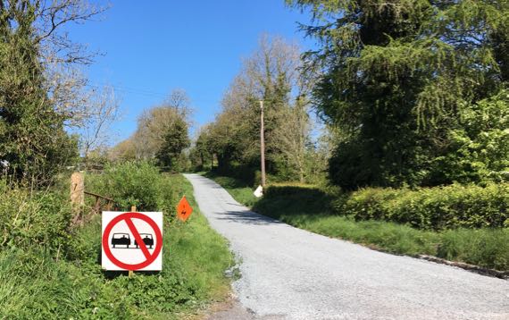
I laughed that someone thought it necessary to mark this one-and-a-half lane road with an aon scoitheadh sign—no passing.
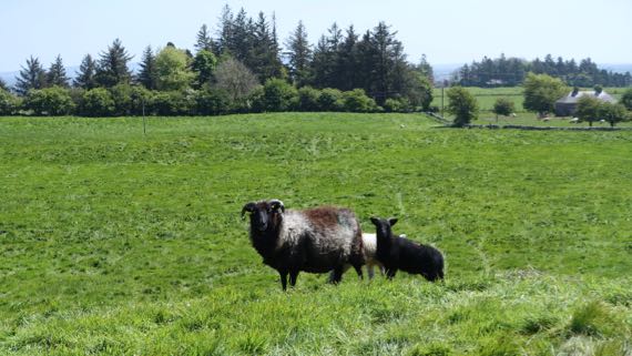
I’m standing on another major architectural feature. Me and this momma sheep and her two babes, one black, one white. Think of it as the sheep site. The formal name is Rathcroghan.
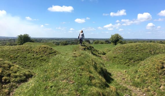
I guess this one might be the person site? It’s called Rathra, and I think this is an old field boundary cutting through the early medieval ring fort. It has two pairs of wall-ditch combos to my left and right. Also you can see a barrow mound just visible over the walls to my left. Darned exciting.
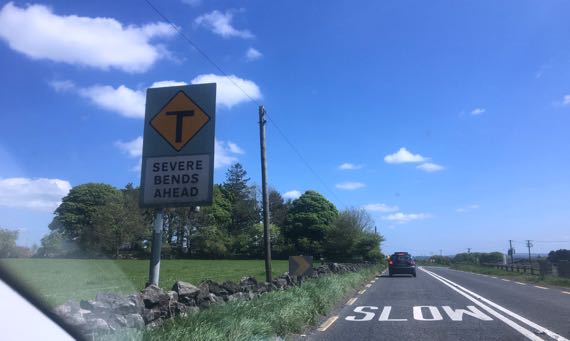
We laughed at this sign. Crappy snapshot, however.

We stopped at the famous monastery ruin named Clonmacnoise. Here’s a view of the oldest structure here (foreground), called Temple Ciarán. It dates to the 8th/9th C, and is considered among the earliest mortared stone shrine chapels in Ireland. That’s the Shannon River in the background; there was a bridge across it as early as ~804. The Guru sent Drony on a mission here getting a great view of a nearby 1214 Anglo-Norman motte-and-bailey castle ruin on the riverbank.

We happened upon turves of peat drying. These are regular shapes from mechanized harvesting. Several (parts of) bog people have been found during such operations.

This abandoned factory is the town of Clara. We spotted another one, too. On the way into town, we drove by the ruins of a monastery. St Brigid founded the original wooden monastery, records indicate. Clara seems pretty resilient; keep on biking.
Posted at 4:27 PM |
Comments Off on Aon scoitheadh
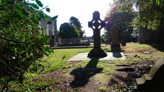
It’s Sunday, so perhaps somehow fitting that we should begin today’s excursion at a churchyard. Another high cross…more burials. Flowers.
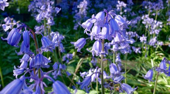
Bluebells, in this case.
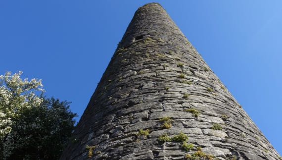
This is the highest hill in Kells, and the oldest building remaining in the compound is the round tower, most of which still stands. Everyone seems compelled to point out that while most such towers have four window-openings at the top, this one has five—one for each of the main roads leading into town (and away from it, duh).
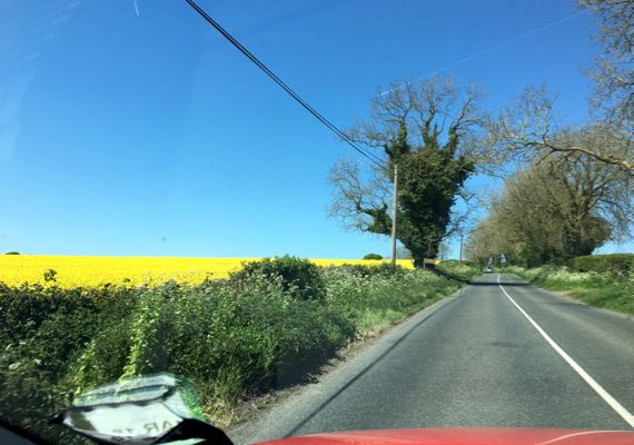
And, we’re off again. Colors—canola yellow flowers, red car, green vegetation, grey road. Yeah, a snapshot.
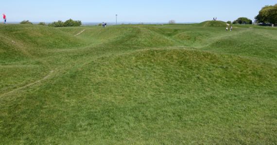
This is some of the earthworks at Hill of Tara, commonly called Tara, just as Margaret Mitchell used it in “Gone with the Wind.” Too much complicated archaeology to even broach it. Take it merely as intricate visual candy, and admire the ancient ones who planned and created this.
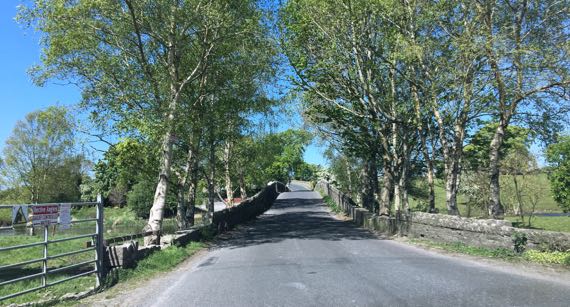
Here’s a little swoopy stone bridge over a river/creek.
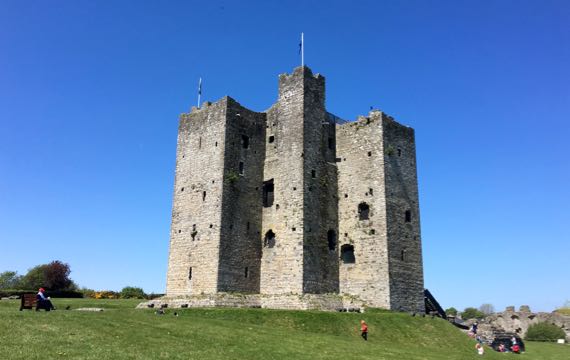
This is the keep of Trim Castle; it’s the largest Anglo-Norman castle on this big island. It was here by 1175, replacing an earlier wooden fortified structure. Life hustled and bustled in the area surrounding the keep and within the curtain walls (completed ~1200)—craftsmen and servants, knights and merchants—and stables, a lime kiln, and so on. The castle offered sufficient security that the town outside the walls became substantial.

Loving these little ferns that have taken hold in the castle wall. And are degrading it.
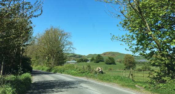
We push on. We are looking for hills. Aha! There are some! We’re still in the Boyne Valley, but we’re inland and nearing the edge of the catchment.
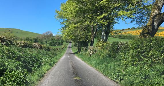
Off on a “leetle” road. I’d call it a lane. With grass overtaking the center.
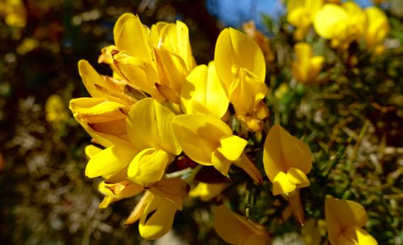
And, off to the right: gorse! Here’s a cluster of gorse blossoms close up.
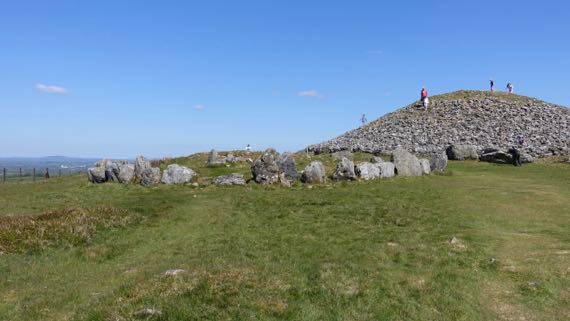
We climbed a little hill this morning at Tara. This one, with some of the Loughcrew cairns atop, requires much more effort. And, on the summit: another Neolithic passage tomb. Signs around it urge “No Climbing.” The accent of every person I heard climbing the mound: Irish. It’s their patrimony…. We stayed on the ground surface. Plenty to see from this hilltop—you can get a hint of how high we are by the distant view in the horizon to the left. Sunny and gorgeous. Beautiful day.
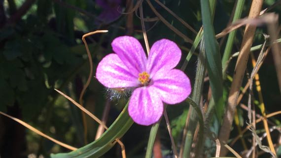
I don’t know what this flower is called; I found it in the hedgerow as I stopped to catch my breath.
Posted at 1:10 PM |
Comments Off on Sunday drive